New Almelo, Kansas | |
---|---|
Coordinates: 39°35′39″N100°07′04″W / 39.59417°N 100.11778°W [1] | |
Country | United States |
State | Kansas |
County | Norton |
Founded | 1870s |
Named for | Almelo, Netherlands |
Elevation | 2,398 ft (731 m) |
Time zone | UTC-6 (CST) |
• Summer (DST) | UTC-5 (CDT) |
Area code | 785 |
FIPS code | 20-50175 [1] |
GNIS ID | 471120 [1] |
New Almelo is an unincorporated community in Norton County, Kansas, United States. [1]
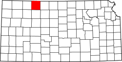
New Elam was issued a post office in 1879. [2] The post office was renamed New Almelo in 1880, [3] [4] then discontinued in 1996. [5]
It is named after the city of Almelo, Netherlands.
The community is served by Norton USD 211 public school district.
Trimble County is a county located in the north central part of the U.S. state of Kentucky. Its county seat is Bedford. The county was founded in 1837 and is named for Robert Trimble. Trimble is no longer a prohibition or dry county. Trimble County is part of the Louisville/Jefferson County, KY–IN Metropolitan Statistical Area.
Pratt County is a county located in the U.S. state of Kansas. Its county seat and largest city is Pratt. As of the 2020 census, the county population was 9,157. The county was named for Caleb Pratt, a U.S. soldier who died in the Battle of Wilson's Creek during the American Civil War and had previously been involved in Bleeding Kansas.
Norton County is a county located in the U.S. state of Kansas. Its county seat and largest city is Norton. As of the 2020 census, the county population was 5,459. The county was established in 1867 and named for Orloff Norton, captain of Company L, 15th Kansas Militia Infantry Regiment.
Decatur County is a county located in Northwest Kansas. Its county seat and most populous city is Oberlin. As of the 2020 census, the county population was 2,764. The county was named in honor of Stephen Decatur, Jr., a commodore in the United States Navy who served during both Barbary Wars in North Africa, the Quasi-War with France, and the War of 1812 with Britain.
Lehigh is a city in Marion County, Kansas, United States. As of the 2020 census, the population of the city was 161. It is located between Hillsboro and Canton on the north side of U.S. Route 56.
Exodusters was a name given to African Americans who migrated from states along the Mississippi River to Kansas in the late nineteenth century, as part of the Exoduster Movement or Exodus of 1879. It was the first general migration of black people following the Civil War.
Berryton is an unincorporated community in Shawnee County, Kansas, United States. It is located east of the Topeka Regional Airport.
Petrolia is an unincorporated community in Allen County, Kansas, United States. It is situated along the Neosho River.
Lee is an unincorporated community in Monon Township, White County, in the U.S. state of Indiana.
Densmore is an unincorporated community in Norton County, Kansas, United States, approximately two miles east of the city of Edmond near K-9 highway.
The McPherson Sentinel is an American daily newspaper published in McPherson, Kansas, United States.
California Junction is an unincorporated community and census-designated place (CDP) in Harrison County, Iowa, United States. It lies just east of the junction between the east–west and north–south lines of the former Sioux City and Pacific Railroad. In the 2010 census it had a population of 85 inhabitants and a population density of 184.38 people per square mile.
Vine Creek is a ghost town in Ottawa County, Kansas, United States.
Brett is a ghost town in Norton County, Kansas, United States.
Fairhaven is a ghost town in Norton County, Kansas, United States.
Wakeman is a ghost town in Norton County, Kansas, United States.
Rockwell is a ghost town in Norton County, Kansas, United States.
Milo is a ghost town in Lincoln County, Kansas, United States. It was located along a former railroad about halfway between the communities of Barnard and Ada.
Little Goose Creek is a tributary of Goose Creek river in Clay County with headwaters in Laurel County in the U.S. state of Kentucky. It is 16.5 miles (26.6 km) long with its confluence with Goose just north of Manchester, at an altitude of 795 feet (242 m).
Collins Creek, also known as Collins Fork, is a creek that is a fork of Goose Creek in Knox County and Clay County, Kentucky. It is 19 miles (31 km) long; is named for its first settler James Collins, a salt maker and hunter; joins Goose just south of Garrard; and is paralleled by road and railway for most of its course.
Name changed — New Elam, Norton Co., to New Almela