Rayville, Kansas

Last updated
Rayville, Kansas
USA Kansas location map.svg
Red pog.svg
Rayville
Usa edcp location map.svg
Red pog.svg
Rayville
Coordinates: 39°59′57″N99°40′53″W / 39.99917°N 99.68139°W / 39.99917; -99.68139
Country United States
State Kansas
County Norton
Elevation
2,280 ft (690 m)
Population
  Total0
Time zone UTC-6 (CST)
  Summer (DST) UTC-5 (CDT)
GNIS ID 482420 [1]

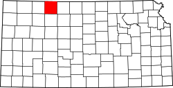
Rayville is a ghost town in Norton County, Kansas, United States.

Contents

History

Rayville was issued a post office in 1885. The post office was discontinued in 1902. [2]

Related Research Articles

<span class="mw-page-title-main">Norton County, Kansas</span> County in Kansas, United States

Norton County is a county located in the U.S. state of Kansas. Its county seat and largest city is Norton. As of the 2020 census, the county population was 5,459. The county was established in 1867 and named for Orloff Norton, captain of Company L, 15th Kansas Militia Infantry Regiment.

<span class="mw-page-title-main">Richland Parish, Louisiana</span> Parish in Louisiana, United States

Richland Parish is a parish located in the North Louisiana Delta Country in the U.S. state of Louisiana, known for its fertile, flat farmland, cane brakes, and open spaces. The parish had a population of 20,043 at the 2020 United States census. The name Richland was chosen due to the rich production from farming. The parish seat and largest community is Rayville.

<span class="mw-page-title-main">Rayville, Louisiana</span> Town in Louisiana, United States

Rayville is a town in and the parish seat of Richland Parish in northeastern Louisiana, United States. The population, which is 69 percent African American, was 4,234 at the 2000 census, but it had declined by nearly 13 percent in 2010 to 3,695.

<span class="mw-page-title-main">Rayville, Missouri</span> Census-designated place in Missouri, United States

Rayville is a census-designated place and former village in Ray County, Missouri, and part of the Kansas City metropolitan area within the United States. The population was 157 at the 2020 census. It disincorporated in 2012.

Oronoque is an unincorporated community in Norton County, Kansas, United States.

<span class="mw-page-title-main">Densmore, Kansas</span> Unincorporated community in Norton County, Kansas

Densmore is an unincorporated community in Norton County, Kansas, United States, approximately two miles east of the city of Edmond near K-9 highway.

Calvert is an unincorporated community in Norton County, Kansas, United States.
Dellvale is an unincorporated community in Norton County, Kansas, United States.

Reager is an unincorporated community in Norton County, Kansas, United States.

Bower is a ghost town in Norton County, Kansas, United States.

Brett is a ghost town in Norton County, Kansas, United States.

Cactus is a ghost town in Norton County, Kansas, United States.

Fairhaven is a ghost town in Norton County, Kansas, United States.

Hanback is a ghost town in Norton County, Kansas, United States.

Hedgewood is a ghost town in Norton County, Kansas, United States.

Smithton is a ghost town in Norton County, Kansas, United States.

Wakeman is a ghost town in Norton County, Kansas, United States.

Devizes is a ghost town in Norton County, Kansas, United States.

<span class="mw-page-title-main">New Almelo, Kansas</span> Unincorporated community in Norton County, Kansas

New Almelo is an unincorporated community in Norton County, Kansas, United States.

Rockwell is a ghost town in Norton County, Kansas, United States.

References

  1. "US Board on Geographic Names". United States Geological Survey. 1984-07-01. Retrieved 2017-12-30.
  2. "Kansas Post Offices, 1828-1961". Kansas Historical Society. Retrieved 2018-01-02.

Further reading