Edmond, Kansas | |
---|---|
Coordinates: 39°37′37″N99°49′12″W / 39.62694°N 99.82000°W [1] | |
Country | United States |
State | Kansas |
County | Norton |
Founded | 1870s |
Incorporated | 1916 |
Named for | Jack Edmond |
Area | |
• Total | 0.17 sq mi (0.43 km2) |
• Land | 0.17 sq mi (0.43 km2) |
• Water | 0.00 sq mi (0.00 km2) |
Elevation | 2,133 ft (650 m) |
Population | |
• Total | 28 |
• Density | 160/sq mi (65/km2) |
Time zone | UTC-6 (CST) |
• Summer (DST) | UTC-5 (CDT) |
ZIP code | 67645 |
Area code | 785 |
FIPS code | 20-19875 |
GNIS ID | 2394623 [1] |
Edmond is a city in Norton County, Kansas, United States. [1] As of the 2020 census, the population of the city was 28. [3]
Edmond had a post office from the 1870s until 1996. [4] Edmond was named for Jack Edmond, who offered a supply of flour in exchange for the naming rights. [5]
According to the United States Census Bureau, the city has a total area of 0.17 square miles (0.44 km2), all land. [6]
Census | Pop. | Note | %± |
---|---|---|---|
1920 | 213 | — | |
1930 | 197 | −7.5% | |
1940 | 180 | −8.6% | |
1950 | 110 | −38.9% | |
1960 | 91 | −17.3% | |
1970 | 90 | −1.1% | |
1980 | 56 | −37.8% | |
1990 | 37 | −33.9% | |
2000 | 47 | 27.0% | |
2010 | 49 | 4.3% | |
2020 | 28 | −42.9% | |
U.S. Decennial Census |
The 2020 United States census counted 28 people, 12 households, and 8 families in Edmond. [7] [8] The population density was 168.7 per square mile (65.1/km2). There were 24 housing units at an average density of 144.6 per square mile (55.8/km2). [8] [9] The racial makeup was 89.29% (25) white or European American (89.29% non-Hispanic white), 0.0% (0) black or African-American, 7.14% (2) Native American or Alaska Native, 0.0% (0) Asian, 0.0% (0) Pacific Islander or Native Hawaiian, 0.0% (0) from other races, and 3.57% (1) from two or more races. [10] Hispanic or Latino of any race was 3.57% (1) of the population. [11]
Of the 12 households, 25.0% had children under the age of 18; 50.0% were married couples living together; 25.0% had a female householder with no spouse or partner present. 33.3% of households consisted of individuals and 25.0% had someone living alone who was 65 years of age or older. [8] The average household size was 3.2 and the average family size was 8.7. [12]
7.1% of the population was under the age of 18, 14.3% from 18 to 24, 17.9% from 25 to 44, 46.4% from 45 to 64, and 14.3% who were 65 years of age or older. The median age was 49.0 years. For every 100 females, there were 115.4 males. [8] For every 100 females ages 18 and older, there were 100.0 males. [8]
As of the census [13] of 2010, there were 49 people, 23 households, and 15 families residing in the city. The population density was 288.2 inhabitants per square mile (111.3/km2). There were 31 housing units at an average density of 182.4 per square mile (70.4/km2). The racial makeup of the city was 98.0% White and 2.0% Native American.
There were 23 households, of which 26.1% had children under the age of 18 living with them, 60.9% were married couples living together, 4.3% had a female householder with no husband present, and 34.8% were non-families. 34.8% of all households were made up of individuals, and 4.3% had someone living alone who was 65 years of age or older. The average household size was 2.13 and the average family size was 2.73.
The median age in the city was 43.5 years. 20.4% of residents were under the age of 18; 4.1% were between the ages of 18 and 24; 26.5% were from 25 to 44; 36.8% were from 45 to 64; and 12.2% were 65 years of age or older. The gender makeup of the city was 53.1% male and 46.9% female.
As of the census [14] of 2000, there were 47 people, 19 households, and 12 families residing in the city. The population density was 285.2 inhabitants per square mile (110.1/km2). There were 31 housing units at an average density of 188.1 per square mile (72.6/km2). The racial makeup of the city was 100.00% White. Hispanic or Latino of any race were 4.26% of the population.
There were 19 households, out of which 36.8% had children under the age of 18 living with them, 52.6% were married couples living together, 10.5% had a female householder with no husband present, and 31.6% were non-families. 26.3% of all households were made up of individuals, and 10.5% had someone living alone who was 65 years of age or older. The average household size was 2.47 and the average family size was 3.08.
In the city, the population was spread out, with 34.0% under the age of 18, 31.9% from 25 to 44, 21.3% from 45 to 64, and 12.8% who were 65 years of age or older. The median age was 40 years. For every 100 females, there were 113.6 males. For every 100 females age 18 and over, there were 82.4 males.
The median income for a household in the city was $11,875, and the median income for a family was $28,750. Males had a median income of $25,000 versus $12,500 for females. The per capita income for the city was $7,395. There were 20.0% of families and 25.6% of the population living below the poverty line, including 17.6% of under eighteens and none of those over 64.
The community is served by Norton USD 211 public school district.
Latham is a city in Butler County, Kansas, United States. As of the 2020 census, the population of the city was 96.
Leon is a city in Butler County, Kansas, United States. As of the 2020 census, the population of the city was 669.
Gridley is a city in Coffey County, Kansas, United States. As of the 2020 census, the population of the city was 313.
Waverly is a city in Coffey County, Kansas, United States. As of the 2020 census, the population of the city was 574.
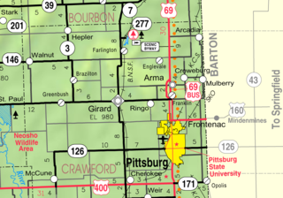
Hepler is a city in Crawford County, Kansas, United States. As of the 2020 census, the population of the city was 90.
Mulberry is a city in Crawford County, Kansas, United States. As of the 2020 census, the population of the city was 409.
Norcatur is a city in Decatur County, Kansas, United States. As of the 2020 census, the population of the city was 159.
Manchester is a city in Dickinson County, Kansas, United States. As of the 2020 census, the population of the city was 47.
Meriden is a city in Jefferson County, Kansas, United States. As of the 2020 census, the population of the city was 744.
Corning is a city in Nemaha County, Kansas, United States. As of the 2020 census, the population of the city was 212.
Lyndon is a city in and the county seat of Osage County, Kansas, United States. As of the 2020 census, the population of the city was 1,037.
Minneapolis is a city in and the county seat of Ottawa County, Kansas, United States. As of the 2020 census, the population of the city was 1,946.
Ogden is a city in Riley County, Kansas, United States. As of the 2020 census, the population of the city was 1,661. It is located near Fort Riley between Manhattan and Junction City.
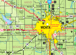
Andale is a city in Sedgwick County, Kansas, United States. As of the 2020 census, the population of the city was 941.
Mount Hope is a city in Sedgwick County, Kansas, United States. As of the 2020 census, the population of the city was 806.
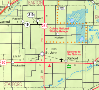
Radium is a city in Stafford County, Kansas, United States. As of the 2020 census, the population of the city was 26.
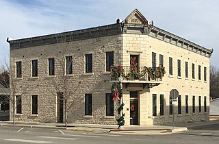
Alma is a city in and the county seat of Wabaunsee County, Kansas, United States. As of the 2020 census, the population of the city was 802.
Palmer is a city in Washington County, Kansas, United States. As of the 2020 census, the population of the city was 125.
Lake Quivira is a city in Johnson and Wyandotte counties in the State of Kansas, and part of the Kansas City Metropolitan Area. As of the 2020 census, the population of the city was 1,014.
Lebo is a city in Coffey County, Kansas, United States. As of the 2020 census, the population of the city was 885.