Norton, Kansas

Last updated

Norton, Kansas
Norton Co KS Courthouse.JPG
Norton County Kansas Incorporated and Unincorporated areas Norton Highlighted.svg
Location within Norton County and Kansas
Map of Norton Co, Ks, USA.png
Coordinates: 39°50′10″N99°53′30″W / 39.83611°N 99.89167°W / 39.83611; -99.89167 [1]
Country United States
State Kansas
County Norton
Incorporated 1885
Named for Orloff Norton
Area
[2]
  Total1.91 sq mi (4.94 km2)
  Land1.91 sq mi (4.94 km2)
  Water0.00 sq mi (0.00 km2)
Elevation
[1]
2,330 ft (710 m)
Population
 (2020) [3]
  Total2,747
  Density1,400/sq mi (560/km2)
Time zone UTC-6 (CST)
  Summer (DST) UTC-5 (CDT)
ZIP code
67654
Area code 785
FIPS code 20-51500
GNIS ID 485631 [1]
Website cityofnorton.com

Norton is a city in, and the county seat of, Norton County, Kansas, United States. [1] As of the 2020 census, the population of the city was 2,747. [3]

Contents

History

Norton was founded in 1872. [4] Like the county, it was named for Capt. Orloff Norton. [5]

The first hotel was a log house, built in 1873. [6]

One of the first recorded tornado pictures was taken in Norton, in 1909, by photographer Will Keller.

Geography

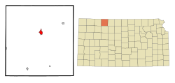
According to the United States Census Bureau, the city has a total area of 1.93 square miles (5.00 km2), all land. [7] The city is situated on the north side of Prairie Dog Creek in Norton County. Before the Bureau of Reclamation constructed Keith Sebelius Lake in 1963, Norton was prone to frequent flooding. The construction of the Dam has since resolved the problem and created the current reservoir that sits 2.5 miles (4.0 km) southwest of Norton. [8] The Nebraska border is located 11 miles (18 km) north of the city.

Climate

Norton is on the boundary of two climate zones, humid continental and semiarid. Temperatures can fluctuate drastically between the winter and summer seasons. Because of its location on the High Plains, snowfall totals can sometimes approach the yearly average after a single snowfall.

Climate data for Norton, Kansas, 1991–2020 normals, extremes 1893–2022
MonthJanFebMarAprMayJunJulAugSepOctNovDecYear
Record high °F (°C)81
(27)
87
(31)
95
(35)
100
(38)
102
(39)
113
(45)
116
(47)
113
(45)
108
(42)
99
(37)
89
(32)
84
(29)
116
(47)
Mean maximum °F (°C)66.9
(19.4)
71.8
(22.1)
81.3
(27.4)
88.1
(31.2)
94.0
(34.4)
100.1
(37.8)
103.4
(39.7)
101.9
(38.8)
97.6
(36.4)
91.3
(32.9)
78.7
(25.9)
68.2
(20.1)
104.6
(40.3)
Mean daily maximum °F (°C)41.7
(5.4)
45.6
(7.6)
56.8
(13.8)
65.8
(18.8)
74.9
(23.8)
86.2
(30.1)
91.5
(33.1)
89.3
(31.8)
81.7
(27.6)
69.4
(20.8)
55.5
(13.1)
43.7
(6.5)
66.8
(19.4)
Daily mean °F (°C)29.0
(−1.7)
32.2
(0.1)
42.0
(5.6)
51.1
(10.6)
61.2
(16.2)
72.3
(22.4)
77.8
(25.4)
75.7
(24.3)
67.3
(19.6)
54.6
(12.6)
41.4
(5.2)
31.1
(−0.5)
53.0
(11.6)
Mean daily minimum °F (°C)16.2
(−8.8)
18.8
(−7.3)
27.3
(−2.6)
36.4
(2.4)
47.6
(8.7)
58.5
(14.7)
64.1
(17.8)
62.2
(16.8)
52.9
(11.6)
39.8
(4.3)
27.3
(−2.6)
18.4
(−7.6)
39.1
(3.9)
Mean minimum °F (°C)−2.5
(−19.2)
.16
(−17.69)
9.7
(−12.4)
22.3
(−5.4)
33.9
(1.1)
47.4
(8.6)
55.1
(12.8)
52.8
(11.6)
39.3
(4.1)
22.7
(−5.2)
11.2
(−11.6)
0.8
(−17.3)
−7.6
(−22.0)
Record low °F (°C)−27
(−33)
−25
(−32)
−17
(−27)
2
(−17)
19
(−7)
37
(3)
42
(6)
36
(2)
24
(−4)
6
(−14)
−11
(−24)
−27
(−33)
−27
(−33)
Average precipitation inches (mm)0.56
(14)
0.69
(18)
1.37
(35)
2.28
(58)
3.55
(90)
3.01
(76)
3.52
(89)
2.76
(70)
1.75
(44)
1.92
(49)
0.89
(23)
0.77
(20)
23.07
(586)
Average snowfall inches (cm)4.6
(12)
5.6
(14)
3.3
(8.4)
1.5
(3.8)
0.1
(0.25)
0.0
(0.0)
0.0
(0.0)
0.0
(0.0)
0.0
(0.0)
1.1
(2.8)
2.1
(5.3)
3.5
(8.9)
21.8
(55.45)
Average precipitation days (≥ 0.01 in)2.93.44.96.89.18.48.16.95.05.23.53.167.3
Average snowy days (≥ 0.1 in)2.32.41.60.70.10.00.00.00.00.31.02.110.5
Source 1: NOAA [9]
Source 2: XMACIS2 [10]

Demographics

Historical population
CensusPop.Note
1880 634
1890 1,07469.4%
1900 1,20211.9%
1910 1,78748.7%
1920 2,18622.3%
1930 2,76726.6%
1940 2,762−0.2%
1950 3,06010.8%
1960 3,3459.3%
1970 3,6278.4%
1980 3,400−6.3%
1990 3,017−11.3%
2000 3,012−0.2%
2010 2,928−2.8%
2020 2,747−6.2%
U.S. Decennial Census

2020 census

The 2020 United States census counted 2,747 people, 1,213 households, and 692 families in Norton. [11] [12] The population density was 1,439.7 per square mile (555.9/km2). There were 1,457 housing units at an average density of 763.6 per square mile (294.8/km2). [12] [13] The racial makeup was 90.21% (2,478) white or European American (88.24% non-Hispanic white), 0.84% (23) black or African-American, 0.55% (15) Native American or Alaska Native, 0.73% (20) Asian, 0.0% (0) Pacific Islander or Native Hawaiian, 1.09% (30) from other races, and 6.59% (181) from two or more races. [14] Hispanic or Latino of any race was 5.28% (145) of the population. [15]

Of the 1,213 households, 26.0% had children under the age of 18; 42.6% were married couples living together; 28.9% had a female householder with no spouse or partner present. 37.5% of households consisted of individuals and 16.0% had someone living alone who was 65 years of age or older. [12] The average household size was 2.7 and the average family size was 3.5. [16] The percent of those with a bachelor’s degree or higher was estimated to be 15.4% of the population. [17]

24.5% of the population was under the age of 18, 6.7% from 18 to 24, 22.4% from 25 to 44, 24.9% from 45 to 64, and 21.5% who were 65 years of age or older. The median age was 42.0 years. For every 100 females, there were 104.8 males. [12] For every 100 females ages 18 and older, there were 104.2 males. [12]

The 2016-2020 5-year American Community Survey estimates show that the median household income was $49,069 (with a margin of error of +/- $7,615) and the median family income was $59,648 (+/- $18,177). [18] Males had a median income of $32,346 (+/- $3,580) versus $29,167 (+/- $11,470) for females. The median income for those above 16 years old was $31,683 (+/- $3,071). [19] Approximately, 0.9% of families and 6.4% of the population were below the poverty line, including 4.7% of those under the age of 18 and 13.0% of those ages 65 or over. [20] [21]

2010 census

As of the census [22] of 2010, there were 2,928 people, 1,290 households, and 763 families residing in the city. The population density was 1,517.1 inhabitants per square mile (585.8/km2). There were 1,465 housing units at an average density of 759.1 per square mile (293.1/km2). The racial makeup of the city was 96.8% White, 0.2% African American, 0.1% Native American, 0.4% Asian, 0.5% from other races, and 1.9% from two or more races. Hispanic or Latino of any race were 3.3% of the population.

There were 1,290 households, of which 26.3% had children under the age of 18 living with them, 46.5% were married couples living together, 9.3% had a female householder with no husband present, 3.3% had a male householder with no wife present, and 40.9% were non-families. 36.1% of all households were made up of individuals, and 18.3% had someone living alone who was 65 years of age or older. The average household size was 2.20 and the average family size was 2.86.

The median age in the city was 44.8 years. 23.2% of residents were under the age of 18; 6.4% were between the ages of 18 and 24; 20.6% were from 25 to 44; 27.8% were from 45 to 64; and 22% were 65 years of age or older. The gender makeup of the city was 46.6% male and 53.4% female.

2000 census

As of the census [23] of 2000, there were 3,012 people, 1,331 households, and 814 families residing in the city. The population density was 1,566.5 inhabitants per square mile (604.8/km2). There were 1,517 housing units at an average density of 789.0 per square mile (304.6/km2). The racial makeup of the city was 97.91% White, 0.40% Native American, 0.33% Asian, 0.03% African American, 0.03% Pacific Islander, 0.63% from other races, and 0.66% from two or more races. Hispanic or Latino of any race were 2.03% of the population.

There were 1,331 households, out of which 27.7% had children under the age of 18 living with them, 50.5% were married couples living together, 8.5% had a female householder with no husband present, and 38.8% were non-families. 36.1% of all households were made up of individuals, and 20.7% had someone living alone who was 65 years of age or older. The average household size was 2.19 and the average family size was 2.86.

In the city, the population was spread out, with 24.5% under the age of 18, 5.3% from 18 to 24, 23.5% from 25 to 44, 22.1% from 45 to 64, and 24.6% who were 65 years of age or older. The median age was 43 years. For every 100 females, there were 91.5 males. For every 100 females age 18 and over, there were 82.9 males.

The median income for a household in the city was $30,339, and the median income for a family was $36,179. Males had a median income of $25,943 versus $20,559 for females. The per capita income for the city was $16,438. About 5.5% of families and 9.5% of the population were below the poverty line, including 10.4% of those under age 18 and 6.5% of those age 65 or over.

Education

Tornado on June 24, 1909 Norton, Kansas tornado 06241909.jpg
Tornado on June 24, 1909

The community is served by Norton USD 211 public school district.

Eisenhower Elementary School Constructed in 1954 and added on to in 1966 and 1990, Eisenhower Elementary serves students in USD 211 in grades ECD through sixth grade. Full day, every day kindergarten is offered as is a full range of special education services. Grades ECD through four are taught in self-contained classrooms. Grades 5 & 6 are departmentalized for instruction in math, reading, science, language arts and computer technology. Each teacher also teaches social studies and spelling to their homeroom students.[ citation needed ]

Norton Junior High School Constructed in 1937 and extensively remodeled in 1984, Norton Junior High School serves the 120+ students in grades 7 & 8. In addition to required classes of math, language arts, physical education/ health, science and social studies each junior high student receives 3 semesters of instruction in computer technology and digital media production and one semester of technology exploration (robotics, pneumatics, electronics, etc.). Elective classes are offered in vocal music, instrumental music, art, wood working, and family and consumer sciences.[ citation needed ]

Norton Community High School Constructed in 1975 & 1977, NCHS is a 3A high school with an enrollment of 200+. A comprehensive high school, NCHS is able to offer instruction in the areas of calculus, physics, human anatomy, chemistry II and foreign language. In addition to the regular academic curriculum, NCHS offers fine arts and vocational training.[ citation needed ]

The Norton Community High School Bluejays have won 17 Kansas State High School Activities Association state championships in wrestling, including six consecutive Class 3-2-1A state championships from 2012–17, and three consecutive Class 3-2-1A championships in 2004-06. Norton's football team won back-to-back Class 4A state championships in 1985 and 1986, and finished as state runners-up in 1989. The girls basketball and boys basketball teams won state championships in 1983 and 2003, respectively, and have made numerous state tournament appearances. NCHS also boasts programs in girls tennis, girls volleyball, boys golf, cross country, and track and field.[ citation needed ]

Notable people

See also

Related Research Articles

<span class="mw-page-title-main">Mulberry, Kansas</span> City in Crawford County, Kansas

Mulberry is a city in Crawford County, Kansas, United States. As of the 2020 census, the population of the city was 409.

<span class="mw-page-title-main">Norcatur, Kansas</span> City in Decatur County, Kansas

Norcatur is a city in Decatur County, Kansas, United States. As of the 2020 census, the population of the city was 159.

<span class="mw-page-title-main">Kinsley, Kansas</span> City in Edwards County, Kansas

Kinsley is a city in and the county seat of Edwards County, Kansas, United States. As of the 2020 census, the population of the city was 1,456. It is located along Highway 50.

<span class="mw-page-title-main">Gove City, Kansas</span> City in Gove County, Kansas

Gove City, more commonly known as Gove, is a city in and the county seat of Gove County, Kansas, United States. As of the 2020 census, the population of the city was 80.

<span class="mw-page-title-main">Nortonville, Kansas</span> City in Kansas, United States

Nortonville is a city in Jefferson County, Kansas, United States. As of the 2020 census, the population of the city was 601.

<span class="mw-page-title-main">Mankato, Kansas</span> City in Jewell County, Kansas

Mankato is a city in and the county seat of Jewell County, Kansas, United States. As of the 2020 census, the population of the city was 836.

<span class="mw-page-title-main">Edgerton, Kansas</span> City in Kansas, United States

Edgerton is a city in Johnson County, Kansas, United States, and part of the Kansas City metropolitan area. As of the 2020 census, the population of the city was 1,748. It is home to a large BNSF intermodal train facility named Logistics Park Kansas City.

<span class="mw-page-title-main">Kingman, Kansas</span> City in Kingman County, Kansas

Kingman is a city in and the county seat of Kingman County, Kansas, United States. As of the 2020 census, the population of the city was 3,105.

<span class="mw-page-title-main">Lansing, Kansas</span> City in Kansas, United States

Lansing is a city in Leavenworth County, Kansas, United States. It is situated along the west side of the Missouri River and Kansas-Missouri state border. As of the 2020 census, the population of the city was 11,239. It is the second most populous city of Leavenworth County and is a part of the Kansas City metropolitan area. The Lansing Correctional Facility, which includes the state's main maximum-security prison, is located in Lansing.

<span class="mw-page-title-main">Meade, Kansas</span> City in Meade County, Kansas

Meade is a city in and the county seat of Meade County, Kansas, United States. As of the 2020 census, the population of the city was 1,505.

<span class="mw-page-title-main">Ness City, Kansas</span> City in Ness County, Kansas

Ness City is a city in and the county seat of Ness County, Kansas, United States. As of the 2020 census, the population of the city was 1,329. Ness City is famous for its four-story Old Ness County Bank Building located downtown, and nicknamed Skyscraper of the Plains.

<span class="mw-page-title-main">Almena, Kansas</span> City in Norton County, Kansas, United States

Almena is a city in Norton County, Kansas, United States. As of the 2020 census, the population of the city was 363.

<span class="mw-page-title-main">Edmond, Kansas</span> City in Norton County, Kansas

Edmond is a city in Norton County, Kansas, United States. As of the 2020 census, the population of the city was 28.

<span class="mw-page-title-main">Lenora, Kansas</span> City in Norton County, Kansas

Lenora is a city in Norton County, Kansas, United States. As of the 2020 census, the population of the city was 207.

<span class="mw-page-title-main">Lyndon, Kansas</span> City in Osage County, Kansas

Lyndon is a city in, and the county seat of Osage County, Kansas, United States. As of the 2020 census, the population of the city was 1,037.

<span class="mw-page-title-main">Atwood, Kansas</span> City in Rawlins County, Kansas

Atwood is a city in and the county seat of Rawlins County, Kansas, United States. As of the 2020 census, the population of the city was 1,290.

<span class="mw-page-title-main">Belleville, Kansas</span> City in Republic County, Kansas

Belleville is a city in and the county seat of Republic County, Kansas, United States. As of the 2020 census, the population of the city was 2,007.

<span class="mw-page-title-main">Andale, Kansas</span> City in Sedgwick County, Kansas

Andale is a city in Sedgwick County, Kansas, United States. As of the 2020 census, the population of the city was 941.

<span class="mw-page-title-main">Mount Hope, Kansas</span> City in Sedgwick County, Kansas

Mount Hope is a city in Sedgwick County, Kansas, United States. As of the 2020 census, the population of the city was 806.

<span class="mw-page-title-main">Clayton, Kansas</span> City in Decatur and Norton Counties of Kansas

Clayton is a city in Decatur and Norton counties in the U.S. state of Kansas. As of the 2020 census, the population of the city was 44.

References

  1. 1 2 3 4 U.S. Geological Survey Geographic Names Information System: Norton, Kansas
  2. "2019 U.S. Gazetteer Files". United States Census Bureau. Retrieved July 24, 2020.
  3. 1 2 "Profile of Norton, Kansas in 2020". United States Census Bureau. Archived from the original on February 27, 2022. Retrieved February 27, 2022.
  4. Kansas State Historical Society (1916). Biennial Report of the Board of Directors of the Kansas State Historical Society. Kansas State Printing Plant. pp.  253.
  5. "Profile for Norton, Kansas". ePodunk. Archived from the original on July 15, 2014. Retrieved June 21, 2014.
  6. Blackmar, Frank Wilson (1912). Kansas: A Cyclopedia of State History, Volume 2. Standard Publishing Company. pp.  374.
  7. "US Gazetteer files 2010". United States Census Bureau. Archived from the original on January 25, 2012. Retrieved July 6, 2012.
  8. "Project Details - Almena Unit". United States Bureau of Reclamation. Archived from the original on September 5, 2015. Retrieved November 2, 2010.
  9. "U.S. Climate Normals Quick Access – Station: Norton 9SSE, KS". National Oceanic and Atmospheric Administration. Retrieved November 26, 2023.
  10. "xmACIS2". National Oceanic and Atmospheric Administration. Retrieved November 26, 2023.
  11. "US Census Bureau, Table P16: HOUSEHOLD TYPE". data.census.gov. Retrieved January 3, 2024.
  12. 1 2 3 4 5 "US Census Bureau, Table DP1: PROFILE OF GENERAL POPULATION AND HOUSING CHARACTERISTICS". data.census.gov. Retrieved January 3, 2024.
  13. Bureau, US Census. "Gazetteer Files". Census.gov. Retrieved December 30, 2023.
  14. "US Census Bureau, Table P1: RACE". data.census.gov. Retrieved January 3, 2024.
  15. "US Census Bureau, Table P2: HISPANIC OR LATINO, AND NOT HISPANIC OR LATINO BY RACE". data.census.gov. Retrieved January 3, 2024.
  16. "US Census Bureau, Table S1101: HOUSEHOLDS AND FAMILIES". data.census.gov. Retrieved January 3, 2024.
  17. "US Census Bureau, Table S1501: EDUCATIONAL ATTAINMENT". data.census.gov. Retrieved January 3, 2024.
  18. "US Census Bureau, Table S1903: MEDIAN INCOME IN THE PAST 12 MONTHS (IN 2020 INFLATION-ADJUSTED DOLLARS)". data.census.gov. Retrieved January 3, 2024.
  19. "US Census Bureau, Table S2001: EARNINGS IN THE PAST 12 MONTHS (IN 2020 INFLATION-ADJUSTED DOLLARS)". data.census.gov. Retrieved January 3, 2024.
  20. "US Census Bureau, Table S1701: POVERTY STATUS IN THE PAST 12 MONTHS". data.census.gov. Retrieved January 3, 2024.
  21. "US Census Bureau, Table S1702: POVERTY STATUS IN THE PAST 12 MONTHS OF FAMILIES". data.census.gov. Retrieved January 3, 2024.
  22. "U.S. Census website". United States Census Bureau . Retrieved July 6, 2012.
  23. "U.S. Census website". United States Census Bureau . Retrieved January 31, 2008.

Further reading