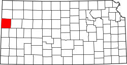
Sharon Springs, Kansas

Last updated

Sharon Springs, Kansas
Wallace County, Kansas courthouse from S 1.JPG
Wallace County Courthouse (2010)
Wallace County Kansas Incorporated and Unincorporated areas Sharon Springs Highlighted.svg
Location within Wallace County and Kansas
Map of Wallace Co, Ks, USA.png
Coordinates: 38°53′40″N101°45′04″W / 38.89444°N 101.75111°W / 38.89444; -101.75111 [1]
Country United States
State Kansas
County Wallace
Founded1868
Incorporated 1890
Named for Sharon Springs, New York
Area
[2]
  Total0.90 sq mi (2.34 km2)
  Land0.90 sq mi (2.34 km2)
  Water0.00 sq mi (0.00 km2)
Elevation
[1]
3,442 ft (1,049 m)
Population
 (2020) [3]
  Total751
  Density830/sq mi (320/km2)
Time zone UTC-7 (Mountain (MST))
  Summer (DST) UTC-6 (MDT)
ZIP code
67758
Area code 785
FIPS code 20-64375
GNIS ID 2395858 [1]
Website Info

Sharon Springs is a city in and the county seat of Wallace County, Kansas, United States. [1] As of the 2020 census, the population of the city was 751. [3]

Contents

History

Sharon Springs in 1943 Kansas - Sharin Springs - NARA - 23940259 (cropped).jpg
Sharon Springs in 1943

Sharon Springs was originally called Eagle Tail station when it was founded in 1868. It was renamed Sharon Springs in 1886, after Sharon Springs, New York. [4] [5] Sharon Springs was incorporated as a city in 1890. [6]

In 2013, the largest sinkhole in Kansas opened north of Sharon Springs. As of December 2013, the sinkhole was approximately 88 feet (27 m) deep and 243 feet (74 m) across. [7]

On April 22, 2022, a high-end EF1 tornado caused severe damage to the city.

Geography

According to the United States Census Bureau, the city has a total area of 0.91 square miles (2.36 km2), all land. [8]

Climate

According to the Köppen Climate Classification system, Sharon Springs has a semi-arid climate, abbreviated "BSk" on climate maps. [9]

Climate data for Sharon Springs, Kansas, 1991–2020 normals, extremes 1893–present
MonthJanFebMarAprMayJunJulAugSepOctNovDecYear
Record high °F (°C)85
(29)
82
(28)
90
(32)
98
(37)
103
(39)
112
(44)
109
(43)
110
(43)
106
(41)
100
(38)
92
(33)
82
(28)
112
(44)
Mean maximum °F (°C)67.4
(19.7)
70.5
(21.4)
80.3
(26.8)
87.2
(30.7)
94.2
(34.6)
101.3
(38.5)
102.8
(39.3)
100.8
(38.2)
96.9
(36.1)
89.3
(31.8)
77.2
(25.1)
66.8
(19.3)
104.1
(40.1)
Mean daily maximum °F (°C)43.7
(6.5)
46.1
(7.8)
56.5
(13.6)
64.9
(18.3)
74.5
(23.6)
86.3
(30.2)
91.2
(32.9)
88.4
(31.3)
80.9
(27.2)
67.8
(19.9)
54.2
(12.3)
44.1
(6.7)
66.6
(19.2)
Daily mean °F (°C)30.5
(−0.8)
32.7
(0.4)
42.1
(5.6)
50.8
(10.4)
61.2
(16.2)
72.4
(22.4)
77.7
(25.4)
75.2
(24.0)
66.9
(19.4)
53.1
(11.7)
40.4
(4.7)
31.4
(−0.3)
52.9
(11.6)
Mean daily minimum °F (°C)17.3
(−8.2)
19.4
(−7.0)
27.8
(−2.3)
36.7
(2.6)
47.9
(8.8)
58.6
(14.8)
64.1
(17.8)
62.0
(16.7)
52.9
(11.6)
38.4
(3.6)
26.5
(−3.1)
18.6
(−7.4)
39.2
(4.0)
Mean minimum °F (°C)−0.6
(−18.1)
3.0
(−16.1)
10.4
(−12.0)
21.6
(−5.8)
33.1
(0.6)
46.0
(7.8)
55.2
(12.9)
52.6
(11.4)
38.7
(3.7)
22.1
(−5.5)
10.3
(−12.1)
1.6
(−16.9)
−5.7
(−20.9)
Record low °F (°C)−20
(−29)
−23
(−31)
−18
(−28)
8
(−13)
21
(−6)
33
(1)
41
(5)
44
(7)
22
(−6)
6
(−14)
−8
(−22)
−22
(−30)
−23
(−31)
Average precipitation inches (mm)0.40
(10)
0.59
(15)
0.95
(24)
1.80
(46)
2.58
(66)
2.77
(70)
3.86
(98)
2.96
(75)
1.57
(40)
1.27
(32)
0.65
(17)
0.45
(11)
19.85
(504)
Average snowfall inches (cm)3.2
(8.1)
4.7
(12)
3.3
(8.4)
1.4
(3.6)
0.1
(0.25)
0.0
(0.0)
0.0
(0.0)
0.0
(0.0)
0.1
(0.25)
1.4
(3.6)
2.3
(5.8)
4.5
(11)
21.0
(53)
Average precipitation days (≥ 0.01 in)2.32.43.34.96.66.37.06.63.33.82.82.351.6
Average snowy days (≥ 0.1 in)1.61.91.30.50.00.00.00.00.00.31.11.98.6
Source 1: NOAA [10]
Source 2: National Weather Service [11]

Demographics

Historical population
CensusPop.Note
1890 178
1900 1801.1%
1910 440144.4%
1920 81585.2%
1930 792−2.8%
1940 760−4.0%
1950 99430.8%
1960 966−2.8%
1970 1,0124.8%
1980 982−3.0%
1990 872−11.2%
2000 835−4.2%
2010 748−10.4%
2020 7510.4%
U.S. Decennial Census
Sharon Springs Kansas Business District (2011) Sharon Springs Kansas Business District 08-20-2011.JPG
Sharon Springs Kansas Business District (2011)

2010 census

As of the census [12] of 2010, there were 748 people, 327 households, and 197 families residing in the city. The population density was 822.0 inhabitants per square mile (317.4/km2). There were 407 housing units at an average density of 447.3 per square mile (172.7/km2). The racial makeup of the city was 94.5% White, 0.1% African American, 0.4% Native American, 3.6% from other races, and 1.3% from two or more races. Hispanic or Latino of any race were 5.7% of the population.

There were 327 households, of which 27.2% had children under the age of 18 living with them, 51.7% were married couples living together, 6.1% had a female householder with no husband present, 2.4% had a male householder with no wife present, and 39.8% were non-families. 38.2% of all households were made up of individuals, and 22.3% had someone living alone who was 65 years of age or older. The average household size was 2.23 and the average family size was 2.99.

The median age in the city was 45.3 years. 25.5% of residents were under the age of 18; 4.9% were between the ages of 18 and 24; 19.2% were from 25 to 44; 25.4% were from 45 to 64; and 25% were 65 years of age or older. The gender makeup of the city was 48.8% male and 51.2% female.

2000 census

As of the census [13] of 2000, there were 835 people, 354 households, and 227 families residing in the city. The population density was 900.0 inhabitants per square mile (347.5/km2). There were 408 housing units at an average density of 439.8 per square mile (169.8/km2). The racial makeup of the city was 96.05% White, 0.24% African American, 0.48% Native American, 1.68% from other races, and 1.56% from two or more races. Hispanic or Latino of any race were 4.31% of the population.

There were 354 households, out of which 29.7% had children under the age of 18 living with them, 57.3% were married couples living together, 3.7% had a female householder with no husband present, and 35.6% were non-families. 33.9% of all households were made up of individuals, and 17.8% had someone living alone who was 65 years of age or older. The average household size was 2.29 and the average family size was 2.93.

In the city, the population was spread out, with 24.2% under the age of 18, 7.9% from 18 to 24, 22.5% from 25 to 44, 21.3% from 45 to 64, and 24.1% who were 65 years of age or older. The median age was 42 years. For every 100 females, there were 90.2 males. For every 100 females age 18 and over, there were 95.4 males.

The median income for a household in the city was $33,333, and the median income for a family was $43,684. Males had a median income of $27,500 versus $14,600 for females. The per capita income for the city was $17,656. About 4.3% of families and 7.3% of the population were below the poverty line, including 6.7% of those under age 18 and 10.8% of those age 65 or over.

Education

The community is served by Wallace County USD 241 public school district.

Transportation

Sharon Springs is located on U.S. Route 40.

Related Research Articles

<span class="mw-page-title-main">Wallace County, Kansas</span> County in Kansas, United States

Wallace County is a county located in the U.S. state of Kansas. Its county seat is Sharon Springs. As of the 2020 census, the county population was 1,512, making it the second-least populous county in Kansas. The county was created in 1868 and named in honor of Brigadier General W.H.L. Wallace, who had been mortally wounded in combat in the Battle of Shiloh. Wallace County is home to Mount Sunflower, the highest point in Kansas at 4,039 feet. Mount Sunflower is located approximately 15 miles (24 km) north-northwest of Weskan, less than one mile (1.6 km) from the Colorado state line. It is one of four Kansas counties to use the Mountain Time Zone rather than the Central Time Zone like the remainder of Kansas.

<span class="mw-page-title-main">Sharon, Kansas</span> City in Kiowa County, Kansas

Sharon is a city in Barber County, Kansas, United States. As of the 2020 census, the population of the city was 147.

<span class="mw-page-title-main">McCune, Kansas</span> City in Crawford County, Kansas

McCune is a city in Crawford County, Kansas, United States. As of the 2020 census, the population of the city was 370.

<span class="mw-page-title-main">Gove City, Kansas</span> City in Gove County, Kansas

Gove City, more commonly known as Gove, is a city in and the county seat of Gove County, Kansas, United States. As of the 2020 census, the population of the city was 80.

<span class="mw-page-title-main">Syracuse, Kansas</span> City in Hamilton County, Kansas

Syracuse is a city in and the county seat of Hamilton County, Kansas, United States. As of the 2020 census, the population of the city was 1,826. It is located along Highway 50.

<span class="mw-page-title-main">Jetmore, Kansas</span> City in Hodgeman County, Kansas

Jetmore is a city in and the county seat of Hodgeman County, Kansas, United States. As of the 2020 census, the population of the city was 770.

<span class="mw-page-title-main">Lakin, Kansas</span> City in Kearny County, Kansas

Lakin is a city in and the county seat of Kearny County, Kansas, United States. As of the 2020 census, the population of the city was 2,205. It is located along Highway 50.

<span class="mw-page-title-main">Kingman, Kansas</span> City in Kingman County, Kansas

Kingman is a city in and the county seat of Kingman County, Kansas, United States. As of the 2020 census, the population of the city was 3,105.

<span class="mw-page-title-main">Meade, Kansas</span> City in Meade County, Kansas

Meade is a city in and the county seat of Meade County, Kansas, United States. As of the 2020 census, the population of the city was 1,505.

<span class="mw-page-title-main">Galesburg, Kansas</span> City in Neosho County, Kansas

Galesburg is a city in Neosho County, Kansas, United States. As of the 2020 census, the population of the city was 149.

<span class="mw-page-title-main">Ness City, Kansas</span> City in Ness County, Kansas

Ness City is a city in and the county seat of Ness County, Kansas, United States. As of the 2020 census, the population of the city was 1,329. Ness City is famous for its four-story Old Ness County Bank Building located downtown, and nicknamed Skyscraper of the Plains.

<span class="mw-page-title-main">Atwood, Kansas</span> City in Rawlins County, Kansas

Atwood is a city in and the county seat of Rawlins County, Kansas, United States. As of the 2020 census, the population of the city was 1,290.

<span class="mw-page-title-main">Ogden, Kansas</span> City in Riley County, Kansas

Ogden is a city in Riley County, Kansas, United States. As of the 2020 census, the population of the city was 1,661. It is located near Fort Riley between Manhattan and Junction City.

<span class="mw-page-title-main">Belle Plaine, Kansas</span> City in Sumner County, Kansas

Belle Plaine is a city in Sumner County, Kansas, United States. As of the 2020 census, the population of the city was 1,467.

<span class="mw-page-title-main">Conway Springs, Kansas</span> City in Sumner County, Kansas

Conway Springs is a city in Sumner County, Kansas, United States. As of the 2020 census, the population of the city was 1,086.

<span class="mw-page-title-main">Wallace, Kansas</span> City in Wallace County, Kansas

Wallace is a city in Wallace County, Kansas, United States. As of the 2020 census, the population of the city was 41.

<span class="mw-page-title-main">Benedict, Kansas</span> City in Wilson County, Kansas

Benedict is a city in Wilson County, Kansas, United States, along the Verdigris River. As of the 2020 census, the population of the city was 69.

<span class="mw-page-title-main">Coyville, Kansas</span> City in Wilson County, Kansas

Coyville is a city in Wilson County, Kansas, United States. As of the 2020 census, the population of the city was 60.

<span class="mw-page-title-main">Smithville, Missouri</span> City in Missouri, United States

Smithville is a city in Clay and Platte counties in the U.S. state of Missouri and is part of the Kansas City metropolitan area, along the Little Platte River. The population was 10,406 at the 2020 United States Census.

<span class="mw-page-title-main">Lebo, Kansas</span> City in Coffey County, Kansas

Lebo is a city in Coffey County, Kansas, United States. As of the 2020 census, the population of the city was 885.

References

  1. 1 2 3 4 U.S. Geological Survey Geographic Names Information System: Sharon Springs, Kansas
  2. "2019 U.S. Gazetteer Files". United States Census Bureau. Retrieved July 24, 2020.
  3. 1 2 "Profile of Sharon Springs, Kansas in 2020". United States Census Bureau. Archived from the original on November 15, 2021. Retrieved November 14, 2021.
  4. Kansas State Historical Society (1916). Biennial Report of the Board of Directors of the Kansas State Historical Society. Kansas State Printing Plant. p. 310.
  5. "Profile for Sharon Springs, Kansas". ePodunk . Retrieved June 27, 2014.
  6. Blackmar, Frank Wilson (1912). Kansas: A Cyclopedia of State History, Volume 2. Standard Publishing Company. p. 682.
  7. "Kansas Sinkhole". UPI . Retrieved August 4, 2013.
  8. "US Gazetteer files 2010". United States Census Bureau. Archived from the original on January 25, 2012. Retrieved July 6, 2012.
  9. Climate Summary for Sharon Springs, Kansas
  10. "U.S. Climate Normals Quick Access – Station: Sharon Springs, KS". National Oceanic and Atmospheric Administration. Retrieved November 27, 2023.
  11. "NOAA Online Weather Data – NWS Goodland". National Weather Service. Retrieved November 27, 2023.
  12. "U.S. Census website". United States Census Bureau . Retrieved July 6, 2012.
  13. "U.S. Census website". United States Census Bureau . Retrieved January 31, 2008.

Further reading