
Pottawatomie County is a county located in the U.S. state of Kansas. Its county seat is Westmoreland. As of the 2020 census, the county population was 25,348. The county was named for the Potawatomi tribe.

Chautauqua is a city in Chautauqua County, Kansas, United States. As of the 2020 census, the population of the city was 108.

West Mineral is a city in Cherokee County, Kansas, United States. As of the 2020 census, the population of the city was 154. It is the home of Big Brutus, the second largest electric shovel in the world.

Burlington is a city in and the county seat of Coffey County, Kansas, United States. As of the 2020 census, the population of the city was 2,634.

Gridley is a city in Coffey County, Kansas, United States. As of the 2020 census, the population of the city was 313.

McCune is a city in Crawford County, Kansas, United States. As of the 2020 census, the population of the city was 370.
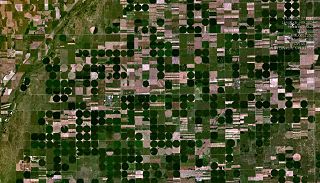
Lewis is a city in Edwards County, Kansas, United States. As of the 2020 census, the population of the city was 400. It is located along Highway 50.
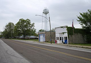
Lane is a city in Franklin County, Kansas, United States. As of the 2020 census, the population of the city was 241.

Gove City, more commonly known as Gove, is a city in and the county seat of Gove County, Kansas, United States. As of the 2020 census, the population of the city was 80.

Copeland is a city in Gray County, Kansas, United States. As of the 2020 census, the population of the city was 251.

Climax is a city in Greenwood County, Kansas, United States. As of the 2020 census, the population of the city was 45.

Harper is a city in Harper County, Kansas, United States. As of the 2020 census, the population of the city was 1,313.

Burlingame is a city in Osage County, Kansas, United States. As of the 2020 census, the population of the city was 971.

Rozel is a city in Pawnee County, Kansas, United States. As of the 2020 census, the population of the city was 102.

Louisville is a city in Pottawatomie County, Kansas, United States. As of the 2020 census, the population of the city was 131.
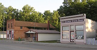
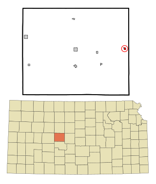
St. George or Saint George is a city in Pottawatomie County, Kansas, United States. As of the 2020 census, the population of the city was 1,054. The name might have been intended to honor several pioneer settlers named George.

Belleville is a city in and the county seat of Republic County, Kansas, United States. As of the 2020 census, the population of the city was 2,007.
Otis is a city in Rush County, Kansas, United States. As of the 2020 census, the population of the city was 296.

Bel Aire is a city in Sedgwick County, Kansas, United States, and a suburb of Wichita. As of the 2020 census, the population of the city was 8,262.

Alma is a city in and the county seat of Wabaunsee County, Kansas, United States. As of the 2020 census, the population of the city was 802.


