National Register of Historic Places listings in Tennessee

Last updated

This is a list of properties and historic districts in Tennessee that are listed on the National Register of Historic Places . There are over 2,000 in total. Of these, 29 are National Historic Landmarks. Each of Tennessee's 95 counties has at least one listing.

Contents

The Tennessee Historical Commission, which manages the state's participation in the National Register program, reports that 80 percent of the state's area has been surveyed for historic buildings. Surveys for archaeological sites have been less extensive; coverage is estimated less than 5 percent of the state. Not all properties that have been determined to be eligible for National Register are listed. [1]

The locations of National Register properties and districts (at least for all showing latitude and longitude coordinates below), may be seen in an online map by clicking on "Map of all coordinates". [2]

Contents: Counties in Tennessee
Anderson  Bedford  Benton  Bledsoe  Blount  Bradley  Campbell  Cannon  Carroll  Carter  Cheatham  Chester  Claiborne  Clay  Cocke  Coffee  Crockett  Cumberland  Davidson  Decatur  DeKalb  Dickson  Dyer  Fayette  Fentress  Franklin  Gibson  Giles  Grainger  Greene  Grundy  Hamblen  Hamilton  Hancock  Hardeman  Hardin  Hawkins  Haywood  Henderson  Henry  Hickman  Houston  Humphreys  Jackson  Jefferson  Johnson  Knox  Lake  Lauderdale  Lawrence  Lewis  Lincoln  Loudon  Macon  Madison  Marion  Marshall  Maury  McMinn  McNairy  Meigs  Monroe  Montgomery  Moore  Morgan  Obion  Overton  Perry  Pickett  Polk  Putnam  Rhea  Roane  Robertson  Rutherford  Scott  Sequatchie  Sevier  Shelby  Smith  Stewart  Sullivan  Sumner  Tipton  Trousdale  Unicoi  Union  Van Buren  Warren  Washington  Wayne  Weakley  White  Williamson  Wilson


    This National Park Service list is complete through NPS recent listings posted March 8, 2024. [3]

Current listings by county

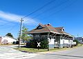
The following are approximate tallies of current listings by county. These counts are based on entries in the National Register Information Database as of April 24, 2008 [4] and new weekly listings posted since then on the National Register of Historic Places web site. [5] There are frequent additions to the listings and occasional delistings and the counts here are approximate and not official. New entries are added to the official Register on a weekly basis. [6] Also, the counts in this table exclude boundary increase and decrease listings which only modify the area covered by an existing property or district, although carrying a separate National Register reference number.

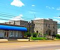
The Tennessee county with the largest number of National Register listings is Davidson County, site of the state capital, Nashville.

Tennessee's counties Tennessee county map.gif
Tennessee's counties
NRHP Tennessee Map.svg
County# of Sites
1 Anderson 19
2 Bedford 32
3 Benton 3
4 Bledsoe 9
5 Blount 74
6 Bradley 24
7 Campbell 8
8 Cannon 10
9 Carroll 5
10 Carter 13
11 Cheatham 8
12 Chester 3
13 Claiborne 12
14 Clay 2
15 Cocke 15
16 Coffee 16
17 Crockett 2
18 Cumberland 8
19 Davidson 197
20 Decatur 5
21 DeKalb 5
22 Dickson 23
23 Dyer 9
24 Fayette 13
25 Fentress 12
26 Franklin 21
27 Gibson 20
28 Giles 33
29 Grainger 9
30 Greene 17
31 Grundy 22
32 Hamblen 13
33 Hamilton 108
34 Hancock 2
35 Hardeman 12
36 Hardin 9
37 Hawkins 12
38 Haywood 14
39 Henderson 5
40 Henry 15
41 Hickman 11
42 Houston 3
43 Humphreys 10
44 Jackson 6
45 Jefferson 13
46 Johnson 7
47 Knox 116
48 Lake 1
49 Lauderdale 7
50 Lawrence 15
51 Lewis 7
52 Lincoln 17
53 Loudon 24
54 Macon 7
55 Madison 30
56 Marion 18
57 Marshall 23
58 Maury 69
59 McMinn 19
60 McNairy 4
61 Meigs 37
62 Monroe 20
63 Montgomery 53
64 Moore 6
65 Morgan 5
66 Obion 16
67 Overton 7
68 Perry 6
69 Pickett 3
70 Polk 18
71 Putnam 15
72 Rhea 8
73 Roane 20
74 Robertson 28
75 Rutherford 48
76 Scott 6
77 Sequatchie 5
78 Sevier 37
79 Shelby 202
80 Smith 13
81 Stewart 16
82 Sullivan 46
83 Sumner 39
84 Tipton 14
85 Trousdale 7
86 Unicoi 4
87 Union 7
88 Van Buren 4
89 Warren 23
90 Washington 37
91 Wayne 10
92 Weakley 12
93 White 12
94 Williamson 132
95 Wilson 24
(duplicates)(23) [7]
Total:2,163

Anderson County

Bedford County

Benton County

[8] Name on the Register [4] ImageDate listed [9] Location City or townDescription
1 Reynoldsburg-Paris Road August 7, 2005
(#05000803)
5.0 miles northeast of Camden off Chestnut Hill Rd.
36°06′00″N87°58′36″W / 36.1°N 87.976667°W / 36.1; -87.976667 (Reynoldsburg-Paris Road)
Camden A Trail of Tears site [10]
2 William Thompson House
William Thompson House William Thompson House.JPG
William Thompson House
May 6, 1976
(#76001763)
South of Camden, off State Route 69
36°02′24″N88°05′37″W / 36.04°N 88.093611°W / 36.04; -88.093611 (William Thompson House)
Camden
3 US Post Office
US Post Office Downtown Camden TN 2012-07-27 017.jpg
US Post Office
September 23, 1988
(#88001577)
81 N. Forest St.
36°03′30″N88°05′49″W / 36.058333°N 88.096944°W / 36.058333; -88.096944 (US Post Office)
Camden

Former listings

[8] Name on the RegisterImageDate listedDate removedLocationCity or townDescription
1 Mount Zion Church October 2, 1973
(#73001752)
July 17, 20125.5 miles southeast of Big Sandy
36°10′41″N88°01′10″W / 36.178056°N 88.019444°W / 36.178056; -88.019444 (Mount Zion Church)
Big Sandy Destroyed by arsonist.
2 John Rushing Farm December 17, 1999
(#99001587)
June 10, 20225760 N. State Route 69A
36°08′00″N88°06′15″W / 36.133333°N 88.104167°W / 36.133333; -88.104167 (John Rushing Farm)
Camden

Bledsoe County

[8] Name on the Register [4] ImageDate listed [9] Location City or townDescription
1 Bellview School
Bellview School Bellview-school-bledsoe-tn1.jpg
Bellview School
March 5, 1999
(#99000279)
State Route 101
35°44′44″N85°10′42″W / 35.745556°N 85.178333°W / 35.745556; -85.178333 (Bellview School)
Pikeville Rural schoolhouse built in 1928; now used as a community center
2 Bledsoe County Courthouse
Bledsoe County Courthouse Bledsoe-county-tennessee-courthouse1.jpg
Bledsoe County Courthouse
March 30, 1995
(#95000346)
Town Sq.
35°36′20″N85°11′19″W / 35.605556°N 85.188611°W / 35.605556; -85.188611 (Bledsoe County Courthouse)
Pikeville
3 Bledsoe County Jail
Bledsoe County Jail Bledsoe-county-jail-tn1.jpg
Bledsoe County Jail
November 12, 2008
(#08001049)
128 Frazier St.
35°36′23″N85°11′20″W / 35.606389°N 85.188889°W / 35.606389; -85.188889 (Bledsoe County Jail)
Pikeville Still serves as the county's jail
4 John Bridgman House
John Bridgman House John-bridgman-house-tn2.jpg
John Bridgman House
June 24, 1993
(#93000567)
106 E. Spring St.
35°36′06″N85°10′59″W / 35.601667°N 85.183056°W / 35.601667; -85.183056 (John Bridgman House)
Pikeville Federal-style house built in 1815
5 Fall Creek Falls Fire Lookout Tower
Fall Creek Falls Fire Lookout Tower FCF Fire Lookout Tower.jpg
Fall Creek Falls Fire Lookout Tower
July 21, 2015
(#15000444)
Fire Tower Rd.
35°40′10″N85°18′23″W / 35.6695°N 85.3063°W / 35.6695; -85.3063 (Fall Creek Falls Fire Lookout Tower)
Pikeville vicinity
6 Lincoln School
Lincoln School Lincoln-school-pikeville-tn1.jpg
Lincoln School
July 15, 1993
(#93000648)
Old State Route 28 near Rockford Rd.
35°36′44″N85°11′26″W / 35.612222°N 85.190556°W / 35.612222; -85.190556 (Lincoln School)
Pikeville A Rosenwald school built in the 1920s
7 Pikeville Chapel African Methodist Episcopal Zion Church
Pikeville Chapel African Methodist Episcopal Zion Church Pikeville-ame-zion-church-tn1.jpg
Pikeville Chapel African Methodist Episcopal Zion Church
November 30, 1999
(#99001444)
E. Valley Dr.
35°36′18″N85°11′08″W / 35.605°N 85.185556°W / 35.605; -85.185556 (Pikeville Chapel African Methodist Episcopal Zion Church)
Pikeville Originally a Freedmen's Bureau school built in 1870; converted to AME Zion church in 1888
8 Dr. James A. Ross House
Dr. James A. Ross House James-ross-house-tn1.jpg
Dr. James A. Ross House
June 25, 1999
(#99000758)
102 Frazier St.
35°36′20″N85°11′16″W / 35.605556°N 85.187778°W / 35.605556; -85.187778 (Dr. James A. Ross House)
Pikeville Home and office of Dr. James Ross, built c. 1872; now home to the Museum of Bledsoe County History
9 South Main Street Historic District
South Main Street Historic District Pikeville-south-main-house-tn1.jpg
South Main Street Historic District
April 21, 1994
(#94000375)
200-422 S. Main St;.
35°36′06″N85°11′25″W / 35.601667°N 85.190278°W / 35.601667; -85.190278 (South Main Street Historic District)
Pikeville

Blount County

Bradley County

Campbell County

[8] Name on the Register [4] ImageDate listed [9] Location City or townDescription
1 Jellico Commercial Historic District
Jellico Commercial Historic District N-Main-S-Main-int-Jellico-tn1.jpg
Jellico Commercial Historic District
November 12, 1999
(#99001344)
Roughly along North and South Main Sts.
36°35′15″N84°07′44″W / 36.5875°N 84.128889°W / 36.5875; -84.128889 (Jellico Commercial Historic District)
Jellico Includes several buildings mostly along North Main and South Main
2 Kincaid-Howard House
Kincaid-Howard House Kincaid-Howard-House-tn1.jpg
Kincaid-Howard House
March 16, 1976
(#76001766)
State Route 63
36°24′32″N84°03′04″W / 36.408889°N 84.051111°W / 36.408889; -84.051111 (Kincaid-Howard House)
Fincastle Built in 1845 by John Kincaid II; Nomination form: https://npgallery.nps.gov/NRHP/GetAsset/NRHP/76001766_text
3 LaFollette Coke Ovens
LaFollette Coke Ovens LaFollette Coke Ovens.jpg
LaFollette Coke Ovens
November 29, 2016
(#16000811)
Ivydale & Water Plant Rds., Coke Oven Ln.
36°23′45″N84°07′40″W / 36.395761°N 84.127767°W / 36.395761; -84.127767 (LaFollette Coke Ovens)
LaFollette
4 LaFollette House
LaFollette House LaFollette-House-tn1.jpg
LaFollette House
May 29, 1975
(#75001736)
Indiana Ave.
36°23′01″N84°07′06″W / 36.383611°N 84.118333°W / 36.383611; -84.118333 (LaFollette House)
LaFollette Also known as "Glen Oaks"; built c. 1895 by Harvey LaFollette; designed by George F. Barber
5 Norris Hydroelectric Project
Norris Hydroelectric Project Norris (8405833087).jpg
Norris Hydroelectric Project
April 12, 2016
(#16000165)
300 Powerhouse Way
36°13′27″N84°05′32″W / 36.224167°N 84.092222°W / 36.224167; -84.092222 (Norris Hydroelectric Project)
Norris Extends into Anderson County
6 A.E. Perkins House
A.E. Perkins House Perkins-house-jacksboro-tn1.jpg
A.E. Perkins House
December 8, 1997
(#97001529)
130 Valley St.
36°19′55″N84°10′50″W / 36.331944°N 84.180556°W / 36.331944; -84.180556 (A.E. Perkins House)
Jacksboro
7 Smith-Little-Mars House
Smith-Little-Mars House Smith-Little-Mars-House-tn1.jpg
Smith-Little-Mars House
November 7, 1976
(#76001767)
West of Speedwell on State Route 63
36°26′41″N83°55′45″W / 36.444722°N 83.929167°W / 36.444722; -83.929167 (Smith-Little-Mars House)
Speedwell https://npgallery.nps.gov/NRHP/GetAsset/NRHP/76001767_text
8 U.S. Post Office and Mine Rescue Station
U.S. Post Office and Mine Rescue Station Jellico-post-office-tn1.jpg
U.S. Post Office and Mine Rescue Station
February 10, 1984
(#84003467)
368 N. Main St. [11]
36°35′23″N84°07′34″W / 36.589722°N 84.126111°W / 36.589722; -84.126111 (U.S. Post Office and Mine Rescue Station)
Jellico

Cannon County

[8] Name on the Register [4] ImageDate listed [9] Location City or townDescription
1 Baptist Female College-Adams House
Baptist Female College-Adams House Adams-house-woodbury-tn1.jpg
Baptist Female College-Adams House
June 25, 1987
(#87001035)
210 S. College St.
35°49′34″N86°04′31″W / 35.826111°N 86.075278°W / 35.826111; -86.075278 (Baptist Female College-Adams House)
Woodbury Built in 1859 as a dormitory for the Baptist Female College, used as a house by Dr. J.E. Adams in the 20th century
2 Auburntown High School Gym July 8, 2022
(#100007915)
150 Vantrease Ave.
35°56′43″N86°05′52″W / 35.9452°N 86.0977°W / 35.9452; -86.0977 (Auburntown High School Gym)
Auburntown
3 Brevard-Macon House
Brevard-Macon House Brevard-house-woodbury-tn1.jpg
Brevard-Macon House
December 23, 1994
(#94001491)
902 W. Main St.
35°49′37″N86°04′56″W / 35.826944°N 86.082222°W / 35.826944; -86.082222 (Brevard-Macon House)
Woodbury Built in 1900 by William F. Brevard; still owned by his descendants
4 Brown-Hancock House
Brown-Hancock House Brown-Hancock House-Woodbury, TN.jpg
Brown-Hancock House
May 7, 2019
(#100003901)
110 W. Water St.
35°49′43″N86°04′11″W / 35.8286°N 86.0697°W / 35.8286; -86.0697 (Brown-Hancock House)
Woodbury
5 Cannon County Courthouse
Cannon County Courthouse Cannon-county-courthouse-tn1.jpg
Cannon County Courthouse
April 14, 1992
(#92000347)
Court Sq.
35°49′42″N86°04′15″W / 35.828333°N 86.070833°W / 35.828333; -86.070833 (Cannon County Courthouse)
Woodbury Built in 1935; designed by George Waller
6 William Cannon Houston House
William Cannon Houston House William Cannon Houston House-Woodbury, TN.jpg
William Cannon Houston House
June 16, 1989
(#89000503)
107 Houston Ln.
35°49′30″N86°03′30″W / 35.825°N 86.058333°W / 35.825; -86.058333 (William Cannon Houston House)
Woodbury
7 The Meltons Bank July 3, 2023
(#100009095)
229 Gassaway Main St.
35°56′22″N85°59′45″W / 35.9395°N 85.9957°W / 35.9395; -85.9957 (The Meltons Bank)
Liberty vicinity
8 Ready-Cates Farm
Ready-Cates Farm Ready-cates-farm-tn1.jpg
Ready-Cates Farm
July 27, 2005
(#05000760)
1662 Northcutt Rd.
35°53′22″N86°07′45″W / 35.889444°N 86.129167°W / 35.889444; -86.129167 (Ready-Cates Farm)
Milton Established 1840s by Abner Alexander; includes circa-1870 house
9 Readyville Mill
Readyville Mill Readyville mill.jpg
Readyville Mill
July 2, 1973
(#73001753)
On U.S. Route 70S
35°49′48″N86°10′35″W / 35.83°N 86.176389°W / 35.83; -86.176389 (Readyville Mill)
Readyville
10 Rucker-Mason Farm January 9, 2007
(#06001234)
837 Hare Ln.
35°54′13″N86°08′40″W / 35.903611°N 86.144444°W / 35.903611; -86.144444 (Rucker-Mason Farm)
Porterfield

Carroll County

[8] Name on the Register [4] ImageDate listed [9] Location City or townDescription
1 Court Theatre
Court Theatre Court Theater Huntingdon.jpg
Court Theatre
March 12, 2012
(#12000115)
155 Court Sq.
36°00′04″N88°25′42″W / 36.001184°N 88.42842°W / 36.001184; -88.42842 (Court Theatre)
Huntingdon
2 First Cumberland Presbyterian Church-McKenzie June 17, 1993
(#93000476)
647 Stonewall Street North
36°08′00″N88°31′13″W / 36.133333°N 88.520278°W / 36.133333; -88.520278 (First Cumberland Presbyterian Church-McKenzie)
McKenzie
3 Leach Fire Lookout Tower November 14, 2017
(#100001821)
RT 1 Leach Rd.
35°54′47″N88°28′49″W / 35.913085°N 88.480318°W / 35.913085; -88.480318 (Leach Fire Lookout Tower)
Cedar Grove
4 Long Rock Methodist Episcopal Church, South
Long Rock Methodist Episcopal Church, South Long Rock UMC.jpg
Long Rock Methodist Episcopal Church, South
July 16, 2010
(#10000466)
340 Long Rock Church Rd.
36°02′59″N88°24′03″W / 36.049722°N 88.400833°W / 36.049722; -88.400833 (Long Rock Methodist Episcopal Church, South)
Huntingdon vicinity
5 McKenzie Depot
McKenzie Depot McKenzie Depot, McKenzie, Tennessee 1.JPG
McKenzie Depot
March 28, 1996
(#96000336)
85 E. Bruce St.
36°07′52″N88°31′09″W / 36.131111°N 88.519167°W / 36.131111; -88.519167 (McKenzie Depot)
McKenzie

Former listing

[8] Name on the RegisterImageDate listedDate removedLocationCity or townDescription
1 Hillsman House March 25, 1982
(#82003955)
June 10, 2022Old Hinkledale-McKenzie Rd.
36°02′23″N88°36′44″W / 36.039722°N 88.612222°W / 36.039722; -88.612222 (Hillsman House)
Trezevant

Carter County

Cheatham County

[8] Name on the Register [4] ImageDate listed [9] Location City or townDescription
1 Cheatham County Courthouse
Cheatham County Courthouse Cheatham-county-courthouse-tn1.jpg
Cheatham County Courthouse
December 12, 1976
(#76001769)
Court Sq.
36°16′29″N87°03′49″W / 36.274722°N 87.063611°W / 36.274722; -87.063611 (Cheatham County Courthouse)
Ashland City
2 Indian Town Bluff August 30, 1974
(#74001904)
Address Restricted
Ashland City
3 Kingston Springs Hotel and Buildings
Kingston Springs Hotel and Buildings Kingston Springs Hotel.jpg
Kingston Springs Hotel and Buildings
October 31, 1979
(#79002417)
Kingston Springs Rd.
36°05′41″N87°06′48″W / 36.094722°N 87.113333°W / 36.094722; -87.113333 (Kingston Springs Hotel and Buildings)
Kingston Springs
4 Montgomery Bell Tunnel
Montgomery Bell Tunnel Montgomery Bell Tunnel.jpg
Montgomery Bell Tunnel
April 19, 1994
(#94001188)
Junction of the Harpeth River and Bell Bend Rd.
36°08′49″N87°07′19″W / 36.146944°N 87.121944°W / 36.146944; -87.121944 (Montgomery Bell Tunnel)
White Bluff
5 Mound Bottom
Mound Bottom Mound Bottom View.jpg
Mound Bottom
September 3, 1971
(#71000813)
Along the Harpeth River below Kingston Springs, in Harpeth River State Park [12]
36°08′24″N87°06′05″W / 36.140000°N 87.101389°W / 36.140000; -87.101389 (Mound Bottom)
Kingston Springs
6 Patterson Forge (40CH87) April 16, 1971
(#71000814)
Address Restricted
Kingston Springs
7 Sycamore Mills Site July 9, 1979
(#79002416)
Address Restricted
Ashland City
8 Turnbull Forge (40CH97) July 20, 1988
(#88001108)
Address Restricted
Kingston Springs

Chester County

[8] Name on the Register [4] ImageDate listed [9] Location City or townDescription
1 Chester County Courthouse
Chester County Courthouse Chester county tennessee courthouse.jpg
Chester County Courthouse
March 26, 1979
(#79002418)
Court Sq.
35°26′24″N88°38′27″W / 35.44°N 88.640833°W / 35.44; -88.640833 (Chester County Courthouse)
Henderson
2 Hamlett-Smith House
Hamlett-Smith House Hamlett-Smith House.jpg
Hamlett-Smith House
December 1, 1983
(#83004227)
Jacks Creek-Mifflin Rd.
35°29′20″N88°31′17″W / 35.488889°N 88.521389°W / 35.488889; -88.521389 (Hamlett-Smith House)
Jacks Creek
3 National Teacher's Normal and Business College Administration Building
National Teacher's Normal and Business College Administration Building National Teacher's Normal and Business College Administration Building.JPG
National Teacher's Normal and Business College Administration Building
March 12, 2012
(#12000116)
158 E. Main St.
35°26′25″N88°38′22″W / 35.440278°N 88.639444°W / 35.440278; -88.639444 (National Teacher's Normal and Business College Administration Building)
Henderson

Claiborne County

Clay County

[8] Name on the Register [4] ImageDate listed [9] Location City or townDescription
1 Clay County Courthouse
Clay County Courthouse Clay-county-tennessee-courthouse.jpg
Clay County Courthouse
September 22, 1977
(#77001261)
State Route 52
36°33′02″N85°30′22″W / 36.550556°N 85.506111°W / 36.550556; -85.506111 (Clay County Courthouse)
Celina
2 Free Hills Rosenwald School
Free Hills Rosenwald School Free-hills-rosenwald-tn1.jpg
Free Hills Rosenwald School
November 15, 1996
(#96001360)
Free Hill Rd., east of State Route 52
36°33′46″N85°29′13″W / 36.562639°N 85.486944°W / 36.562639; -85.486944 (Free Hills Rosenwald School)
Free Hill One of only about 30 Rosenwald schools still extant, was built to educate African Americans and used from circa 1925 to 1966.

Cocke County

Coffee County

Crockett County

[8] Name on the Register [4] ImageDate listed [9] Location City or townDescription
1 Bank of Alamo
Bank of Alamo Alamo-Bank-tn.jpg
Bank of Alamo
June 26, 1986
(#86001397)
103 S. Bells St.
35°47′06″N89°07′02″W / 35.785°N 89.117222°W / 35.785; -89.117222 (Bank of Alamo)
Alamo Built in 1912
2 Fruitvale Historic District November 14, 2012
(#12000943)
Along Fruitvale Rd. & Jct. with Edward Williams Rd.
35°44′49″N89°01′50″W / 35.746913°N 89.030521°W / 35.746913; -89.030521 (Fruitvale Historic District)
Fruitvale

Cumberland County

[8] Name on the Register [4] ImageDate listed [9] Location City or townDescription
1 Camp Nakanawa Wigwam
Camp Nakanawa Wigwam Camp-nakanawa-wigwam-tn1.jpg
Camp Nakanawa Wigwam
November 12, 1999
(#99001345)
Camp Nakanawa Wigwam Rd.
36°03′48″N85°11′45″W / 36.063333°N 85.195833°W / 36.063333; -85.195833 (Camp Nakanawa Wigwam)
Mayland
2 Crossville Tennessee Highway Patrol Building
Crossville Tennessee Highway Patrol Building Tennessee-Highway-Patrol-Building-Crossville-tn2.jpg
Crossville Tennessee Highway Patrol Building
April 18, 2003
(#03000281)
39 Main St.
35°56′51″N85°01′33″W / 35.9475°N 85.025833°W / 35.9475; -85.025833 (Crossville Tennessee Highway Patrol Building)
Crossville Currently serves as the Tennessee Native Stone Museum to commemorate the uses and history of native Crab Orchard Stone.
3 Cumberland County Courthouses
Cumberland County Courthouses Cumberland County Courthouse, Crossville TN.jpg
Cumberland County Courthouses
June 17, 1980
(#80003783)
Main St.
35°56′53″N85°01′37″W / 35.948056°N 85.026944°W / 35.948056; -85.026944 (Cumberland County Courthouses)
Crossville Listing includes the current courthouse, built in 1905, and the old courthouse (currently the Military Memorial Museum), built in 1886.
4 Cumberland Homesteads Historic District
Cumberland Homesteads Historic District Cumberland-homesteads-tower-tn1.jpg
Cumberland Homesteads Historic District
September 30, 1988
(#88001593)
Roughly along County Seat and Valley Rds., Grassy Cove Rd., Deep Draw and Pigeon Ridge Rds.
35°54′22″N84°58′58″W / 35.906111°N 84.982778°W / 35.906111; -84.982778 (Cumberland Homesteads Historic District)
Crossville Includes several hundred houses and public buildings of 1930s-era planned community; also includes parts of Cumberland Mountain State Park
5 Cumberland Mountain School
Cumberland Mountain School Cumberland-mtn-school-tn1.jpg
Cumberland Mountain School
August 5, 1993
(#93000779)
Western side of Old U.S. Route 127N, 2 miles north of Crossville
35°58′45″N85°02′07″W / 35.979167°N 85.035278°W / 35.979167; -85.035278 (Cumberland Mountain School)
Crossville
6 Palace Theater
Palace Theater The Palace Theater.jpg
Palace Theater
January 7, 1994
(#93001477)
210 N. Main St.
35°56′49″N85°01′33″W / 35.946944°N 85.025833°W / 35.946944; -85.025833 (Palace Theater)
Crossville Art Deco theatre built in 1936. Now used as a community center
7 Pioneer Hall
Pioneer Hall Pioneer-hall-museum-tn1.jpg
Pioneer Hall
November 21, 1978
(#78002576)
Main St.
35°58′34″N85°11′40″W / 35.976111°N 85.194444°W / 35.976111; -85.194444 (Pioneer Hall)
Pleasant Hill Once part of the Pleasant Hill Academy; now a local museum
8 Greenberry Wilson House
Greenberry Wilson House 2-Greenberry Wilson house-9sep14.png
Greenberry Wilson House
June 28, 1996
(#96000719)
E.G. Wilson Rd., 7 miles southeast of Crossville
35°46′08″N85°01′53″W / 35.768889°N 85.031389°W / 35.768889; -85.031389 (Greenberry Wilson House)
Burke

Davidson County

DeKalb County

[8] Name on the Register [4] ImageDate listed [9] Location City or townDescription
1 Alexandria Cemeteries Historic District
Alexandria Cemeteries Historic District Alexandria-cemetery-tn1.jpg
Alexandria Cemeteries Historic District
May 30, 2002
(#02000584)
Cemetery St.
36°04′34″N86°01′44″W / 36.076111°N 86.028889°W / 36.076111; -86.028889 (Alexandria Cemeteries Historic District)
Alexandria
2 DeKalb County Fairgrounds
DeKalb County Fairgrounds DeKalb-county-fairground-tn1.jpg
DeKalb County Fairgrounds
November 29, 1995
(#95001372)
103 Fairground Rd.
36°04′41″N86°01′55″W / 36.078056°N 86.031944°W / 36.078056; -86.031944 (DeKalb County Fairgrounds)
Alexandria
3 Evans Block
Evans Block Smithville-evans-block-tn1.jpg
Evans Block
August 30, 1984
(#84003533)
101 and 103 N. 4th St.
35°57′41″N85°48′50″W / 35.961389°N 85.813889°W / 35.961389; -85.813889 (Evans Block)
Smithville
4 Susie Foster Log House July 3, 2007
(#07000665)
810 College St.
35°57′01″N85°48′57″W / 35.950278°N 85.815833°W / 35.950278; -85.815833 (Susie Foster Log House)
Smithville
5 Liberty Historic District
Liberty Historic District Liberty-town-hall-tn1.jpg
Liberty Historic District
June 25, 1987
(#87001058)
Roughly along Main and N. Main Sts.
36°00′18″N85°57′58″W / 36.005°N 85.966111°W / 36.005; -85.966111 (Liberty Historic District)
Liberty

Former listing

[8] Name on the RegisterImageDate listedDate removedLocationCity or townDescription
1 Caplinger-Smith House February 12, 1980
(#80004296)
April 20, 1989SW Temperance Hall
Temperance Hall

Decatur County

[8] Name on the Register [4] ImageDate listed [9] Location City or townDescription
1 Dr. Beauregard Martin Brooks House September 3, 1992
(#92001074)
State Route 114 (Clifton Ferry Rd.) east of its junction with State Route 69
35°26′21″N88°05′21″W / 35.439167°N 88.089167°W / 35.439167; -88.089167 (Dr. Beauregard Martin Brooks House)
Bath Springs
2 Brownsport I Furnace (40DR85) July 28, 1988
(#88001144)
Address Restricted
Gumdale
3 Brownsport II Furnace (40DR86) August 26, 1977
(#77001265)
Address Restricted
Decaturville
4 Decatur Furnace (40DR84) July 28, 1988
(#88001142)
Address Restricted
Bath Springs
5 John P. Rains Hotel
John P. Rains Hotel John P. Rains Hotel.jpg
John P. Rains Hotel
November 21, 1978
(#78002585)
106-108 Tennessee Ave., S.
35°38′58″N88°07′35″W / 35.649306°N 88.126389°W / 35.649306; -88.126389 (John P. Rains Hotel)
Parsons

Dickson County

Dyer County

[8] Name on the Register [4] ImageDate listed [9] Location City or townDescription
1 Bank of Dyersburg
Bank of Dyersburg Dyer bank.jpg
Bank of Dyersburg
June 16, 1983
(#83003030)
100 N. Main St.
36°01′57″N89°23′07″W / 36.0325°N 89.385278°W / 36.0325; -89.385278 (Bank of Dyersburg)
Dyersburg 2-story Italianate/Romanesque style bank building constructed in 1885 with a three story 1890 addition.
2 Bruce High School July 6, 2023
(#100009096)
801 Vernon St.
36°01′28″N89°22′40″W / 36.0244°N 89.3778°W / 36.0244; -89.3778 (Bruce High School)
Dyersburg
3 Dyersburg Courthouse Square Historic District
Dyersburg Courthouse Square Historic District Dyer County Tennessee Courthouse.jpg
Dyersburg Courthouse Square Historic District
February 28, 1991
(#91000222)
Roughly bounded by Church, Main, Cedar, and Court Sts.
36°01′48″N89°23′02″W / 36.03°N 89.383889°W / 36.03; -89.383889 (Dyersburg Courthouse Square Historic District)
Dyersburg
4 Gordon-Oak Streets Historic District May 8, 1992
(#92000428)
107-302 Gordon and 114-305 Oak Sts., and the western side of 711-731 Sampson Ave.
36°02′22″N89°22′58″W / 36.039444°N 89.382778°W / 36.039444; -89.382778 (Gordon-Oak Streets Historic District)
Dyersburg
5 Edward Moody King House
Edward Moody King House Edward Moody King House.jpg
Edward Moody King House
October 25, 1990
(#90001658)
512 Finley St.
36°02′03″N89°23′27″W / 36.034167°N 89.390833°W / 36.034167; -89.390833 (Edward Moody King House)
Dyersburg
6 Latta House November 14, 1978
(#78002586)
917 Troy Ave.
36°02′31″N89°23′06″W / 36.041944°N 89.385°W / 36.041944; -89.385 (Latta House)
Dyersburg
7 Newbern Illinois Central Depot
Newbern Illinois Central Depot Dyer Country Newbern Depot.jpg
Newbern Illinois Central Depot
March 25, 1993
(#93000213)
Junction of Main and Jefferson Sts.
36°06′44″N89°15′44″W / 36.112222°N 89.262222°W / 36.112222; -89.262222 (Newbern Illinois Central Depot)
Newbern
8 Pleasant Hill Cemetery
Pleasant Hill Cemetery Pleasant Hill Cemetery.jpg
Pleasant Hill Cemetery
November 13, 2003
(#03001159)
Approximately 0.7 miles west of the cattle gate at the end of Cemetery Rd.
36°02′45″N89°29′04″W / 36.045833°N 89.484444°W / 36.045833; -89.484444 (Pleasant Hill Cemetery)
Finley
9 Troy Avenue Historic District
Troy Avenue Historic District Dyer County Troy Avenue Historic District.jpg
Troy Avenue Historic District
May 8, 1992
(#92000429)
827-1445 Troy Ave., western side
36°02′36″N89°23′07″W / 36.043333°N 89.385278°W / 36.043333; -89.385278 (Troy Avenue Historic District)
Dyersburg

Former listing

[8] Name on the RegisterImageDate listedDate removedLocationCity or townDescription
1 Dyersburg Sanatarium September 8, 1976
(#76002241)
December 9, 1976124 McGaughey
Dyersburg Demolished. [13]

Fayette County

Fentress County

Franklin County

Gibson County

Giles County

Grainger County

Greene County

Grundy County

Hamblen County

Hamilton County

Hancock County

[8] Name on the Register [4] ImageDate listed [9] Location City or townDescription
1 Old Jail
Old Jail Hancock-county-old-jail-tn1.jpg
Old Jail
April 11, 1973
(#73001784)
Jail St.
36°31′46″N83°13′00″W / 36.529444°N 83.216667°W / 36.529444; -83.216667 (Old Jail)
Sneedville
2 Vardy School Community Historic District
Vardy School Community Historic District Vardy-community-presbyterian-church-tn1.jpg
Vardy School Community Historic District
November 8, 1984
(#84000373)
Blackwater Rd.
36°35′03″N83°11′19″W / 36.584167°N 83.188611°W / 36.584167; -83.188611 (Vardy School Community Historic District)
Sneedville The school has collapsed, but other structures in the district intact and preserved.

Hardeman County

Hardin County

[8] Name on the Register [4] ImageDate listed [9] Location City or townDescription
1 Arch Bridge
Arch Bridge Arch Bridge-Olive Hill TN.jpg
Arch Bridge
July 20, 2020
(#100005375)
2221 US-64
35°16′37″N88°01′19″W / 35.2770°N 88.0220°W / 35.2770; -88.0220 (Arch Bridge)
Olive Hill
2 Cherry Mansion
Cherry Mansion Cherry Mansion, 101 Main Street, Savannah (Hardin County, Tennessee).jpg
Cherry Mansion
August 16, 1977
(#77001274)
101 Main St.
35°13′32″N88°15′24″W / 35.2256°N 88.2567°W / 35.2256; -88.2567 (Cherry Mansion)
Savannah
3 James Graham House
James Graham House James Graham House-Savannah TN.jpg
James Graham House
October 29, 1991
(#91001594)
2221 Airport Rd.
35°09′39″N88°13′02″W / 35.1608°N 88.2172°W / 35.1608; -88.2172 (James Graham House)
Savannah
4 Pickwick Landing Hydroelectric Project
Pickwick Landing Hydroelectric Project USACE Pickwick Landing Dam.jpg
Pickwick Landing Hydroelectric Project
August 11, 2017
(#100001467)
850 Carolina Ln.
35°03′50″N88°14′50″W / 35.0639°N 88.2472°W / 35.0639; -88.2472 (Pickwick Landing Hydroelectric Project)
Counce
5 Savannah Historic District
Savannah Historic District Savannah Historic District, Irregular pattern along Main, Deford, Guinn, Church, College, Williams and Cook Sts 12.JPG
Savannah Historic District
April 2, 1980
(#80003832)
Irregular pattern along Main, Deford, Guinn, Church, College, Williams and Cook Sts.; also 410 and 506 Main St.; also roughly bounded by College St., Main St., Tennessee St., and Williams St.
35°13′38″N88°14′59″W / 35.2272°N 88.2497°W / 35.2272; -88.2497 (Savannah Historic District)
Savannah 410/506 Main St. represent a boundary increase of November 8, 1993; "roughly bounded" represent a boundary increase of August 7, 2009
6 Shiloh Indian Mounds Site
Shiloh Indian Mounds Site Shiloh Mounds Aerial Illustration HRoe 2022 350px.jpg
Shiloh Indian Mounds Site
April 27, 1979
(#79000279)
East of Hurley in Shiloh National Military Park
35°08′32″N88°19′26″W / 35.1422°N 88.3239°W / 35.1422; -88.3239 (Shiloh Indian Mounds Site)
Hurley
7 Shiloh National Military Park
Shiloh National Military Park Iowa Monument, Shiloh National Military Park.JPG
Shiloh National Military Park
October 15, 1966
(#66000074)
Off State Route 22
35°08′22″N88°20′35″W / 35.1394°N 88.3431°W / 35.1394; -88.3431 (Shiloh National Military Park)
Pittsburg Landing
8 Tanyard Branch Furnace (40HR121) April 9, 1988
(#88000250)
Address Restricted
Bath Springs
9 Meady White House
Meady White House Meady White House-Saltillo TN.jpg
Meady White House
July 1, 1993
(#93000586)
47915 Main St.
35°22′39″N88°12′31″W / 35.3775°N 88.2086°W / 35.3775; -88.2086 (Meady White House)
Saltillo

Hawkins County

Haywood County

Henderson County

[8] Name on the Register [4] ImageDate listed [9] Location City or townDescription
1 Doe Creek School November 29, 2010
(#10000935)
Doe Creek Rd., approximately ½ mile north of Dyer Rd.
35°28′11″N88°14′51″W / 35.469722°N 88.2475°W / 35.469722; -88.2475 (Doe Creek School)
Sardis
2 Thompsie Edwards House
Thompsie Edwards House Thompsie Edwards House.jpg
Thompsie Edwards House
June 30, 1983
(#83003039)
113 Main St.
35°38′53″N88°23′30″W / 35.648194°N 88.391667°W / 35.648194; -88.391667 (Thompsie Edwards House)
Lexington
3 Montgomery High School
Montgomery High School Montgomery High School, Lexington.jpg
Montgomery High School
July 3, 2007
(#07000662)
Montgomery Ave.
35°39′02″N88°23′59″W / 35.650556°N 88.399722°W / 35.650556; -88.399722 (Montgomery High School)
Lexington
4 Mount Pisgah Missionary Baptist Church and Cemetery November 19, 2014
(#14000942)
3435 Scarce Creek Rd.
35°45′40″N88°19′59″W / 35.7611°N 88.333°W / 35.7611; -88.333 (Mount Pisgah Missionary Baptist Church and Cemetery)
Wildersville vicinity
5 Parker's Crossroads Battlefield
Parker's Crossroads Battlefield Parkers Crossroads Battlefield.jpg
Parker's Crossroads Battlefield
February 22, 1999
(#97001550)
State Route 22, 26 miles east of Jackson
35°47′33″N88°23′40″W / 35.7925°N 88.394444°W / 35.7925; -88.394444 (Parker's Crossroads Battlefield)
Parkers Crossroads

Henry County

Hickman County

Houston County

[8] Name on the Register [4] ImageDate listed [9] Location City or townDescription
1 Erin Limekilns
Erin Limekilns Erin Limekilns.jpg
Erin Limekilns
November 10, 2004
(#04001230)
708 McMillan St.
36°18′57″N87°42′52″W / 36.315833°N 87.714444°W / 36.315833; -87.714444 (Erin Limekilns)
Erin
2 V.R. Harris House
V.R. Harris House V.R. Harris House.jpg
V.R. Harris House
August 18, 1983
(#83003040)
Main St.
36°19′01″N87°42′04″W / 36.316944°N 87.701111°W / 36.316944; -87.701111 (V.R. Harris House)
Erin
3 Quarry Limekiln
Quarry Limekiln Quarry Limekiln.jpg
Quarry Limekiln
November 10, 2004
(#04001229)
State Route 49, approximately 0.25 miles east of Denmark Rd.
36°19′01″N87°42′44″W / 36.316944°N 87.712222°W / 36.316944; -87.712222 (Quarry Limekiln)
Erin

Humphreys County

Jackson County

[8] Name on the Register [4] ImageDate listed [9] Location City or townDescription
1 Carverdale Farms
Carverdale Farms Carverdale Farms.jpg
Carverdale Farms
July 31, 2018
(#100002754)
112 Harris Hollow Rd.
36°16′29″N85°45′21″W / 36.2746°N 85.7559°W / 36.2746; -85.7559 (Carverdale Farms)
Granville 
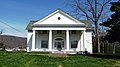
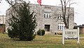
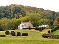
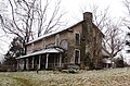
Farm first settled in 1830 by Joseph Williamson and family in the small community of Liberty just east of Granville. Historic home built in 1850 by Andrew Jackson Vantrease. Samuel Sampson Carver purchased property in 1890, operating a saw mill, blacksmith shop, and general store in addition to his agricultural uses. Farm was used for maneuver training during World War II. On October 24, 1955, current owner and great grandson of Carver, Joe Moore, was featured on the cover of Time magazine after being named 1955 Star Farmer of America. Contributing buildings range in construction dates from 1830 to 1945.
2 Fort Blount-Williamsburg Site
Fort Blount-Williamsburg Site Fort-blount-site-tn1.jpg
Fort Blount-Williamsburg Site
July 17, 1974
(#74001918)
On the Cumberland River south of Gainesboro
36°19′09″N85°45′05″W / 36.319167°N 85.751389°W / 36.319167; -85.751389 (Fort Blount-Williamsburg Site)
Gainesboro Site of Fort Blount (1794-1798) and later town of Williamsburg (founded 1807)
3 Gainesboro Historic District
Gainesboro Historic District Jackson-county-courthouse-tn2.jpg
Gainesboro Historic District
October 25, 1990
(#90001570)
Roughly bounded by Cox, Minor, Montpelier, and Mark Twain Sts.
36°21′19″N85°39′29″W / 36.355278°N 85.658056°W / 36.355278; -85.658056 (Gainesboro Historic District)
Gainesboro
4 Gainesboro Residential Historic District
Gainesboro Residential Historic District Gainesboro-house-tn1.jpg
Gainesboro Residential Historic District
July 11, 2001
(#01000728)
Roughly along Dixie Ave. and Cox, Minor, and N. Murray Sts.
36°21′24″N85°39′30″W / 36.356667°N 85.658333°W / 36.356667; -85.658333 (Gainesboro Residential Historic District)
Gainesboro
5 Jackson County High School
Jackson County High School Fox-elementary-school-tn1.jpg
Jackson County High School
July 8, 2009
(#09000535)
707 School Dr.
36°20′49″N85°39′26″W / 36.346925°N 85.657139°W / 36.346925; -85.657139 (Jackson County High School)
Gainesboro
6 T.B. Sutton General Store
T.B. Sutton General Store T.B. Sutton General Store.jpg
T.B. Sutton General Store
May 7, 2019
(#100003902)
169 Clover St.
36°16′18″N85°47′50″W / 36.271750°N 85.797084°W / 36.271750; -85.797084 (T.B. Sutton General Store)
Granville 
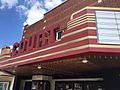
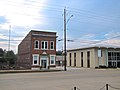
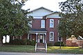
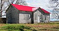
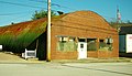
Constructed in 1880, Sutton Store is the oldest remaining commercial institution in Granville. The store sat empty for approximately thirty years before Harold and Beverley Sutton (no relation to T.B. Sutton) purchased and restored the building. In 2007, they donated the building to Historic Granville Incorporated who continue to operate the building as a general store, restaurant, and music venue. Sutton Store has been recently recognized by Country Living and Taste of the South magazines as one of the must see general stores in America.

Jefferson County

Johnson County

[8] Name on the Register [4] ImageDate listed [9] Location City or townDescription
1 Butler House
Butler House Roderick-butler-house-tn1.jpg
Butler House
April 11, 1973
(#73001798)
309 N. Church St.
36°28′19″N81°48′07″W / 36.471944°N 81.801944°W / 36.471944; -81.801944 (Butler House)
Mountain City Home of Congressman Roderick R. Butler, built circa 1870. [14]
2 Alfred Johnson Farm
Alfred Johnson Farm Alfred-Johnson-Farm-tn1.jpg
Alfred Johnson Farm
July 1, 1998
(#98000820)
825 Johnson Hollow Rd.
36°29′40″N81°47′59″W / 36.494444°N 81.799722°W / 36.494444; -81.799722 (Alfred Johnson Farm)
Mountain City
3 Kettlefoot Fire Lookout Tower
Kettlefoot Fire Lookout Tower Kettlefoot Fire Lookout Tower atop Doe Mountain, Johnson County, Tennessee.jpg
Kettlefoot Fire Lookout Tower
November 20, 2015
(#15000833)
Fire Tower Rd.
36°25′36″N81°52′00″W / 36.426785°N 81.866660°W / 36.426785; -81.866660 (Kettlefoot Fire Lookout Tower)
Mountain City
4 Maymead Farm
Maymead Farm Maymead-Farm-Johnson-County-tn1.jpg
Maymead Farm
February 15, 2012
(#11000100)
1995 Roan Creek Rd.
36°25′36″N81°49′11″W / 36.426618°N 81.819726°W / 36.426618; -81.819726 (Maymead Farm)
Mountain City
5 Morrison Farm and Store
Morrison Farm and Store Morrison-store-Johnson-County-tn1.jpg
Morrison Farm and Store
April 11, 1973
(#73001797)
State Route 91: specifically, 6171 and 6174 State Route 91, N.
36°33′20″N81°46′11″W / 36.555421°N 81.769804°W / 36.555421; -81.769804 (Morrison Farm and Store)
Laurel Bloomery Consists of a farmhouse and several outbuildings, including a log store.
6 Dr. Wiley Wagner Vaught Office
Dr. Wiley Wagner Vaught Office Wiley-Vaught-Office-tn1.jpg
Dr. Wiley Wagner Vaught Office
November 20, 2009
(#09000950)
W.W. Vaught Ln., south of Dug Hill Rd.
36°24′22″N81°48′33″W / 36.406056°N 81.809106°W / 36.406056; -81.809106 (Dr. Wiley Wagner Vaught Office)
Mountain City Doctors' office built c. 1905 by rural physician Wiley Wagner Vaught (18741974).
7 A.J. Wright Farm July 14, 2000
(#00000808)
297 A.J. Wright Rd.
36°30′05″N81°55′46″W / 36.501389°N 81.929444°W / 36.501389; -81.929444 (A.J. Wright Farm)
Shady Valley

Former listing

[8] Name on the RegisterImageDate listedDate removedLocationCity or townDescription
1 Rhea House April 11, 1973
(#73001799)
March 20, 1997 U.S. Route 421
36°26′38″N81°47′49″W / 36.443889°N 81.796944°W / 36.443889; -81.796944 (Rhea House)
Shouns Destroyed by fire [15]

Knox County

Lake County

[8] Name on the Register [4] ImageDate listed [9] Location City or townDescription
1 Caldwell-Hopson House
Caldwell-Hopson House Caldwell-Hopson House in Tiptonville.jpg
Caldwell-Hopson House
March 11, 1993
(#93000150)
431 Wynn St.
36°22′34″N89°28′50″W / 36.376111°N 89.480556°W / 36.376111; -89.480556 (Caldwell-Hopson House)
Tiptonville

Lauderdale County

[8] Name on the Register [4] ImageDate listed [9] Location City or townDescription
1 Fort Pillow
Fort Pillow Fort Pillow cannons 2006.jpg
Fort Pillow
April 11, 1973
(#73001806)
State Route 87
35°38′20″N89°49′56″W / 35.638889°N 89.832222°W / 35.638889; -89.832222 (Fort Pillow)
Fort Pillow
2 Lauderdale County Courthouse
Lauderdale County Courthouse Lauderdale County court house Ripley TN 2013-09-14 008.jpg
Lauderdale County Courthouse
March 30, 1995
(#95000343)
Town Sq.
35°44′45″N89°31′49″W / 35.745833°N 89.530278°W / 35.745833; -89.530278 (Lauderdale County Courthouse)
Ripley
3 W.E. Palmer House
W.E. Palmer House Henning Alex Haley Home and Memorial.jpg
W.E. Palmer House
December 14, 1978
(#78002604)
Off U.S. Route 51
35°40′24″N89°34′35″W / 35.673333°N 89.576389°W / 35.673333; -89.576389 (W.E. Palmer House)
Henning
4 Lauderdale High School October 29, 2021
(#100007125)
185 Spring St.
35°44′29″N89°31′23″W / 35.7414°N 89.5230°W / 35.7414; -89.5230 (Lauderdale High School)
Ripley
5 Ripley Fire Lookout Tower March 9, 2020
(#100004684)
Joe Crihfield Rd.
35°50′59″N89°31′04″W / 35.849769°N 89.517651°W / 35.849769; -89.517651 (Ripley Fire Lookout Tower)
Ripley Fire lookout tower built around 1970.
6 US Post Office September 23, 1988
(#88001582)
17 E. Jackson Ave.
35°44′41″N89°31′39″W / 35.744722°N 89.5275°W / 35.744722; -89.5275 (US Post Office)
Ripley
7 Wardlaw-Steele House January 8, 1980
(#80003844)
128 Wardlaw Pl.
35°44′31″N89°31′59″W / 35.741944°N 89.533056°W / 35.741944; -89.533056 (Wardlaw-Steele House)
Ripley

Lawrence County

Lewis County

[8] Name on the Register [4] ImageDate listed [9] Location City or townDescription
1 Ambrose Blackburn Farmstead
Ambrose Blackburn Farmstead Ambrose Blackburn Farmstead.jpg
Ambrose Blackburn Farmstead
March 28, 1985
(#85000670)
Gordonsburg Rd.
35°33′58″N87°23′55″W / 35.566111°N 87.398611°W / 35.566111; -87.398611 (Ambrose Blackburn Farmstead)
Gordonsburg
2 Hohenwald Railroad Depot
Hohenwald Railroad Depot Hohenwald Rail Depot.JPG
Hohenwald Railroad Depot
May 14, 1987
(#87000730)
State Route 99
35°32′50″N87°32′59″W / 35.547222°N 87.549722°W / 35.547222; -87.549722 (Hohenwald Railroad Depot)
Hohenwald
3 Lewis County Courthouse
Lewis County Courthouse Lewis County Courthouse, Tennessee.JPG
Lewis County Courthouse
March 29, 2006
(#06000203)
110 N. Park St.
35°33′05″N87°33′10″W / 35.551389°N 87.552778°W / 35.551389; -87.552778 (Lewis County Courthouse)
Hohenwald
4 Napier Furnaces Historic District (40LS14) May 4, 1988
(#88000459)
Address Restricted
Napier
5 Old Natchez Trace
Old Natchez Trace Old Natchez Trace, Lewis County.JPG
Old Natchez Trace
May 30, 1975
(#75002125)
From the Alabama/Tennessee border to State Route 100 in Davidson County
Coordinates missing
Gordonsburg Extends into Davidson, Hickman, Lawrence, Maury, Wayne, and Williamson counties
6 Steele's Iron Works (40LS15)
Steele's Iron Works (40LS15) Steele's Iron Works.JPG
Steele's Iron Works (40LS15)
May 4, 1988
(#88000458)
Address Restricted
Napier
7 Netherland Tait House August 9, 1984
(#84003577)
Napier Rd.
35°27′53″N87°28′14″W / 35.464722°N 87.470556°W / 35.464722; -87.470556 (Netherland Tait House)
Napier

Lincoln County

Loudon County

Macon County

[8] Name on the Register [4] ImageDate listed [9] Location City or townDescription
1 Belview School
Belview School Belview-school-underwood-tn1.jpg
Belview School
March 21, 2007
(#07000189)
Underwood Rd. near Akersville Rd.
36°36′45″N85°59′17″W / 36.6125°N 85.988056°W / 36.6125; -85.988056 (Belview School)
Underwood
2 Cloyd Hotel
Cloyd Hotel Cloyd-hotel-thomas-house-tn1.jpg
Cloyd Hotel
September 11, 1986
(#86002855)
Market St.
36°31′45″N85°50′20″W / 36.529167°N 85.838889°W / 36.529167; -85.838889 (Cloyd Hotel)
Red Boiling Springs Now called the Thomas House
3 Counts Hotel
Counts Hotel Counts-hotel-armour-tn1.jpg
Counts Hotel
September 11, 1986
(#86002856)
Market St.
36°31′49″N85°50′50″W / 36.530278°N 85.847222°W / 36.530278; -85.847222 (Counts Hotel)
Red Boiling Springs Now called the Armour's Hotel
4 Donoho Hotel Historic District
Donoho Hotel Historic District Donoho-hotel-tn1.jpg
Donoho Hotel Historic District
September 11, 1986
(#86002857)
Market St.
36°31′47″N85°50′28″W / 36.529722°N 85.841111°W / 36.529722; -85.841111 (Donoho Hotel Historic District)
Red Boiling Springs Still in operation
5 Galen Elementary School
Galen Elementary School Galen-elementary-school-tn1.jpg
Galen Elementary School
February 22, 1993
(#93000030)
Junction of Galen and Tucker Rds.
36°34′37″N85°57′44″W / 36.576944°N 85.962222°W / 36.576944; -85.962222 (Galen Elementary School)
Galen
6 Long Creek School
Long Creek School Long-creek-school-tn1.jpg
Long Creek School
February 22, 1993
(#93000032)
Long Creek Rd. northwest of Lafayette
36°33′27″N86°05′38″W / 36.5575°N 86.093889°W / 36.5575; -86.093889 (Long Creek School)
Lafayette
7 Red Boiling Springs Bank
Red Boiling Springs Bank Red-boiling-springs-bank-tn1.jpg
Red Boiling Springs Bank
September 18, 2013
(#13000747)
100 Main St.
36°31′57″N85°51′01″W / 36.532465°N 85.850178°W / 36.532465; -85.850178 (Red Boiling Springs Bank)
Red Boiling Springs Built in 1928, used as a bank until 1963

Former listings

[8] Name on the RegisterImageDate listedDate removedLocationCity or townDescription
1 Keystone School February 22, 1993
(#93000031)
July 22, 2014 State Route 52 west of Lafayette, just east of Gap of the Ridge
36°31′25″N86°06′31″W / 36.523611°N 86.108611°W / 36.523611; -86.108611 (Keystone School)
Lafayette

Madison County

Marion County

Marshall County

Maury County

McMinn County

McNairy County

[8] Name on the Register [4] ImageDate listed [9] Location City or townDescription
1 Bethel Springs Presbyterian Church
Bethel Springs Presbyterian Church Bethel Springs Presbyterian Church.JPG
Bethel Springs Presbyterian Church
August 18, 1983
(#83003054)
3rd Ave.
35°13′57″N88°36′25″W / 35.2325°N 88.606944°W / 35.2325; -88.606944 (Bethel Springs Presbyterian Church)
Bethel Springs
2 Big Hill Pond Fortification
Big Hill Pond Fortification Big Hill Pond Fortification 1.jpg
Big Hill Pond Fortification
September 29, 1998
(#98001182)
John Howell Rd. and the former Southern railroad line
35°02′12″N88°44′06″W / 35.036667°N 88.735°W / 35.036667; -88.735 (Big Hill Pond Fortification)
Pocahontas
3 Davis Bridge Battlefield
Davis Bridge Battlefield Davis Bridge Battlefield; Confederate Soldier Graves and Monument.jpg
Davis Bridge Battlefield
July 13, 1998
(#97001549)
Roughly along Ripley-Pocahontas and Essary Spring Rds
35°01′51″N88°47′44″W / 35.030833°N 88.795556°W / 35.030833; -88.795556 (Davis Bridge Battlefield)
Pocahontas Extends into Hardeman County
4 Wray's Bluff Fortification September 29, 1998
(#98001183)
Address Restricted
Pocahontas

Meigs County

Monroe County

Montgomery County

Moore County

[8] Name on the Register [4] ImageDate listed [9] Location City or townDescription
1 Bobo Hotel
Bobo Hotel Mary-bobo-boarding-house-tn1.jpg
Bobo Hotel
April 7, 1994
(#94000283)
Main St.
35°17′03″N86°22′10″W / 35.284167°N 86.369444°W / 35.284167; -86.369444 (Bobo Hotel)
Lynchburg 
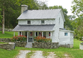
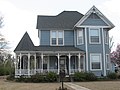
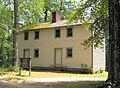
Built late 1850s by E.Y. Salmon, operated as boarding house during the 20th century by Jack and Mary Bobo; once a frequent meeting place for Jack Daniel's executives
2 Green-Evans House
Green-Evans House Green-evans-house-lynchburg-tn1.jpg
Green-Evans House
December 17, 1992
(#92001713)
Old State Route 55 north of Lynchburg
35°18′09″N86°21′54″W / 35.3025°N 86.365°W / 35.3025; -86.365 (Green-Evans House)
Lynchburg Built by Townsend P. Green in mid-19th century; contains interior painted by noted regional painter Fred Swanton
3 Jack Daniel Distillery
Jack Daniel Distillery Jack Daniel Distillery Lynchburg TN 001.JPG
Jack Daniel Distillery
September 14, 1972
(#72001248)
State Route 55
35°17′04″N86°22′03″W / 35.284444°N 86.3675°W / 35.284444; -86.3675 (Jack Daniel Distillery)
Lynchburg
4 Ledfords Mill
Ledfords Mill Ledford's Mill-Wartrace, TN.jpg
Ledfords Mill
January 10, 1985
(#85000077)
1195 Shipman Creek Rd.
35°24′12″N86°16′34″W / 35.403333°N 86.276111°W / 35.403333; -86.276111 (Ledfords Mill)
Tullahoma
5 Lynchburg Historic District
Lynchburg Historic District Althauger-Dickey-house-tn1.jpg
Lynchburg Historic District
July 19, 1996
(#96000771)
Roughly bounded by Majors, Main, Elm, and Wall Sts.
35°16′56″N86°22′28″W / 35.282222°N 86.374444°W / 35.282222; -86.374444 (Lynchburg Historic District)
Lynchburg Contains several dozen buildings in the downtown Lynchburg area
6 Moore County Courthouse and Jail
Moore County Courthouse and Jail Moore County Courthouse in Lynchburg Tennessee 4-8-2010.jpg
Moore County Courthouse and Jail
September 26, 1979
(#79002452)
Court Sq.
35°16′55″N86°22′25″W / 35.281944°N 86.373611°W / 35.281944; -86.373611 (Moore County Courthouse and Jail)
Lynchburg Courthouse built in 1885; Old jail (now a museum) located across the street from the courthouse, built in 1893

Morgan County

[8] Name on the Register [4] ImageDate listed [9] Location City or townDescription
1 R.M. Brooks General Store and Residence
R.M. Brooks General Store and Residence Brooks-general-store-rugby-tn2.jpg
R.M. Brooks General Store and Residence
April 14, 1992
(#92000364)
Junction of State Route 52 and Brewstertown Rd.
36°21′23″N84°43′21″W / 36.356389°N 84.7225°W / 36.356389; -84.7225 (R.M. Brooks General Store and Residence)
Rugby Served as a post office for Rugby in the mid-20th century
2 Rugby Colony
Rugby Colony Rugby-christ-church-tn1.jpg
Rugby Colony
April 26, 1972
(#72001249)
State Route 52
36°21′40″N84°42′01″W / 36.361111°N 84.700278°W / 36.361111; -84.700278 (Rugby Colony)
Rugby Extends into Scott County
3 Sixteen Tunnel
Sixteen Tunnel Tunnel 16.jpg
Sixteen Tunnel
July 10, 2017
(#100001306)
Tunnels through Sunbright Mt. on ATV trail/abandoned RR grade
36°15′36″N84°39′39″W / 36.260024°N 84.660800°W / 36.260024; -84.660800 (Sixteen Tunnel)
Sunbright vicinity
4 Tanner Store
Tanner Store Tanners Store.jpg
Tanner Store
July 24, 2017
(#100001369)
201 Court St.
36°06′21″N84°35′49″W / 36.105775°N 84.596819°W / 36.105775; -84.596819 (Tanner Store)
Wartburg
5 Wartburg Presbyterian Church
Wartburg Presbyterian Church Wartburg-Presbyterian-Church-tn1.jpg
Wartburg Presbyterian Church
December 18, 2013
(#13000952)
205 S. Kingston St.
36°06′10″N84°35′49″W / 36.102768°N 84.596928°W / 36.102768; -84.596928 (Wartburg Presbyterian Church)
Wartburg

Obion County

Overton County

[8] Name on the Register [4] ImageDate listed [9] Location City or townDescription
1 Alpine Institute
Alpine Institute Alpine-presbyterian-church-tn1.jpg
Alpine Institute
November 15, 2002
(#02001339)
State Route 52
36°23′35″N85°13′08″W / 36.3931°N 85.2189°W / 36.3931; -85.2189 (Alpine Institute)
Alpine Presbyterian mission school that operated between 1821 and 1947; a congregation still meets at the institute's church
2 American Legion Bohannon Post #4
American Legion Bohannon Post #4 American-legion-post-livingston-tn1.jpg
American Legion Bohannon Post #4
August 7, 2012
(#12000489)
121 S. Church St.
36°22′56″N85°19′19″W / 36.3823°N 85.3219°W / 36.3823; -85.3219 (American Legion Bohannon Post #4)
Livingston 1940s-era quonset hut
3 Officer Farmstead
Officer Farmstead Officer-farmstead-house-tn1.jpg
Officer Farmstead
May 2, 2001
(#01000469)
189 Rock Springs Rd.
36°11′16″N85°16′27″W / 36.1878°N 85.2742°W / 36.1878; -85.2742 (Officer Farmstead)
Monterey 
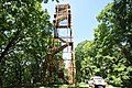
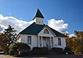
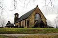
Maps indicate location as "Rock Springs Rd.," but the road's sign says "Rock Springs Church Rd."; part of the Historic Family Farms in Middle Tennessee Multiple Property Submission (MPS)
4 Overton County Courthouse
Overton County Courthouse Overton-county-courthouse-tn2.jpg
Overton County Courthouse
November 13, 1980
(#80003852)
Court Sq.
36°22′58″N85°19′23″W / 36.3828°N 85.3231°W / 36.3828; -85.3231 (Overton County Courthouse)
Livingston
5 Gov. Albert H. Roberts Law Office
Gov. Albert H. Roberts Law Office Albert-houston-roberts-law-office-tn1.jpg
Gov. Albert H. Roberts Law Office
February 20, 1975
(#75001773)
114 E. Main St.
35°23′01″N85°19′18″W / 35.3836°N 85.3217°W / 35.3836; -85.3217 (Gov. Albert H. Roberts Law Office)
Livingston Relocated a few blocks away to junction of Roberts St. and University Ave.; designed in the Victorian style known as Stick-Eastlake
6 Standing Stone Rustic Park Historic District
Standing Stone Rustic Park Historic District Moses-fisk-house-tn1.jpg
Standing Stone Rustic Park Historic District
July 8, 1986
(#86002794)
Standing Stone State Park
36°27′45″N85°24′42″W / 36.4625°N 85.4117°W / 36.4625; -85.4117 (Standing Stone Rustic Park Historic District)
Livingston part of the State Parks in Tennessee Built by the CCC and the WPA, 1934--1942, Thematic Resource (TR)
7 Twinton Fire Lookout Tower June 28, 2021
(#100006707)
Threet Rd.
36°17′29″N85°08′19″W / 36.2914°N 85.1386°W / 36.2914; -85.1386 (Twinton Fire Lookout Tower)
Crawford vicinity

Perry County

[8] Name on the Register [4] ImageDate listed [9] Location City or townDescription
1 Dr. Richard Calvin Bromley House November 29, 1995
(#95001373)
State Route 13 near its junction with Slink Shoals Rd.
35°28′35″N87°49′36″W / 35.4764°N 87.8268°W / 35.4764; -87.8268 (Dr. Richard Calvin Bromley House)
Flat Woods
2 Cedar Grove Furnace
Cedar Grove Furnace Cedar Grove Iron Furnace (Perry County, Tennessee) - 1.jpg
Cedar Grove Furnace
June 19, 1973
(#73001814)
Buckfork Rd., southwest of Linden [16]
35°33′32″N87°57′40″W / 35.5590°N 87.9611°W / 35.5590; -87.9611 (Cedar Grove Furnace)
Linden Boundaries increased on September 28, 1988
3 Craig Family Farm May 15, 2006
(#05001219)
1031 N. Fork Rd.
35°40′51″N87°53′58″W / 35.6807°N 87.8994°W / 35.6807; -87.8994 (Craig Family Farm)
Linden
4 James Dickson House March 28, 1985
(#85000668)
Lower Lick Creek Rd.
35°41′20″N87°57′37″W / 35.6889°N 87.9603°W / 35.6889; -87.9603 (James Dickson House)
Linden
5 Hufstedler Gravehouse
Hufstedler Gravehouse Hufstedler Gravehouse.jpg
Hufstedler Gravehouse
June 25, 1987
(#87001038)
Hurricane Creek Rd.
35°33′37″N87°49′01″W / 35.5603°N 87.8169°W / 35.5603; -87.8169 (Hufstedler Gravehouse)
Linden Also known as Pinckney's Tomb
6 Perry County Courthouse
Perry County Courthouse Perry County Tennessee Courthouse.JPG
Perry County Courthouse
March 30, 1995
(#95000339)
Town Square
35°37′02″N87°50′15″W / 35.6171°N 87.8375°W / 35.6171; -87.8375 (Perry County Courthouse)
Linden

Pickett County

[8] Name on the Register [4] ImageDate listed [9] Location City or townDescription
1 Cordell Hull Birthplace
Cordell Hull Birthplace Cordell-hull-birthplace-cabin.jpg
Cordell Hull Birthplace
May 5, 1972
(#72001250)
About 2 miles west of Byrdstown
36°34′55″N85°11′02″W / 36.5819°N 85.1839°W / 36.5819; -85.1839 (Cordell Hull Birthplace)
Byrdstown The birthplace cabin of U.S. Secretary of State Cordell Hull
2 Pickett County Courthouse
Pickett County Courthouse Pickett-county-courthouse-tn1.jpg
Pickett County Courthouse
March 30, 1995
(#95000338)
Town Sq.
36°34′11″N85°07′44″W / 36.5697°N 85.1289°W / 36.5697; -85.1289 (Pickett County Courthouse)
Byrdstown
3 Pickett State Rustic Park Historic District
Pickett State Rustic Park Historic District Pickett-recreation-lodge-tn1.jpg
Pickett State Rustic Park Historic District
July 8, 1986
(#86002795)
Pickett State Park and Forest
36°33′25″N84°47′43″W / 36.5569°N 84.7953°W / 36.5569; -84.7953 (Pickett State Rustic Park Historic District)
Jamestown Contains several park structures built by the CCC in the 1930s and 1940s

Polk County

Putnam County

Rhea County

[8] Name on the Register [4] ImageDate listed [9] Location City or townDescription
1 Blythe Ferry
Blythe Ferry Blythe-ferry-site-tn1.jpg
Blythe Ferry
January 5, 1983
(#83003055)
North of Birchwood on State Route 60 at the Tennessee River
35°24′51″N85°00′41″W / 35.4142°N 85.0114°W / 35.4142; -85.0114 (Blythe Ferry)
Dayton Extends into Meigs County
2 Broyles-Darwin House
Broyles-Darwin House The Broyles-Darwin House Circa 1860.jpg
Broyles-Darwin House
July 9, 1997
(#97000779)
108 Idaho
35°29′06″N85°01′10″W / 35.485°N 85.0194°W / 35.485; -85.0194 (Broyles-Darwin House)
Dayton
3 First Avenue Methodist Episcopal Church November 16, 2020
(#100005790)
240 1st Ave.
35°29′34″N85°00′43″W / 35.4928°N 85.0120°W / 35.4928; -85.0120 (First Avenue Methodist Episcopal Church)
Dayton
4 Hastings-Locke Ferry
Hastings-Locke Ferry Hastings-Locke Ferry site from west.jpg
Hastings-Locke Ferry
January 5, 1983
(#83003056)
East of Dayton on State Route 30 at the Tennessee River
35°32′15″N84°52′41″W / 35.5375°N 84.8781°W / 35.5375; -84.8781 (Hastings-Locke Ferry)
Dayton Extends into Meigs County
5 Hiwassee Garrison Site
Hiwassee Garrison Site Hiwassee Garrison Site.jpg
Hiwassee Garrison Site
November 14, 1978
(#78002625)
West bank of the Tennessee River, south of Dayton [17]
35°26′23″N84°59′13″W / 35.4397°N 84.9869°W / 35.4397; -84.9869 (Hiwassee Garrison Site)
Dayton
6 Rhea County Courthouse
Rhea County Courthouse Rhea county courthouse usda.jpg
Rhea County Courthouse
November 7, 1972
(#72001251)
Market St. between 2nd and 3rd Aves.
35°29′42″N85°00′46″W / 35.495°N 85.0128°W / 35.495; -85.0128 (Rhea County Courthouse)
Dayton
7 Dr. Walter Thomison House
Dr. Walter Thomison House Dr. Walter Thomison House.jpg
Dr. Walter Thomison House
September 11, 1997
(#97001140)
656 Market St.
35°29′10″N85°01′11″W / 35.4861°N 85.0197°W / 35.4861; -85.0197 (Dr. Walter Thomison House)
Dayton
8 Watts Bar Hydroelectric Project
Watts Bar Hydroelectric Project Watts Bar Dam.jpg
Watts Bar Hydroelectric Project
August 14, 2017
(#100001474)
6868 State Route 68
35°37′13″N84°47′04″W / 35.6203°N 84.7844°W / 35.6203; -84.7844 (Watts Bar Hydroelectric Project)
Spring City Extends into Meigs County

Roane County

Robertson County

Rutherford County

Scott County

[8] Name on the Register [4] ImageDate listed [9] Location City or townDescription
1 Barton Chapel
Barton Chapel Barton-chapel-robbins-tn1.jpg
Barton Chapel
July 12, 1984
(#84003679)
U.S. Route 27
36°21′06″N84°35′19″W / 36.3517°N 84.5886°W / 36.3517; -84.5886 (Barton Chapel)
Robbins
2 Black Creek Fire Lookout Tower
Black Creek Fire Lookout Tower Black Creek Fire Lookout Tower.jpg
Black Creek Fire Lookout Tower
November 15, 2017
(#100001828)
Black Creek Rd.
36°23′13″N84°36′39″W / 36.3869°N 84.6109°W / 36.3869; -84.6109 (Black Creek Fire Lookout Tower)
Robbins
3 Louis E. Bryant House
Louis E. Bryant House Bryant Home.jpg
Louis E. Bryant House
May 29, 1975
(#75001776)
2 miles east of Oneida on Bear Creek Rd.
36°32′50″N84°29′18″W / 36.5472°N 84.4883°W / 36.5472; -84.4883 (Louis E. Bryant House)
Oneida
4 First National Bank of Huntsville
First National Bank of Huntsville First-national-bank-scott-tn1.jpg
First National Bank of Huntsville
July 11, 1985
(#85001510)
4 Courthouse Square
36°24′33″N84°29′27″W / 36.4092°N 84.4908°W / 36.4092; -84.4908 (First National Bank of Huntsville)
Huntsville
5 Old Scott County Jail
Old Scott County Jail Old-scott-county-jail-tn1.jpg
Old Scott County Jail
April 18, 1974
(#74001927)
214 Litton Covered Bridge Rd
36°24′30″N84°29′27″W / 36.4083°N 84.4908°W / 36.4083; -84.4908 (Old Scott County Jail)
Huntsville
6 Rugby Colony
Rugby Colony Laurel-dale-cemetery-tn1.jpg
Rugby Colony
April 26, 1972
(#72001249)
State Route 52
36°21′40″N84°42′01″W / 36.3611°N 84.7003°W / 36.3611; -84.7003 (Rugby Colony)
Rugby Extends into Morgan County; Scott County section of the district includes Laurel Dale Cemetery.

Former listings

[8] Name on the RegisterImageDate listedDate removedLocationCity or townDescription
1 Huntsville High School July 2, 1987
(#87001119)
February 7, 1996220 E. Main St.
Huntsville
2 Paint Rock Creek Covered Bridge April 18, 1977
(#77001287)
June 19, 1980SE of Huntsville on Jacksboro Rd.
Huntsville vicinityDestroyed by fire in March, 1980.

Sequatchie County

[8] Name on the Register [4] ImageDate listed [9] Location City or townDescription
1 Douglas Coal and Coke Company Clubhouse
Douglas Coal and Coke Company Clubhouse Dunlap-coke-ovens-house-tn1.jpg
Douglas Coal and Coke Company Clubhouse
November 7, 1996
(#96001317)
512 Mountain View
35°22′38″N85°23′55″W / 35.3772°N 85.3986°W / 35.3772; -85.3986 (Douglas Coal and Coke Company Clubhouse)
Dunlap Built by Douglas Coal and Coke Company for visiting businesspeople
2 Dunlap Coke Ovens
Dunlap Coke Ovens Dunlap-coke-ovens-tn2.jpg
Dunlap Coke Ovens
July 5, 1985
(#85001489)
Hickory St. and Cordell Rd.
35°22′48″N85°24′06″W / 35.38°N 85.4017°W / 35.38; -85.4017 (Dunlap Coke Ovens)
Dunlap Ruins of early 20th century ovens used to convert coal into coke
3 Dunlap Community Building
Dunlap Community Building Dunlap-community-building-tn2.jpg
Dunlap Community Building
November 21, 1994
(#94001337)
227 Cherry St
35°22′18″N85°23′26″W / 35.3717°N 85.3906°W / 35.3717; -85.3906 (Dunlap Community Building)
Dunlap Built by the National Youth Administration, 19381942; currently home to the Sequatchie County Library
4 Hill Road at the Cumberland Plateau
Hill Road at the Cumberland Plateau Trail-of-tears-road-fredonia-tn1.jpg
Hill Road at the Cumberland Plateau
August 7, 2005
(#05000801)
West of Fredonia Rd., 1.0 mile northwest of downtown Dunlap
35°23′08″N85°23′59″W / 35.3856°N 85.3997°W / 35.3856; -85.3997 (Hill Road at the Cumberland Plateau)
Dunlap A Trail of Tears site [10]
5 Sequatchie County Courthouse
Sequatchie County Courthouse Sequatchie-county-ch-tn1.jpg
Sequatchie County Courthouse
January 20, 1980
(#80003853)
Cherry St.
35°22′17″N85°23′14″W / 35.3714°N 85.3872°W / 35.3714; -85.3872 (Sequatchie County Courthouse)
Dunlap

Sevier County

Shelby County

Smith County

Stewart County

Sullivan County

Sumner County

Tipton County

Trousdale County

[8] Name on the Register [4] ImageDate listed [9] Location City or townDescription
1 Averitt-Herod House
Averitt-Herod House Averitt-herod-house-tn1.jpg
Averitt-Herod House
April 12, 1996
(#96000411)
395 Herod Ln.
36°22′28″N86°09′39″W / 36.3744°N 86.1608°W / 36.3744; -86.1608 (Averitt-Herod House)
Hartsville Originally built in 1832
2 James R. DeBow House
James R. DeBow House James-debow-house-tn1.jpg
James R. DeBow House
November 3, 1988
(#88002381)
State Route 25
36°23′02″N86°07′16″W / 36.3839°N 86.1211°W / 36.3839; -86.1211 (James R. DeBow House)
Hartsville Italianate-style house constructed intermittently between 1854 and 1870
3 Hartsville Battlefield October 28, 1998
(#98001247)
Address Restricted
Hartsville
4 Hartsville Depot
Hartsville Depot Hartsville-depot-tn1.jpg
Hartsville Depot
July 3, 1980
(#80003876)
Broadway
36°23′43″N86°09′55″W / 36.3953°N 86.1653°W / 36.3953; -86.1653 (Hartsville Depot)
Hartsville Now houses offices of the Hartsville-Trousdale Co. Chamber of Commerce
5 Hartsville Historic District
Hartsville Historic District Trousdale-county-courthouse-tn1.jpg
Hartsville Historic District
June 24, 1993
(#93000568)
Roughly bounded by Church, Front, River, Greentop, and Court Sts.
36°23′26″N86°10′02″W / 36.3906°N 86.1672°W / 36.3906; -86.1672 (Hartsville Historic District)
Hartsville
6 Turney-Hutchins House
Turney-Hutchins House Turney-Hutchins House.jpg
Turney-Hutchins House
July 1, 1992
(#92000780)
State Route 25
36°23′31″N86°09′12″W / 36.3919°N 86.1533°W / 36.3919; -86.1533 (Turney-Hutchins House)
Hartsville
7 Ward School
Ward School Ward School-Hartsville.jpg
Ward School
July 20, 2020
(#100005367)
113 Hall St.
36°23′38″N86°10′16″W / 36.3938°N 86.1712°W / 36.3938; -86.1712 (Ward School)
Hartsville

Unicoi County

[8] Name on the Register [4] ImageDate listed [9] Location City or townDescription
1 A.R. Brown House
A.R. Brown House A.R. Brown House.jpg
A.R. Brown House
November 8, 2007
(#07001167)
241 S. Main Ave.
36°08′38″N82°25′07″W / 36.1439°N 82.4186°W / 36.1439; -82.4186 (A.R. Brown House)
Erwin
2 Clarksville Iron Furnace June 4, 1973
(#73001852)
Southwest of Erwin off State Route 107 in the Cherokee National Forest
36°08′53″N82°31′40″W / 36.1481°N 82.5278°W / 36.1481; -82.5278 (Clarksville Iron Furnace)
Erwin In Cherokee National Forest
3 Clinchfield Depot
Clinchfield Depot Clinchfield-depot-erwin-tn1.jpg
Clinchfield Depot
June 22, 1993
(#93000530)
Junction of Nolichucky Ave. and Union St.
36°08′43″N82°25′08″W / 36.1453°N 82.4189°W / 36.1453; -82.4189 (Clinchfield Depot)
Erwin
4 Tilson Farm June 17, 1994
(#94000613)
242 Little Branch Rd.
36°02′12″N82°31′55″W / 36.0368°N 82.5320°W / 36.0368; -82.5320 (Tilson Farm)
Flag Pond

Union County

[8] Name on the Register [4] ImageDate listed [9] Location City or townDescription
1 Booker Farm
Booker Farm Booker farm house front with horse sheds on each side.jpg
Booker Farm
June 25, 1999
(#99000721)
Corryton-Luttrell Rd.
36°10′11″N83°46′11″W / 36.1697°N 83.7697°W / 36.1697; -83.7697 (Booker Farm)
Luttrell
2 Chuck Swan Fire Lookout Tower June 28, 2021
(#100006709)
Main Forest Rd.
36°22′19″N83°53′34″W / 36.3719°N 83.8928°W / 36.3719; -83.8928 (Chuck Swan Fire Lookout Tower)
Sharps Chapel
3 Hamilton-Lay Store
Hamilton-Lay Store Back of the old Hamilton-Lay store.jpg
Hamilton-Lay Store
March 15, 2011
(#11000084)
Intersection of Mill Pond Hollow Rd. and Walkers Ford Rd.
36°16′04″N83°44′24″W / 36.2678°N 83.74°W / 36.2678; -83.74 (Hamilton-Lay Store)
Maynardville
4 Hamilton-Tolliver Complex
Hamilton-Tolliver Complex Hamilton-Tolliver barn.jpg
Hamilton-Tolliver Complex
March 12, 2010
(#10000087)
158 Kettle Hollow Rd.
36°17′19″N83°45′17″W / 36.2886°N 83.7546°W / 36.2886; -83.7546 (Hamilton-Tolliver Complex)
Maynardville
5 Maynardville State Bank
Maynardville State Bank Maynardville-state-bank-tn1.jpg
Maynardville State Bank
November 21, 2001
(#01001259)
1001 Main St.
36°14′59″N83°47′54″W / 36.2497°N 83.7983°W / 36.2497; -83.7983 (Maynardville State Bank)
Maynardville
6 Oak Grove School
Oak Grove School Oak Grove School.jpg
Oak Grove School
November 26, 2018
(#100003161)
410 Brantley Rd.
36°21′14″N83°49′06″W / 36.3538°N 83.8182°W / 36.3538; -83.8182 (Oak Grove School)
Sharps Chapel
7 Baite Ousley House
Baite Ousley House Baite Ousley House.jpg
Baite Ousley House
March 4, 1975
(#75001794)
15 miles southwest of Tazewell, north of Norris Lake on Big Valley Rd.
36°19′05″N83°51′15″W / 36.3181°N 83.8542°W / 36.3181; -83.8542 (Baite Ousley House)
Sharps Chapel Built by Jacob Sharp; also known as the Jacob Sharp House [18]

Van Buren County

[8] Name on the Register [4] ImageDate listed [9] Location City or townDescription
1 Big Bone Cave
Big Bone Cave Cave Salamander at Big Bone Cave.JPG
Big Bone Cave
April 11, 1973
(#73001853)
East of Bone Cave and west of the summit of Tandy Knob [19]
35°46′38″N85°33′19″W / 35.7772°N 85.5553°W / 35.7772; -85.5553 (Big Bone Cave)
Bone Cave
2 Crain Hill School and Church
Crain Hill School and Church Crain-hill-church-school-tn1.jpg
Crain Hill School and Church
March 21, 1985
(#85000622)
Crain Hill Rd.
35°43′02″N85°35′18″W / 35.7172°N 85.5883°W / 35.7172; -85.5883 (Crain Hill School and Church)
Crain Hill Built in 1870
3 Higginbotham Turnpike July 20, 2020
(#100005368)
Pleasant Hill Cemetery Rd.
35°35′29″N85°31′30″W / 35.5913°N 85.5250°W / 35.5913; -85.5250 (Higginbotham Turnpike)
Spencer
4 Rocky River Crossing and Road November 15, 2006
(#06001038)
Rocky River and a continuation of Pleasant Hill Cemetery Rd.
35°35′33″N85°31′11″W / 35.5925°N 85.5197°W / 35.5925; -85.5197 (Rocky River Crossing and Road)
Spencer A Trail of Tears site [10]

Warren County

Washington County

Wayne County

[8] Name on the Register [4] ImageDate listed [9] Location City or townDescription
1 Collinwood Railroad Station
Collinwood Railroad Station Collinwood-Railroad-Station-tn1.jpg
Collinwood Railroad Station
March 24, 1988
(#88000264)
Old railroad bed
35°10′25″N87°44′19″W / 35.17359°N 87.73867°W / 35.17359; -87.73867 (Collinwood Railroad Station)
Collinwood Built in 1916; now a library and museum
2 Evans Chapel United Methodist Church July 9, 1999
(#99000757)
Old Clifton Turnpike
35°21′13″N87°57′19″W / 35.3536°N 87.9553°W / 35.3536; -87.9553 (Evans Chapel United Methodist Church)
Waynesboro
3 First Presbyterian Church of Clifton March 8, 1988
(#88000172)
Main St.
35°23′05″N87°59′39″W / 35.3847°N 87.9942°W / 35.3847; -87.9942 (First Presbyterian Church of Clifton)
Clifton
4 Forty-eight Forge (40WY63) April 11, 1988
(#88000254)
Address Restricted
Waynesboro
5 Hughes House November 17, 2020
(#100005793)
204 West Pillow St.
35°23′10″N87°59′34″W / 35.3862°N 87.9927°W / 35.3862; -87.9927 (Hughes House)
Clifton
6 Marion Furnace (40WY61) April 9, 1988
(#88000252)
Address Restricted
Eagle Creek
7 Old Natchez Trace
Old Natchez Trace Natchz Trace 4.jpg
Old Natchez Trace
May 30, 1975
(#75002125)
From the Alabama/Tennessee border to State Route 100 in Davidson County
35°02′54″N87°48′47″W / 35.0483°N 87.8131°W / 35.0483; -87.8131 (Old Natchez Trace)
Collinwood Extends into Davidson, Hickman, Lawrence, Lewis, Maury, and Williamson counties
8 Water Street Historic District July 8, 1992
(#92000829)
Water St. (State Route 128) between Polk and Cedar Sts.
35°23′15″N87°59′33″W / 35.3875°N 87.9925°W / 35.3875; -87.9925 (Water Street Historic District)
Clifton
9 Wayne County Courthouse
Wayne County Courthouse Wayne-County-Courthouse-E-tn1.jpg
Wayne County Courthouse
July 29, 2020
(#100005369)
100 Court Cir.
35°19′16″N87°45′48″W / 35.3211°N 87.7633°W / 35.3211; -87.7633 (Wayne County Courthouse)
Waynesboro
10 Waynesboro Cumberland Presbyterian Church
Waynesboro Cumberland Presbyterian Church Waynesboro-Cumberland-Presbyterian-Church-tn1.jpg
Waynesboro Cumberland Presbyterian Church
October 22, 1987
(#87001877)
High St.
35°19′16″N87°45′48″W / 35.3211°N 87.7633°W / 35.3211; -87.7633 (Waynesboro Cumberland Presbyterian Church)
Waynesboro Congregation founded in 1846; church constructed in 1854

Weakley County

White County

Williamson County

Wilson County

See also

Related Research Articles

<span class="mw-page-title-main">National Register of Historic Places listings in Dauphin County, Pennsylvania</span>

This is a list of the National Register of Historic Places listings in Dauphin County, Pennsylvania.

<span class="mw-page-title-main">National Register of Historic Places listings in Delaware County, Ohio</span>

This is a list of the National Register of Historic Places listings in Delaware County, Ohio.

<span class="mw-page-title-main">National Register of Historic Places listings in Licking County, Ohio</span>

This is a list of the National Register of Historic Places listings in Licking County, Ohio.

<span class="mw-page-title-main">National Register of Historic Places listings in Warren County, Ohio</span>

This is a list of the National Register of Historic Places listings in Warren County, Ohio.

<span class="mw-page-title-main">National Register of Historic Places listings in Clark County, Ohio</span>

This is a list of the National Register of Historic Places listings in Clark County, Ohio.

<span class="mw-page-title-main">National Register of Historic Places listings in Athens County, Ohio</span>

This is a list of the National Register of Historic Places listings in Athens County, Ohio.

<span class="mw-page-title-main">National Register of Historic Places listings in Beaver County, Pennsylvania</span>

This is a list of the National Register of Historic Places listings in Beaver County, Pennsylvania.

<span class="mw-page-title-main">National Register of Historic Places listings in Greenup County, Kentucky</span>

This is a list of the National Register of Historic Places listings in Greenup County, Kentucky.

This is a list of the National Register of Historic Places listings in Davidson County, Tennessee.

This is a list of the National Register of Historic Places listings in Maury County, Tennessee.

This is a list of the National Register of Historic Places listings in Smith County, Tennessee.

This is a list of the National Register of Historic Places listings in Sumner County, Tennessee.

This is a list of the National Register of Historic Places listings in Hickman County, Tennessee.

This is a list of the National Register of Historic Places listings in Hardeman County, Tennessee.

This is a list of the National Register of Historic Places listings in Madison County, Tennessee.

This is a list of the National Register of Historic Places listings in Meigs County, Tennessee.

This is a list of the National Register of Historic Places listings in Loudon County, Tennessee.

<span class="mw-page-title-main">National Register of Historic Places listings in Gibson County, Indiana</span>

This is a list of the National Register of Historic Places listings in Gibson County, Indiana.

<span class="mw-page-title-main">National Register of Historic Places listings in Vinton County, Ohio</span>

This is a list of the National Register of Historic Places listings in Vinton County, Ohio.

<span class="mw-page-title-main">National Register of Historic Places listings in Meigs County, Ohio</span>

This is a list of the National Register of Historic Places listings in Meigs County, Ohio.

References

  1. Tennessee Historical Commission. "A FUTURE FOR THE PAST: A COMPREHENSIVE PLAN FOR HISTORIC PRESERVATION IN TENNESSEE, 2013-2018" (PDF). Archived from the original (PDF) on October 12, 2013. Retrieved February 3, 2014.
  2. The latitude and longitude information provided in this table was derived originally from the National Register Information System, which has been found to be fairly accurate for about 99% of listings. Some locations in this table may have been corrected to current GPS standards.
  3. National Park Service, United States Department of the Interior, "National Register of Historic Places: Weekly List Actions", retrieved March 8, 2024.
  4. 1 2 3 4 5 6 7 8 9 10 11 12 13 14 15 16 17 18 19 20 21 22 23 24 25 26 27 28 29 30 31 32 33 34 35 36 37 38 "National Register Information System". National Register of Historic Places . National Park Service. April 24, 2008.
  5. "National Register of Historic Places: Weekly List Actions". National Park Service. Retrieved January 2, 2009.
  6. Weekly List Actions, National Register of Historic Places website
  7. The following sites are listed in multiple counties: Blythe Ferry (Meigs and Rhea), Boatyard Historic District (Hawkins and Sullivan), Bolivar-Somerville Stage Road (Fayette and Hardeman), Calderwood Dam (Blount and Monroe), Conway Bridge (Cocke and Greene), John Gordon House (Hickman and Maury), Great Falls Hydroelectric Station (Warren and White), Hastings-Locke Ferry (Meigs and Rhea), Norris Hydroelectric Project (Anderson and Campbell), Old Natchez Trace (Davidson, Hickman, Lawrence, Lewis, Maury, Wayne, and Williamson), Palmetto Farm (Bedford and Marshall), Petersburg Historic District (Fayette and Lincoln), Rugby Colony (Morgan and Scott), Shelby Bend Archeological District (Hickman and Maury), Davis Bridge Battlefield (Hardeman and McNairy), Boone Hydroelectric Project (Sullivan and Washington), Warner Park Historic Park (Davidson and Williamson), and Watts Bar Hydroelectric Project (Meigs and Rhea).
  8. 1 2 3 4 5 6 7 8 9 10 11 12 13 14 15 16 17 18 19 20 21 22 23 24 25 26 27 28 29 30 31 32 33 34 35 36 37 38 39 40 41 42 43 44 Numbers represent an alphabetical ordering by significant words. Various colorings, defined here, differentiate National Historic Landmarks and historic districts from other NRHP buildings, structures, sites or objects.
  9. 1 2 3 4 5 6 7 8 9 10 11 12 13 14 15 16 17 18 19 20 21 22 23 24 25 26 27 28 29 30 31 32 33 34 35 36 37 The eight-digit number below each date is the number assigned to each location in the National Register Information System database, which can be viewed by clicking the number.
  10. 1 2 3 "Trail Of Tears National Historic Trail: National Register Research". National Park Service. Retrieved January 22, 2013.
  11. Address based on USPS website. Accessed April 9, 2016.
  12. Location derived from this Harpeth River State Park map; the NRIS lists it as "Address Restricted"
  13. Pioneer in local medical field dies at 94 State Gazette. March 4, 2008 Archived March 9, 2008, at the Wayback Machine
  14. Carolyn Sakowski (2007), Touring the East Tennessee Backroads , John F. Blair, Publisher. ISBN   0-89587-350-8, ISBN   978-0-89587-350-7. Pages 28-29.
  15. Tennessee Architectural List TN.gov Historical Sites list
  16. "Cedar Grove Furnace (historical)". Geographic Names Information System . United States Geological Survey, United States Department of the Interior.
  17. Hiwassee Garrison (historical), GNIS, 1989-10-01.
  18. Trent, Kim (March 27, 2009). "Resurrection in Sharps Chapel". Saving Places. Metro Pulse.com. Archived from the original on June 5, 2009.
  19. Location derived from a notice on USGS topographical maps accessible from this GNIS feature record; the NRIS lists the site as "Address Restricted"