National Register of Historic Places listings in Sumner County, Tennessee

Last updated

Location of Sumner County in Tennessee Map of Tennessee highlighting Sumner County.svg
Location of Sumner County in Tennessee

This is a list of the National Register of Historic Places listings in Sumner County, Tennessee.

Contents

This is intended to be a complete list of the properties and districts on the National Register of Historic Places in Sumner County, Tennessee, United States. Latitude and longitude coordinates are provided for many National Register properties and districts; these locations may be seen together in a map. [1]

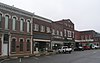
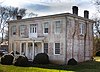
There are 39 properties and districts listed on the National Register in the county, including 1 National Historic Landmark. Another 2 properties were once listed but have been removed.

See also National Register of Historic Places listings in Davidson County, Tennessee for additional properties in Goodlettsville, a city that spans the county line.

Map all coordinates using: OpenStreetMap
Contents: Counties in Tennessee
Anderson  Bedford  Benton  Bledsoe  Blount  Bradley  Campbell  Cannon  Carroll  Carter  Cheatham  Chester  Claiborne  Clay  Cocke  Coffee  Crockett  Cumberland  Davidson  Decatur  DeKalb  Dickson  Dyer  Fayette  Fentress  Franklin  Gibson  Giles  Grainger  Greene  Grundy  Hamblen  Hamilton  Hancock  Hardeman  Hardin  Hawkins  Haywood  Henderson  Henry  Hickman  Houston  Humphreys  Jackson  Jefferson  Johnson  Knox  Lake  Lauderdale  Lawrence  Lewis  Lincoln  Loudon  Macon  Madison  Marion  Marshall  Maury  McMinn  McNairy  Meigs  Monroe  Montgomery  Moore  Morgan  Obion  Overton  Perry  Pickett  Polk  Putnam  Rhea  Roane  Robertson  Rutherford  Scott  Sequatchie  Sevier  Shelby  Smith  Stewart  Sullivan  Sumner  Tipton  Trousdale  Unicoi  Union  Van Buren  Warren  Washington  Wayne  Weakley  White  Williamson  Wilson


    This National Park Service list is complete through NPS recent listings posted February 9, 2024. [2]

Current listings

[3] Name on the Register [4] ImageDate listed [5] Location City or townDescription
1 Ashcrest Farm
Ashcrest Farm Ashcrest Farm.JPG
Ashcrest Farm
April 14, 1992
(#92000349)
410 Gallatin Rd.
36°19′12″N86°35′29″W / 36.32°N 86.591389°W / 36.32; -86.591389 (Ashcrest Farm)
Hendersonville
2 Bledsoe's Station
Bledsoe's Station Bledsoe-station-site-tn1.jpg
Bledsoe's Station
July 30, 1992
(#92000970)
Off State Route 25 west of Castalian Springs [6]
36°23′58″N86°19′14″W / 36.399444°N 86.320556°W / 36.399444; -86.320556 (Bledsoe's Station)
Castalian Springs
3 Bowen-Campbell House
Bowen-Campbell House Bowen-Campbell House2007.jpg
Bowen-Campbell House
July 25, 1977
(#77001295)
East of Goodlettsville on Jackson Rd.
36°19′19″N86°41′22″W / 36.321944°N 86.689444°W / 36.321944; -86.689444 (Bowen-Campbell House)
Goodlettsville
4 Bridal House
Bridal House Bridal House.jpg
Bridal House
February 4, 1982
(#82004059)
Red River Rd.
36°27′04″N86°32′18″W / 36.451111°N 86.538333°W / 36.451111; -86.538333 (Bridal House)
Cottontown
5 Brown-Chenault House
Brown-Chenault House Brown-Chenault House.jpg
Brown-Chenault House
July 25, 1985
(#85001614)
Chenault Lane
36°25′33″N86°18′10″W / 36.425833°N 86.302778°W / 36.425833; -86.302778 (Brown-Chenault House)
Castalian Springs
6 Cairo Rosenwald School
Cairo Rosenwald School Cairo Rosenwald School.jpg
Cairo Rosenwald School
November 15, 1996
(#96001359)
Zieglers Fort Rd., approximately 2.5 miles (4.0 km) south of State Route 25
36°21′48″N86°21′49″W / 36.363333°N 86.363611°W / 36.363333; -86.363611 (Cairo Rosenwald School)
Cairo
7 Castalian Springs
Castalian Springs Wynnewood (Tennessee).jpg
Castalian Springs
July 14, 1971
(#71000838)
Gallatin-Hartsville Pike, State Route 25
36°23′39″N86°18′59″W / 36.394167°N 86.316389°W / 36.394167; -86.316389 (Castalian Springs)
Castalian Springs
8 Cragfont
Cragfont Cragfont-house-tn1.jpg
Cragfont
February 26, 1970
(#70000618)
East of Gallatin off State Route 25
36°24′11″N86°20′27″W / 36.403056°N 86.340833°W / 36.403056; -86.340833 (Cragfont)
Gallatin
9 Daniel Smith Donelson House
Daniel Smith Donelson House Daniel Smith Donelson House.JPG
Daniel Smith Donelson House
January 4, 1983
(#83003071)
178 Berrywood Dr.
36°17′51″N86°35′44″W / 36.2975°N 86.595556°W / 36.2975; -86.595556 (Daniel Smith Donelson House)
Hendersonville
10 Douglass-Clark House
Douglass-Clark House Douglass-Clark House.jpg
Douglass-Clark House
March 21, 2011
(#11000098)
Long Hollow Pike at Lower Station Camp Creek Rd.
36°22′57″N86°33′30″W / 36.3825°N 86.558333°W / 36.3825; -86.558333 (Douglass-Clark House)
Gallatin vicinity
11 Durham's Chapel School
Durham's Chapel School Durham's Chapel School.jpg
Durham's Chapel School
November 8, 2006
(#06000652)
5055 Old State Route 31E
36°28′26″N86°19′50″W / 36.473889°N 86.330556°W / 36.473889; -86.330556 (Durham's Chapel School)
Bethpage
12 Mary Felice Ferrell House
Mary Felice Ferrell House Mary Felice Ferell House.jpg
Mary Felice Ferrell House
April 14, 1992
(#92000348)
2144 Nashville Pike
36°20′28″N86°32′06″W / 36.341111°N 86.535°W / 36.341111; -86.535 (Mary Felice Ferrell House)
Gallatin
13 Leonard B. Fite House
Leonard B. Fite House Historic Monthaven (Front View).JPG
Leonard B. Fite House
March 25, 1982
(#82004061)
1154 W. Main St.
36°18′38″N86°39′43″W / 36.310556°N 86.661944°W / 36.310556; -86.661944 (Leonard B. Fite House)
Hendersonville
14 Gallatin Commercial Historic District
Gallatin Commercial Historic District Gallatin Tennessee Town Square.jpg
Gallatin Commercial Historic District
October 23, 1985
(#85003369)
Roughly bounded by Town Creek, N. Water Ave., and Boyer and College Sts., E. Main St, S. Water Ave., and Trimble St.
36°23′21″N86°26′40″W / 36.389167°N 86.444444°W / 36.389167; -86.444444 (Gallatin Commercial Historic District)
Gallatin
15 Gallatin Presbyterian Church
Gallatin Presbyterian Church Gallatin Presbyterian Church.jpg
Gallatin Presbyterian Church
March 25, 1982
(#82004060)
167 W. Main St.
36°23′14″N86°26′55″W / 36.387222°N 86.448611°W / 36.387222; -86.448611 (Gallatin Presbyterian Church)
Gallatin
16 Greenfield November 7, 1990
(#90001579)
683 Rock Springs Rd.
36°26′02″N86°19′00″W / 36.433889°N 86.316667°W / 36.433889; -86.316667 (Greenfield)
Castalian Springs
17 Hawthorne Hill
Hawthorne Hill Hawthorne Hoouse-Castalian Springs, TN.jpg
Hawthorne Hill
June 14, 2013
(#13000401)
470 Old Hwy 25
36°23′27″N86°17′55″W / 36.390811°N 86.298548°W / 36.390811; -86.298548 (Hawthorne Hill)
Castalian Springs
18 Hazel Path
Hazel Path Hazel Path.JPG
Hazel Path
April 5, 1984
(#84003713)
175 E. Main St.
36°18′20″N86°36′25″W / 36.305556°N 86.606944°W / 36.305556; -86.606944 (Hazel Path)
Hendersonville
19 James B. Jameson House
James B. Jameson House James B. Jameson House-Gallatin, TN.jpg
James B. Jameson House
November 25, 1985
(#85002968)
2458 Hartsville Pike
36°23′57″N86°20′59″W / 36.399167°N 86.349722°W / 36.399167; -86.349722 (James B. Jameson House)
Gallatin
20 King Homestead
King Homestead King Homestead-TN.jpg
King Homestead
January 30, 1978
(#78002640)
West of Cottontown off State Route 25
36°27′06″N86°34′14″W / 36.451667°N 86.570556°W / 36.451667; -86.570556 (King Homestead)
Cottontown
21 Locust Grove January 8, 1979
(#79002484)
North of Castalian Springs
36°25′30″N86°18′24″W / 36.425°N 86.306667°W / 36.425; -86.306667 (Locust Grove)
Castalian Springs
22 Maple Cottage March 15, 2000
(#00000229)
1335 Long Hollow Pike
36°23′05″N86°30′34″W / 36.384722°N 86.509444°W / 36.384722; -86.509444 (Maple Cottage)
Gallatin
23 Maple Shade April 22, 2003
(#03000303)
1755 State Route 31E
36°25′24″N86°23′47″W / 36.423333°N 86.396389°W / 36.423333; -86.396389 (Maple Shade)
Gallatin
24 Moye Boarding House
Moye Boarding House Moye Boarding House.jpg
Moye Boarding House
March 27, 2013
(#13000124)
Northeast corner of Wheeler & N. Russell Sts.
36°34′55″N86°30′54″W / 36.581875°N 86.514922°W / 36.581875; -86.514922 (Moye Boarding House)
Portland
25 Oakland
Oakland Oakland-Gallatin,TN.jpg
Oakland
October 2, 1992
(#92000841)
1995 Hartsville Pike
36°23′55″N86°22′08″W / 36.398611°N 86.368889°W / 36.398611; -86.368889 (Oakland)
Gallatin
26 Oakley
Oakley Oakley House-TN.jpg
Oakley
July 25, 1985
(#85001615)
2243 Nashville Pike
36°21′09″N86°30′27″W / 36.3525°N 86.5075°W / 36.3525; -86.5075 (Oakley)
Gallatin
27 Parker's Chapel Missionary Baptist Church and Cemetery October 29, 2021
(#100007121)
387 Airport Rd.
36°35′09″N86°28′49″W / 36.5858°N 86.4802°W / 36.5858; -86.4802 (Parker's Chapel Missionary Baptist Church and Cemetery)
Portland
28 Parker-Bryson Historic District June 25, 1987
(#87001036)
Greenfield Lane
36°25′54″N86°19′51″W / 36.431667°N 86.330833°W / 36.431667; -86.330833 (Parker-Bryson Historic District)
Castalian Springs
29 Rascoe-Harris Farm July 19, 1996
(#96000772)
1135 Liberty Ln.
36°24′24″N86°30′42″W / 36.406635°N 86.511543°W / 36.406635; -86.511543 (Rascoe-Harris Farm)
Liberty
30 Rock Castle
Rock Castle Rock Castle 026.jpg
Rock Castle
July 8, 1970
(#70000619)
Southeast of Hendersonville on Indian Lake Rd.
36°16′45″N86°35′47″W / 36.279167°N 86.596389°W / 36.279167; -86.596389 (Rock Castle)
Hendersonville
31 Rosemont
Rosemont Rosemont.jpg
Rosemont
April 26, 1978
(#78002641)
810 S. Water St.
36°22′35″N86°26′33″W / 36.376389°N 86.4425°W / 36.376389; -86.4425 (Rosemont)
Gallatin
32 Scattersville Public School
Scattersville Public School Scattersville Public School (1928-1962).png
Scattersville Public School
February 7, 2024
(#100009970)
227 Scattersville Road
36°35′36″N86°34′05″W / 36.5932°N 86.5681°W / 36.5932; -86.5681 (Scattersville Public School)
Portland
33 Shackle Island Historic District
Shackle Island Historic District Shackle Island Historic District.JPG
Shackle Island Historic District
January 30, 1978
(#78002643)
North of Hendersonville at Shackle Island Rd. and Long Hollow Pike
36°22′14″N86°37′03″W / 36.370556°N 86.6175°W / 36.370556; -86.6175 (Shackle Island Historic District)
Hendersonville
34 Trousdale-Baskerville House
Trousdale-Baskerville House Trousdale-Baskerville House.jpg
Trousdale-Baskerville House
July 30, 2009
(#09000577)
211 W. Smith St.
36°23′11″N86°26′57″W / 36.38645°N 86.449303°W / 36.38645; -86.449303 (Trousdale-Baskerville House)
Gallatin
35 Trousdale Place
Trousdale Place Trousdale Place.jpg
Trousdale Place
June 5, 1975
(#75001793)
183 W. Main St.
36°23′14″N86°26′56″W / 36.387222°N 86.448889°W / 36.387222; -86.448889 (Trousdale Place)
Gallatin
36 Wall Spring
Wall Spring Wall Spring.jpg
Wall Spring
April 8, 1994
(#94000334)
931 Red River Rd.
36°23′40″N86°28′11″W / 36.394444°N 86.469722°W / 36.394444; -86.469722 (Wall Spring)
Gallatin
37 Walnut Grove
Walnut Grove Walnut Grove-Gallatin, TN.jpg
Walnut Grove
December 29, 1978
(#78002642)
911 Laura St.
36°23′30″N86°28′18″W / 36.391667°N 86.471667°W / 36.391667; -86.471667 (Walnut Grove)
Gallatin
38 Westmoreland Tunnel
Westmoreland Tunnel Westmoreland Tunnel.jpg
Westmoreland Tunnel
January 20, 1978
(#78002644)
Off State Route 52
36°33′31″N86°14′57″W / 36.558611°N 86.249167°W / 36.558611; -86.249167 (Westmoreland Tunnel)
Westmoreland
39 Williamson and Adams Carriage Factory
Williamson and Adams Carriage Factory Wilson Adams Carriage House.jpg
Williamson and Adams Carriage Factory
May 12, 1987
(#87000488)
326 E. Main St.
36°23′22″N86°26′33″W / 36.389444°N 86.4425°W / 36.389444; -86.4425 (Williamson and Adams Carriage Factory)
Gallatin

Former listings

[3] Name on the RegisterImageDate listedDate removedLocationCity or townDescription
1 Fairvue
Fairvue Fairvue, U.S. Highway 31-E, Gallatin vicinity Sumner County, Tennessee.jpg
Fairvue
June 10, 1975
(#75002162)
April 4, 20054 mi. S of Gallatin on U.S. 31E (Rozella Way below Plantation Blvd)
Gallatin Formerly a National Historic Landmark (note: home still exists, but it was delisted after residential development on plantation grounds)
2 Talley-Beals House August 22, 1977
(#77001296)
June 5, 1990N of Hendersonville off Saunderville Rd.
Hendersonville House burned to the ground due to lightning strike on May 28, 1990. [7]

See also

Related Research Articles

<span class="mw-page-title-main">National Register of Historic Places listings in Sumner County, Kansas</span>

This is a list of the National Register of Historic Places listings in Sumner County, Kansas.

This is a list of the National Register of Historic Places listings in Davidson County, Tennessee.

This is a list of the National Register of Historic Places listings in Obion County, Tennessee.

This is a list of the National Register of Historic Places listings in Bedford County, Tennessee.

This is a list of the National Register of Historic Places listings in Bradley County, Tennessee.

This is a list of the National Register of Historic Places listings in Hamilton County, Tennessee.

This is a list of the National Register of Historic Places listings in Maury County, Tennessee.

This is a list of the National Register of Historic Places listings in Carter County, Tennessee.

This is a list of the National Register of Historic Places listings in Weakley County, Tennessee.

This is a list of the National Register of Historic Places listings in Washington County, Tennessee.

This is a list of the National Register of Historic Places listings in Smith County, Tennessee.

This is a list of the National Register of Historic Places listings in Putnam County, Tennessee.

This is a list of the National Register of Historic Places listings in Robertson County, Tennessee.

This is a list of the National Register of Historic Places listings in Fentress County, Tennessee.

This is a list of the National Register of Historic Places listings in Jefferson County, Tennessee.

This is a list of the National Register of Historic Places listings in Hardeman County, Tennessee.

This is a list of the National Register of Historic Places listings in Lawrence County, Tennessee.

This is a list of the National Register of Historic Places listings in McMinn County, Tennessee.

This is a list of the National Register of Historic Places listings in Meigs County, Tennessee.

This is a list of the National Register of Historic Places listings in Marion County, Tennessee.

References

  1. The latitude and longitude information provided in this table was derived originally from the National Register Information System, which has been found to be fairly accurate for about 99% of listings. Some locations in this table may have been corrected to current GPS standards.
  2. National Park Service, United States Department of the Interior, "National Register of Historic Places: Weekly List Actions", retrieved February 9, 2024.
  3. 1 2 Numbers represent an alphabetical ordering by significant words. Various colorings, defined here, differentiate National Historic Landmarks and historic districts from other NRHP buildings, structures, sites or objects.
  4. "National Register Information System". National Register of Historic Places . National Park Service. April 24, 2008.
  5. The eight-digit number below each date is the number assigned to each location in the National Register Information System database, which can be viewed by clicking the number.
  6. Location derived from this Bledsoe's Fort-related website; the NRIS lists it as "Address Restricted"
  7. "Fire destroys historic Hendersonville home". The Tennessean . May 29, 1990. p. 2B. Retrieved August 29, 2022 via Newspapers.com.