National Register of Historic Places listings in Sullivan County, Tennessee

Last updated

Location of Sullivan County in Tennessee Map of Tennessee highlighting Sullivan County.svg
Location of Sullivan County in Tennessee

This is a list of the National Register of Historic Places listings in Sullivan County, Tennessee.

Contents

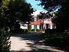
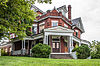
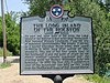
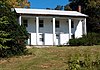
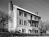
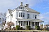
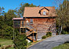
This is intended to be a complete list of the properties and districts on the National Register of Historic Places in Sullivan County, Tennessee, United States. Latitude and longitude coordinates are provided for many National Register properties and districts; these locations may be seen together in a map. [1]

There are 46 properties and districts listed on the National Register in the county, including 1 National Historic Landmark. Another 6 properties were once listed but have been removed.

Map all coordinates using: OpenStreetMap
Contents: Counties in Tennessee
Anderson  Bedford  Benton  Bledsoe  Blount  Bradley  Campbell  Cannon  Carroll  Carter  Cheatham  Chester  Claiborne  Clay  Cocke  Coffee  Crockett  Cumberland  Davidson  Decatur  DeKalb  Dickson  Dyer  Fayette  Fentress  Franklin  Gibson  Giles  Grainger  Greene  Grundy  Hamblen  Hamilton  Hancock  Hardeman  Hardin  Hawkins  Haywood  Henderson  Henry  Hickman  Houston  Humphreys  Jackson  Jefferson  Johnson  Knox  Lake  Lauderdale  Lawrence  Lewis  Lincoln  Loudon  Macon  Madison  Marion  Marshall  Maury  McMinn  McNairy  Meigs  Monroe  Montgomery  Moore  Morgan  Obion  Overton  Perry  Pickett  Polk  Putnam  Rhea  Roane  Robertson  Rutherford  Scott  Sequatchie  Sevier  Shelby  Smith  Stewart  Sullivan  Sumner  Tipton  Trousdale  Unicoi  Union  Van Buren  Warren  Washington  Wayne  Weakley  White  Williamson  Wilson


    This National Park Service list is complete through NPS recent listings posted December 15, 2023. [2]

Current listings

[3] Name on the Register [4] ImageDate listed [5] Location City or townDescription
1 Finlay Alison House April 11, 1973
(#73001851)
West of Piney Flats off U.S. Route 11E
36°25′22″N82°21′34″W / 36.422778°N 82.359444°W / 36.422778; -82.359444 (Finlay Alison House)
Piney Flats
2 Arcadia
Arcadia Arcadiasign.jpg
Arcadia
April 11, 1973
(#73001834)
East of Bloomingdale off U.S. Route 11W
36°35′01″N82°26′43″W / 36.5835722°N 82.4453722°W / 36.5835722; -82.4453722 (Arcadia)
Arcadia
3 Blountville Historic District
Blountville Historic District Blountvillehistdist.jpg
Blountville Historic District
February 23, 1973
(#73001835)
Center of Blountville along both sides of State Route 126; also roughly bounded by the Blountville Cemetery, Great Stage and Massengill Rds., and the Blountville Bypass
36°31′58″N82°19′37″W / 36.532778°N 82.326944°W / 36.532778; -82.326944 (Blountville Historic District)
Blountville Second set of addresses represents a boundary increase of March 26, 2014
4 Boatyard Historic District
Boatyard Historic District Nethinnboatyard.jpg
Boatyard Historic District
December 12, 1973
(#73001785)
Southwest of Kingsport on the Holston River and the South Fork of the Holston River
36°33′02″N82°36′17″W / 36.550556°N 82.604722°W / 36.550556; -82.604722 (Boatyard Historic District)
Kingsport
5 Boone Hydroelectric Project
Boone Hydroelectric Project Boone Dam.jpg
Boone Hydroelectric Project
October 26, 2017
(#100001476)
301 Boone Dam Rd.
36°26′25″N82°26′12″W / 36.440278°N 82.436667°W / 36.440278; -82.436667 (Boone Hydroelectric Project)
Kingsport Extends into Washington County
6 Bristol Commercial Historic District
Bristol Commercial Historic District 2012-02-08; Susong Building, Bristol, Virginia (6849254603).jpg
Bristol Commercial Historic District
May 22, 2003
(#03000441)
Roughly along State, Piedmont, Moore, Shelby, Bank, Progress, 5th, 6th, 7th, and 8th Sts.
36°35′38″N82°11′03″W / 36.593889°N 82.184167°W / 36.593889; -82.184167 (Bristol Commercial Historic District)
Bristol Extends into Bristol, Virginia
7 Bristol Municipal Stadium
Bristol Municipal Stadium BristolMunicipalStadium 1061.jpg
Bristol Municipal Stadium
June 25, 1987
(#87001039)
1112 Edgemont Ave.
36°34′57″N82°11′00″W / 36.5825°N 82.183333°W / 36.5825; -82.183333 (Bristol Municipal Stadium)
Bristol
8 Bristol Virginia-Tennessee Slogan Sign
Bristol Virginia-Tennessee Slogan Sign Bristol.jpg
Bristol Virginia-Tennessee Slogan Sign
September 8, 1988
(#88001568)
E. State St.
36°35′40″N82°10′45″W / 36.594444°N 82.179167°W / 36.594444; -82.179167 (Bristol Virginia-Tennessee Slogan Sign)
Bristol Extends into Bristol, Virginia
9 Church Circle District
Church Circle District Church Circle District, Kingsport.jpg
Church Circle District
April 11, 1973
(#73001841)
Along Sullivan in the center of Kingsport
36°32′59″N82°33′29″W / 36.549722°N 82.558056°W / 36.549722; -82.558056 (Church Circle District)
Kingsport
10 Clinchfield Railroad Station
Clinchfield Railroad Station Kpttrainstation.jpg
Clinchfield Railroad Station
April 24, 1973
(#73001842)
101 E. Main St.
36°32′40″N82°33′45″W / 36.544444°N 82.5625°W / 36.544444; -82.5625 (Clinchfield Railroad Station)
Kingsport
11 DeVault-Masengill House March 28, 1985
(#85000669)
Andrew Johnson Highway, U.S. Route 11E
36°24′20″N82°20′40″W / 36.405556°N 82.344444°W / 36.405556; -82.344444 (DeVault-Masengill House)
Piney Flats An alternate spelling of Massengill is also used.
12 East Hill Cemetery
East Hill Cemetery East Hill Cemetery (Bristol, VA) - Confederate Unknown.jpg
East Hill Cemetery
March 28, 2011
(#11000142)
E. State St. at Georgia Ave.
36°35′39″N82°10′16″W / 36.594167°N 82.171111°W / 36.594167; -82.171111 (East Hill Cemetery)
Bristol 
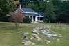
American Civil War-era cemetery with sections for Confederate soldiers and veterans as well as a small section for African American burials. [6] Extends into Bristol, Virginia
13 Erwin Farm April 11, 1973
(#73001836)
West of Blountville off State Route 75
36°31′24″N82°22′30″W / 36.523333°N 82.375°W / 36.523333; -82.375 (Erwin Farm)
Blountville
14 Fairmont Neighborhood Historic District
Fairmont Neighborhood Historic District Spruce east of Carolina in Bristol.jpg
Fairmont Neighborhood Historic District
July 30, 2010
(#10000510)
Roughly bounded by Taylor St., Pennsylvania Ave., Maple St., and Florida Ave.
36°35′20″N82°10′13″W / 36.588889°N 82.170278°W / 36.588889; -82.170278 (Fairmont Neighborhood Historic District)
Bristol
15 First National Bank of Bristol
First National Bank of Bristol FirstNatlBank Bristol 1082.jpg
First National Bank of Bristol
July 25, 1985
(#85001606)
500 State St.
36°35′41″N82°10′57″W / 36.594722°N 82.1825°W / 36.594722; -82.1825 (First National Bank of Bristol)
Bristol
16 Fort Patrick Henry Hydroelectric Project
Fort Patrick Henry Hydroelectric Project Fort Patrick Henry Dam.jpg
Fort Patrick Henry Hydroelectric Project
October 26, 2017
(#100001477)
Rt. 1 Box 2385
36°29′52″N82°30′30″W / 36.497778°N 82.508333°W / 36.497778; -82.508333 (Fort Patrick Henry Hydroelectric Project)
Kingsport
17 Gammon House
Gammon House GammonHouse 1065.jpg
Gammon House
March 10, 2009
(#09000119)
324 6th St.
36°35′28″N82°11′02″W / 36.59116°N 82.18382°W / 36.59116; -82.18382 (Gammon House)
Bristol
18 Grass Dale
Grass Dale Grassdale.jpg
Grass Dale
October 25, 1984
(#84000140)
774 Bloomingdale Pike
36°33′30″N82°33′22″W / 36.558333°N 82.556111°W / 36.558333; -82.556111 (Grass Dale)
Kingsport
19 Alexander Doak Hall Farm
Alexander Doak Hall Farm Alexanderdoakhallfarmhouse.jpg
Alexander Doak Hall Farm
July 28, 1995
(#95000931)
440 Proffitt Ln.
36°26′51″N82°28′39″W / 36.4475°N 82.4775°W / 36.4475; -82.4775 (Alexander Doak Hall Farm)
Kingsport
20 Holston Avenue Neighborhood Historic District
Holston Avenue Neighborhood Historic District 1917 postcard Showing Holston Avenue in Bristol, TN.JPG
Holston Avenue Neighborhood Historic District
November 14, 2012
(#12000945)
Roughly Holston, 7th, 8th, and Watauga Aves., and Haynes, Orchard, Clyde Reser, Reynolds, and Weise Sts.
36°35′08″N82°11′18″W / 36.585467°N 82.188302°W / 36.585467; -82.188302 (Holston Avenue Neighborhood Historic District)
Bristol
21 J. Fred Johnson House
J. Fred Johnson House Jfredjohnsonhousekingsporttn.jpg
J. Fred Johnson House
April 11, 1973
(#73001843)
1322 Watauga Ave.
36°32′38″N82°32′22″W / 36.5439°N 82.5394°W / 36.5439; -82.5394 (J. Fred Johnson House)
Kingsport
22 Edward Washington King House
Edward Washington King House EdwardWashingtonKingHouse 1074.jpg
Edward Washington King House
November 18, 1999
(#99001371)
308 7th St.
36°35′32″N82°11′10″W / 36.5922°N 82.1861°W / 36.5922; -82.1861 (Edward Washington King House)
Bristol
23 Kingsport Hosiery Mills November 16, 2020
(#100005791)
435 Press St.
36°33′05″N82°33′46″W / 36.5514°N 82.5629°W / 36.5514; -82.5629 (Kingsport Hosiery Mills)
Kingsport
24 Long Island of the Holston
Long Island of the Holston LongIslandoftheHolston.jpg
Long Island of the Holston
October 15, 1966
(#66000733)
South Fork of the Holston River
36°31′49″N82°33′39″W / 36.5303°N 82.5608°W / 36.5303; -82.5608 (Long Island of the Holston)
Kingsport
25 Moses Looney Fort House
Moses Looney Fort House Moses looney fort.jpg
Moses Looney Fort House
January 18, 1978
(#78002638)
567 Island Rd
36°33′19″N82°25′28″W / 36.5553°N 82.4244°W / 36.5553; -82.4244 (Moses Looney Fort House)
Kingsport
26 Martin-Dobyns House
Martin-Dobyns House Martindobynshousekingsporttn.jpg
Martin-Dobyns House
March 26, 2014
(#14000088)
1434 Watauga St.
36°32′27″N82°32′04″W / 36.5409°N 82.5345°W / 36.5409; -82.5345 (Martin-Dobyns House)
Kingsport
27 Mount Ida
Mount Ida Mtida.jpg
Mount Ida
April 2, 1973
(#73001844)
1010-1012 Sevier Terrace Dr.
36°33′29″N82°34′12″W / 36.5581°N 82.57°W / 36.5581; -82.57 (Mount Ida)
Kingsport
28 Netherland Inn and Complex
Netherland Inn and Complex Netherland Inn, 2144 Knoxville Highway, Kingsport (Sullivan County, Tennessee).jpg
Netherland Inn and Complex
December 23, 1969
(#69000182)
2144 Netherland Inn Rd.
36°33′05″N82°35′48″W / 36.5514°N 82.5967°W / 36.5514; -82.5967 (Netherland Inn and Complex)
Kingsport
29 Old Deery Inn
Old Deery Inn Blountville-deery-inn-tn1.jpg
Old Deery Inn
May 7, 1973
(#73001838)
Main St.
36°31′59″N82°19′34″W / 36.5331°N 82.3261°W / 36.5331; -82.3261 (Old Deery Inn)
Blountville
30 Old Kingsport Presbyterian Church
Old Kingsport Presbyterian Church OldKingsportPresbyterianChurch August2008.jpg
Old Kingsport Presbyterian Church
October 2, 1973
(#73001845)
2049 Greenway St
36°33′22″N82°35′32″W / 36.5561°N 82.5922°W / 36.5561; -82.5922 (Old Kingsport Presbyterian Church)
Kingsport
31 Paramount Theatre and Office Building
Paramount Theatre and Office Building ParamountTheatre 1085.jpg
Paramount Theatre and Office Building
April 4, 1985
(#85000701)
516 State St.
36°35′41″N82°10′59″W / 36.5947°N 82.1831°W / 36.5947; -82.1831 (Paramount Theatre and Office Building)
Bristol
32 Parlett House
Parlett House Parlett House from southeast.jpg
Parlett House
August 18, 1983
(#83003070)
728 Georgia Ave.
36°35′19″N82°10′04″W / 36.5886°N 82.1678°W / 36.5886; -82.1678 (Parlett House)
Bristol
33 Pemberton Mansion and Oak March 14, 1973
(#73001840)
1152 Pemberton Rd
36°33′45″N82°04′24″W / 36.5625°N 82.0733°W / 36.5625; -82.0733 (Pemberton Mansion and Oak)
Bristol
34 Pierce Chapel AME Church Cemetery
Pierce Chapel AME Church Cemetery Piercecemeterykingsporttn.jpg
Pierce Chapel AME Church Cemetery
July 14, 2000
(#00000809)
Seaver Rd. at Horse Creek Rd.
36°30′04″N82°34′40″W / 36.5011°N 82.5778°W / 36.5011; -82.5778 (Pierce Chapel AME Church Cemetery)
Kingsport
35 Piney Flats Historic District November 15, 2011
(#11000808)
Main, McKamey, and Methodist Church Sts. and parts of Tank Hill, Piney Flats, Austin Springs, and Mountain View Rds.
36°25′07″N82°18′22″W / 36.4186°N 82.3061°W / 36.4186; -82.3061 (Piney Flats Historic District)
Piney Flats
36 Preston Farm
Preston Farm Prestonfarm.jpg
Preston Farm
September 3, 1971
(#71000837)
4812 Orebank Rd.
36°32′38″N82°29′10″W / 36.5439°N 82.4861°W / 36.5439; -82.4861 (Preston Farm)
Kingsport
37 Rock Ledge
Rock Ledge Rockledge.jpg
Rock Ledge
May 24, 1978
(#78002639)
117 Stuffle Place
36°34′35″N82°30′52″W / 36.5764°N 82.5144°W / 36.5764; -82.5144 (Rock Ledge)
Kingsport
38 Rocky Mount
Rocky Mount DSC 0944 (2) The Cobb House 01.jpg
Rocky Mount
February 26, 1970
(#70000617)
200 Hyder Hill Rd
36°24′21″N82°20′12″W / 36.4058°N 82.3367°W / 36.4058; -82.3367 (Rocky Mount)
Piney Flats
39 Roller-Pettyjohn Mill
Roller-Pettyjohn Mill Roller-Pettyjohn Mill.jpg
Roller-Pettyjohn Mill
December 7, 1977
(#77001293)
676 Fall Creek Rd
36°31′48″N82°26′52″W / 36.53°N 82.4478°W / 36.53; -82.4478 (Roller-Pettyjohn Mill)
Blountville
40 South Holston Hydroelectric Project
South Holston Hydroelectric Project South Holston Dam.jpg
South Holston Hydroelectric Project
August 14, 2017
(#100001478)
918 South View Rd.
36°31′24″N82°05′20″W / 36.5233°N 82.0889°W / 36.5233; -82.0889 (South Holston Hydroelectric Project)
Bristol
41 Steel-Seneker Houses August 22, 1977
(#77001294)
4 miles (6.4 km) west of Bristol on State Route 126
36°33′56″N82°15′44″W / 36.5656°N 82.2622°W / 36.5656; -82.2622 (Steel-Seneker Houses)
Bristol
42 Stone-Penn House
Stone-Penn House Stonepennhousekingsporttn.jpg
Stone-Penn House
November 15, 1984
(#84000669)
1306 Watauga St.
36°32′39″N82°32′25″W / 36.544167°N 82.540278°W / 36.544167; -82.540278 (Stone-Penn House)
Kingsport
43 US Post Office-Shelby Street Station
US Post Office-Shelby Street Station Front right street view.jpg
US Post Office-Shelby Street Station
November 7, 1985
(#85002772)
620 Shelby St.
36°35′37″N82°11′04″W / 36.593611°N 82.184444°W / 36.593611; -82.184444 (US Post Office-Shelby Street Station)
Bristol
44 George Washington School
George Washington School Washingtonschoolkingsporttn.jpg
George Washington School
March 21, 2007
(#07000184)
205 E. Sevier Ave.
36°32′54″N82°33′13″W / 36.548333°N 82.553611°W / 36.548333; -82.553611 (George Washington School)
Kingsport
45 Wills-Dickey Stone House
Wills-Dickey Stone House Willsdickeystonehouse.jpg
Wills-Dickey Stone House
March 30, 1973
(#73001849)
2670 Pratt Rd
36°35′22″N82°34′18″W / 36.589444°N 82.571667°W / 36.589444; -82.571667 (Wills-Dickey Stone House)
Kingsport
46 Yancey's Tavern
Yancey's Tavern Yanceystavern.jpg
Yancey's Tavern
April 11, 1973
(#73001850)
East of Kingsport on State Route 126
36°32′55″N82°27′28″W / 36.548611°N 82.457778°W / 36.548611; -82.457778 (Yancey's Tavern)
Kingsport

Former listings

[3] Name on the RegisterImageDate listedDate removedLocationCity or townDescription
1 Jesse Alison House April 2, 1973
(#73001839)
July 17, 2012Southwest of Bluff City off U.S. Route 11E
36°26′08″N82°21′17″W / 36.435556°N 82.354722°W / 36.435556; -82.354722 (Jesse Alison House)
Bluff City Demolished
2 Grand Guitar
Grand Guitar Grand Guitar.jpeg
Grand Guitar
March 11, 2014
(#14000057)
March 27, 20203245 W. State St.
36°35′36″N82°14′50″W / 36.593472°N 82.247222°W / 36.593472; -82.247222 (Grand Guitar)
Bristol Deemed structurally unsound and demolished in August 2019 [7]
3 Pearson Brick House April 11, 1973
(#73001846)
March 20, 2017East of Kingsport on Shipley Ferry Rd.
36°28′55″N82°28′21″W / 36.481944°N 82.4725°W / 36.481944; -82.4725 (Pearson Brick House)
Kingsport
4 Roseland April 2, 1973
(#73001847)
August 27, 2013South of Kingsport on Shipp St.
36°31′24″N82°33′43″W / 36.523333°N 82.561944°W / 36.523333; -82.561944 (Roseland)
Kingsport Relocated to Preston Farm.
5 Spring Place April 11, 1973
(#73001848)
July 17, 2013Northwest of Kingsport on W. Carter's Valley Rd., off U.S. Route 23
36°35′26″N82°36′13″W / 36.590556°N 82.603611°W / 36.590556; -82.603611 (Spring Place)
Kingsport
6 Squire John Fain Barn
Squire John Fain Barn Squire John Fain Barn, Blountville, Tennessee.jpg
Squire John Fain Barn
April 11, 1973
(#73001837)
December 30, 1985Lone Oak Estates, TN 126
Blountville Destroyed by fire in 1984. [8]

See also

Related Research Articles

This is a list of properties and historic districts in Tennessee that are listed on the National Register of Historic Places. There are over 2,000 in total. Of these, 29 are National Historic Landmarks. Each of Tennessee's 95 counties has at least one listing.

This is a list of the National Register of Historic Places listings in Sullivan County, New Hampshire.

<span class="mw-page-title-main">National Register of Historic Places listings in Sullivan County, New York</span>

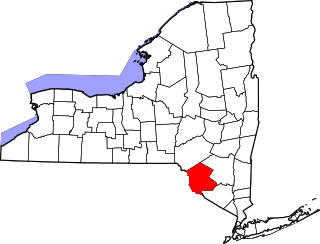
List of the National Register of Historic Places listings in Sullivan County, New York

<span class="mw-page-title-main">National Register of Historic Places listings in Bristol County, Rhode Island</span>

This is a list of the National Register of Historic Places listings in Bristol County, Rhode Island.

<span class="mw-page-title-main">National Register of Historic Places listings in Bristol, Virginia</span>

This is a list of the National Register of Historic Places listings in Bristol, Virginia.

<span class="mw-page-title-main">National Register of Historic Places listings in Washington County, Virginia</span>

This is a list of the National Register of Historic Places listings in Washington County, Virginia.

<span class="mw-page-title-main">National Register of Historic Places listings in Sullivan County, Pennsylvania</span>

This is a list of the National Register of Historic Places listings in Sullivan County, Pennsylvania.

This is a list of the National Register of Historic Places listings in Obion County, Tennessee.

This is a list of the National Register of Historic Places listings in Bedford County, Tennessee.

This is a list of the National Register of Historic Places listings in Bradley County, Tennessee.

This is a list of the National Register of Historic Places listings in Hamilton County, Tennessee.

This is a list of the National Register of Historic Places listings in Maury County, Tennessee.

This is a list of the National Register of Historic Places listings in Washington County, Tennessee.

This is a list of the National Register of Historic Places listings in Fentress County, Tennessee.

This is a list of the National Register of Historic Places listings in Hardeman County, Tennessee.

This is a list of the National Register of Historic Places listings in Lawrence County, Tennessee.

This is a list of the National Register of Historic Places listings in Marshall County, Tennessee.

This is a list of the National Register of Historic Places listings in McMinn County, Tennessee.

<span class="mw-page-title-main">National Register of Historic Places listings in Sullivan County, Indiana</span>

This is a list of the National Register of Historic Places listings in Sullivan County, Indiana.

<span class="mw-page-title-main">National Register of Historic Places listings in Sullivan County, Missouri</span>

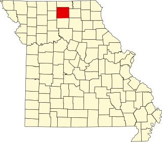
This is a list of the National Register of Historic Places listings in Sullivan County, Missouri.

References

  1. The latitude and longitude information provided in this table was derived originally from the National Register Information System, which has been found to be fairly accurate for about 99% of listings. Some locations in this table may have been corrected to current GPS standards.
  2. National Park Service, United States Department of the Interior, "National Register of Historic Places: Weekly List Actions", retrieved December 15, 2023.
  3. 1 2 Numbers represent an alphabetical ordering by significant words. Various colorings, defined here, differentiate National Historic Landmarks and historic districts from other NRHP buildings, structures, sites or objects.
  4. "National Register Information System". National Register of Historic Places . National Park Service. April 24, 2008.
  5. The eight-digit number below each date is the number assigned to each location in the National Register Information System database, which can be viewed by clicking the number.
  6. "East Hill Cemetery Brochure" (PDF). Bristol, Tennessee: Bristol Historical Association. Retrieved April 14, 2011.
  7. Sorrell, Robert. "Landmark Grand Guitar building demolished". Bristol Herald Courier, 2019-08-17. Accessed 2020-02-16.
  8. "Gifts for our children". Kingsport Times News . September 26, 1985. p. C1. Retrieved August 29, 2022 via Newspapers.com.