National Register of Historic Places listings in Knox County, Tennessee

Last updated

Location of Knox County in Tennessee Map of Tennessee highlighting Knox County.svg
Location of Knox County in Tennessee

This is a list of the National Register of Historic Places listings in Knox County, Tennessee.

Contents

This is intended to be a complete list of the properties and districts on the National Register of Historic Places in Knox County, Tennessee, United States. Latitude and longitude coordinates are provided for many National Register properties and districts; these locations may be seen together in a map. [1]

There are 116 properties and districts listed on the National Register in the county, including 1 National Historic Landmark. Another 5 properties were once listed but have been removed.

Map all coordinates using: OpenStreetMap
Contents: Counties in Tennessee
Anderson  Bedford  Benton  Bledsoe  Blount  Bradley  Campbell  Cannon  Carroll  Carter  Cheatham  Chester  Claiborne  Clay  Cocke  Coffee  Crockett  Cumberland  Davidson  Decatur  DeKalb  Dickson  Dyer  Fayette  Fentress  Franklin  Gibson  Giles  Grainger  Greene  Grundy  Hamblen  Hamilton  Hancock  Hardeman  Hardin  Hawkins  Haywood  Henderson  Henry  Hickman  Houston  Humphreys  Jackson  Jefferson  Johnson  Knox  Lake  Lauderdale  Lawrence  Lewis  Lincoln  Loudon  Macon  Madison  Marion  Marshall  Maury  McMinn  McNairy  Meigs  Monroe  Montgomery  Moore  Morgan  Obion  Overton  Perry  Pickett  Polk  Putnam  Rhea  Roane  Robertson  Rutherford  Scott  Sequatchie  Sevier  Shelby  Smith  Stewart  Sullivan  Sumner  Tipton  Trousdale  Unicoi  Union  Van Buren  Warren  Washington  Wayne  Weakley  White  Williamson  Wilson


    This National Park Service list is complete through NPS recent listings posted October 20, 2023. [2]

History

1871 Rendering of Knoxville, looking to the north-northwest 1-birds-eye-view-knoxville-1871-tn1.jpg
1871 Rendering of Knoxville, looking to the north-northwest

The earliest settlers in what is now Knox County were Native Americans - the Indian mound is the primary "built structure" that remains from their era. Beginning with explorer Hernando de Soto, who traveled near the county, the earliest Europeans were not settlers but explorers and hunters who left no permanent structures. However, when North Carolina made land available in the Land Grab Act of 1783, early settlers began surveying the region. These men included General James White, who soon owned the land that became downtown Knoxville, as well as Frances Alexander Ramsey and Alexander McMillan.

James White settled in rural east Knox County on the French Broad River in 1785, but constructed a cabin in what is now downtown Knoxville in 1786. General White later requested that his son-in-law, Charles McClung, survey the land around his cabin and lay out sixteen blocks with four lots on each block. After setting aside lots for his residence, a cemetery, college and other functions he deemed necessary, the balance of the lots were sold by lottery on October 3, 1791. In 1792, the community began to take shape: 1) Knox County, Tennessee, was split off from Hawkins County, Tennessee; 2) settlers were constructing buildings on lots they received in the lottery; 3) Samuel and Nathan Cowan opened the first store; and 4) the first tavern was opened by John Chisholm. In 1793, a garrison of soldiers was assigned to protect the settlers.

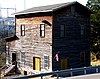
Other than setting aside land for Blount College (now the University of Tennessee), the earliest structures were built to accommodate basic frontier needs. These included the fort, residences, churches, taverns (which also served as inns) and a cemetery.

In terms of growth, development of the county was due both to expansion of the early settlement (a) and the development of roads (b), which linked James White's Fort to other parts of the state: (a) The original 16 square blocks was expanded to accommodate growth in the population. Moses White, James White's son, laid out East Knoxville, which was originally a separate city and called Mechanicsburg. Colonel John Williams laid out the west end of the town, which was briefly known as Williamsburg; and (b) Roads were constructed to allow access both to surrounding settlements in rural areas of Knox County, and to allow pioneers to travel from the east coast further west. Settlers typically traveled down from southwest Virginia through Rogersville, Tennessee on the Knoxville Road before arriving at Knoxville. By 1795, what is now Kingston Pike went from James White's Fort to the western end of the county. Beyond the western end of the county, this route became known as the Nashville Road. By 1807, the Knoxville Gazette reported that 200 settlers a day were passing through the city on their way further west. Further north in Knox County, Adair's Fort, built by John Adair in Fountain City, protected settlers traveling westward on the Emory Road. And by 1792, Alexander Cunningham was operating the first ferry over the Tennessee River south of Knoxville.

Despite ceasing to be Tennessee's state capital in 1817, Knoxville continued to grow slowly through the antebellum period. And due to the mountainous terrain, slavery never took root as deeply in East Tennessee as it did in Middle Tennessee and West Tennessee. The valleys of East Tennessee, such as the area west of Knoxville accessed by Kingston Pike, did have plantations, a few of whose houses still remain. And the Tennessee River was not as navigable at Knoxville as it was further downstream, so, other than the roads, the city remained comparatively isolated until the railroads reached the city in 1855. Then, due to Knoxville's central location in the southeast and the railroads that traversed it, the city experienced explosive growth. Initially, the East Tennessee & Virginia Railroad (which soon became the East Tennessee, Virginia and Georgia Railroad, and later became part of Southern Railway) began operations in the city. The Louisville and Nashville Railroad soon followed, giving Knoxville access to two prominent transportation companies and two rail stations of architectural significance. The 1880s were the greatest growth period in the city's history, although there was substantial growth after World War II.

1886 Aerial Rendering of Knoxville 1-birds-eye-view-Knoxville-1886-tn1.jpg
1886 Aerial Rendering of Knoxville

Structures now listed on the National Register of Historic Places largely reflect this expansion. There were isolated pockets of settlement, such as the Ramsey House and Marble Springs, in what remains the rural part of the county. As Kingston Pike developed, Crescent Bend and other estates were constructed in what soon became affluent western Knox County. Kingston Pike also linked Bearden, Ebenezer's Mill, and later linked Farragut, Concord and Kingston to Knoxville. There was a flurry of commercial and residential development in the late 19th century. As electric streetcars began operation, suburban expansion moved both north and south. Automobiles allowed further urban sprawl to develop.

As the county has expanded, many historic structures have been lost to development. Examples include: 18th-century Chisholm Tavern, which was not demolished until the 20th century as part of the construction of James White Parkway; the Mabry Hood House on Kingston Pike, which was demolished to allow construction of Pellissippi Parkway; and the Baker Peters House on Kingston Pike, which has survived, but has been stripped of its context due to surrounding commercial development, including a carwash in its front yard. By 1900, all that remained of James White's Fort was the fort's main house, which itself was dismantled and moved to a farm outside the city in 1906. In the 1960s, preservation groups moved the house to its present location on Hill Avenue, and reconstructed its historic palisades and outbuildings. Because it has been moved from its original location, the fort is not eligible for listing on the National Register.

Current listings

[3] Name on the Register [4] ImageDate listed [5] Location City or townDescription
1 Adair Gardens Historic District
Adair Gardens Historic District 119-adair-drive-knox-tn1.jpg
Adair Gardens Historic District
September 23, 1994
(#94001136)
Roughly bounded by Adair, Rose, and Coile Drs.
36°01′32″N83°55′32″W / 36.025625°N 83.925633°W / 36.025625; -83.925633 (Adair Gardens Historic District)
Knoxville Consists of several houses built in the 1920s and 1930s in the Fountain City community
2 Airplane Service Station
Airplane Service Station Airplane-service-station-knox-tn1.jpg
Airplane Service Station
March 18, 2004
(#04000198)
6829 Clinton Highway
36°00′33″N84°01′53″W / 36.009167°N 84.031389°W / 36.009167; -84.031389 (Airplane Service Station)
Knoxville Filling station built in 1930 in the shape of an airplane; located just outside Knoxville in the Powell community
3 Asbury Methodist Episcopal Church, South
Asbury Methodist Episcopal Church, South Asbury-united-methodist-church-tn1.jpg
Asbury Methodist Episcopal Church, South
March 18, 1997
(#97000222)
2820 Asbury Rd.
35°57′13″N83°49′33″W / 35.953611°N 83.825833°W / 35.953611; -83.825833 (Asbury Methodist Episcopal Church, South)
Knoxville Now Asbury United Methodist Church
4 Alexander Bishop House
Alexander Bishop House Bishop-ln-house-tn1.jpg
Alexander Bishop House
September 3, 1997
(#97000953)
7924 Bishop Rd.
36°03′51″N83°59′35″W / 36.064167°N 83.993056°W / 36.064167; -83.993056 (Alexander Bishop House)
Knoxville Believed to have been built in the early 1790s
5 Ayres Hall
Ayres Hall Ayres Hall abree.jpg
Ayres Hall
August 1, 2012
(#12000466)
1403 Circle Dr., University of Tennessee
35°57′27″N83°55′34″W / 35.957496°N 83.926°W / 35.957496; -83.926 (Ayres Hall)
Knoxville Completed 1921; renovated 2008
6 Bethel Confederate Cemetery and Winstead Cottage
Bethel Confederate Cemetery and Winstead Cottage Confederate Monument.jpg
Bethel Confederate Cemetery and Winstead Cottage
September 8, 2015
(#15000117)
1917 Bethel Ave.
35°58′28″N83°54′05″W / 35.9744°N 83.9015°W / 35.9744; -83.9015 (Bethel Confederate Cemetery and Winstead Cottage)
Knoxville Website
7 Bleak House
Bleak House Bleak-house-knoxville-tn1.jpg
Bleak House
November 8, 1984
(#84000369)
3148 Kingston Pike
35°56′58″N83°57′22″W / 35.949444°N 83.956111°W / 35.949444; -83.956111 (Bleak House)
Knoxville Also known as "Confederate Memorial Hall"; currently a museum
8 William Blount Mansion
William Blount Mansion Blount-mansion-knoxville-tn1.jpg
William Blount Mansion
October 15, 1966
(#66000726)
200 W. Hill Ave.
35°57′40″N83°54′55″W / 35.961111°N 83.915278°W / 35.961111; -83.915278 (William Blount Mansion)
Knoxville
9 Boyd-Harvey House
Boyd-Harvey House Boyd-harvey-house-tn1.jpg
Boyd-Harvey House
November 7, 1985
(#85002774)
Harvey Rd.
35°50′04″N84°10′48″W / 35.834444°N 84.18°W / 35.834444; -84.18 (Boyd-Harvey House)
Knoxville Located west of Knoxville near Concord
10 Alfred Buffat Homestead
Alfred Buffat Homestead Buffat-homestead-knoxville-tn1.jpg
Alfred Buffat Homestead
April 1, 1975
(#75001761)
1 mile (1.6 km) north of Knoxville on Love Creek Road
36°01′39″N83°51′48″W / 36.0275°N 83.863333°W / 36.0275; -83.863333 (Alfred Buffat Homestead)
Knoxville Late-1860s homestead in northeast Knoxville
11 Burwell Building Tennessee Theater
Burwell Building Tennessee Theater Tennessee Theatre 2019.png
Burwell Building Tennessee Theater
April 1, 1982
(#82003979)
600 S. Gay St.
35°57′44″N83°55′10″W / 35.962222°N 83.919444°W / 35.962222; -83.919444 (Burwell Building Tennessee Theater)
Knoxville Built 1907, theater designed in the Spanish-Moorish style by Graven & Mayger
12 Camp House
Camp House Greystone-camp-house-tn1.jpg
Camp House
April 24, 1973
(#73001800)
1306 Broadway, NE.
35°59′03″N83°55′19″W / 35.984167°N 83.921944°W / 35.984167; -83.921944 (Camp House)
Knoxville 
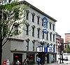
Commonly called "Greystone"; completed in 1890 for coal tycoon Eldad Cicero Camp, designed by Alfred B. Mullett; now houses offices for local station WATE-TV
13 Candoro Marble Works
Candoro Marble Works Candoro-marble-works-bldg-tn1.jpg
Candoro Marble Works
July 22, 2005
(#96001399)
681 Maryville Pike
35°55′58″N83°55′06″W / 35.932778°N 83.918333°W / 35.932778; -83.918333 (Candoro Marble Works)
Knoxville 
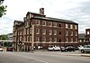
Marble finishing complex built in 1914; includes showroom and garage designed by architect Charles I. Barber; initially added in 1996, showroom and garage relisted for architectural significance in 2005
14 Central United Methodist Church
Central United Methodist Church Central-united-methodist-church-tn1.jpg
Central United Methodist Church
November 9, 2005
(#05001225)
201 E. 3rd Ave.
35°58′42″N83°55′20″W / 35.978333°N 83.922222°W / 35.978333; -83.922222 (Central United Methodist Church)
Knoxville Gothic Revival church designed by Baumann & Baumann
15 Chesterfield House
Chesterfield House Chesterfield-knox-tn1.jpg
Chesterfield House
November 16, 1977
(#77001276)
North of Mascot off Old Rutledge Pike
36°05′37″N83°45′06″W / 36.093611°N 83.751667°W / 36.093611; -83.751667 (Chesterfield House)
Mascot Georgian-style house built in 1838
16 Christenberry Club Room
Christenberry Club Room Christenberry-club-tn1.jpg
Christenberry Club Room
March 14, 1997
(#97000242)
Southwestern corner of the junction of Henegar and Shamrock Aves.
35°59′51″N83°55′46″W / 35.9975°N 83.929444°W / 35.9975; -83.929444 (Christenberry Club Room)
Knoxville Designed by Knoxville architectural firm Barber & McMurry
17 Church Street Methodist Church
Church Street Methodist Church ChurchStreetUMC.jpg
Church Street Methodist Church
March 10, 2009
(#09000115)
913 Henley St.
35°57′36″N83°55′14″W / 35.95991°N 83.92057°W / 35.95991; -83.92057 (Church Street Methodist Church)
Knoxville Designed by Barber & McMurry and John Russell Pope
18 Concord Village Historic District
Concord Village Historic District Concord TN.jpg
Concord Village Historic District
October 22, 1987
(#87001888)
Roughly bounded by Lakeridge and 3rd Drs., Spring St., and the Masonic Hall and Cemetery
35°51′58″N84°08′17″W / 35.866111°N 84.138056°W / 35.866111; -84.138056 (Concord Village Historic District)
Concord
19 Contractor's Supply, Inc.
Contractor's Supply, Inc. Contractors-supply-knoxville-tn1.jpg
Contractor's Supply, Inc.
July 13, 2011
(#11000457)
1909 Schofield St.
35°58′18″N83°57′20″W / 35.971667°N 83.955556°W / 35.971667; -83.955556 (Contractor's Supply, Inc.)
Knoxville Moderne-style structure built by contractor and developer Howard Rodgers in 1947; designed by Shelton & Stachel
20 Cowan, McClung and Company Building
Cowan, McClung and Company Building Fidelity-building-knoxville-tn1.jpg
Cowan, McClung and Company Building
July 12, 1984
(#84003566)
500-504 Gay St.
35°57′55″N83°55′05″W / 35.965278°N 83.918056°W / 35.965278; -83.918056 (Cowan, McClung and Company Building)
Knoxville Now called the "Fidelity Building"; built in 1871, remodeled in 1929 by Baumann & Baumann
21 Craighead-Jackson House
Craighead-Jackson House Craighead-jackson-knoxville-tn1.jpg
Craighead-Jackson House
March 20, 1973
(#73001801)
1000 State St.
35°57′40″N83°54′52″W / 35.961111°N 83.914444°W / 35.961111; -83.914444 (Craighead-Jackson House)
Knoxville
22 Daniel House
Daniel House Daniel-house-south-knox-tn1.JPG
Daniel House
March 19, 1998
(#98000240)
2701 Woodson Dr.
35°55′23″N83°56′57″W / 35.923056°N 83.949167°W / 35.923056; -83.949167 (Daniel House)
Knoxville Moderne-style house built using the frame of a Quonset hut; designed by James Fitzgibbon
23 Daylight Building
Daylight Building Daylight-building-knoxville-tn1.jpg
Daylight Building
November 25, 2009
(#09000956)
501-517 Union Ave.
35°56′59″N83°57′17″W / 35.949722°N 83.954722°W / 35.949722; -83.954722 (Daylight Building)
Knoxville
24 H.L. Dulin House
H.L. Dulin House Crescent-bluff-knoxville-tn1.jpg
H.L. Dulin House
October 15, 1974
(#74002265)
3100 Kingston Pike
35°56′59″N83°57′17″W / 35.949722°N 83.954722°W / 35.949722; -83.954722 (H.L. Dulin House)
Knoxville Also called "Crescent Bluff"; current address is 3106 Kingston Pike
25 Ebenezer Mill
Ebenezer Mill Ebenezer-mill-tn1.jpg
Ebenezer Mill
June 25, 1987
(#87001037)
409 Ebenezer Rd.
35°54′19″N84°04′25″W / 35.905278°N 84.073611°W / 35.905278; -84.073611 (Ebenezer Mill)
Knoxville Turbine-powered gristmill in West Knoxville
26 Emory Place Historic District
Emory Place Historic District Green-and-co-grocery-tn1.jpg
Emory Place Historic District
November 10, 1994
(#94001259)
Roughly bounded by Broadway, N. Central, Emory, 5th, E. 4th, and King Sts.; also Portions of North Broadway, North Central, Lamar, King, and North Gay Sts., Emory Pl., East 4th, East 5th. and West 5th Aves.
35°58′27″N83°55′21″W / 35.974069°N 83.922483°W / 35.974069; -83.922483 (Emory Place Historic District)
Knoxville 
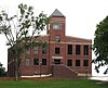
Includes Knoxville High School, First Christian Church, a fire station, and several commercial and residential structures; boundary increase approved April 20, 2023.
27 Fire Station No. 5
Fire Station No. 5 Fire-station-5-knoxville-tn2.jpg
Fire Station No. 5
November 2, 1978
(#78002602)
419 Arthur St., NW.
35°58′09″N83°55′56″W / 35.969167°N 83.932222°W / 35.969167; -83.932222 (Fire Station No. 5)
Knoxville Early-20th century Knoxville Fire Department station built to serve the Mechanicsville neighborhood
28 First Baptist Church
First Baptist Church First-baptist-church-knoxville-tn1.jpg
First Baptist Church
March 8, 1997
(#97000223)
510 Main Ave.
35°57′37″N83°55′07″W / 35.960278°N 83.918611°W / 35.960278; -83.918611 (First Baptist Church)
Knoxville Designed by Dougherty & Gardner
29 First Presbyterian Church Cemetery
First Presbyterian Church Cemetery First-presbyterian-church-cemetery-tn1.jpg
First Presbyterian Church Cemetery
December 4, 1996
(#96001400)
Adjacent to 620 State St.
35°57′35″N83°55′15″W / 35.959722°N 83.920833°W / 35.959722; -83.920833 (First Presbyterian Church Cemetery)
Knoxville Knoxville's oldest cemetery
30 Forest Hills Boulevard Historic District
Forest Hills Boulevard Historic District Wayland-house-forest-hills-tn1.jpg
Forest Hills Boulevard Historic District
April 14, 1992
(#92000350)
500-709 Forest Hills Blvd.
35°56′44″N83°59′09″W / 35.945556°N 83.985833°W / 35.945556; -83.985833 (Forest Hills Boulevard Historic District)
Knoxville Consists of 20 houses built in the late 1920s and 1930s
31 Fort Sanders Historic District
Fort Sanders Historic District Laurel-terrace-knoxville-tn1.jpg
Fort Sanders Historic District
September 16, 1980
(#80003839)
Roughly bounded by White and Grand Aves. and 11th and 19th Sts.
35°57′37″N83°55′54″W / 35.960278°N 83.931667°W / 35.960278; -83.931667 (Fort Sanders Historic District)
Knoxville Consists of several hundred houses and other buildings constructed c. 1880-1920 in the vicinity of the Civil War-era Fort Sanders
32 Fourth and Gill Historic District
Fourth and Gill Historic District 933-luttrell-fourth-and-gill-tn1.jpg
Fourth and Gill Historic District
April 29, 1985
(#85000948)
Roughly bounded by Interstate 40, Broadway, Central and 5th Ave.
35°58′48″N83°55′14″W / 35.98°N 83.920556°W / 35.98; -83.920556 (Fourth and Gill Historic District)
Knoxville Includes three churches and several dozen houses built c. 1880-1930
33 Gay Street Commercial Historic District
Gay Street Commercial Historic District South-gay-street-knoxville-tn1.jpg
Gay Street Commercial Historic District
November 4, 1986
(#86002912)
Roughly along Gay St. from Summit Hill Dr. to Church Ave.
35°57′56″N83°55′06″W / 35.965556°N 83.918333°W / 35.965556; -83.918333 (Gay Street Commercial Historic District)
Knoxville Consists of nearly three dozen buildings constructed c. 1880-1940, during Knoxville's commercial boom period
34 General Building
General Building General-building-knoxville-tn1.jpg
General Building
March 8, 1988
(#88000174)
625 Market St.
35°57′47″N83°55′07″W / 35.963056°N 83.918611°W / 35.963056; -83.918611 (General Building)
Knoxville Designed by Barber & McMurry; now home to First Bank
35 Gibbs Drive Historic District
Gibbs Drive Historic District 2811-gibbs-drive-knox-tn1.jpg
Gibbs Drive Historic District
November 8, 2000
(#00001354)
Gibbs Dr.
36°02′07″N83°55′35″W / 36.035278°N 83.926389°W / 36.035278; -83.926389 (Gibbs Drive Historic District)
Knoxville Consists of several early-20th-century houses built along Gibbs Drive in Knoxville's Fountain City community
36 Nicholas Gibbs House
Nicholas Gibbs House Nicholas-gibbs-house-knox-tn1.jpg
Nicholas Gibbs House
September 9, 1988
(#88001447)
7633 E Emory Rd.
36°07′26″N83°50′37″W / 36.123889°N 83.843611°W / 36.123889; -83.843611 (Nicholas Gibbs House)
Corryton Log house built in 1793 by pioneer Nicholas Gibbs
37 Giffin Grammar School November 22, 2016
(#16000788)
1834 Beech St.
35°57′14″N83°53′27″W / 35.953863°N 83.890814°W / 35.953863; -83.890814 (Giffin Grammar School)
Knoxville
38 Happy Holler Historic District
Happy Holler Historic District TN Knox County Happy Holler Historic District 0009.jpg
Happy Holler Historic District
April 23, 2014
(#14000185)
1200-1209, 1211 N, Central St., 103,105 E. Anderson & 109, 115 W. Anderson Aves.
35°58′54″N83°55′47″W / 35.9816501°N 83.9296257°W / 35.9816501; -83.9296257 (Happy Holler Historic District)
Knoxville Part of the Knoxville and Knox County MPS
39 Hilltop March 22, 2016
(#16000119)
5617 Lyons View Pike
35°55′50″N83°59′30″W / 35.93043°N 83.99174°W / 35.93043; -83.99174 (Hilltop)
Knoxville NRHP page
40 Holston National Bank
Holston National Bank Holston-bank-building-knoxville-tn1.jpg
Holston National Bank
October 2, 1979
(#79002446)
531 S. Gay St.
35°57′51″N83°55′06″W / 35.964167°N 83.918333°W / 35.964167; -83.918333 (Holston National Bank)
Knoxville Designed by John Kevan Peebles. Currently a condominium high-rise known simply as "The Holston".
41 Hopecote
Hopecote Hopecote-utk-tn1.jpg
Hopecote
March 20, 2012
(#12000137)
1820 Melrose Ave.
35°57′11″N83°55′59″W / 35.953162°N 83.932995°W / 35.953162; -83.932995 (Hopecote)
Knoxville Designed by local architect John Fanz Staub; includes a cupboard designed by Thomas Hope (whose great-great-grandson built the house), a hearthstone from the James Park House, and woodwork made from timbers salvaged from the Admiral David Farragut birthplace; used as a guesthouse by U.T.
42 Hotpoint Living-Conditioned Home
Hotpoint Living-Conditioned Home Hotpoint-living-conditioned-house-tn1.jpg
Hotpoint Living-Conditioned Home
March 15, 2010
(#10000086)
509 W. Hills Rd.
35°56′12″N84°01′51″W / 35.9368°N 84.030803°W / 35.9368; -84.030803 (Hotpoint Living-Conditioned Home)
Knoxville Demonstration "starter home" built in 1954 in West Hills subdivision; designed by Bruce McCarty
43 Howell Nurseries July 26, 2022
(#100007965)
2743 Wimpole Ave.
35°59′00″N83°52′55″W / 35.9833°N 83.8820°W / 35.9833; -83.8820 (Howell Nurseries)
Knoxville
44 Island Home Park Historic District
Island Home Park Historic District 2222-island-home-blvd-knox-tn1.jpg
Island Home Park Historic District
November 10, 1994
(#94001260)
Bounded by Island Home Boulevard, Fisher and Spence Places, and Maplewood
35°57′33″N83°52′52″W / 35.959122°N 83.881153°W / 35.959122; -83.881153 (Island Home Park Historic District)
Knoxville Includes 119 contributing houses built c. 1899-1940 in the Island Home Park community of South Knoxville
45 Jackson Avenue Warehouse District
Jackson Avenue Warehouse District Jackson-avenue-warehouses-habs-tn-212.jpg
Jackson Avenue Warehouse District
April 11, 1973
(#73001802)
Jackson Ave.; also 120-124 Jackson Ave.
35°58′13″N83°55′08″W / 35.970278°N 83.918889°W / 35.970278; -83.918889 (Jackson Avenue Warehouse District)
Knoxville 120-124 Jackson represents a boundary increase of March 10, 1975
46 Andrew Johnson Hotel
Andrew Johnson Hotel Andrew Johnson Building, cropped.JPG
Andrew Johnson Hotel
July 9, 1980
(#80003840)
912 S. Gay St.
35°57′41″N83°54′56″W / 35.961389°N 83.915556°W / 35.961389; -83.915556 (Andrew Johnson Hotel)
Knoxville Now houses offices for Knox County Schools and other county departments; designed by Baumann & Baumann
47 Leroy Keener House
Leroy Keener House Leroy-keener-house-tn1.jpg
Leroy Keener House
November 13, 1997
(#97001440)
3506 Woodlawn School Rd.
35°56′51″N83°43′24″W / 35.9475°N 83.723333°W / 35.9475; -83.723333 (Leroy Keener House)
Knoxville Greek Revival-style house in southeast Knox County
48 Kern's Bakery
Kern's Bakery Kern's Bakery, 2110 Chapman Hwy, Knoxville.jpg
Kern's Bakery
May 8, 2017
(#100000979)
2110 Chapman Hwy.
35°57′11″N83°54′55″W / 35.953111°N 83.915300°W / 35.953111; -83.915300 (Kern's Bakery)
Knoxville
49 Kingston Pike Historic District
Kingston Pike Historic District Crescent-bend-knoxville-tn1.jpg
Kingston Pike Historic District
December 4, 1996
(#96001404)
Roughly 2728-3151, 3201, 3219, 3401, 3425, and 3643 Kingston Pike
35°56′58″N83°57′18″W / 35.949444°N 83.955°W / 35.949444; -83.955 (Kingston Pike Historic District)
Knoxville Includes Crescent Bend, the H.L. Dulin House, Judge Taylor House, and several others
50 Knollwood
Knollwood Knollwood-bearden-hill-knoxville-tn1.jpg
Knollwood
May 12, 1975
(#75001762)
6411 Kingston Pike
35°56′02″N84°00′32″W / 35.933889°N 84.008889°W / 35.933889; -84.008889 (Knollwood)
Knoxville Currently home to Schaad Companies; address sometimes listed as 150 Major Reynolds Place
51 Knox County Courthouse
Knox County Courthouse Oldknoxcourthouse.JPG
Knox County Courthouse
April 24, 1973
(#73001803)
Main Ave. and Gay St.
35°57′39″N83°55′01″W / 35.960833°N 83.916944°W / 35.960833; -83.916944 (Knox County Courthouse)
Knoxville Built by Stephenson and Getaz
52 Knoxville Business College
Knoxville Business College Keyhole-building-knoxville-tn1.jpg
Knoxville Business College
January 27, 1983
(#83003042)
209 W. Church St.
35°57′50″N83°55′01″W / 35.963889°N 83.916944°W / 35.963889; -83.916944 (Knoxville Business College)
Knoxville Commonly called the "Keyhole Building"; now houses condominiums
53 Knoxville College Historic District
Knoxville College Historic District Knoxville-college-mckee-tn1.jpg
Knoxville College Historic District
May 1, 1980
(#80003841)
901 College St., NW.
35°58′11″N83°56′34″W / 35.969722°N 83.942778°W / 35.969722; -83.942778 (Knoxville College Historic District)
Knoxville
54 Knoxville Iron Foundry Complex-Nail Factory and Warehouse
Knoxville Iron Foundry Complex-Nail Factory and Warehouse Foundry-knoxville-tn1.jpg
Knoxville Iron Foundry Complex-Nail Factory and Warehouse
March 25, 1982
(#82003980)
715 Western Ave., NW.
35°57′55″N83°55′36″W / 35.965278°N 83.926667°W / 35.965278; -83.926667 (Knoxville Iron Foundry Complex-Nail Factory and Warehouse)
Knoxville Built by the Knoxville Iron Company in 1875 as a nail factory; now an event center known as "The Foundry"
55 Knoxville National Cemetery
Knoxville National Cemetery Knoxville-union-soldier-monument-tn1.jpg
Knoxville National Cemetery
September 12, 1996
(#96000966)
939 Tyson St., NW.
35°58′32″N83°55′39″W / 35.975556°N 83.9275°W / 35.975556; -83.9275 (Knoxville National Cemetery)
Knoxville
56 Knoxville Post Office
Knoxville Post Office Knoxville-post-office-tn1.jpg
Knoxville Post Office
May 31, 1984
(#84003567)
501 Main St.
35°57′39″N83°55′08″W / 35.960833°N 83.918889°W / 35.960833; -83.918889 (Knoxville Post Office)
Knoxville Designed by Baumann & Baumann
57 Knoxville YMCA Building
Knoxville YMCA Building YMCA-building-knoxville-tn2.jpg
Knoxville YMCA Building
November 17, 1983
(#83004256)
605 Clinch Ave.
35°57′47″N83°55′16″W / 35.963056°N 83.921111°W / 35.963056; -83.921111 (Knoxville YMCA Building)
Knoxville Designed by Barber & McMurry
58 Lamar House Hotel
Lamar House Hotel Bijou-theater-lamar-house-tn1.jpg
Lamar House Hotel
December 4, 1975
(#75001763)
803 Gay St., SW.
35°57′47″N83°55′03″W / 35.963056°N 83.9175°W / 35.963056; -83.9175 (Lamar House Hotel)
Knoxville Lamar House Hotel built in 1816, Bijou Theater (its current function) added in 1909
59 Charles L. Lawhon Cottage
Charles L. Lawhon Cottage Charles L Lawhon Cottage - south view.jpg
Charles L. Lawhon Cottage
November 27, 2019
(#100004685)
1910 Prospect Place
35°58′09″N83°53′43″W / 35.9693°N 83.8954°W / 35.9693; -83.8954 (Charles L. Lawhon Cottage)
Knoxville
60 Lebanon in the Forks Cemetery
Lebanon in the Forks Cemetery Lebanon-in-the-fork-site-tn1.jpg
Lebanon in the Forks Cemetery
November 29, 2010
(#10000934)
Asbury Rd. north of Norfolk Southern Railroad
35°57′37″N83°50′50″W / 35.960278°N 83.847222°W / 35.960278; -83.847222 (Lebanon in the Forks Cemetery)
Knoxville Contains Knox County's oldest marked burial.
61 Lincoln Park United Methodist Church
Lincoln Park United Methodist Church Lincoln-park-methodist-church-tn1.jpg
Lincoln Park United Methodist Church
July 14, 2005
(#05000695)
3120 Pershing St.
36°00′03″N83°56′12″W / 36.000833°N 83.936667°W / 36.000833; -83.936667 (Lincoln Park United Methodist Church)
Knoxville
62 Lindbergh Forest Historic District
Lindbergh Forest Historic District 3419-southwood-knox-tn1.jpg
Lindbergh Forest Historic District
February 10, 1998
(#94001261)
Along Chamberlain, Druid, Glenhurst, Southwood, Winslow, and Woodlawn
35°56′35″N83°54′27″W / 35.943181°N 83.907425°W / 35.943181; -83.907425 (Lindbergh Forest Historic District)
Knoxville Early automobile suburb, developed in the late-1920s and 1930s
63 Louisville and Nashville Freight Depot
Louisville and Nashville Freight Depot Louisville-and-nashville-depot-tn1.jpg
Louisville and Nashville Freight Depot
March 25, 1982
(#82003981)
700 Western Ave., NW.
35°57′51″N83°55′31″W / 35.964167°N 83.925278°W / 35.964167; -83.925278 (Louisville and Nashville Freight Depot)
Knoxville Built 1903-1904
64 Louisville and Nashville Passenger Station
Louisville and Nashville Passenger Station Louisville-and-nashville-station-knoxville-tn1.jpg
Louisville and Nashville Passenger Station
March 25, 1982
(#82003982)
700 Western Ave., NW.
35°57′51″N83°55′28″W / 35.964167°N 83.924444°W / 35.964167; -83.924444 (Louisville and Nashville Passenger Station)
Knoxville Built 1904-1905, currently home to the Knox County STEM Academy; designed by Richard Monfort
65 Joseph Alexander Mabry, Jr. House
Joseph Alexander Mabry, Jr. House Mabry-hazen-house-tn1.jpg
Joseph Alexander Mabry, Jr. House
November 13, 1989
(#89001974)
1711 Dandridge Ave.
35°58′16″N83°54′11″W / 35.971111°N 83.903056°W / 35.971111; -83.903056 (Joseph Alexander Mabry, Jr. House)
Knoxville Built in 1858. Commonly called the Mabry-Hazen House; now a museum
66 Mall Building
Mall Building 1-market-square-mall-building-tn1.jpg
Mall Building
August 26, 1982
(#82003983)
1, 3, 5 Market St.
35°57′53″N83°55′11″W / 35.964722°N 83.919722°W / 35.964722; -83.919722 (Mall Building)
Knoxville Also called the Kern Building, Odd Fellows Hall, or Hotel St. Oliver; designed by Joseph Baumann, and built in 1875 for confectioner Peter Kern
67 Marble Springs
Marble Springs Marble-springs-full-tn1.jpg
Marble Springs
May 6, 1971
(#71000823)
South of Knoxville on Neubert Springs Rd.
35°53′46″N83°52′20″W / 35.896111°N 83.872222°W / 35.896111; -83.872222 (Marble Springs)
Knoxville
68 Market Square Commercial Historic District
Market Square Commercial Historic District Market-square-north-tn1.jpg
Market Square Commercial Historic District
December 20, 1984
(#84001138)
Market Sq. Mall
35°57′54″N83°55′10″W / 35.965°N 83.919444°W / 35.965; -83.919444 (Market Square Commercial Historic District)
Knoxville Contains 20 contributing buildings constructed c. 1870-1925
69 Maxwell-Kirby House November 30, 1999
(#99001446)
8671 Northshore Dr.
35°53′08″N84°02′23″W / 35.88564°N 84.03973°W / 35.88564; -84.03973 (Maxwell-Kirby House)
Knoxville
70 Samuel McCammon House
Samuel McCammon House Samuel-mccammon-house-tn1.jpg
Samuel McCammon House
March 1, 1984
(#84003571)
1715 Riverside Dr.
35°57′55″N83°53′51″W / 35.965278°N 83.8975°W / 35.965278; -83.8975 (Samuel McCammon House)
Knoxville Currently houses offices of Engert Plumbing & Heating, Inc.
71 Alexander McMillan House
Alexander McMillan House Alexander-mcmillan-house-tn1.jpg
Alexander McMillan House
May 10, 2001
(#01000504)
7703 Strawberry Plains Pike
36°00′41″N83°45′57″W / 36.011442°N 83.765958°W / 36.011442; -83.765958 (Alexander McMillan House)
Knoxville Constructed c. 1785 by early Knox County pioneer Alexander McMillan (1749-1837)
72 Mead Marble Quarry
Mead Marble Quarry Meads-quarry-outcrops-tn1.jpg
Mead Marble Quarry
March 26, 2014
(#14000085)
2915 Island Home Ave.
35°57′05″N83°52′14″W / 35.951521°N 83.870435°W / 35.951521; -83.870435 (Mead Marble Quarry)
Knoxville Tennessee marble quarry and lime plant complex
73 Mechanics' Bank and Trust Company Building
Mechanics' Bank and Trust Company Building Mechanics-bank-and-trust-knoxville-tn1.jpg
Mechanics' Bank and Trust Company Building
January 27, 1983
(#83003043)
612 S. Gay St.
35°57′53″N83°55′04″W / 35.964722°N 83.917778°W / 35.964722; -83.917778 (Mechanics' Bank and Trust Company Building)
Knoxville
74 Mechanicsville Historic District
Mechanicsville Historic District 1007-oak-knoxville-tn1.jpg
Mechanicsville Historic District
July 18, 1980
(#80003842)
Off State Route 62
35°58′07″N83°56′02″W / 35.968611°N 83.933889°W / 35.968611; -83.933889 (Mechanicsville Historic District)
Knoxville Consists of several dozen houses and other buildings constructed in the late 19th and early 20th centuries
75 Medical Arts Building
Medical Arts Building Medical-arts-building-knox-tn3.jpg
Medical Arts Building
May 24, 1984
(#84003573)
603 Main St.
35°57′39″N83°55′11″W / 35.960833°N 83.919722°W / 35.960833; -83.919722 (Medical Arts Building)
Knoxville Built 1929-1930 as an office building for physicians; designed by Manley and Young
76 Middlebrook
Middlebrook Middlebrook-knoxville-tn1.jpg
Middlebrook
June 18, 1974
(#74001920)
4001 Middlebrook Pike
35°57′50″N83°58′39″W / 35.963889°N 83.9775°W / 35.963889; -83.9775 (Middlebrook)
Knoxville 1845-era frame house
77 Minvilla
Minvilla Minvilla-manor-knox-tn1.jpg
Minvilla
December 10, 2010
(#10001046)
447 N. Broadway
35°58′20″N83°55′28″W / 35.972222°N 83.924444°W / 35.972222; -83.924444 (Minvilla)
Knoxville 
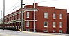
Built as a rowhouse complex in 1913; converted into Fifth Avenue Motel in the early 1960s; rehabilitated as housing for the homeless, 2002-2010; designed by Baumann Brothers
78 Monday House
Monday House Monday-house-knoxville-tn1.jpg
Monday House
April 19, 2001
(#01000394)
2721 Asbury Rd.
35°57′10″N83°49′46″W / 35.952803°N 83.829542°W / 35.952803; -83.829542 (Monday House)
Knoxville Also called the Weigel-Shell House
79 Benjamin Morton House
Benjamin Morton House Ben-morton-house-knox-tn1.jpg
Benjamin Morton House
November 10, 2004
(#04001233)
4084 Kingston Pike
35°56′39″N83°58′26″W / 35.944167°N 83.973889°W / 35.944167; -83.973889 (Benjamin Morton House)
Knoxville Built in 1927 for Knoxville mayor Benjamin Morton, designed by Baumann & Baumann
80 Murphy Springs Farm
Murphy Springs Farm MURPHY SPRINGS FARM, KNOXVILLE, KNOX COUNTY, TN.jpg
Murphy Springs Farm
July 14, 2015
(#14001034)
4508 Murphy Rd.
36°03′17″N83°52′29″W / 36.054825°N 83.874690°W / 36.054825; -83.874690 (Murphy Springs Farm)
Knoxville
81 New Salem United Methodist Church
New Salem United Methodist Church New-salem-methodist-south-knox-tn1.jpg
New Salem United Methodist Church
August 11, 1983
(#83003044)
2417 Tipton Station Rd.
35°53′06″N83°53′54″W / 35.885°N 83.898333°W / 35.885; -83.898333 (New Salem United Methodist Church)
Knoxville Gothic Revival-style church located off Gov. John Sevier Highway in South Knox County
82 Capt. James Newman House October 30, 1998
(#98001304)
8906 Newman Ln.
35°57′14″N83°41′59″W / 35.95380°N 83.69977°W / 35.95380; -83.69977 (Capt. James Newman House)
Knoxville gate across road
83 North Hills Historic District
North Hills Historic District 1829-n-hills-knox-tn1.jpg
North Hills Historic District
July 25, 2008
(#08000677)
Roughly bounded by North Hills, North Park, and Fountain Park Boulevards
36°00′18″N83°54′06″W / 36.005042°N 83.901744°W / 36.005042; -83.901744 (North Hills Historic District)
Knoxville Consists of several dozen houses built in the late 1920s and 1930s
84 Old Gray Cemetery
Old Gray Cemetery Charles-mcclung-mcghee-obelisk-old-gray-tn1.jpg
Old Gray Cemetery
December 4, 1996
(#96001402)
543 N. Broadway
35°58′29″N83°55′35″W / 35.974722°N 83.926389°W / 35.974722; -83.926389 (Old Gray Cemetery)
Knoxville
85 Old Knoxville City Hall
Old Knoxville City Hall Old-knoxville-city-hall-habs-tn-5-1.jpg
Old Knoxville City Hall
May 31, 1972
(#72001241)
Summit Hill Dr.
35°57′55″N83°55′24″W / 35.965278°N 83.923333°W / 35.965278; -83.923333 (Old Knoxville City Hall)
Knoxville Originally the Deaf and Dumb Asylum, used as city hall 1923-1980; now an extension of Lincoln Memorial University; built and possibly designed by Jacob Newman
86 Old North Knoxville Historic District
Old North Knoxville Historic District Lou-mar-onk-tn1.jpg
Old North Knoxville Historic District
May 14, 1992
(#92000506)
Roughly bounded by E. Woodland, Bluff, Armstrong, E. Baxter, and Central Aves.
35°59′13″N83°55′33″W / 35.986953°N 83.925883°W / 35.986953; -83.925883 (Old North Knoxville Historic District)
Knoxville Consists of 496 houses and outbuildings constructed c. 1888-1940
87 Old Post Office Building
Old Post Office Building Customs-house-knoxville-tn1906.jpg
Old Post Office Building
March 20, 1973
(#73001804)
Clinch and Market Sts.
35°57′49″N83°55′07″W / 35.963611°N 83.918611°W / 35.963611; -83.918611 (Old Post Office Building)
Knoxville Usually called the "Old Customs House"; designed by Alfred B. Mullett; currently houses part of the East Tennessee History Center
88 Ossoli Circle Clubhouse
Ossoli Circle Clubhouse Ossoli-circle-clubhouse-facade-tn1.jpg
Ossoli Circle Clubhouse
March 21, 1985
(#85000620)
2511 W. Cumberland Ave.
35°57′10″N83°56′37″W / 35.952778°N 83.943611°W / 35.952778; -83.943611 (Ossoli Circle Clubhouse)
Knoxville Designed by Barber & McMurry
89 Park City Historic District
Park City Historic District 1618-washington-knoxville-tn1.jpg
Park City Historic District
October 25, 1990
(#90001578)
Roughly bounded by Washington Ave., Cherry St., Woodbine Ave., Beaman St., Magnolia Ave., and Winona St.
35°59′13″N83°53′56″W / 35.986944°N 83.898889°W / 35.986944; -83.898889 (Park City Historic District)
Knoxville Consists of several hundred houses built in the late 19th and early 20th centuries in what is now the Parkridge community and its vicinity
90 Park City Junior High School
Park City Junior High School Park-city-junior-high-knox-tn1.jpg
Park City Junior High School
June 30, 1983
(#83003045)
523 Bertrand St.
35°58′52″N83°54′27″W / 35.981111°N 83.9075°W / 35.981111; -83.9075 (Park City Junior High School)
Knoxville Designed by Albert Baumann, Jr., and William B. Ittner; renovated as a condominium by Kristopher Kendrick
91 James Park House
James Park House James Park House.jpg
James Park House
October 18, 1972
(#72001242)
422 W. Cumberland Ave.
35°57′42″N83°55′07″W / 35.961667°N 83.918611°W / 35.961667; -83.918611 (James Park House)
Knoxville Rests on foundation built in 1790s by John Sevier, house constructed in 1812 by James Park; now corporate headquarters for Gulf and Ohio Railways
92 Peters House
Peters House Peters-house-knoxville-tn1.jpg
Peters House
March 31, 1999
(#99000364)
1319 Grainger Ave.
35°59′20″N83°55′10″W / 35.988889°N 83.919444°W / 35.988889; -83.919444 (Peters House)
Knoxville Built in the 1850s, remodeled in the 1890s by George Franklin Barber
93 Ivan Racheff House
Ivan Racheff House Ivan-racheff-house-tn1.jpg
Ivan Racheff House
July 17, 2002
(#02000810)
1943 Tennessee Ave.
35°58′46″N83°57′12″W / 35.979444°N 83.953333°W / 35.979444; -83.953333 (Ivan Racheff House)
Knoxville Home and gardens of Knoxville Iron Company president Ivan Racheff; now a museum
94 Ramsey House
Ramsey House Ramseyhouse1.jpg
Ramsey House
December 23, 1969
(#69000180)
Southeast of Knoxville on Thorngrove Pike
35°58′02″N83°49′33″W / 35.967222°N 83.825833°W / 35.967222; -83.825833 (Ramsey House)
Knoxville Now a museum; built by early Knoxville architect Thomas Hope
95 Riverdale Historic District
Riverdale Historic District Riverdale-6416-knox-tn1.jpg
Riverdale Historic District
April 23, 1997
(#94001258)
6145 and 6603 Thorngrove Pike and 6802 Hodges Ferry Rd.
35°57′32″N83°46′27″W / 35.958889°N 83.774167°W / 35.958889; -83.774167 (Riverdale Historic District)
Knoxville Contains several 19th-century houses related to the Riverdale community
96 Riverdale Mill
Riverdale Mill Riverdale-mill-knox-tn1.jpg
Riverdale Mill
March 13, 1987
(#87000464)
Wayland Rd. and Thorngrove Pike
35°57′32″N83°46′37″W / 35.958889°N 83.776944°W / 35.958889; -83.776944 (Riverdale Mill)
Knoxville 19th-century gristmill; overshot wheel still intact
97 Riverdale School
Riverdale School Riverdale-school-knox-tn1.jpg
Riverdale School
March 14, 1997
(#97000243)
7009 Thorngrove Pike
35°57′57″N83°45′11″W / 35.965833°N 83.753056°W / 35.965833; -83.753056 (Riverdale School)
Knoxville Built in 1938; designed by Barber & McMurry
98 Ross Marble Quarry
Ross Marble Quarry Ross-marble-quarry-walls-full-tn1.jpg
Ross Marble Quarry
March 26, 2014
(#14000086)
2915 Island Home Ave.
35°56′53″N83°52′18″W / 35.948038°N 83.871562°W / 35.948038; -83.871562 (Ross Marble Quarry)
Knoxville Tennessee marble quarry
99 Avery Russell House
Avery Russell House Avery-russell-house-tn1.jpg
Avery Russell House
June 5, 1975
(#75001759)
11409 Kingston Pike
35°52′51″N84°09′41″W / 35.880833°N 84.161389°W / 35.880833; -84.161389 (Avery Russell House)
Farragut Also known as the Martin-Russell House after its initial owner, Samuel Martin
100 St. John's Lutheran Church
St. John's Lutheran Church St-johns-lutheran-church-knoxville-tn1.jpg
St. John's Lutheran Church
April 4, 1985
(#85000700)
544 Broadway, NW.
35°58′26″N83°55′26″W / 35.973889°N 83.923889°W / 35.973889; -83.923889 (St. John's Lutheran Church)
Knoxville Designed by R. F. Graf
101 Savage House and Garden
Savage House and Garden Savage-garden-knox-tn1.jpg
Savage House and Garden
October 17, 1997
(#97001230)
3237 Garden Dr.
36°02′31″N83°55′38″W / 36.041944°N 83.927222°W / 36.041944; -83.927222 (Savage House and Garden)
Knoxville Japanese-style garden established c. 1915 in Knoxville's Fountain City community
102 Seven Islands Methodist Church
Seven Islands Methodist Church Seven-islands-methodist-tn1.jpg
Seven Islands Methodist Church
March 18, 1997
(#97000244)
8100 Seven Islands Rd.
35°57′05″N83°42′19″W / 35.951389°N 83.705278°W / 35.951389; -83.705278 (Seven Islands Methodist Church)
Knoxville Located in southeast Knox County near the Sevier County line; congregation founded in 1802, church built in the 1850s
103 South Market Historic District
South Market Historic District South-market-historic-district-tn1.jpg
South Market Historic District
December 4, 1996
(#96001403)
707, 709, and 713 Market St. and 404 and 406 Church Ave.
35°57′47″N83°54′27″W / 35.963056°N 83.9075°W / 35.963056; -83.9075 (South Market Historic District)
Knoxville Includes the Cherokee Building (404 Church), the Ely (406 Church), the Cunningham (707 Market), the Stuart (709 Market), and the Cate (713 Market), all constructed c. 1895-1907
104 Southern Terminal and Warehouse Historic District
Southern Terminal and Warehouse Historic District Knoxville-southern-terminal-tn1.jpg
Southern Terminal and Warehouse Historic District
November 18, 1985
(#85002909)
Roughly bounded by Depot Ave., N. Central Ave., Sullivan St., S. Central Ave., Vine Ave., and N. and S. Gay St.; also 100 N. Broadway and 525 W. Jackson Ave.
35°58′10″N83°55′12″W / 35.969444°N 83.92°W / 35.969444; -83.92 (Southern Terminal and Warehouse Historic District)
Knoxville Part of this district overlaps with the Jackson Avenue Warehouse Historic District. Second set of addresses represents a boundary increase of March 10, 2004
105 Statesview
Statesview Statesview 002.jpg
Statesview
April 24, 1973
(#73001805)
600 S Peters Rd, about 10 miles (16 km) southwest of Knoxville off U.S. Route 70
35°53′53″N84°04′22″W / 35.898056°N 84.072778°W / 35.898056; -84.072778 (Statesview)
Knoxville Built by early Knoxville architect Thomas Hope for surveyor Charles McClung
106 Stratford
Stratford Stratford-sterchi-mansion-knox-tn.jpg
Stratford
July 16, 2009
(#09000536)
809 Dry Gap Pike
36°01′40″N83°58′24″W / 36.027722°N 83.973458°W / 36.027722; -83.973458 (Stratford)
Knoxville Built in 1910 by furniture magnate James G. Sterchi, designed by R.F. Graf; now an event center
107 Talahi Improvements
Talahi Improvements Sunhouse-fountain-sequoyah-hills-tn1.jpg
Talahi Improvements
December 26, 1979
(#79002447)
near the intersection of Cherokee Blvd and Talahi Dr
35°56′09″N83°57′37″W / 35.935833°N 83.960278°W / 35.935833; -83.960278 (Talahi Improvements)
Knoxville Late-1920s suburban development in the Sequoyah Hills neighborhood
108 Tennessee School for the Deaf Historic District
Tennessee School for the Deaf Historic District TSD-gymnasium-knoxville-tn1.jpg
Tennessee School for the Deaf Historic District
December 4, 1996
(#96001401)
2725 Island Home Boulevard
35°57′33″N83°52′46″W / 35.959167°N 83.879444°W / 35.959167; -83.879444 (Tennessee School for the Deaf Historic District)
Knoxville
109 Trinity Methodist Episcopal Church
Trinity Methodist Episcopal Church Knoxville-house-of-faith-tn1.jpg
Trinity Methodist Episcopal Church
August 26, 1982
(#82003984)
416 Lovenia Ave.
35°58′41″N83°55′18″W / 35.978056°N 83.921667°W / 35.978056; -83.921667 (Trinity Methodist Episcopal Church)
Knoxville Now called the "Knoxville House of Faith"; home to a Pentecostal congregation
110 Gen. Lawrence D. Tyson House
Gen. Lawrence D. Tyson House Tyson-alumni-house-tn1.jpg
Gen. Lawrence D. Tyson House
August 1, 2012
(#12000467)
1609 Melrose Ave., University of Tennessee
35°57′21″N83°55′49″W / 35.955759°N 83.930184°W / 35.955759; -83.930184 (Gen. Lawrence D. Tyson House)
Knoxville Home of General Lawrence Tyson; built in 1890s, remodeled in 1907 by George Franklin Barber; now known as the Tyson Alumni House
111 Tyson Junior High School
Tyson Junior High School Tyson-junior-high-tn1.jpg
Tyson Junior High School
July 1, 1998
(#98000821)
2607 Kingston Pike
35°57′08″N83°56′45″W / 35.952222°N 83.945833°W / 35.952222; -83.945833 (Tyson Junior High School)
Knoxville Designed by Baumann & Baumann; now an office building
112 U.T. Agriculture Farm Mound
U.T. Agriculture Farm Mound Ut-ag-farm-mound-tn1.jpg
U.T. Agriculture Farm Mound
March 30, 1978
(#78002603)
Junction of Chapman and Joe Johnson Drives on the University of Tennessee campus [6]
35°56′50″N83°56′24″W / 35.947222°N 83.940000°W / 35.947222; -83.940000 (U.T. Agriculture Farm Mound)
Knoxville Late Woodland period mound built c. AD 1000.
113 Westmoreland Water Wheel and Gatepost
Westmoreland Water Wheel and Gatepost Westmoreland-waterwheel-tn1.jpg
Westmoreland Water Wheel and Gatepost
December 18, 2013
(#13000949)
Jct. of Sherwood Dr. & Westland Ave.
35°55′20″N83°59′57″W / 35.92213°N 83.99924°W / 35.92213; -83.99924 (Westmoreland Water Wheel and Gatepost)
Knoxville Part of the Knoxville and Knox County MPS; built in 1923 and designed by Charles I. Barber.
114 Westwood
Westwood Westwood-knoxville-tn1.jpg
Westwood
November 8, 1984
(#84000366)
3425 Kingston Pike
35°56′55″N83°56′58″W / 35.948611°N 83.949444°W / 35.948611; -83.949444 (Westwood)
Knoxville Also known as the Adelia Armstrong Lutz House; designed by Baumann Brothers
115 Gen. John T. Wilder House
Gen. John T. Wilder House John-wilder-house-knox-tn1.jpg
Gen. John T. Wilder House
November 24, 1997
(#97001463)
2027 Riverside Dr.
35°57′59″N83°53′23″W / 35.966389°N 83.889722°W / 35.966389; -83.889722 (Gen. John T. Wilder House)
Knoxville Built in 1904 by General John T. Wilder
116 Col. John Williams House
Col. John Williams House John-williams-house-tn1.jpg
Col. John Williams House
December 3, 1980
(#80003843)
2325 Dandridge Ave.
35°58′17″N83°53′08″W / 35.971389°N 83.885556°W / 35.971389; -83.885556 (Col. John Williams House)
Knoxville Home of senator and diplomat John Williams

Former listings

[3] Name on the RegisterImageDate listedDate removedLocationCity or townDescription
1 Caswell-Taylor House
Caswell-Taylor House Caswell-taylor-house-tn1.jpg
Caswell-Taylor House
November 10, 1983
(#83004253)
August 1, 1986803 N. Fourth St.
Knoxville Damaged by fire; demolished; former home of Governor Robert Love Taylor
2 Commerce Avenue Fire Hall
Commerce Avenue Fire Hall SOUTHWEST SIDE - Commerce Avenue Fire Hall, 201-205 Commerce Avenue, Knoxville, Knox County, TN HABS TENN,47-KNOVI,7-3.tif
Commerce Avenue Fire Hall
August 16, 1977
(#77001275)
August 31, 1977201-205 Commerce Ave.
35°58′04″N83°55′06″W / 35.96782°N 83.91823°W / 35.96782; -83.91823 (Commerce Avenue Fire Hall)
Knoxville HABS TN-211 ; demolished
3 Lebanon-in-the-Fork Presbyterian Church May 27, 1975
(#75001764)
February 18, 1983Asbury Rd.
Knoxville 
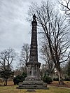
The church was the first Presbyterian church in Knox County, established in 1791 by Rev. Samuel Carrick. [7] Its building was destroyed in a 1981 fire. [8] The associated cemetery was relisted in 2010. [9]
4 Thomas J. Walker House April 1, 1998
(#98000279)
July 24, 2008645 Mars Hill Road
Knoxville Burned down in 2003
5 Isaac Ziegler House
Isaac Ziegler House NORTHWEST FRONT - Isaac B. Zeigler House, 712 North Fourth Avenue, Knoxville, Knox County, TN HABS TENN,47-KNOVI,12-1.tif
Isaac Ziegler House
May 2, 1975
(#75001765)
August 1, 1986712 N. Fourth Ave.
35°58′43″N83°55′04″W / 35.9786°N 83.9178°W / 35.9786; -83.9178 (Isaac Ziegler House)
Knoxville Demolished.

See also

Related Research Articles

<span class="mw-page-title-main">Knoxville, Tennessee</span> City in Tennessee, United States

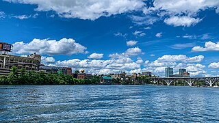
Knoxville is a city in and the county seat of Knox County, Tennessee, United States. As of the 2020 United States census, Knoxville's population was 190,740, making it the largest city in the East Tennessee Grand Division and the state's third largest city after Nashville and Memphis. It is the principal city of the Knoxville metropolitan area, which had a population of 879,773 in 2020.

<span class="mw-page-title-main">Farragut, Tennessee</span> Town in Tennessee, United States

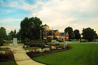
Farragut is a suburban town located in Knox and Loudon counties in the State of Tennessee, United States. The town's population was 23,506 at the 2020 census. It is included in the Knoxville Metropolitan Area. The town is named in honor of Hispanic American and Union Admiral David Farragut, who was born just east of Farragut at Campbell's Station in 1801, and fought in the American Civil War.

James White was an American pioneer and soldier who founded Knoxville, Tennessee, in the early 1790s. Born in Rowan County, North Carolina, White served as a captain in the county's militia during the American Revolutionary War. In 1783, he led an expedition into the upper Tennessee Valley, where he discovered the future site of Knoxville. White served in various official capacities with the failed State of Franklin (1784–1788) before building James White's Fort in 1786. The fort was chosen as the capital of the Southwest Territory in 1790, and White donated the land for a permanent city, Knoxville, in 1791. He represented Knox County at Tennessee's constitutional convention in 1796. During the Creek War (1813), White served as a brigadier general in the Tennessee militia.

<span class="mw-page-title-main">Mechanicsville, Knoxville</span> United States historic place

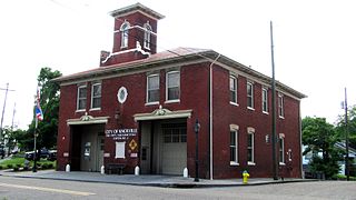
Mechanicsville is a neighborhood in Knoxville, Tennessee, United States, located northwest of the city's downtown area. One of the city's oldest neighborhoods, Mechanicsville was established in the late 1860s for skilled laborers working in the many factories that sprang up along Knoxville's periphery. The neighborhood still contains a significant number of late-19th-century Victorian homes, and a notable concentration of early-20th-century shotgun houses. In 1980, several dozen properties in Mechanicsville were added to the National Register of Historic Places as the Mechanicsville Historic District. The neighborhood was also designated as a local historic district in 1991, subject to historic zoning and design standards.

<span class="mw-page-title-main">Sequoyah Hills</span> Neighborhood of Knoxville, Tennessee, United States

Sequoyah Hills is a neighborhood in Knoxville, Tennessee, United States, named for the Cherokee scholar Sequoyah, inventor of the Cherokee alphabet. It is located off Kingston Pike, between the city's downtown and West Knoxville. Initially developed in the 1920s, Sequoyah Hills was one of Knoxville's first suburbs and today is home to some of the city's most affluent residents. The neighborhood contains numerous notable examples of mid-20th century residential architecture, with houses designed by architects such as Charles I. Barber, Benjamin McMurry, and Francis Keally.

Concord is an unincorporated community in Knox County, Tennessee, United States and is listed on the National Register of Historic Places as a historic district, the Concord Village Historic District. The United States Geographic Names Information System classifies Concord as a populated place. It is located in western Knox County, east of Farragut and west of Knoxville. Mail destined for Concord is now addressed to Concord, Knoxville, or Farragut.

<span class="mw-page-title-main">Statesview</span> Historic house in Tennessee, United States

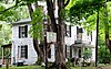
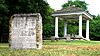
Statesview, or States View, is a historic house located on South Peters Road off Kingston Pike in Knoxville, Tennessee, United States. Built in 1805 by early Knoxville architect Thomas Hope and rebuilt in 1823 following a fire, Statesview was originally the home of surveyor Charles McClung (1761–1835). Following McClung's death, newspaper publisher Frederick Heiskell (1786–1882) purchased the house and estate, which he renamed "Fruit Hill." The house is listed on the National Register of Historic Places for its architecture and political significance.

<span class="mw-page-title-main">Westwood (Knoxville, Tennessee)</span> Historic house in Tennessee, United States

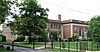
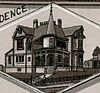
Westwood is a historic home located at 3425 Kingston Pike at the edge of the Sequoyah Hills area of Knoxville, Tennessee. Also known as the Adelia Armstrong Lutz House, the house was built in 1890 by John Lutz and his wife, artist Adelia Armstrong Lutz, on land given to them by Adelia's father, Robert H. Armstrong. In 1984, the house was listed on the National Register of Historic Places for its architecture.

<span class="mw-page-title-main">Old Customs House (Knoxville, Tennessee)</span> United States historic place

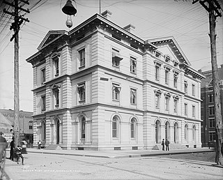
The Old Customs House, also called the Old Post Office, is a historic building located at the corner of Clinch Avenue and Market Street in Knoxville, Tennessee, United States. Completed in 1874, it was the city's first federal building. It housed the federal courts, excise offices and post office until 1933. From 1936 to 1976, it was used by the Tennessee Valley Authority for offices. Expanded in 2004, the building is home to the East Tennessee History Center, which includes the Lawson McGhee Library's Calvin M. McClung Historical Collection, the Knox County Archives, and the East Tennessee Historical Society's headquarters and museum. The building is listed on the National Register of Historic Places for its architectural significance.

<span class="mw-page-title-main">Kingston Pike</span> United States historic place

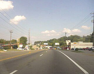
Kingston Pike is a highway in Knox County, Tennessee, United States, that connects Downtown Knoxville with West Knoxville, Farragut, and other communities in the western part of the county. The road follows a merged stretch of U.S. Route 11 (US 11) and US 70. From its initial construction in the 1790s until the development of the Interstate Highway System in the 1960s, Kingston Pike was the main traffic artery in western Knox County, and an important section of several cross-country highways. The road is now a major commercial corridor, containing hundreds of stores, restaurants, and other retail establishments.

<span class="mw-page-title-main">South Knoxville</span>

South Knoxville is the section of Knoxville, Tennessee, United States, that lies south of the Tennessee River. It is concentrated along Chapman Highway, Alcoa Highway, Maryville Pike, Sevierville Pike, and adjacent roads, and includes the neighborhoods of Lindbergh Forest, Island Home Park, Old Sevier, South Haven, Vestal, Lake Forest, South Woodlawn and Colonial Village. South Knoxville is connected to Downtown Knoxville via four vehicle bridges: the James C. Ford Memorial Bridge, the Gay Street Bridge, the Henley Bridge, by some incorrectly called the Henley Street Bridge, and the J. E. "Buck" Karnes Bridge. Parts of South Knoxville were annexed by Knoxville in 1917.

West Knoxville is a section of Knoxville, Tennessee, US. It west of the city's downtown area. It stretches from Sequoyah Hills on the east to the city's border with Farragut on the west. West Knoxville is concentrated around Kingston Pike (US-70/US-11), and along with Sequoyah Hills includes the neighborhoods of Lyons View, Forest Hills, Bearden, West Hills, Westmoreland Heights, Cedar Bluff, and Ebenezer.

<span class="mw-page-title-main">Bearden, Knoxville</span> Neighborhood of Knoxville in Tennessee, United States

Bearden, also known as Bearden Village, is a neighborhood in Knoxville, Tennessee, United States, located along Kingston Pike in West Knoxville. Developed primarily as an agrarian community in the 19th century, this neighborhood now lies at the heart of one of Knoxville's major commercial corridors. Named for former Knoxville mayor and Tennessee state legislator, Marcus De Lafayette Bearden (1830–1885), the community was annexed by Knoxville in 1962.

<span class="mw-page-title-main">Fort Sanders, Knoxville</span> United States historic place

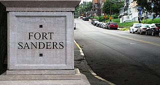
Fort Sanders is a neighborhood in Knoxville, Tennessee, USA, located west of the downtown area and immediately north of the main campus of the University of Tennessee. Developed in the late 19th century as a residential area for Knoxville's growing upper and middle classes, the neighborhood now provides housing primarily for the university's student population. The neighborhood still contains a notable number of its original Victorian-era houses and other buildings, several hundred of which were added to the National Register of Historic Places in 1980 as the Fort Sanders Historic District.

<span class="mw-page-title-main">Charles McClung</span>

Charles McClung was an American pioneer, politician, and surveyor best known for drawing up the original plat of Knoxville, Tennessee, in 1791. While Knoxville has since expanded to many times its original size, the city's downtown area still roughly follows McClung's 1791 grid. McClung also helped draft Tennessee's constitution in 1796, surveyed and planned what is now Kingston Pike in 1792, and served as Knox County's first court clerk. His home, Statesview, still stands in West Knoxville, and has been listed on the National Register of Historic Places.

<span class="mw-page-title-main">Gay Street (Knoxville)</span> United States historic place

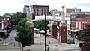
Gay Street is a street in Knoxville, Tennessee, United States, that traverses the heart of the city's downtown area. Since its development in the 1790s, Gay Street has served as the city's principal financial and commercial thoroughfare, and has played a primary role in the city's historical and cultural development. The street contains Knoxville's largest office buildings and oldest commercial structures. Several buildings on Gay Street have been listed on the National Register of Historic Places.

<span class="mw-page-title-main">Baumann family (architects)</span> American architect

The Baumann family was a family of American architects who practiced in Knoxville, Tennessee, and the surrounding region, in the late 19th and early 20th centuries. It included Joseph F. Baumann (1844–1920), his brother, Albert B. Baumann, Sr. (1861–1942), and Albert's son, Albert B. Baumann, Jr. (1897–1952). Buildings designed by the Baumanns include the Mall Building (1875), the Church of the Immaculate Conception (1886), Minvilla (1913), the Andrew Johnson Building (1930), and the Knoxville Post Office (1934).

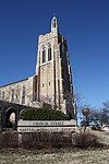
Charles Ives Barber was an American architect, active primarily in Knoxville, Tennessee, and vicinity, during the first half of the 20th century. He was cofounder of the firm, Barber & McMurry, through which he designed or codesigned buildings such as the Church Street Methodist Episcopal Church, South, the General Building, and the Knoxville YMCA, as well as several campus buildings for the University of Tennessee and numerous elaborate houses in West Knoxville. Several buildings designed by Barber have been listed on the National Register of Historic Places.

<span class="mw-page-title-main">History of Knoxville, Tennessee</span>

The History of Knoxville, Tennessee, began with the establishment of James White's Fort on the Trans-Appalachian frontier in 1786. The fort was chosen as the capital of the Southwest Territory in 1790, and the city, named for Secretary of War Henry Knox, was platted the following year. Knoxville became the first capital of the State of Tennessee in 1796, and grew steadily during the early 19th century as a way station for westward-bound migrants and as a commercial center for nearby mountain communities. The arrival of the railroad in the 1850s led to a boom in the city's population and commercial activity.

<span class="mw-page-title-main">Adelia Armstrong Lutz</span> American painter

Adelia Armstrong Lutz was an American artist active in the late nineteenth and early twentieth centuries. She organized art circles in Knoxville, Tennessee, as director of the Knoxville Art Club and as a co-organizer of the Nicholson Art League. Her still lifes and portraits were exhibited throughout the American South, and they are to be the subject of a permanent exhibit at her former home, Historic Westwood.

References

  1. The latitude and longitude information provided in this table was derived originally from the National Register Information System, which has been found to be fairly accurate for about 99% of listings. Some locations in this table may have been corrected to current GPS standards.
  2. National Park Service, United States Department of the Interior, "National Register of Historic Places: Weekly List Actions", retrieved October 20, 2023.
  3. 1 2 Numbers represent an alphabetical ordering by significant words. Various colorings, defined here, differentiate National Historic Landmarks and historic districts from other NRHP buildings, structures, sites or objects.
  4. "National Register Information System". National Register of Historic Places . National Park Service. April 24, 2008.
  5. The eight-digit number below each date is the number assigned to each location in the National Register Information System database, which can be viewed by clicking the number.
  6. Activities and Projects: Indian Mound Adopt-a-Spot Archived 2013-02-13 at archive.today , University of Tennessee, n.d. Accessed 2013-04-06.
  7. Bennett, Ann K. (1994). "National Register of Historic Places Registration Form: Historic and Architectural Resources in Knoxville and Knox County, Tennessee". National Park Service.
  8. "Turn-of-Century Church Building Razed By Fire". Knoxville News Sentinel . August 26, 1981. p. D1. Retrieved August 28, 2022 via Newspapers.com.
  9. "Designated Properties: Knox County Historic Zoning Commission". Archived from the original on 2007-08-05.

Further reading