Knox County is a county located in the U.S. state of Tennessee. The population was 506,748 as of a 2024 estimate, making it the third-most populous county in Tennessee. Its county seat is Knoxville,[4] which is the third-most populous city in Tennessee. Knox County is included in the Knoxville metropolitan area. The county is located at the geographical center of the Great Valley of East Tennessee. Near the heart of the county is the origin of the Tennessee River, at the confluence of the Holston and French Broad rivers.
In 1783, James White and Francis Alexander Ramsey led an expedition to explore the Upper Tennessee Valley, now within the boundaries of Knox County. White moved to what is now the Riverdale community on the banks of the French Broad Riverin the eastern part of the county in 1785, and the following year constructed a fort a few miles to the west. A community developed around the fortified trading post, ultimately becoming the city of Knoxville. Governor Blount designated the fort as the capital of the Southwest Territory in 1790, and gave the new town the name "Knoxville" after his superior, Henry Knox.[6]
Blount began construction of his house, Blount Mansion, in the early 1790s. This is one of a number of late eighteenth-century structures that have been preserved in the county. The house still stands in downtown Knoxville. The Alexander McMillan House, built in the mid-1780s by Alexander McMillan (1749–1837), still stands in eastern Knox County. The Alexander Bishop House, built by Stockley Donelson in 1793,[7] and a log house built in the same year by Nicholas Gibbs both still stand in the northern part of the county.[8] Campbell's Station, a fort and stagecoach stop located in what is now Farragut, was built by Captain David Campbell (1753–1832) in 1787.[9]John Sevier established a plantation, known as Marble Springs, in the southern part of the county in the 1790s.[10] He was active in leading raids against the Cherokee people, who for years resisted with force American settlement in their territory.
Civil War
View from the south bank of the Tennessee River by Union photographer George C. Barnard after the end of the Siege of Knoxville, December 1863. Source: Library of Congress
Important railroad lines passed through Knox County, making it a strategic area both for Union and for Confederate forces throughout the Civil War. Since the mountainous terrain of East Tennessee was mostly unsuitable for plantation crops such as cotton, slavery was not as prevalent as it was in Middle and West Tennessee. The US 1860 census of Knox County showed a population of 20,020 white citizens and 2,370 enslaved African Americans.[11] The lack of slavery combined with the vestiges of a once-strong abolitionist movement were two reasons most residents of Knox County, along with much of East Tennessee, were pro-Union. In February 1861, 89% of Knox Countians voted for the pro-Union ballot in a statewide referendum on secession. On June 8, 1861, the county voted against Tennessee's Ordinance of Secession by a margin of 3,108 to 1,226.[12]
Prior to secession, Unionists from Knox County collaborated with other East Tennessee Unionists in an attempt to secede from Tennessee itself and remain part of the Union. Oliver Perry Temple, a Knoxville lawyer, was named to a three-man commission to appear before the General Assembly in Nashville and request East Tennessee and pro-Union Middle Tennessee counties be allowed to secede from the state.[13] The attempt failed. After the second state referendum for secession passed in 1861, Knox County and the rest of Tennessee joined the Confederacy.[14]
Knox County remained under Confederate control until September 3, 1863, when General Ambrose Burnside and the Union army marched into Knoxville unopposed. Parts of Middle Tennessee had been occupied by Union troops since 1862.
Union Colonel William Harris, son of New York Senator Ira Harris, wrote his father:[11]
'Glory be to God, the Yankees have come! The flag's come back to Tennessee!' Such were the welcomes all along the road, as we entered Knoxville, it was past all description. The people seemed frantic with joy. I never knew what the Love of Liberty was before. The old flag has been hidden in mattresses and under carpets. It now floats to the breeze at every staff in East Tennessee. Ladies wear it–carry it–wave it! Little children clap their hands and kiss it.
With the success of Burnside's troops in the Knoxville Campaign, and especially during the decisive Battle of Fort Sanders, Knox County remained under Union control for the duration of the Civil War.
Tennessee marble
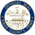
The XVI on the Knox County Seal is a nod to Tennessee becoming the 16th state. The late 19th and early 20th centuries, Knox County was an important venue for the quarrying and finishing of Tennessee marble, a type of limestone used in monument construction across the United States and Canada. Eleven quarries were operating in Knox County in 1882, and within ten years that number had doubled. Notable quarries in Knox included the Bond Quarry in Concord, an Evans Company quarry near Forks-of-the-River, and the Ross-Republic quarries near Island Home Park in South Knoxville. Finishing centers were located in Lonsdale and at the Candoro Marble Works in South Knoxville.[15][16]
Geography
House Mountain, Knox County's high point, viewed from Emory Road, near the Knox–Grainger line
According to the U.S. Census Bureau, the county has a total area of 526 square miles (1,360km2), of which 508 square miles (1,320km2) is land and 18 square miles (47km2) (3.4%) is water.[17] The county lies amidst the Ridge-and-Valley Appalachians, which are characterized by long, narrow ridges, oriented northeast-to-southwest, alternating with similarly shaped valleys. Notable ridges in the county include Bays Mountain, McAnnally Ridge, Beaver Ridge, Sharp's Ridge and Copper Ridge. House Mountain, at 2,064 feet (629m), is the county's highest point, and is the focus of a state natural area.[18]
The Holston and French Broad rivers join to form the Tennessee River in the eastern part of the county, an area known as "Forks-of-the-River." This section of the river is part of Fort Loudoun Lake, which is created by Fort Loudoun Dam on the river several miles downstream in Lenoir City.
Cherokee Caverns
Cherokee Caverns is 14 miles west of Knoxville and can be accessed by Highway 62. It was discovered in 1854 by Robert Crudgington, who noticed fog emerging between rocks on his farm. He dug the entrance open and explored the cave. His daughter Margaret Crudgington opened the cave to the public in 1929 under the name Gentrys Cave; the next year she changed the name to Grand Caverns.
The cave has been open to the public, sporadically, ever since, under a variety of names. It is currently called Cherokee Caverns, referring to the historic tribe who occupied this area at the time of European encounter.[19]
Indian artifacts located in the cave indicate that another entrance to the cave existed at some time in the past.[19]
As of the 2020 census, there were 478,971 people and 118,160 families residing in the county.[27]
There were 195,165 households in the county, of which 27.9% had children under the age of 18 living in them, 45.9% were married-couple households, 18.9% were households with a male householder and no spouse or partner present, and 28.7% were households with a female householder and no spouse or partner present. About 29.9% of all households were made up of individuals and 10.9% had someone living alone who was 65 years of age or older.[28]
The median age was 37.9 years. 21.0% of residents were under the age of 18 and 16.6% of residents were 65 years of age or older. For every 100 females there were 94.1 males, and for every 100 females age 18 and over there were 91.6 males age 18 and over.[28]
90.8% of residents lived in urban areas, while 9.2% lived in rural areas.[29]
There were 210,972 housing units, of which 7.5% were vacant. Among occupied housing units, 64.4% were owner-occupied and 35.6% were renter-occupied. The homeowner vacancy rate was 1.5% and the rental vacancy rate was 8.0%.[28]
2010 census
As of the census[30] of 2010, there were 432,226 people, 177,249 households, and 110,757 families residing in the county. The population density was 821.72 personsper square mile (317.27 persons/km2). The average housing unit density was 348.92 unitsper square mile (134.72/km2). The racial makeup of the county was 86.78% White, 8.8% Black or African American, 0.29% Native American, 1.87% Asian, 0.08% Pacific Islander, and 1.91% multiracial. Hispanics and/or Latinos (of any race) were 3.47% of the population.
Out of all the households, 29.68% had children under the age of 18 living in them, 47.04% were family households, 3.95% had a male householder with no wife present, 11.49% had a female householder with no husband present, and 37.51% were non families. 29.65% of all households were made up of individuals living alone, and 9.14% had someone living alone who was 65 years of age or older. The average household size was 2.37 and the average family size was 2.95.
21.86% of the population was under the age of 18, 65.07% from ages 18 to 64, and 13.05% aged 65 and older. The median age was 37.2 years. 51.39% of the population was female, and 48.61% was male.
The median household income was estimated to be $52,458, and the per capita income was estimated to be $30,541. Approximately 13.5% of the population was below the poverty line.
2000 census
As of the census[30] of 2000, there were 382,032 people, 157,872 households, and 100,722 families residing in the county. The population density was 751 peopleper square mile (290 people/km2). There were 171,439 housing units at an average density of 337 unitsper square mile (130/km2). The racial makeup of the county was 88.10% White, 8.63% Black or African American, 0.26% Native American, 1.29% Asian, 0.03% Pacific Islander, 0.50% from other races, and 1.18% from two or more races. 1.26% of the population were Hispanic or Latino of any race.
There were 157,872 households, out of which 28.50% had children under the age of 18 living with them, 49.80% were married couples living together, 10.90% had a female householder with no husband present, and 36.20% were non-families. 29.60% of all households were made up of individuals, and 9.10% had someone living alone who was 65 years of age or older. The average household size was 2.34 and the average family size was 2.92.
In the county, the population was spread out, with 22.30% under the age of 18, 11.60% from 18 to 24, 30.40% from 25 to 44, 23.10% from 45 to 64, and 12.70% who were 65 years of age or older. The median age was 36 years. For every 100 females, there were 93.50 males. For every 100 females age 18 and over, there were 90.10 males.
The median income for a household in the county was $37,454, and the median income for a family was $49,182. Males had a median income of $35,755 versus $25,140 for females. The per capita income for the county was $21,875. About 8.40% of families and 12.60% of the population were below the poverty line, including 14.50% of those under age 18 and 9.70% of those age 65 or over.
Government and politics
County government
The county mayor is the head of the executive branch of Knox County Government. The current county mayor is Republican professional wrestler Glenn Jacobs, better known by his WWE persona Kane. According to the county charter, the mayor serves as the chief financial officer of the county, responsible for developing the county’s annual budget, approving contracts, and overseeing county operations. Other duties include maintaining county roads, highways, and bridges, enforcing codes, operating the county health department and public library system, and supervising various executive branch departments.[31]
The mayor has the authority to veto resolutions and ordinances passed by the Knox County Commission. A majority-plus-one vote of the commission is required to override a mayoral veto unless the vetoed legislation originally required a two-thirds vote, in which case a two-thirds vote is required to override.[32]
Knox County administers the local school and library systems, while Knoxville maintains an independent police department separate from the county sheriff. The property assessor’s office, tax offices, and the Metropolitan Planning Commission are combined between city and county governments. All county elections are conducted on a partisan basis. County commissioners’ districts do not correspond with the city of Knoxville, which has its own mayor and city council. Residents living within Knoxville city limits vote in both city and county elections, are represented by both mayors, and pay city and county taxes. While some administrative functions may appear duplicated, services are generally separated.[33]
The Knox County Board of Commissioners is the legislative body of Knox County and consists of 11 members: 9 elected at the district level and 2 elected countywide to serve at-large.[34] Commissioners meet multiple times each month, with their primary business meetings being a monthly work session and a monthly voting meeting. During the work session, commissioners generally debate items on the monthly agenda and take a non-binding vote on each item in advance of the more formal voting meeting, which is generally held the following week.[35]
The Board of Commissioners approves resolutions, ordinances, honorariums, road names, as well as most county contracts and large expenditures. Resolutions require a single vote for passage, while ordinances require two votes, or "two readings". The County Commission also serves as the appropriating body of the county and must approve an annual budget–presented by the mayor–which includes funding for the various county departments, including the Knox County Schools. The body also sets the property tax rate for the county.[35]
The board currently has a Republican majority, with 8 Republicans and 3 Democrats as of the 2024 elections.[36]
Public education in Knox County is overseen by the Knox County Board of Education, which governs the Knox County Schools. The board consists of nine members elected from single-member districts, serving four-year terms. These districts use the same boundary lines as the Knox County Commission, representing residents of Knoxville, the Town of Farragut, and all other areas of Knox County.[37]
Members represent residents of Knoxville, the Town of Farragut, and other areas of Knox County.[38][39]
The board acts as a single governing body, making decisions that apply to the entire school system. Its responsibilities include setting policies for Knox County Schools, approving the annual school system budget, appointing and supervising the Superintendent of Schools, and selecting a chair and vice chair from among its members each year.[38]
The board currently has a Republican majority, with 5 Republicans and 4 Democrats as of the 2024 elections.[40]
Like most counties in heavily-Unionist East Tennessee, Knox County has historically been strongly Republican. Although it is conservative for an urban county, it is notably less Republican than most of the rest of East Tennessee. This is largely due to the influence of Knoxville, which in recent years has had a tendency to vote Democratic in statewide races,[41] has elected Democratic mayors, and regularly elects Democrats to the state legislature. However, the suburban and rural areas are among the most Republican areas of Tennessee and the South.
Presidentially, Franklin Roosevelt carried the county in three of his four presidential elections, while several nearby counties are among the only counties in the nation to have never supported a Democratic candidate for president in their entire existence. Nevertheless, Democratic candidates have crossed the 40-percent mark only seven times since Roosevelt's death. In 1964, it was nearly swept up in Lyndon Johnson's national landslide; Johnson lost the county by only 334 votes. Jimmy Carter in 1976 and Bill Clinton in 1992 and 1996 are the only Democrats since then to come reasonably close to carrying the county, losing it by single-digit margins; in Clinton's case with Tennessean Al Gore on the ticket. Gore lost the county by 17 points in 2000 during his own bid for president, but still managed 40 percent. The Democrats would not cross the 40 percent threshold again until 2020, when Joe Biden received over 41 percent of the county's vote.[42]
United States presidential election results for Knox County, Tennessee[42][43]
East Tennessee Historical Society, Mary Rothrock (ed.), The French Broad-Holston Country: A History of Knox County, Tennessee. Knoxville, Tenn.: East Tennessee Historical Society, 1946; revised 1972. ISBN978-0941199025
↑Eric Lacy, Vanquished Volunteers: East Tennessee Sectionalism from Statehood to Secession (Johnson City, Tenn.: East Tennessee State University Press, 1965), p. 217 (Appendix B). Oliver Perry Temple (East Tennessee and the Civil War, p. 199) gives the margin as 3,196 to 752.
↑John Wooldridge, George Mellen, William Rule (ed.), Standard History of Knoxville, Tennessee (Chicago: Lewis Publishing Company, 1900; reprinted by Kessinger Books, 2010), pp. 204–206.
↑Charles Gordon, The Marbles of Tennessee (State of Tennessee Geological Survey, 1911), pp. 5–33.
12"Caves of Knoxville and the Great Smoky Mountains" by Larry E. Matthews, 2008, ISBN978-1-879961-30-2, Published by the National Speleological Society, Chapter1–Cherokee Caverns, pages 17–36.
This page is based on this Wikipedia article Text is available under the CC BY-SA 4.0 license; additional terms may apply. Images, videos and audio are available under their respective licenses.