
Knox County is located in the U.S. state of Tennessee. As of the 2010 census, the population was 432,226, making it the third-most populous county in Tennessee. It ranks as the 153rd-most populous county or county-equivalent in the nation. Its county seat is Knoxville, which is the third-most populous city in Tennessee.

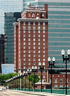
Knoxville is a city in, and the county seat of, Knox County in the U.S. state of Tennessee. As of July 1, 2019, Knoxville's population was 187,603, making it the largest city in the East Tennessee Grand Division, and the state’s overall third largest city after Nashville and Memphis. Knoxville is the principal city of the Knoxville Metropolitan Statistical Area, which had an estimated population of 869,046 in 2019.
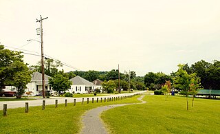
Mascot is a census-designated place (CDP) in Knox County, Tennessee, United States. The population was 2,411 at the 2010 census.

Oak Ridge is a city in Anderson and Roane counties in the eastern part of the U.S. state of Tennessee, about 25 miles (40 km) west of downtown Knoxville. Oak Ridge's population was 29,330 at the 2010 census. It is part of the Knoxville Metropolitan Area. Oak Ridge's nicknames include the Atomic City, the Secret City, the Ridge, and the City Behind the Fence.
Farragut is a suburban town located in Knox and Loudon counties in the State of Tennessee, United States. The town's population was 20,676 at the 2010 census. It is included in the Knoxville Metropolitan Area. The town is named in honor of Union Admiral David Farragut, who was born just east of Farragut at Campbell's Station in 1801, and fought in the American Civil War.
Halls Crossroads is an census-designated place in northern Knox County, Tennessee. As a northern suburb of nearby Knoxville, Halls is included in the Knoxville Metropolitan Statistical Area. The town takes its name from the Thomas Hall family that settled in the area in the late 18th century.
Corryton, also known as Corryton Village, is an unincorporated village and bedroom community in northeastern Knox County, Tennessee, United States, about 15 miles northeast of Knoxville. The United States Geographic Names System classifies Corryton as a populated place. It is included in Knoxville Metropolitan Statistical Area.

Powell, formerly known as Powell Station, is an census-designated place in Knox County, Tennessee, United States. The area is located in the Emory Road corridor, just north of Knoxville, southeast of Clinton, and east of Oak Ridge. The United States Geographic Names System classifies Powell as a populated place. It is included in the Knoxville, Tennessee Metropolitan Statistical Area.
The Pellissippi Parkway is a highway in Knox and Blount counties in Tennessee. It extends from SR 62 at Solway in Knox County to a terminus east of US 129 at SR 33 in Blount County. The central portion of the Pellissippi Parkway is included in the Interstate Highway system and is designated Interstate 140 (I-140), while portions at either end are designated State Route 162, a north–south primary highway.

Fountain City is a neighborhood in northern Knoxville, Tennessee, in the southeastern United States. Although not a census-designated place, the populations of the two ZIP codes that serve Fountain City— 37918 and 37912— were 36,815 and 18,695, respectively, as of the 2000 U.S. census. At the time of its annexation by the city of Knoxville in 1962, Fountain City was the largest unincorporated community in the United States.

Karns is a census-designated place in northwest Knox County, Tennessee, United States, about 11 miles (18 km) northwest of the center of Knoxville.

State Route 169 , also known as Middlebrook Pike, is a west-to-east secondary highway in Knox County in the U.S. state of Tennessee.
Knox County Schools is the school district that operates all public schools in Knox County, Tennessee. It is headquartered in the Andrew Johnson Building in downtown Knoxville.
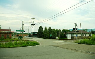
Solway is an unincorporated community in Knox County, Tennessee, United States. The United States Geographic Names System classifies Solway as a populated place. The area is located between Oak Ridge and Knoxville, just southeast of the Clinch River, which forms the Anderson County line. It lies on Oak Ridge Highway, also known as Tennessee State Route 62, just north of its intersection with Pellissippi Parkway. Beaver Creek flows through the area.
Harvey Benjamin Broome was an American lawyer, writer and conservationist. A native of Knoxville, Tennessee, Broome was a founding member of The Wilderness Society, for which he served as president from 1957 until his death in 1968, and played a key role in the establishment of the Great Smoky Mountains National Park. The Tennessee Chapter of the Sierra Club is named the "Harvey Broome Group" in his honor.
West Knoxville is a section of Knoxville, Tennessee, west of the city's downtown area. It stretches from Sequoyah Hills on the east to the city's border with Farragut on the west. West Knoxville is concentrated around Kingston Pike (US-70/US-11), and along with Sequoyah Hills includes the neighborhoods of Lyons View, Forest Hills, Bearden, West Hills, Westmoreland Heights, Cedar Bluff, and Ebenezer.
North Knoxville is the section of Knoxville, Tennessee, USA, that lies north of the city's downtown area. It is concentrated around Broadway (US-441), Clinton Highway (US-25W), Tazewell Pike (TN-331), Washington Pike, and adjacent roads, and includes the neighborhoods of Fountain City, Inskip-Norwood, Oakwood-Lincoln Park, Old North Knoxville, Fourth and Gill, North Hills, and Whittle Springs. North Knoxville is bisected by Sharp's Ridge, a 7-mile (11 km) elongate ridge that rises prominently above the surrounding terrain.
Bearden, also known as Bearden Village, is a neighborhood in Knoxville, Tennessee, United States, located along Kingston Pike in West Knoxville. Developed primarily as an agrarian community in the 19th century, this neighborhood now lies at the heart of one of Knoxville's major commercial corridors. Named for former Knoxville mayor and Tennessee state legislator, Marcus De Lafayette Bearden (1830–1885), the community was annexed by Knoxville in 1962.

Cumberland Estates is a residential neighborhood in the City of Knoxville, Tennessee, United States, which gained national attention for architectural innovation and research housing in the mid-20th century. It began 2.1 miles outside the city limits, in Knox County, as one of many planned suburban neighborhoods in the post-World War II economic expansion. The development soon attracted an innovative young architect and national sponsors who would create new ways to rapidly and affordably fill the demand for residential housing needs for America’s growing population of families. Their prominent work in the neighborhood influenced the evolution of residential building design. While the attention received from the research homes waned in the last century, the neighborhood has maintained its residential character with few changes while avoiding commercial encroachment and blight.

Hardin Valley is a suburban unincorporated community in northwest Knox County, Tennessee, United States. It is about 20.8 miles (33.5 km) northwest of downtown Knoxville.

