Related Research Articles
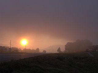
Townsend is a city in Blount County, Tennessee, in the southeastern United States. The population was 244 at the 2000 census and 448 at the 2010 census. For thousands of years a site of Native American occupation by varying cultures, Townsend is one of three "gateways" to the Great Smoky Mountains National Park. It has several museums and attractions relating to the natural and human history of the Great Smokies.
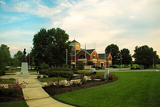
Farragut is a suburban town located in Knox and Loudon counties in the State of Tennessee, United States. The town's population was 20,676 at the 2010 census. It is included in the Knoxville Metropolitan Area. The town is named in honor of Union Admiral David Farragut, who was born just east of Farragut at Campbell's Station in 1801, and fought in the American Civil War.
The Foothills Parkway is a national parkway which traverses the foothills of the northern Great Smoky Mountains in East Tennessee, located in the southeastern United States. The 72.1-mile (114 km) parkway will connect U.S. Route 129 along the Little Tennessee River in the west with Interstate 40 (I-40) along the Pigeon River in the east.

Fountain City is a neighborhood in northern Knoxville, Tennessee, in the southeastern United States. Although not a census-designated place, the populations of the two ZIP codes that serve Fountain City— 37918 and 37912— were 36,815 and 18,695, respectively, as of the 2000 U.S. census. At the time of its annexation by the city of Knoxville in 1962, Fountain City was the largest unincorporated community in the United States.
Cherry Creek is a neighborhood on the West Side of Columbus, Ohio. It is a part of Lincoln Village and the Greater Hilltop. It contains the Oakbrook Manor apartments and the Westview apartments. It is bounded on the east by Interstate 270, on the north by Sullivant Avenue, on the west by Norton Road, and on the south by Hall Road. It is in the ZIP code 43228. Its official area is West Columbus. The neighborhood is known as being the birthplace of the Westside Foxes where legendary parties took place in the Harlor apartment from 1993-1997. Although they are technically two separate neighborhoods, Cherry Creek and Murray Hill are often considered the same neighborhood. They are only separated by Sullivant Avenue, and many people just consider the two together Cherry Creek. This is reflected by the Columbus Police Department grouping the two together as one neighborhood.
Murray Hill is a street in a neighborhood on the westside of Columbus, Ohio. It is part of the Lincoln Village subdivision and is colloquially known as Lincoln Village. It is bounded by West Broad Street on the north, Sullivant Avenue on the south, South Grener Avenue on the east, and Redmond and Hiler Roads on the west. It is in Prairie Township, and the ZIP Code 43228.
Georgian Heights is a neighborhood in West Columbus, in Columbus, Ohio, United States. It neighbors Holly Hill. The two are bounded together by Sullivant Avenue on the north, Clime Road on the south, Georgesville Road on the west, and Demorest Road on the east. There is a 10.7 acre public park, Georgian Heights Park, in the center of the area. Georgian Heights has a youth travel football team called the Georgian Heights Packers. The neighborhood is generally lower-middle class.

Andrews Bald is a mountain in the Great Smoky Mountains, located in the Southeastern United States. It has an elevation of 5,920 feet (1,800 m) above sea level, making it the highest grassy bald in the Great Smoky Mountains National Park. The mountain is one of two grassy balds maintained in the range by the park service. The other is Gregory Bald, in the western Smokies.

Spence Field is a mountain highland meadow in the Great Smoky Mountains, located in the Southeastern United States. It has an elevation of 4,920 feet above sea level. The Appalachian Trail traverses the field, and a backcountry shelter just off the trail provides an overnight stopover for through-hikers.
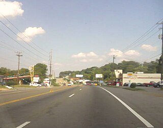
South Knoxville is the section of Knoxville, Tennessee, United States, that lies south of the Tennessee River. It is concentrated along Chapman Highway, Alcoa Highway, Maryville Pike, Sevierville Pike, and adjacent roads, and includes the neighborhoods of Lindbergh Forest, Island Home Park, Old Sevier, South Haven, Vestal, Lake Forest, South Woodlawn and Colonial Village. South Knoxville is connected to Downtown Knoxville via four vehicle bridges: the James C. Ford Memorial Bridge, the Gay Street Bridge, the Henley Bridge, by some incorrectly called the Henley Street Bridge, and the J. E. "Buck" Karnes Bridge. Parts of South Knoxville were annexed by Knoxville in 1917.
North Knoxville is the section of Knoxville, Tennessee, USA, that lies north of the city's downtown area. It is concentrated around Broadway (US-441), Clinton Highway (US-25W), Tazewell Pike (TN-331), Washington Pike, and adjacent roads, and includes the neighborhoods of Fountain City, Inskip-Norwood, Oakwood-Lincoln Park, Old North Knoxville, Fourth and Gill, North Hills, and Whittle Springs. North Knoxville is bisected by Sharp's Ridge, a 7-mile (11 km) elongate ridge that rises prominently above the surrounding terrain.
East Knoxville is the section of Knoxville, Tennessee, USA, that lies east of the city's downtown area. It is concentrated along Magnolia Avenue (US-70/US-11), Martin Luther King, Jr., Boulevard, Dandridge Avenue, and adjacent streets, and includes the neighborhoods of Holston Hills, Parkridge, Chilhowee Park, Morningside, Five Points, and Burlington. East Knoxville is home to Zoo Knoxville, the Knoxville Botanical Garden and Arboretum, and Chilhowee Park.

Fourth and Gill is a neighborhood in Knoxville, Tennessee, United States, located north of the city's downtown area. Initially developed in the late nineteenth century as a residential area for Knoxville's growing middle and professional classes, the neighborhood still contains most of its original Victorian-era houses, churches, and streetscapes. In 1985, 282 houses and other buildings in the neighborhood were added to the National Register of Historic Places as the Fourth and Gill Historic District.
Lake Forest is a neighborhood in Knoxville, Tennessee located in the South Knoxville area. The area covers south of Knoxville Downtown Island Home Airport, then along Island Home Avenue, Chapman Highway, West Red Bud Drive, Stone Road, Oliver Road, Neubert Springs Road, Martin Mill Pike to Ogle Avenue, Doyle Street, Maryville Pike, back to Chapman Highway, then Moody Avenue to Seveirville Pike, East Red Bud Road, and Gilbert Lane.

Oakwood-Lincoln Park is a residential and commercial neighborhood in Knoxville, Tennessee, United States that was developed in the early 20th century as two suburban neighborhoods.
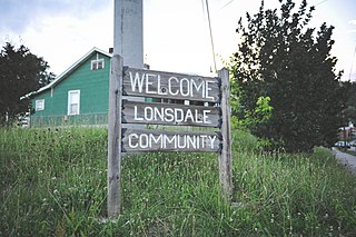
Lonsdale is a neighborhood in Knoxville, Tennessee, United States, located northwest of the city's downtown area. Established in the late-19th century as a land development project, Lonsdale incorporated as a separate city in 1907, and was annexed by Knoxville in 1917. After a period of decline in the latter half of the 20th century, Lonsdale has recently undergone several major revitalization efforts.

Norwood is a neighborhood in Knoxville, Tennessee. It is located in an area north and west of Interstate 75, north of Interstate 640, east of Western Avenue, and south of Schaad Road and Callahan Drive.
West Hills is a neighborhood in Knoxville, Tennessee, United States, located just off Kingston Pike in West Knoxville. Initially developed in the 1950s, West Hills was Knoxville's first major post-World War II subdivision, and the first subdivision to consist primarily of modern ranch-style houses. While West Knoxville experienced a boom in commercial development in the 1970s and 1980s, West Hills has managed to retain its residential character, due in large part to its aggressive neighborhood advocacy group, the West Hills Community Association.

Chilhowee Park is a residential neighborhood in Knoxville, Tennessee, United States, located off Magnolia Avenue in the East Knoxville area. Developed as a streetcar suburb in the 1890s, this neighborhood was initially part of Park City, which was incorporated as a separate city in 1907, and annexed by Knoxville in 1917. Chilhowee Park lies adjacent to one of Knoxville's largest municipal parks, as well as Zoo Knoxville. The neighborhood contains a notable number of early-20th-century houses.
Fulton High School is a secondary school in Knoxville, Tennessee, opened in 1951. It has adopted the Small Learning Community model. The school is currently in the midst of controversy for suspending two trans students who were being bullied by peers.
References
Knoxify.com profile of Colonial Village.
Coordinates: 35°55′12″N83°52′59″W / 35.920°N 83.883°W
| | This Knox County, Tennessee geography–related article is a stub. You can help Wikipedia by expanding it. |