Lake County, Tennessee

Last updated

Lake County
Lake County Tennessee Courthouse.jpg
Lake County Courthouse in Tiptonville
Map of Tennessee highlighting Lake County.svg
Location within the U.S. state of Tennessee
Tennessee in United States.svg
Tennessee's location within the U.S.
Coordinates: 36°20′N89°29′W / 36.34°N 89.49°W / 36.34; -89.49
CountryFlag of the United States.svg United States
StateFlag of Tennessee.svg  Tennessee
Founded1870
Named for Reelfoot Lake [1]
Seat Tiptonville
Largest townTiptonville
Area
  Total194 sq mi (500 km2)
  Land166 sq mi (430 km2)
  Water28 sq mi (70 km2)  14%
Population
 (2020)
  Total7,005 Decrease2.svg
  Density47/sq mi (18/km2)
Time zone UTC−6 (Central)
  Summer (DST) UTC−5 (CDT)
Congressional district 8th
Website www.lakecountytn.com

Lake County is a county located in the northwest corner of the U.S. state of Tennessee. As of the 2020 census, the population was 7,005, making it the fifth-least populous county in Tennessee. [2] Its county seat is Tiptonville. [3] It shares a border with Kentucky to the north and is separated from Missouri to the west by the Mississippi River.

Contents

Reelfoot Lake, formed after the New Madrid earthquakes in the early 19th century, occupies much of the northern part of the county. Issues of control of the lake and the development of cotton plantations in this part of the county resulted in violence by local farmers against corporate owners in 1908; the state called in the militia to suppress night riding. Reelfoot Lake and surrounding property were finally acquired by the state beginning in 1914. It is now within the Reelfoot Lake State Park and preserved for public use. The Northwest Correctional Complex in Tiptonville, a state prison first opened in 1981, can house up to 2,391 male prisoners, a significant share of the county's population. [4]

History

The history of Lake County has been largely defined by Reelfoot Lake, a natural lake created by the New Madrid earthquakes of 1811 and 1812. It is surrounded by wetlands. This territory was originally included in Obion County. [1]

In 1862, during the Civil War, the Battle of Island Number Ten took place in the Mississippi River, just off the shores of Obion County, in territory now part of Lake County. [1]

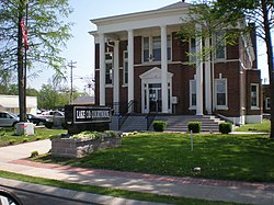
The county was organized in 1870, during the Reconstruction era. Its residents had long complained about the difficulty of having to traverse swampy areas during seasonal high waters around Reelfoot Lake to reach the county seat, then Troy, Tennessee, located to the east of the lake. After the new Lake County was established, Tiptonville was designated as its county seat.

In 1907 and 1908, a violent conflict took place in Lake and Obion counties, and neighboring Fulton County, Kentucky, which also had frontage on the lake. Private investors bought title to most of the land around the lake, gaining control, and formed the West Tennessee Land Company, to develop the property. In this era, western Tennessee and Kentucky were being developed for cotton culture and the lowlands around the lake were fertile floodplain. They announced plans to drain the lake. A band of local farmers and others who made their living from the lake, organized resistance, becoming known as the "Night Riders of Reelfoot Lake."

Beginning with the burning of John Carlos Burdick's fish docks on April 12, 1908, they committed crimes over a period of months, harassing the land company's employees. [5] In October 1908 they kidnapped two attorneys and lynched one, Quentin Rankin, who was also a shareholder in the land company. The other escaped. [1] Given this attack and murder, Governor Malcolm Patterson personally led the Tennessee National Guard into the area, and arrested hundreds of suspected Night Riders. [6] The Night Riders also rode against African Americans, as they were resisting the increase of blacks in the counties, some of whom had come to work as sharecroppers on newly developed cotton plantations. Since the late 19th century, the white-dominated legislature had passed Jim Crow laws and increasing restrictions on voters.

The state gained title to Reelfoot Lake in 1914 to preserve it for public use, but actions were tied up for some years in court challenges. [6] To prevent private development from restricting its use, in 1925 Governor Austin Peay designated the lake as a hunting and fishing reserve. This was the precedent for the larger area to be preserved as the modern Reelfoot Lake State Park. [7]

From 1877 to 1950, there were 13 lynchings of blacks in Lake County, the third-highest number in the state. Neighboring Obion County had 18 lynchings. These were high rates for counties with relatively small populations; Shelby County had the highest total, 20 lynchings in that period. Most of these murders were committed in the decades around the turn of the century, [8] during the period of heightened violence related to opposition to corporate control of Reelfoot Lake and the introduction of cotton plantations and African-American workers to this area. [9]

Geography

According to the U.S. Census Bureau, the county has a total area of 194 square miles (500 km2), of which 166 square miles (430 km2) is land and 28 square miles (73 km2) (14%) is water. [10] It is the fifth-smallest county in Tennessee by area.

Adjacent counties

National protected areas

State protected areas

Demographics

From 1950 to 1990 the population declined noticeably, as many African Americans moved to cities or to the West Coast in the Great Migration of the second half of the 20th century.

Historical population
CensusPop.Note
1870 2,428
1880 3,96863.4%
1890 5,30433.7%
1900 7,36838.9%
1910 8,70418.1%
1920 9,0754.3%
1930 10,48615.5%
1940 11,2357.1%
1950 11,6553.7%
1960 9,572−17.9%
1970 7,896−17.5%
1980 7,455−5.6%
1990 7,129−4.4%
2000 7,95411.6%
2010 7,832−1.5%
2020 7,005−10.6%
U.S. Decennial Census [11]
1790–1960 [12] 1900–1990 [13]
1990–2000 [14] 2010–2020 [15] 2020 [2]
Age pyramid Lake County USA Lake County, Tennessee.csv age pyramid.svg
Age pyramid Lake County

2020 census

Lake County racial composition [17]
RaceNum.Perc.
White (non-Hispanic)4,75567.88%
Black or African American (non-Hispanic)1,83226.15%
Native American 150.21%
Asian 120.17%
Pacific Islander 50.07%
Other/Mixed 2113.01%
Hispanic or Latino 1752.5%

As of the 2020 United States census, there were 7,005 people, 2,243 households, and 1,498 families residing in the county.

2000 census

As of the census [18] of 2000, there were 7,954 people, 2,410 households, and 1,614 families residing in the county. The population density was 49 people per square mile (19 people/km2). There were 2,716 housing units at an average density of 17 units per square mile (6.6/km2). The racial makeup of the county was 66.63% White, 31.19% Black or African American, 0.39% Native American, 0.14% Asian, 0.62% from other races, and 1.03% from two or more races. 1.37% of the population were Hispanic or Latino of any race.

There were 2,410 households, out of which 28.80% had children under the age of 18 living with them, 47.20% were married couples living together, 16.30% had a female householder with no husband present, and 33.00% were non-families. 30.00% of all households were made up of individuals, and 15.50% had someone living alone who was 65 years of age or older. The average household size was 2.36 and the average family size was 2.92.

In the county, the population was spread out, with 17.70% under the age of 18, 13.70% from 18 to 24, 33.80% from 25 to 44, 21.50% from 45 to 64, and 13.30% who were 65 years of age or older. The median age was 36 years. For every 100 females there were 151.00 males. For every 100 females age 18 and over, there were 163.40 males.

The median income for a household in the county was $21,995, and the median income for a family was $30,339. Males had a median income of $25,082 versus $18,700 for females. The per capita income for the county was $10,794. About 19.90% of families and 23.60% of the population were below the poverty line, including 35.10% of those under age 18 and 25.10% of those age 65 or over.

Media

Radio stations

Newspaper

Education

Communities

Towns

Unincorporated communities

Reelfoot Lake State Park

The eastern half of the county sits mostly in Reelfoot Lake State Park, a 280 acre recreational area with sections for boating, hunting, fishing, and bird watching. A yearly highlight is watching Bald Eagles nest in the park.

Politics

Prior to 2008, Lake County was a Democratic Party stronghold in presidential elections. During the period between 1880 and 2004 it only failed to back that party's presidential candidates in 1968 and 1972. Since then, the county has become increasingly Republican, with Hillary Clinton failing to even crack thirty percent of the county's vote despite her husband Bill Clinton winning over sixty percent in 1992 and 1996.

United States presidential election results for Lake County, Tennessee [20]
Year Republican Democratic Third party
No.%No.%No.%
2020 1,49273.35%52625.86%160.79%
2016 1,35768.88%57729.29%361.83%
2012 1,16355.73%88442.36%401.92%
2008 1,17552.50%1,02445.76%391.74%
2004 1,03943.84%1,31755.57%140.59%
2000 78135.12%1,41963.80%241.08%
1996 58929.72%1,27364.23%1206.05%
1992 68029.49%1,44962.84%1777.68%
1988 80646.06%93553.43%90.51%
1984 87841.97%1,19156.93%231.10%
1980 82332.11%1,71867.03%220.86%
1976 59123.19%1,93375.83%250.98%
1972 1,14765.69%53630.70%633.61%
1968 40916.99%73730.61%1,26252.41%
1964 73630.63%1,66769.37%00.00%
1960 73234.03%1,34662.58%733.39%
1956 51222.80%1,67374.49%612.72%
1952 48724.66%1,47574.68%130.66%
1948 17911.92%83355.46%49032.62%
1944 1509.43%1,44090.57%00.00%
1940 2136.68%2,96292.94%120.38%
1936 1133.04%3,60496.88%30.08%
1932 784.10%1,82495.90%00.00%
1928 16614.74%96085.26%00.00%
1924 879.53%81789.49%90.99%
1920 35222.68%1,19276.80%80.52%
1916 13014.96%72783.66%121.38%
1912 12218.35%49975.04%446.62%

See also

Related Research Articles

<span class="mw-page-title-main">Weakley County, Tennessee</span> County in Tennessee, United States

Weakley County is a county located in the northwest of the U.S. state of Tennessee. As of the 2020 census, the population was 32,902. Its county seat is Dresden. Its largest city is Martin, the home of the University of Tennessee at Martin. The county was established by the Tennessee General Assembly on October 21, 1823, and is named for U.S. Congressman Robert Weakley (1764–1845). Weakley County comprises the Martin, TN Micropolitan Statistical Area.

<span class="mw-page-title-main">Obion County, Tennessee</span> County in Tennessee, United States

Obion County is a county located in the northwest corner of the U.S. state of Tennessee. As of the 2020 census, the population was 30,787. The county seat is Union City. The county was formed in 1823 and organized in 1824. It was named after the Obion River.

<span class="mw-page-title-main">Henry County, Tennessee</span> County in Tennessee, United States

Henry County is a county located on the northwestern border of the U.S. state of Tennessee, and is considered part of West Tennessee. As of the 2020 census, the population was 32,199. Its county seat is Paris. The county is named for the Virginia orator and American Founding Father Patrick Henry.

<span class="mw-page-title-main">Dyer County, Tennessee</span> County in Tennessee, United States

Dyer County is a county located in the westernmost part of the U.S. state of Tennessee. As of the 2020 census, the population was 36,801. The county seat is Dyersburg. Dyer County comprises the Dyersburg, TN Micropolitan Statistical Area.

<span class="mw-page-title-main">Logan County, Kentucky</span> County in Kentucky, United States

Logan County is a county in the southwest Pennyroyal Plateau area of the U.S. Commonwealth of Kentucky. As of the 2020 census, the population was 27,432. Its county seat is Russellville.

<span class="mw-page-title-main">Fulton County, Kentucky</span> County in Kentucky, United States

Fulton County is the westernmost county in the U.S. state of Kentucky, with the Mississippi River forming its western boundary. As of the 2020 census, the population was 6,515. Its county seat is Hickman and its largest city is Fulton. The county was formed in 1845 from Hickman County, Kentucky and named for Robert Fulton, the inventor of the steamboat.

<span class="mw-page-title-main">Caldwell County, Kentucky</span> County in Kentucky, United States

Caldwell County is a county located in the U.S. state of Kentucky. As of the 2020 census, the population was 12,649. Its county seat is Princeton. The county was formed in 1809 from Livingston County, Kentucky and named for John Caldwell, who participated in the George Rogers Clark Indian Campaign of 1786 and was the second lieutenant governor of Kentucky. Caldwell was a prohibition or dry county until 2013, when the citizens voted to lift the ban.

<span class="mw-page-title-main">Hickman, Kentucky</span> City in Kentucky, United States

Hickman is a city in and the county seat of Fulton County, Kentucky, United States. Located on the Mississippi River, the city had a population of 2,365 at the 2020 U.S. census and is classified as a home rule-class city. Hickman is part of the Union City micropolitan area.

<span class="mw-page-title-main">Lynch, Kentucky</span> City in Kentucky, United States

Lynch is a home rule-class city in Harlan County, Kentucky, United States. In the 2020 census the city population was 658, down from 747 in 2010.

<span class="mw-page-title-main">Paris, Tennessee</span> City in Tennessee, United States

Paris is a city in and the county seat of Henry County, Tennessee, United States. As of the 2020 census, the city had a population of 10,316.

<span class="mw-page-title-main">Puryear, Tennessee</span> City in Tennessee, United States

Puryear is a city in Henry County, Tennessee, United States. The population was 671 at the 2010 census.

<span class="mw-page-title-main">Ridgely, Tennessee</span> Town in Tennessee, United States

Ridgely is a town in Lake County, Tennessee, United States. The population was 1,667 at the 2000 census and 1,795 at the 2010 census.

<span class="mw-page-title-main">Tiptonville, Tennessee</span> Town in Tennessee, United States

Tiptonville is a town in and the county seat of Lake County, Tennessee, United States. Its population was 2,439 as of the 2000 census and 4,464 in 2010, showing an increase of 2,025. It is also home to the Northwest Correctional Complex, a maximum security prison, known for once housing mass murderer Jessie Dotson.

<span class="mw-page-title-main">Samburg, Tennessee</span> Town in Tennessee, United States

Samburg is a town in Obion County, Tennessee, United States. The population was 210 at the 2020 census. Samburg is located on the eastern shores of Reelfoot Lake.

<span class="mw-page-title-main">Union City, Tennessee</span> City in Tennessee, United States

Union City is located in Obion County, Tennessee, United States. 11,170 people were living in the town as of the 2020 census. It is the principal urban settlement of the surrounding micropolitan area, which includes Obion County and Fulton County, Kentucky. Union City is home to Discovery Park of America which is a world-renowned encyclopedic museum with many exhibits pertaining to local history, as well as state, national, and world history, science, technology, and art.

<span class="mw-page-title-main">Kenton, Tennessee</span> Town in Tennessee, United States

Kenton is a town in Gibson and Obion counties, Tennessee. The population was 1,281 at the 2010 census, a decline of 25 from 2000. The Gibson County portion of Kenton is part of the Humboldt, TN Micropolitan Statistical Area, while the Obion County portion is part of the Union City, TN–KY Micropolitan Statistical Area.

<span class="mw-page-title-main">Reelfoot Lake</span> Lake in Tennessee, United States

Reelfoot Lake is a shallow natural lake located in the northwest portion of the U.S. state of Tennessee, in Lake and Obion Counties. Much of it is swamp-like, with bayou-like ditches connecting more open bodies of water called basins, the largest of which is called Blue Basin. Reelfoot Lake is noted for its bald cypress trees and its nesting pairs of bald eagles.

<span class="mw-page-title-main">Kentucky Bend</span> Peninsula in Fulton County, Kentucky

The Kentucky Bend, variously called the New Madrid Bend, Madrid Bend, Bessie Bend, or Bubbleland, is an exclave of Fulton County, Kentucky, encircled by the states of Tennessee and Missouri. It is a portion of a peninsula defined by an oxbow loop meander of the Mississippi River, and its inclusion in the state of Kentucky stems from uncertainties of the course of the Mississippi River when the boundary between Tennessee and Kentucky was established.

<span class="mw-page-title-main">Tennessee State Route 21</span> State highway in Tennessee, United States

State Route 21 (SR 21) is a two lane highway that runs from the Mississippi River west of Tiptonville, Tennessee to the Kentucky state line north of Union City. This road provides access to Reelfoot Lake State Park.

The lynching of the Walker family took place near Hickman, Fulton County, Kentucky, on October 3, 1908, at the hands of about fifty masked Night Riders. David Walker was a landowner, with a 21.5-acre (8.7 ha) farm. The entire family of seven African Americans including parents, infant in arms, and four children were killed, with the event reported by national newspapers. Governor Augustus E. Willson of Kentucky strongly condemned the murders and promised a reward for information leading to prosecution. No one was ever prosecuted.

References

  1. 1 2 3 4 Abigail Hyde, "Lake County," Tennessee Encyclopedia of History and Culture. Retrieved: October 21, 2013.
  2. 1 2 "2020 Census Data". data.census.gov.
  3. "Find a County". National Association of Counties. Retrieved June 7, 2011.
  4. Tennessee Department of Correction (May 31, 2020). Tennessee Bed Space and Operating Capacities Report (PDF). Archived (PDF) from the original on October 9, 2022.
  5. Grove, Uneasy Waters (2012, p. 7
  6. 1 2 Bill Threlkeld, "Night Riders of Reelfoot Lake," Tennessee Encyclopedia of History and Culture. Retrieved: October 21, 2013.
  7. Phillip Langsdon, Tennessee: A Political History (Franklin, Tenn.: Hillsboro Press, 2000), pp. 303–309.
  8. Lynching in America/ Supplement: Lynchings by County Archived June 27, 2018, at the Wayback Machine , Equal Justice Initiative, 2015, p. 6
  9. Jama McMurtery Grove, "Uneasy Waters: The Night Riders at Reelfoot Lake, Tennessee, 1908"], East Tennessee University, 2012; Electronic Theses and Dissertations. Paper 1496. http://dc.etsu.edu etd/1496
  10. "2010 Census Gazetteer Files". United States Census Bureau. August 22, 2012. Retrieved April 7, 2015.
  11. "U.S. Decennial Census". United States Census Bureau. Retrieved April 7, 2015.
  12. "Historical Census Browser". University of Virginia Library. Retrieved April 7, 2015.
  13. Forstall, Richard L., ed. (March 27, 1995). "Population of Counties by Decennial Census: 1900 to 1990". United States Census Bureau. Retrieved April 7, 2015.
  14. "Census 2000 PHC-T-4. Ranking Tables for Counties: 1990 and 2000" (PDF). United States Census Bureau. April 2, 2001. Archived (PDF) from the original on October 9, 2022. Retrieved April 7, 2015.
  15. "State & County QuickFacts". United States Census Bureau. Archived from the original on June 7, 2011. Retrieved December 3, 2013.
  16. Based on 2000 census data
  17. "Explore Census Data". data.census.gov. Retrieved December 8, 2021.
  18. "U.S. Census website". United States Census Bureau . Retrieved May 14, 2011.
  19. Lake County Banner website. Retrieved: October 21, 2013.
  20. Leip, David. "Dave Leip's Atlas of U.S. Presidential Elections". uselectionatlas.org. Retrieved March 11, 2018.

36°20′N89°29′W / 36.34°N 89.49°W / 36.34; -89.49