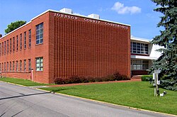
Johnson County | |
---|---|
Coordinates: 36°28′N81°52′W / 36.46°N 81.86°W | |
Country | United States |
State | Tennessee |
Founded | 1836 |
Named for | Thomas Johnson, early settler [1] |
Seat | Mountain City |
Largest town | Mountain City |
Area | |
• Total | 303 sq mi (780 km2) |
• Land | 298 sq mi (770 km2) |
• Water | 4.2 sq mi (11 km2) 1.4% |
Population (2020) | |
• Total | 17,948 |
• Density | 61/sq mi (24/km2) |
Time zone | UTC−5 (Eastern) |
• Summer (DST) | UTC−4 (EDT) |
Congressional district | 1st |
Johnson County is a county located in the U.S. state of Tennessee. As of the 2020 census, the population was 17,948. [2] Its county seat is Mountain City. [3] It is the state's northeasternmost county, sharing borders with Virginia and North Carolina.
Johnson County was created in 1836 from parts of Carter County. This followed several years of bickering over the location of Carter County's seat, with residents of what is now Johnson County arguing that travel to Elizabethton was too lengthy and difficult. When their petition to move the seat to a more central location was rejected, they petitioned the state legislature for the creation of a new county. The new county was named after Thomas Johnson, an early settler. The county seat was initially named "Taylorsville" in honor of Colonel James P. Taylor (it was changed to "Mountain City" in the 1880s). [1] [4]
Most Johnson Countians supported the Union during the Civil War. The county's residents rejected secession by a margin of 788 to 111 in Tennessee's secession referendum on June 8, 1861. [5] The county sent a sizable delegation to the Greeneville session of the pro-Union East Tennessee Convention in June 1861. [6]
Due in large part to the county's remoteness, the railroads did not reach Johnson until the early 20th century. The arrival of the railroads during this period aided the development of the timber and manganese mining industries. [1]
According to the U.S. Census Bureau, the county has a total area of 303 square miles (780 km2), of which 298 square miles (770 km2) is land and 4.2 square miles (11 km2) (1.4%) is water. [7]
Situated entirely within the Blue Ridge Mountains, [8] Johnson County is relatively rugged and hilly. The county's boundary with Sullivan County to the northwest is defined as the ridgeline of Holston Mountain, while the Iron Mountains provide the county's boundary with Carter County to the southwest. Snake Mountain, at 5,574 feet (1,699 m), is the county's highest point. [1]
In terms of average elevation, Johnson County is one of the highest counties (if not the highest) in Tennessee. The county is home to the two highest communities in the state: Trade, at 3,133 feet (955 m), and Shady Valley, at 2,785 feet (849 m). Mountain City is the highest incorporated city in Tennessee, at 2,418 feet (737 m). The highest place in Johnson County is Snake Mountain's lower peak, (near the North Carolina state line), at 5,518 feet (1,682 m). The lowest point in the county is Watauga Lake, at an elevation of 1,959 feet (597 m).
Census | Pop. | Note | %± |
---|---|---|---|
1840 | 2,658 | — | |
1850 | 3,705 | 39.4% | |
1860 | 5,018 | 35.4% | |
1870 | 5,852 | 16.6% | |
1880 | 7,766 | 32.7% | |
1890 | 8,858 | 14.1% | |
1900 | 10,589 | 19.5% | |
1910 | 13,191 | 24.6% | |
1920 | 12,230 | −7.3% | |
1930 | 12,209 | −0.2% | |
1940 | 12,998 | 6.5% | |
1950 | 12,278 | −5.5% | |
1960 | 10,765 | −12.3% | |
1970 | 11,569 | 7.5% | |
1980 | 13,745 | 18.8% | |
1990 | 13,766 | 0.2% | |
2000 | 17,499 | 27.1% | |
2010 | 18,244 | 4.3% | |
2020 | 17,948 | −1.6% | |
U.S. Decennial Census [9] 1790-1960 [10] 1900-1990 [11] 1990-2000 [12] 2010-2014 [13] |
Race | Number | Percentage |
---|---|---|
White (non-Hispanic) | 16,126 | 89.85% |
Black or African American (non-Hispanic) | 724 | 4.03% |
Native American | 28 | 0.16% |
Asian | 27 | 0.15% |
Pacific Islander | 9 | 0.05% |
Other/Mixed | 518 | 2.89% |
Hispanic or Latino | 516 | 2.87% |
As of the 2020 United States census, there were 17,948 people, 6,794 households, and 4,635 families residing in the county.
As of the census [16] of 2000, there were 17,499 people, 6,827 households, and 4,751 families residing in the county. The population density was 59 people per square mile (23 people/km2). There were 7,879 housing units at an average density of 26 units per square mile (10/km2). The racial makeup of the county was 96.40% White, 2.42% Black or African American, 0.34% Native American, 0.12% Asian, 0.02% Pacific Islander, 0.23% from other races, and 0.46% from two or more races. 0.86% of the population were Hispanic or Latino of any race.
There were 6,827 households, out of which 26.40% had children under the age of 18 living with them, 55.40% were married couples living together, 10.00% had a female householder with no husband present, and 30.40% were non-families. 26.40% of all households were made up of individuals, and 11.50% had someone living alone who was 65 years of age or older. The average household size was 2.35 and the average family size was 2.81.
In the county, the population was spread out, with 19.70% under the age of 18, 7.40% from 18 to 24, 30.80% from 25 to 44, 27.10% from 45 to 64, and 15.00% who were 65 years of age or older. The median age was 40 years. For every 100 females there were 114.60 males. For every 100 females age 18 and over, there were 114.40 males.
The median income for a household in the county was $23,067, and the median income for a family was $28,400. Males had a median income of $24,018 versus $18,817 for females. The per capita income for the county was $13,388. About 18.70% of families and 22.60% of the population were below the poverty line, including 26.80% of those under age 18 and 21.50% of those age 65 or over.
Male inmates in the Northeast Correctional Complex, southwest of Mountain City, account for 1,299 (7.4%) of the county's population. [17]
Year | Republican | Democratic | Third party(ies) | |||
---|---|---|---|---|---|---|
No. | % | No. | % | No. | % | |
2020 | 6,468 | 82.91% | 1,246 | 15.97% | 87 | 1.12% |
2016 | 5,410 | 82.23% | 988 | 15.02% | 181 | 2.75% |
2012 | 4,611 | 74.44% | 1,483 | 23.94% | 100 | 1.61% |
2008 | 4,621 | 70.11% | 1,837 | 27.87% | 133 | 2.02% |
2004 | 4,634 | 71.51% | 1,812 | 27.96% | 34 | 0.52% |
2000 | 3,740 | 66.11% | 1,813 | 32.05% | 104 | 1.84% |
1996 | 3,137 | 58.54% | 1,698 | 31.69% | 524 | 9.78% |
1992 | 3,170 | 56.98% | 1,781 | 32.02% | 612 | 11.00% |
1988 | 3,715 | 73.14% | 1,329 | 26.17% | 35 | 0.69% |
1984 | 3,853 | 79.10% | 999 | 20.51% | 19 | 0.39% |
1980 | 3,716 | 74.99% | 1,141 | 23.03% | 98 | 1.98% |
1976 | 2,986 | 66.68% | 1,464 | 32.69% | 28 | 0.63% |
1972 | 3,362 | 87.08% | 450 | 11.66% | 49 | 1.27% |
1968 | 3,107 | 79.02% | 450 | 11.44% | 375 | 9.54% |
1964 | 2,889 | 75.71% | 927 | 24.29% | 0 | 0.00% |
1960 | 3,854 | 86.74% | 571 | 12.85% | 18 | 0.41% |
1956 | 3,690 | 87.44% | 503 | 11.92% | 27 | 0.64% |
1952 | 3,590 | 87.65% | 506 | 12.35% | 0 | 0.00% |
1948 | 2,413 | 82.98% | 433 | 14.89% | 62 | 2.13% |
1944 | 2,699 | 85.47% | 450 | 14.25% | 9 | 0.28% |
1940 | 2,502 | 84.21% | 469 | 15.79% | 0 | 0.00% |
1936 | 2,882 | 84.39% | 533 | 15.61% | 0 | 0.00% |
1932 | 2,400 | 84.51% | 425 | 14.96% | 15 | 0.53% |
1928 | 3,057 | 93.97% | 196 | 6.03% | 0 | 0.00% |
1924 | 2,799 | 91.35% | 254 | 8.29% | 11 | 0.36% |
1920 | 3,627 | 92.57% | 291 | 7.43% | 0 | 0.00% |
1916 | 1,812 | 87.33% | 263 | 12.67% | 0 | 0.00% |
1912 | 933 | 42.14% | 256 | 11.56% | 1,025 | 46.30% |
1908 | 2,148 | 90.21% | 232 | 9.74% | 1 | 0.04% |
1904 | 1,769 | 88.49% | 219 | 10.96% | 11 | 0.55% |
1900 | 1,618 | 89.20% | 189 | 10.42% | 7 | 0.39% |
1896 | 1,683 | 88.02% | 224 | 11.72% | 5 | 0.26% |
1892 | 1,100 | 78.46% | 209 | 14.91% | 93 | 6.63% |
1888 | 1,347 | 87.52% | 180 | 11.70% | 12 | 0.78% |
1884 | 1,101 | 85.81% | 179 | 13.95% | 3 | 0.23% |
1880 | 1,092 | 84.32% | 203 | 15.68% | 0 | 0.00% |
1876 | 717 | 77.77% | 205 | 22.23% | 0 | 0.00% |
1872 | 778 | 93.17% | 57 | 6.83% | 0 | 0.00% |
1868 | 501 | 99.80% | 1 | 0.20% | 0 | 0.00% |
1860 | 0 | 0.00% | 144 | 22.09% | 508 | 77.91% |
1856 | 0 | 0.00% | 178 | 27.94% | 459 | 72.06% |
1852 | 365 | 79.69% | 93 | 20.31% | 0 | 0.00% |
1848 | 382 | 85.27% | 66 | 14.73% | 0 | 0.00% |
1844 | 370 | 82.41% | 79 | 17.59% | 0 | 0.00% |
1840 | 390 | 88.84% | 49 | 11.16% | 0 | 0.00% |
Johnson County is a long-term Republican stronghold and is located within Tennessee's 1st congressional district, which has not been represented by a Democrat since 1881. Johnson County has never been carried by a Democratic presidential nominee. Since a Republican Party presidential nominee first appeared on the ballot in Tennessee in 1868, there has only been one occasion when Johnson County's voters didn't vote for the official Republican Party candidate, and that was in 1912, when voters voted for the official Bull Moose Progressive Party candidate, Theodore Roosevelt, the former Republican president of the United States from 1901 to 1909. Johnson County's voters chose Roosevelt in 1912 rather than the man who was then the incumbent Republican president of the United States, William Howard Taft (president of the United States from 1909 to 1913).
Johnson County was reportedly the strongest county in the US for Republican candidates Calvin Coolidge in 1924, [19] Herbert Hoover in 1932 [20] and the second strongest behind Jackson County, Kentucky for Alf Landon in 1936. [21] The Republican candidate has consistently won since 1916, [22] [23] during which period no Republican candidate has received less than 57 percent of the county's vote. In 2012, Mitt Romney received 74.4 percent, [24] while Donald Trump received 82.2 percent in 2016, and then 82.9 percent in 2020.
Steve Earle's song "Copperhead Road" is about a family of moonshiners from Johnson County – where, until 2018, alcohol was prohibited ever since the Twenty-First Amendment. The second verse contains the line "Johnson County Sheriff painted on the side".
The childhood home of Valene Ewing, a character in the TV series Dallas and Knots Landing , is in Johnson County, in the fictional community of Shula.
Clinton County is a county located in the U.S. state of Kentucky in the Pennyrile Region along the southern border with Tennessee. As of the 2020 census, the population was 9,253. Its county seat is Albany. The county was formed in 1835 and named for DeWitt Clinton, the seventh Governor of New York. It is a prohibition or dry county.
Washington County is a county located in the U.S. state of Tennessee. As of the 2020 census, the population was 133,001. Its county seat is Jonesborough. The county's largest city and a regional educational, medical and commercial center is Johnson City. Washington County is Tennessee's oldest county, having been established in 1777 when the state was still part of North Carolina. Washington County is part of the Johnson City, TN Metropolitan Statistical Area, which is a component of the Johnson City–Kingsport–Bristol, TN-VA Combined Statistical Area, commonly known as the "Tri-Cities" region.
Unicoi County is a county located in the U.S. state of Tennessee. As of the 2020 census, the population was 17,928. Its county seat is Erwin. Unicoi is a Cherokee word meaning "white," "hazy," "fog-like," or "fog draped," and refers to the mist often seen in the foothills and mountains of this far northeast county. Unicoi County is part of the Johnson City Metropolitan Statistical Area, which is a component of the Johnson City–Kingsport–Bristol, TN-VA Combined Statistical Area, commonly known as the "Tri-Cities" region.
Sullivan County is a county located in the U.S. state of Tennessee on its northeast border. As of the 2020 census, the population was 158,163. Its county seat is Blountville.
Stewart County is a county located on the northwestern corner of Middle Tennessee, in the U.S. state of Tennessee. As of the 2020 census, the population was 13,657. Its county seat is Dover. Stewart County is part of the Clarksville Metropolitan Statistical Area.
Greene County is a county located on the eastern border of the U.S. state of Tennessee. As of the 2020 census, the population was 70,152. Its county seat is Greeneville. Greene County comprises the Greeneville, TN Micropolitan Statistical Area.
Cumberland County is a county located in the U.S. state of Tennessee. As of the 2020 census, the population was 61,145. Its county seat is Crossville. Cumberland County comprises the Crossville, TN micropolitan statistical area.
Cocke County is a county on the eastern border of the U.S. state of Tennessee. As of the 2020 census, the population was 35,999. Its county seat is Newport. Cocke County comprises the Newport, TN Micropolitan Statistical Area, which is part of the Knoxville-Morristown-Sevierville, Tennessee Combined Statistical Area.
Carter County is a county located in the U.S. state of Tennessee. As of the 2020 census, the population was 56,356. Its county seat is Elizabethton. The county is named in honor of Landon Carter (1760–1800), an early settler active in the "Lost State of Franklin" 1784-1788 secession from the State of North Carolina. Carter County is part of the Johnson City, TN Metropolitan Statistical Area, which is a component of the Johnson City–Kingsport–Bristol, TN-VA Combined Statistical Area, located in northeastern Tennessee.
Watauga County is a county located in the U.S. state of North Carolina. As of the 2020 census, the population was 54,086. Its county seat and largest community is Boone. The county is in an exceptionally mountainous region, known as the High Country. It is the home of Appalachian State University, which has approximately 21,570 students as of Fall 2024. Watauga County comprises the Boone, NC Micropolitan Statistical Area.
Swain County is a county located on the far western border of the U.S. state of North Carolina. As of the 2020 census, the population was 14,117. Its county seat is Bryson City.
McDowell County is a county located in the U.S. state of North Carolina. As of the 2020 census, the population was 44,578. Its county seat is Marion.
Greene County is a county located in the U.S. state of North Carolina. As of the 2020 census, the population was 20,451. Its county seat is Snow Hill.
Caldwell County is a county in the U.S. state of North Carolina. It is located in the foothills of the Blue Ridge Mountains. As of the 2020 census, the population was 80,652. Its county seat is Lenoir. Caldwell County is part of the Hickory-Lenoir-Morganton, NC Metropolitan Statistical Area.
Avery County is a county located in the U.S. state of North Carolina. As of the 2020 census, the population was 17,806. The county seat is Newland. The county seat was initially established in Elk Park when the county was first formed, but was moved to Newland upon completion of the courthouse in 1912. Founded in 1911, it is the youngest of North Carolina's 100 counties.
Ashe County is a county located in the U.S. state of North Carolina. As of the 2020 census, the population was 26,577. Its county seat is Jefferson.
Hooker County is a county in the U.S. state of Nebraska. As of the 2020 United States Census, the population was 711. Its county seat is Mullen, which is the county's only community of substantial size.
Custer County is a rural mountain county in the center of the U.S. state of Idaho. As of the 2020 census, the population was 4,275, making it the fifth-least populous county in Idaho. The county seat is Challis. Established in 1881, the county was named for the General Custer Mine, where gold was discovered five years earlier. Custer County relies on ranching, mining, and tourism as its main resources.
Yuma County is a county located in the U.S. state of Colorado. As of the 2020 census, the population was 9,988. The county seat is Wray.
Carroll County is a United States county located in the southwestern part of the Commonwealth of Virginia. Roughly one fifth of the county lies in the Virginia Piedmont region, while the rest is part of the Appalachian Mountains. The county seat and only town is Hillsville.