Blount County, Tennessee

Last updated

Blount County
Blount-county-tennessee-courthouse1.jpg
Blount County Courthouse in Maryville
Flag of Blount County, Tennessee.png
Blountcountytnseal.png
Map of Tennessee highlighting Blount County.svg
Location within the U.S. state of Tennessee
Tennessee in United States.svg
Tennessee's location within the U.S.
Coordinates: 35°41′N83°56′W / 35.69°N 83.93°W / 35.69; -83.93
CountryFlag of the United States.svg United States
StateFlag of Tennessee.svg  Tennessee
Founded1795
Named for William Blount [1]
Seat Maryville
Largest cityMaryville
Area
  Total567 sq mi (1,470 km2)
  Land559 sq mi (1,450 km2)
  Water7.8 sq mi (20 km2)  1.4%
Population
 (2020)
  Total135,280 Increase2.svg
  Density242/sq mi (93/km2)
Time zone UTC−5 (Eastern)
  Summer (DST) UTC−4 (EDT)
Congressional district 2nd
Website www.blounttn.org

Blount County is a county located in the East Tennessee Grand Division of the U.S. state of Tennessee. As of the 2020 census, its population was 135,280. [2] The county seat is Maryville, [3] which is also the county's largest city. Blount County is included in the Knoxville metropolitan area.

Contents

History

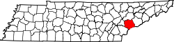
What is today Blount County was for many thousands of years Indian territory, passed down to the Cherokee tribe that claimed the land upon the arrival of White settlers in the late 18th century. Shortly thereafter, on July 11, 1795, Blount County became the 10th county established in Tennessee, when the Territorial Legislature voted to split adjacent Knox and Jefferson Counties. The new county was named for the governor of the Southwest Territory, William Blount, and its county seat, Maryville, was named for his wife Mary Grainger Blount. This establishment, however, did little to settle the differences between White immigrants and Cherokee natives, which was, for the most part, not accomplished until an 1819 treaty. [4]

Like a majority of East Tennessee counties, Blount County was opposed to secession on the eve of the Civil War. In Tennessee's Ordinance of Secession referendum on June 8, 1861, Blount Countians voted against secession by a margin of 1,766 to 414. [5] Residents of pro-Union Cades Cove and pro-Confederate Hazel Creek (on the other side of the mountains in North Carolina) regularly launched raids against one another during the war. [6]

Throughout its history, the boundaries of Blount County have been altered numerous times, most notably in 1870, when a large swath of western Blount was split into Loudon and portions of other counties. Also, the establishment of the Great Smoky Mountains National Park in 1936, while not affecting the legal boundaries of Blount County, has significantly impacted the use of southeastern Blount County. [7]

Blount County has been served by The Daily Times, currently published in Maryville, since 1883. [8]

On July 2, 2015, a freight train carrying hazardous materials derailed. About 5,000 residents were displaced from their homes within a two-mile (three-kilometer) radius. [9] [10] [11] [12] [13]

Geography

Chilhowee Mountain in winter Chilhowee-mountain-blount-tn4.jpg
Chilhowee Mountain in winter
Lakefront subdivisions along the Tennessee River shoreline in Louisville Fort Loudoun Lake subdivisions in Louisville, Tennessee.jpg
Lakefront subdivisions along the Tennessee River shoreline in Louisville

According to the U.S. Census Bureau, the county has a total area of 567 square miles (1,470 km2), of which 7.8 square miles (20 km2) (1.4%) are covered by water. [14]

The southern part of Blount County is part of the Great Smoky Mountains, and is protected by the Great Smoky Mountains National Park. The crest of the range forms the county's border with Swain County, North Carolina, and includes Blount's highest point, 5,527-foot (1,685 m) Thunderhead Mountain, and the 4,949-foot (1,508 m) Gregory Bald, a prominent grassy bald. The northern part of the county is part of the Ridge-and-Valley Appalachians. [15] The geologic boundary between the Blue Ridge (which includes the Smokies) and Ridge-and-Valley provinces runs along Chilhowee Mountain, a long and narrow ridge that stretches across the central part of the county. [16] Much of Blount's topography is characterized by elongate ridges and rolling hills known locally as "The Foothills" which emanate outward from the Smokies range.

The mountainous southern portion of Blount County is dotted by relatively isolated valleys known as Appalachian coves. The best known of these valleys, Cades Cove, is one of the most visited sections of the national park, and is noted for the remnants of the Appalachian community that occupied the cove prior to the park's formation, as well as an abundance of wildlife, especially white-tailed deer. Tuckaleechee Cove is occupied by the city of Townsend, and Millers Cove is occupied by the community of Walland. This part of the county is also home to two large caves: Tuckaleechee Caverns, a popular show cave, and Bull Cave, which at 924 feet (282 m), is the deepest in Tennessee. [17]

The Tennessee River forms part of Blount's border with Knox County to the northwest. This section of the Tennessee is part of Fort Loudoun Lake, an artificial lake created by the Tennessee Valley Authority. The Little Tennessee River, a tributary of the Tennessee, forms part of Blount's southern border with Monroe County, and includes three artificial lakes: Tellico, Chilhowee, and Calderwood (two others, Cheoah and Fontana, are located just upstream in North Carolina). Little River, another tributary of the Tennessee, flows northward from deep within the Smokies and traverses the central part of the county. The river's confluence with its Middle Prong forms a popular swimming area known as the "Townsend Wye", which is located just inside the park south of Townsend.

Geographical features

Adjacent counties

National protected areas

State protected areas

Demographics

Historical population
CensusPop.Note
1800 5,587
1810 12,098116.5%
1820 11,258−6.9%
1830 11,028−2.0%
1840 11,7456.5%
1850 12,4245.8%
1860 13,2706.8%
1870 14,2377.3%
1880 15,98512.3%
1890 17,58910.0%
1900 19,2069.2%
1910 20,8098.3%
1920 28,80038.4%
1930 33,98918.0%
1940 41,11621.0%
1950 54,69133.0%
1960 57,5255.2%
1970 63,74410.8%
1980 77,70021.9%
1990 85,96910.6%
2000 105,82323.1%
2010 123,01016.2%
2020 135,28010.0%
U.S. Decennial Census [18]
1790-1960 [19] 1900-1990 [20]
1990-2000 [21]
2010-2020 [2]
Age pyramid Blount County USA Blount County, Tennessee.csv age pyramid.svg
Age pyramid Blount County

2020 census

Blount County racial composition [23]
RaceNumberPercentage
White (non-Hispanic)117,95287.19%
Black or African American (non-Hispanic)3,5522.63%
Native American 3390.25%
Asian 1,2800.95%
Pacific Islander 230.02%
Other/mixed 6,4254.75%
Hispanic or Latino 5,7094.22%

As of the 2020 United States census, 135,280 people, 50,813 households, and 35,299 families were residing in the county.

2000 census

As of the census [24] of 2000, 105,823 people, 42,667 households, and 30,634 families were residing in the county. The population density was 190 people per square mile (73 people/km2). The 47,059 housing units had an average density of 84 per square mile (32/km2). The racial makeup of the county was 94.73% White, 2.91% Black, 0.29% Native American, 0.72% Asian, 0.37% from other races, and 0.99% from two or more races. About 1.06% of the population were Hispanics or Latinos of any race.

Of the 42,667 households, 30.5% had children under 18 living with them, 58.4% were married couples living together, 10.0% had a female householder with no husband present, 28.2% were not families, and 1,384 were unmarried partner households: 1,147 heterosexual, 107 same-sex male, 130 same-sex female. About 24.4% of all households were made up of individuals, and 9.5% had someone living alone who was 65 or older. The average household size was 2.43, and the average family size was 2.88.

In the county, the age distribution was 22.8% under 18, 8.30% from 18 to 24, 29.40% from 25 to 44, 25.40% from 45 to 64, and 14.10% who were 65 or older. The median age was 38 years. For every 100 females, there were 93.80 males. For every 100 females 18 and over, there were 90.80 males. As verified by 2000 U.S. Census, for every 100 females under 65, there were 98.7 males, for every 100 females under 55 there were 99.5 males, and for every 100 females under 20 there were 105 males.

The median income for a household in the county was $37,862, and for a family was $45,038. Males had a median income of $31,877 versus $23,007 for females. The per capita income for the county was $19,416. About 7.3% of families and 9.7% of the population were below the poverty line, including 12.3% of those under age 18 and 9.1% of those 65 or over.

Government

United States presidential election results for Blount County, Tennessee [25] [26]
Year Republican Democratic Third party
No.%No.%No.%
2020 47,36971.12%17,93226.92%1,3081.96%
2016 37,44371.72%12,10023.18%2,6655.10%
2012 35,44171.98%12,93426.27%8591.74%
2008 35,57168.88%15,25329.53%8211.59%
2004 33,24168.24%15,04730.89%4240.87%
2000 25,27362.15%14,68836.12%7011.72%
1996 19,31052.29%14,68739.77%2,9337.94%
1992 18,41548.91%14,65538.92%4,58112.17%
1988 20,02767.26%9,60232.25%1470.49%
1984 20,52568.74%9,18830.77%1460.49%
1980 17,95963.81%9,41233.44%7732.75%
1976 13,85152.79%12,09646.10%2931.12%
1972 16,07873.85%5,30324.36%3901.79%
1968 12,75357.10%5,17623.17%4,40719.73%
1964 11,87658.40%8,45941.60%00.00%
1960 13,55268.20%6,21331.27%1070.54%
1956 12,66770.90%5,07628.41%1240.69%
1952 11,70869.22%5,16330.53%420.25%
1948 6,15264.47%3,14132.91%2502.62%
1944 6,19368.30%2,83631.28%380.42%
1940 4,31255.85%3,36343.56%450.58%
1936 4,11957.22%3,05642.45%240.33%
1932 3,27567.29%1,51531.13%771.58%
1928 4,12585.16%71214.70%70.14%
1924 2,75472.93%96825.64%541.43%
1920 5,54078.09%1,55021.85%40.06%
1916 2,46270.42%1,01529.03%190.54%
1912 87027.92%83626.83%1,41045.25%
1908 2,56874.80%84724.67%180.52%
1904 1,98775.52%61823.49%260.99%
1900 2,20171.35%82526.74%591.91%
1896 2,65272.20%97026.41%511.39%
1892 1,93366.77%82128.36%1414.87%
1888 2,23767.73%1,00930.55%571.73%
1884 1,82367.32%84931.35%361.33%
1880 1,59764.42%88235.58%00.00%

Like most of East Tennessee, Blount County has been a Republican bastion for decades. The last non-Republican to carry the county was Theodore Roosevelt, during his third-party run in 1912. In 1976, Jimmy Carter took 46% of the vote. In 1992, George H. W. Bush was held to 48.9% of the vote—the only time in over a century that a Republican has failed to win a majority in Blount County.

The current elected members of the Blount County government are: [27]

Blount County government
County executive Ed Mitchell
Assessor of property Todd Orr
Clerk and master Stephen Ogle
County clerk Gaye Hasty
Clerk of courts Thomas Hatcher
County treasurer
District attorney Mike Flynn
Registrar of deeds Phyllis Crisp
Chief highway officer Jeff Headrick
Registrar of probate
County sheriff James Berrong
Trustee Scott Graves
State government
State representative(s) 2 Representatives:Jerome Moon (R-Tennessee District 8), Bryan Richey (R-Tennessee District 20)
State senator(s) 1 Senators:Art Swann (R-Tennessee District 8)
Federal government
U.S. representative(s) Tim Burchett (R-2nd District)
U.S. senators Bill Hagerty (R)
Marsha Blackburn (R)

Economy

Most of the early European-American settlers were of little means; they were subsistence farmers throughout the early years of the county's establishment. The first industry to make its mark on Blount County, as in other neighboring counties, was that of lumber.

It was the massive development of this industry in the mountains of east Blount that, in part, led to the creation of the Great Smoky Mountains National Park. It includes the southeastern portion of the county. Today, manufacturing has replaced lumber in importance, with over 100 manufacturing plants located in the county. [4]

Denso Manufacturing Tennessee Inc., a division of Denso Global, is the county's largest employer, with about 3,000 employees. [28] [29]

Education

Wilson Center at Maryville College Wilson-center-mc-tn1.jpg
Wilson Center at Maryville College

Public schools in Blount County are part of the Blount County Schools system, with the exception of schools in the cities of Maryville and Alcoa, both of which operate separate, independent school systems. Private schools located in the county include Maryville Christian School [30] [31] and Clayton-Bradley STEM school. [32]

Blount County is home to two postsecondary educational institutions: Maryville College, a Presbyterian-related, liberal-arts college, founded in 1819 in downtown Maryville, and a satellite campus of Knoxville-based Pellissippi State Community College, referred to as Pellissippi State Community College, or PSCC, Blount County Campus.

Transportation

Paratransit

Blount County is served by the East Tennessee Human Resource Agency's Public Transit system. ETHRA operates in about 16 counties in eastern Tennessee, and is headquartered in the nearby city of Loudon. The service offers residents of any of the counties covered by ETHRA door-to-door pickup transportation across its service area by request only. [33] ETHRA provides a large variety of services in Blount County and other parts of East Tennessee. [34]

Airports

TYS - McGhee Tyson Airport

Highways

Parks

In addition to the federally operated Great Smoky Mountains National Park, which draws many visitors to the county each year, Blount County operates numerous smaller community parks and recreation centers, primarily in the cities of Alcoa and Maryville. Some of these facilities include: [35]

An integral part of keeping the parks and other parts of Blount County beautiful is the organization called Keep Blount Beautiful. [36] This organization works in coordination with other companies including The City of Alcoa Residential Recycling Pick Up Service [37] and Blount County HGS Trash and Recycling Same Day Residential Pick Up Service, [38] as well as many other recycling resources in Blount County, [39] to work towards the community goals of reducing air, water, and land pollution in order to reduce particulate matter and smog, [40] and to improve the overall health of local parks and preserved ecosystems in Blount County, as well as surrounding areas, of East Tennessee. These organizations and companies are appreciated by thousands of East Tennesseans due to their honorable work in the Blount County community.

Communities

Map of Blount County, Tennessee showing cities, CDPs, and census county divisions. Map of Blount County Tennessee.png
Map of Blount County, Tennessee showing cities, CDPs, and census county divisions.
Wildwood area Retention-pond-wildwood-tn1.jpg
Wildwood area

Cities

Towns

Census-designated places

Unincorporated communities

Former communities

See also

Related Research Articles

<span class="mw-page-title-main">Alcoa, Tennessee</span> City in Tennessee, United States

Alcoa is a city in Blount County, Tennessee, United States. Its population was 10,978 at the 2020 census. It is part of the Knoxville, TN Metropolitan Statistical Area.

<span class="mw-page-title-main">Maryville, Tennessee</span> City in Tennessee, United States

Maryville is a city in and the county seat of Blount County, Tennessee. Its population was 31,907 at the 2020 census.

<span class="mw-page-title-main">Townsend, Tennessee</span> City in Tennessee, United States

Townsend is a city in Blount County, Tennessee. The city was chartered in 1921 by persons who were involved with the Little River Railroad and Lumber Company. The population was 550 at the 2020 census. For thousands of years a site of Native American occupation by varying cultures, Townsend is one of three "gateways" to the Great Smoky Mountains National Park. It has several museums and attractions relating to the natural and human history of the Great Smokies.

<span class="mw-page-title-main">Seymour, Tennessee</span> CDP in Tennessee, United States

Seymour is a census-designated place (CDP) and unincorporated community in Blount and Sevier counties in the U.S. state of Tennessee. The CDP population was 14,705 at the 2020 U.S. census. It is included in the Knoxville, Tennessee Metropolitan Statistical Area.

<span class="mw-page-title-main">Little Tennessee River</span> River in the United States of America

The Little Tennessee River is a 135-mile (217 km) tributary of the Tennessee River that flows through the Blue Ridge Mountains from Georgia, into North Carolina, and then into Tennessee, in the southeastern United States. It drains portions of three national forests— Chattahoochee, Nantahala, and Cherokee— and provides the southwestern boundary of the Great Smoky Mountains National Park.

<span class="mw-page-title-main">Great Smoky Mountains</span> American mountain range along North Carolina/Tennessee border

The Great Smoky Mountains are a mountain range rising along the Tennessee–North Carolina border in the southeastern United States. They are a subrange of the Appalachian Mountains and form part of the Blue Ridge Physiographic Province. The range is sometimes called the Smoky Mountains, and the name is commonly shortened to the Smokies. The Smokies are best known as the home of the Great Smoky Mountains National Park, which protects most of the range. The park was established in 1934 and, with over 11 million visits per year, is the most visited national park in the United States.

<span class="mw-page-title-main">Little River (Tennessee)</span> River in Tennessee, United States

Little River is a 60-mile (97 km) river in Tennessee which drains a 380-square-mile (980 km2) area containing some of the most spectacular scenery in the southeastern United States. The first 18 miles (29 km) of the river are all located within the borders of the Great Smoky Mountains National Park. The remaining 42 miles (68 km) flow out of the mountains through Blount County to join the Tennessee River at Fort Loudon Lake in Knox County.

<span class="mw-page-title-main">Cades Cove</span> Valley within the Great Smoky Mountains

Cades Cove is an isolated valley located in the Tennessee section of the Great Smoky Mountains National Park. The valley was home to numerous settlers before the formation of the national park. Cades Cove, the single most popular destination for visitors to the park, attracts more than two million visitors annually because of its well preserved homesteads, scenic mountain views, and abundant display of wildlife. The Cades Cove Historic District is listed on the National Register of Historic Places.

<span class="mw-page-title-main">Foothills Parkway</span> National parkway in Tennessee

The Foothills Parkway is a national parkway which traverses the foothills of the northern Great Smoky Mountains in East Tennessee, located in the southeastern United States. The 72.1-mile (114 km) parkway will connect U.S. Route 129 along the Little Tennessee River in the west with Interstate 40 (I-40) along the Pigeon River in the east.

<span class="mw-page-title-main">Pellissippi Parkway</span> Highway in Tennessee, United States

The Pellissippi Parkway is a major highway in Knox and Blount counties in the Knoxville metropolitan area in Tennessee that extends 19.75 miles (31.78 km) from State Route 62 at Solway to SR 33 in Alcoa. It provides access to the cities of Oak Ridge and Maryville from Interstates 40 and 75 in the western part of Knoxville and also serves a major corridor that includes Oak Ridge National Laboratory, Y-12 National Security Complex, and a number of science and technology firms. The central portion of the Pellissippi Parkway is included in the Interstate Highway System and is designated Interstate 140 (I-140), while the remainder is designated as State Route 162. The entire highway is part of the National Highway System, a national network of roads identified as important to the national economy, defense, and mobility. It takes its name from an older name for the Clinch River of Native American origin.

<span class="mw-page-title-main">Happy Valley, Blount County, Tennessee</span> Unincorporated community in Tennessee, United States

Happy Valley is an unincorporated community in Blount County, Tennessee, near the Great Smoky Mountains National Park. Although it is not a census-designated place, the ZIP Code Tabulation Area for the ZIP Code (37878) that serves Happy Valley had a population of 529 as of the 2000 U.S. Census.

<span class="mw-page-title-main">Calderwood Dam</span> Hydroelectric dam in Tennessee

Calderwood Dam is a hydroelectric dam located along the Little Tennessee River in Blount and Monroe counties, in the U. S. state of Tennessee. Completed in 1930, the dam is owned and maintained by Tapoco, a subsidiary of the Aluminum Company of America (Alcoa), although the Tennessee Valley Authority (TVA) controls the dam's reservoir levels from Fontana Dam further upstream. Calderwood Dam is named for Alcoa engineer Isaac Glidden Calderwood (1871–1941), who supervised much of the company's early Little Tennessee River operations.

<span class="mw-page-title-main">Walland, Tennessee</span> CDP in Tennessee, United States

Walland is an unincorporated community and census-designated place (CDP) in Blount County, Tennessee. Its population was 281 as of the 2020 census. Walland is the site of a post office and is the place name associated with zip code 37886, which covers an area beyond the Walland community.

<span class="mw-page-title-main">Chilhowee (Cherokee town)</span> Cherokee village site in Blount and Monroe Counties, Tennessee

Chilhowee was a prehistoric and historic Native American site in present-day Blount and Monroe counties in Tennessee, in what were the Southeastern Woodlands. Although now submerged by the Chilhowee Lake impoundment of the Little Tennessee River, the Chilhowee site was home to a substantial 18th-century Overhill Cherokee town. It may have been the site of the older Creek village "Chalahume" visited by Spanish explorer Juan Pardo in 1567. The Cherokee later pushed the Muscogee Creek out of this area.

<span class="mw-page-title-main">U.S. Route 129 in Tennessee</span> Segment of American highway

U.S. Route 129 is a north–south United States highway that runs for 52.8 miles (85.0 km) in East Tennessee, from the North Carolina state line, near Tapoco, to Knoxville. In Tennessee, the highway is completely overlapped by unsigned State Route 115. In the Greater Knoxville area, US 129 serves as a six-lane controlled-access highway known as Alcoa Highway.

<span class="mw-page-title-main">Calderwood, Tennessee</span> United States historic place

Calderwood was a community once located along the Little Tennessee River in Blount County, Tennessee, United States. Established in 1912 as a base for the Aluminum Company of America's Little Tennessee Valley hydroelectric development operations, the community continued to house construction personnel and dam maintenance personnel for nearby Calderwood Dam until the 1960s. Although the community's houses were razed after its abandonment, three buildings located in the community— the Calderwood Dam service building, the Calderwood School, and a Quonset hut used as a theater— were included in a supplementary listing for Calderwood Dam on the National Register of Historic Places in 2004.

<span class="mw-page-title-main">Tennessee State Route 73</span> Highway in Tennessee, United States

State Route 73 is west-north state highway in East Tennessee. For most of its length, it is an unsigned companion route to U.S. Route 321.

Daniel Davis Foute (1799–1865) was an American entrepreneur who did much to develop Cades Cove in Blount County, Tennessee. He built an iron forge, launched a resort hotel, and built various roads in the region. After siding with the Confederates in the American Civil War he lost most of his fortune and died insolvent.

<span class="mw-page-title-main">Great Smoky Mountains Heritage Center</span> Museum in Tennessee

The Great Smoky Mountains Heritage Center is a private non-profit museum located in Townsend, Tennessee, United States, near the city's entrance to the Great Smoky Mountains National Park. Its mission is to preserve the heritage and culture of the inhabitants of the Great Smoky Mountains, including both the region's Native American inhabitants and the pioneers and residents of the region's Appalachian communities. The center was organized in the early 2000s, and officially opened in February 2006.

<span class="mw-page-title-main">Abrams Creek (Tennessee)</span> Stream in Tennessee, USA

Abrams Creek is a creek in Blount County, Tennessee. Its headwaters are in Cades Cove, and it is a tributary of the Little Tennessee River. It is named after the Chilhowee Cherokee chief Old Abraham ("Abram"). Visitors swim and fish in the creek. The creek was deliberately poisoned in 1957 to kill fish in potential competition with rainbow trout; many fish species were extirpated from the river and have never recovered.

References

  1. Tara Mitchell Mielnik, "Blount County," Tennessee Encyclopedia of History and Culture. Retrieved: March 31, 2013.
  2. 1 2 "Blount County, Tennessee". quickfacts.census.gov. United States Census Bureau. Retrieved August 29, 2021.
  3. "Find a County". National Association of Counties. Archived from the original on May 31, 2011. Retrieved June 7, 2011.
  4. 1 2 About Blount County Archived June 16, 2006, at the Wayback Machine Blount County official website
  5. Oliver Perry Temple, East Tennessee and the Civil War (R. Clarke Company, 1899), p. 199.
  6. Durwood Dunn, Cades Cove: The Life and Death of An Appalachian Community (University of Tennessee Press, 1988), pp. 134-136.
  7. Lansford, D., and D. Waterworth. "Blount County History," TNGenWeb Project
  8. "About Us". The Daily Times. Retrieved March 9, 2018.
  9. "Thousands Evacuated After Derailed Train Hauling Chemicals Catches Fire in Tennessee". Archived from the original on July 3, 2015. Retrieved March 9, 2018.
  10. "Tennessee Train Derailment: 5,000 Residents Evacuated From Maryville". NBC News. Retrieved March 9, 2018.
  11. "5,000 Evacuated in Tennessee After Train Derailment Releases Toxic Fumes". Newsweek. July 2, 2015. Retrieved March 9, 2018.
  12. "Quick Links". CNN.
  13. "Train Carrying Toxic Substance Derails Near Knoxville, Tennessee; Thousands Evacuated". Huffington Post. July 2, 2015.
  14. "2010 Census Gazetteer Files". United States Census Bureau. August 22, 2012. Retrieved April 1, 2015.
  15. Tennessee Department of Environment and Conservation, et al., "Ambient Air Monitoring Plan," Environmental Protection Agency website, July 1, 2010, p. 6. Accessed: March 18, 2015.
  16. Harry Moore, A Roadside Guide to the Geology of the Great Smoky Mountains National Park (Knoxville: University of Tennessee Press, 1988), p. 149.
  17. Larry E. Matthews, "Caves of Knoxville and the Great Smoky Mountains", 2008, ISBN   978-1-879961-30-2, pages 171-173.
  18. "U.S. Decennial Census". United States Census Bureau. Retrieved April 1, 2015.
  19. "Historical Census Browser". University of Virginia Library. Retrieved April 1, 2015.
  20. Forstall, Richard L., ed. (March 27, 1995). "Population of Counties by Decennial Census: 1900 to 1990". United States Census Bureau. Retrieved April 1, 2015.
  21. "Census 2000 PHC-T-4. Ranking Tables for Counties: 1990 and 2000" (PDF). United States Census Bureau. April 2, 2001. Archived (PDF) from the original on October 9, 2022. Retrieved April 1, 2015.
  22. Based on 2000 census data
  23. "Explore Census Data". data.census.gov. Retrieved December 26, 2021.
  24. "U.S. Census website". United States Census Bureau . Retrieved May 14, 2011.
  25. Leip, David. "Dave Leip's Atlas of U.S. Presidential Elections". uselectionatlas.org. Retrieved March 9, 2018.
  26. http://geoelections.free.fr/ . Retrieved January 13, 2021.{{cite web}}: Missing or empty |title= (help)
  27. Blount County Archived June 29, 2010, at the Wayback Machine , National Association of Counties website
  28. "DENSO Plant 203 is a key marker in 20-year history," The Maryville-Alcoa Daily Times, April 7, 2008
  29. "Denso Tennessee names new president," The Knoxville News-Sentinel Archived April 15, 2009, at the Wayback Machine , April 1, 2008
  30. Maryville Christian School website
  31. Millard, B. "Maryville Christian welcomes record class," The Maryville-Alcoa Daily Times, September 17, 2006
  32. "Clayton-Bradley Academy - Reimagine education in Blount County, TN". Clayton-Bradley Academy. Retrieved September 13, 2022.
  33. ETHRA homepage Archived June 16, 2006, at the Wayback Machine
  34. "Transportation | ETHRA". www.ethra.org. Retrieved October 4, 2015.
  35. Maryville-Alcoa-Blount County Parks & Rec website
  36. "Recycling Pick Up Options". Keep Blount Beautiful. Archived from the original on September 30, 2015. Retrieved October 4, 2015.
  37. Alcoa, City of. "Recycling / Sanitation & Recycling Services / Public Works & Engineering Department / City Departments / City of Alcoa - City of Alcoa". www.cityofalcoa-tn.gov. Retrieved October 4, 2015.[ permanent dead link ]
  38. "Trash Garbage Recycling Services Blount County Maryville". www.hgstrashremoval.com. Archived from the original on October 4, 2015. Retrieved October 4, 2015.
  39. "Recycling". Keep Blount Beautiful. Archived from the original on September 30, 2015. Retrieved October 4, 2015.
  40. "Particulate Matter | Air & Radiation | US EPA". www3.epa.gov. Retrieved October 4, 2015.

Further reading

35°41′N83°56′W / 35.69°N 83.93°W / 35.69; -83.93