Top of the World, Tennessee

Last updated
Top of the World
Foothills Parkway Overlook.jpg
Overlook from Foothills Parkway, July 2013
USA Tennessee location map.svg
Red pog.svg
Top of the World
Location within the state of Tennessee
Coordinates: 35°39′16″N83°54′38″W / 35.65453°N 83.91043°W / 35.65453; -83.91043
Country United States
State Tennessee
County Blount
Founded1965
Elevation
2,024 ft (617 m)
Time zone UTC-5 (Eastern (EST))
  Summer (DST) UTC-4 (EDT)
ZIP code
37878
Area code 865
GNIS feature ID1272776 [1]

Top of the World (alternately, Top O' the World and Top of The World Estates) is an unincorporated community in rural Blount County, Tennessee.

Contents

Location

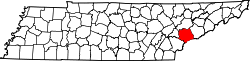
The community lies in an area called The Flats, on a spur of Chilhowee Mountain in East Tennessee. The surrounding country is rugged. [2] The Foothills Parkway passes just to the northwest, and the boundary of the Great Smoky Mountains National Park lies just to the southeast. [3] The neighboring park has a natural forest environment of yellow pines and hardwood species. Controlled burns are used to reduce the risk of uncontrolled fires. [4] There is a healthy black bear population. [5]

The community is relatively isolated. The Foothills Parkway is the only road to Top of the World that is passable by school bus. [6] Otherwise it must be accessed by steep and winding secondary roads. [7]

History

The land was originally the home of the Cherokee Nation, who were mostly displaced to Oklahoma along the Trail of Tears in 1838. A grant of 5,000 acres (2,000 ha) was made to Daniel D. Foute in 1837. This included the area now covered by Top of the World, which was purchased by a developer in the early 1960s. [8] Construction of the Top of World Estates by Roy and Charles Headrick was reported by the Knoxville News Sentinel in June 1965. [9] The community surrounds Lake in the Sky, a 52.5-acre (21.2 ha) artificial lake formed by a dam built in 1966. [10]

Community

Residents may belong to the Top of the World Landowners' Association (TOWLA). [11] The Blount County Fire Protection District has its station #8 at 5714 Flats Road, on the east shore of the lake. [12] The fire station officially came into service when the TOWLA and the Blount County Fire Protection District signed a contract on 23 March 2012. [13] There is no local school. School children are taken by bus along the Foothills Parkway to nearby Walland. [14] [15] [16] There is no post office in Top of The World. The nearest post office is in Walland.

Related Research Articles

<span class="mw-page-title-main">Sevier County, Tennessee</span> County in Tennessee, United States

Sevier County is a county of the U.S. state of Tennessee. As of the 2020 census, the population was 98,380. Its county seat and largest city is Sevierville. Sevier County comprises the Sevierville, TN Micropolitan Statistical Area, which is included in the Knoxville-Morristown-Sevierville, TN Combined Statistical Area.

<span class="mw-page-title-main">Blount County, Tennessee</span> County in Tennessee, United States

Blount County is a county located in the East Tennessee Grand Division of the U.S. state of Tennessee. As of the 2020 census, its population was 135,280. The county seat is Maryville, which is also the county's largest city. Blount County is included in the Knoxville, TN metropolitan statistical area.

<span class="mw-page-title-main">Maryville, Tennessee</span> City in Tennessee, United States

Maryville is a city in and the county seat of Blount County, Tennessee, and is a suburb of Knoxville. Its population was 31,907 at the 2020 census.

<span class="mw-page-title-main">Townsend, Tennessee</span> City in Tennessee, United States

Townsend is a city in Blount County, Tennessee. The city was chartered in 1921 by persons who were involved with the Little River Railroad and Lumber Company. The population was 550 at the 2020 census. For thousands of years a site of Native American occupation by varying cultures, Townsend is one of three "gateways" to the Great Smoky Mountains National Park. It has several museums and attractions relating to the natural and human history of the Great Smokies.

<span class="mw-page-title-main">Knoxville, Tennessee</span> City in Tennessee, United States

Knoxville is a city in and the county seat of Knox County, Tennessee, United States. As of the 2020 United States census, Knoxville's population was 190,740, making it the largest city in the East Tennessee Grand Division and the state's third largest city after Nashville and Memphis. It is the principal city of the Knoxville metropolitan area, which had a population of 879,773 in 2020.

<span class="mw-page-title-main">Sevierville, Tennessee</span> City in Tennessee, United States

Sevierville is a city in and the county seat of Sevier County, Tennessee, located in eastern Tennessee. The population was 17,889 at the 2020 United States Census.

<span class="mw-page-title-main">Little River (Tennessee)</span> River in Tennessee, United States

Little River is a 60-mile (97 km) river in Tennessee which drains a 380-square-mile (980 km2) area containing some of the most spectacular scenery in the southeastern United States. The first 18 miles (29 km) of the river are all located within the borders of the Great Smoky Mountains National Park. The remaining 42 miles (68 km) flow out of the mountains through Blount County to join the Tennessee River at Fort Loudon Lake in Knox County.

<span class="mw-page-title-main">U.S. Route 411</span> Numbered U.S. Highway in Alabama, Georgia, and Tennessee in the United States

U.S. Route 411 (US 411) is an alternate parallel-highway associated with US 11. It extends for about 309.7 miles (498.4 km) from US 78 in Leeds, Alabama, to US 25W/US 70 in Newport, Tennessee. US 411 travels through northeastern Alabama, northwestern Georgia, and southeastern Tennessee. It is signed north-south, as with most highways that have odd numbers, but the route runs primarily in a northeast-southwest direction, and covers a more east-west mileage than it does north-south. Notable towns and cities along its route include Gadsden, Alabama; Rome, Georgia; Cartersville, Georgia; Maryville, Tennessee; Sevierville, Tennessee, and Newport, Tennessee.

<span class="mw-page-title-main">Foothills Parkway</span> National parkway in Tennessee

The Foothills Parkway is a national parkway which traverses the foothills of the northern Great Smoky Mountains in East Tennessee, located in the southeastern United States. The 72.1-mile (114 km) parkway will connect U.S. Route 129 along the Little Tennessee River in the west with Interstate 40 (I-40) along the Pigeon River in the east.

The Great Smoky Mountains Parkway is a highway that travels 23.4 miles (37.7 km) between the Great Smoky Mountains National Park and Interstate 40 (I-40) in Kodak, Tennessee, in East Tennessee. It serves as the main thoroughfare for Gatlinburg, Pigeon Forge, and Sevierville, and includes a 4.3-mile (6.9 km) spur of the Foothills Parkway. It is composed of sections of a number of numbered highways, including U.S. Route 441 (US 441) and US 321 and State Route 66 (SR 66) and SR 448.

<span class="mw-page-title-main">Pellissippi Parkway</span> Highway in Tennessee, United States

The Pellissippi Parkway is a major highway in Knox and Blount counties in the Knoxville metropolitan area in Tennessee that extends 19.75 miles (31.78 km) from State Route 62 at Solway to SR 33 in Alcoa. It provides access to the cities of Oak Ridge and Maryville from Interstates 40 and 75 in the western part of Knoxville, and also serves a major corridor that includes Oak Ridge National Laboratory, Y-12 National Security Complex, and a number of science and technology firms. The central portion of the Pellissippi Parkway is included in the Interstate Highway System and is designated Interstate 140 (I-140), while the remainder is designated as State Route 162. The entire highway is part of the National Highway System, a national network of roads identified as important to the national economy, defense, and mobility. It takes its name from an older name for the Clinch River of Native American origin.

<span class="mw-page-title-main">Gatlinburg Bypass</span> Bypass route in Sevier County, Tennessee, United States

The Gatlinburg Bypass is a 3.6-mile-long (5.8 km) bypass road around the resort city of Gatlinburg in Sevier County, Tennessee, at the edge of the Great Smoky Mountains National Park. It runs between the Great Smoky Mountains Parkway north of the city to Newfound Gap Road (US 441), the main route through the national park. It is owned and maintained by the National Park Service (NPS) and serves as a bypass around the business district of Gatlinburg for easier access to the national park. It is also considered part of the longer Foothills Parkway, a National Parkway that traverses the foothills of the Great Smoky Mountains. The road provides scenic overlooks with views of the city of Gatlinburg and the mountains beyond. The Gatlinburg Bypass opened to traffic in 1968.

<span class="mw-page-title-main">Happy Valley, Blount County, Tennessee</span> Unincorporated community in Tennessee, United States

Happy Valley is an unincorporated community in Blount County, Tennessee, near the Great Smoky Mountains National Park. Although it is not a census-designated place, the ZIP Code Tabulation Area for the ZIP Code (37878) that serves Happy Valley had a population of 529 as of the 2000 U.S. Census.

Heritage High School is a public high school located approximately 3.5 miles (5.6 km) outside the city of Maryville, in Blount County, Tennessee, USA, which opened in 1977. It was created through the consolidation of four community high schools into a comprehensive high school.

<span class="mw-page-title-main">Wears Valley, Tennessee</span> Unincorporated community in Tennessee, United States

Wears Valley is an unincorporated community in Sevier County, Tennessee that was formerly treated by the U.S. Census Bureau as a census county division. As of the 2000 Census, the population of Wears Valley was 6,486.

<span class="mw-page-title-main">Tennessee State Route 71</span>

State Route 71 is a north–south state highway in Tennessee. For most of the length it is a "hidden" route, as it coincides with US 441 in all but a short section in Knoxville. The road begins at the North Carolina state line in Sevier County within the Great Smoky Mountains National Park at Newfound Gap and ends at an intersection with US 25W, SR 116, and SR 9 (hidden) in Rocky Top. Along its length SR 71 passes through Sevier County, a small portion of Blount County, Knox County, Anderson County, and in and out of Campbell County. Despite being signed on Hall of Fame Parkway in Knoxville, Tennessee, the Knox County TDOT map ignores SR 71 while SR 33 has a concurrency with US 441.

<span class="mw-page-title-main">Walland, Tennessee</span> CDP in Tennessee, United States

Walland is an unincorporated community and census-designated place (CDP) in Blount County, Tennessee. Its population was 281 as of the 2020 census. Walland is the site of a post office and is the place name associated with zip code 37886, which covers an area beyond the Walland community.

<span class="mw-page-title-main">Chilhowee Inn</span>

Chilhowee Inn was an inn built by the Schlosser Leather Company in 1902 in Walland, Tennessee. It was constructed as a five room cottage to house executives visiting the nearby tannery. This was the last stop of the Knoxville and Augusta line of the Southern Railway System, and the starting point for the Little River Railroad. The Inn was named by Mrs. Rachel Fisher, wife of the builder, Mr. A. J. Fisher who was also superintendent of the tannery.

Lake in the Sky is an artificial lake in Blount County, Tennessee, formed by damming Flat Creek. It lies in the center of Top of the World, an unincorporated community.

References

  1. U.S. Geological Survey Geographic Names Information System: Top of the World Estates
  2. Tennessee Anthropologist. Tennessee Anthropological Association. 1987. p. 77.
  3. "Foothills Parkway". BlueRidgeHighlander.com. Retrieved 2013-12-19.
  4. "Park Plans Prescribed Burns". National Park Service. March 7, 2013. Retrieved 2013-12-19.
  5. Bean, Betty (1997). "Bear Baiting". Metro Pulse . Knoxville, Tennessee . Retrieved 2013-12-20.
  6. Starnes, Todd (7 October 2013). "'All about power and leverage' -- feds shut down major roadway, block access to graveyard". Fox News . Retrieved 2013-12-19.
  7. Serrie, Jonathan (10 October 2013). "Tennessee mayor offers to manage national park during partial shutdown". Fox News. Retrieved 2013-12-19.
  8. G. Douglas Cox. "History: The History of Chestnut Tops". Chestnut Tops Community. Retrieved 2013-12-20.
  9. Brewer, Carson (27 June 1965). "Near Smokies Park: 'Top of World' Developed". Knoxville News-Sentinel.
  10. Arnwine, Deborah H.; Sparks, Kimberly J.; James, Rebecca R. (September 2006). "Probabilistic Monitoring of Streams Below Small Impoundments in Tennessee" (PDF). Tennessee Department of Environment and Conservation. p. 167. Archived from the original (PDF) on 2013-10-12. Retrieved 2013-12-19.
  11. "Home". Top of The World Landowners' Association. Retrieved 2013-12-19.
  12. "Stations". Blount County Fire Protection District. Retrieved 2013-12-19.
  13. "Fire Station Operational". Top of The World Landowners' Association. Archived from the original on 2013-12-11. Retrieved 2013-12-19.
  14. Ault, Josh (1 October 2013). "Blount County school bus route stopped by government shutdown". WorldNow. Retrieved 2013-12-19.
  15. "Bus 49 Resumes Service". Blount County Schools. Archived from the original on 2013-12-24. Retrieved 2013-12-22.
  16. http://www.maryville.wbir.com/news/news/624842-shutdown-inconvenient-for-some-rural-families%5B%5D