Friendsville, Tennessee

Last updated

Friendsville
Friendsville-Homecoming-tn.jpg
Friendsville
Seal of Friendsville, Tennessee.png
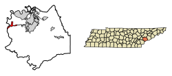
Blount County Tennessee Incorporated and Unincorporated areas Friendsville Highlighted 4728060.svg
Location of Friendsville in Blount County, Tennessee.
Coordinates: 35°45′23″N84°07′55″W / 35.75639°N 84.13194°W / 35.75639; -84.13194
Country United States
State Tennessee
County Blount
Settled1790s
Incorporated1953 [1]
Named for Friends Church (Quakers)
Government
Area
[2]
  Total2.84 sq mi (7.35 km2)
  Land2.84 sq mi (7.35 km2)
  Water0.00 sq mi (0.00 km2)
Elevation
[3]
840 ft (260 m)
Population
 (2020) [4]
  Total896
  Density315.72/sq mi (121.89/km2)
Time zone UTC-5 (Eastern (EST))
  Summer (DST) UTC-4 (EDT)
ZIP code
37737
Area code 865
FIPS code 47-28060 [5]
GNIS feature ID2403666 [3]

Friendsville is a city in Blount County, Tennessee. Its population was 896 at the 2020 census. [6] It is included in the Knoxville, Tennessee Metropolitan Statistical Area.

Contents

History

Friendsville in 1942 Friendsville-1942-tva1.gif
Friendsville in 1942

Friendsville was founded by Quakers from New Garden, North Carolina, who settled in the area in the 1790s. The town is still home to a Friends Meetinghouse. [7] In 1854, a group of British Quaker elders stayed here whilst promoting the abolitionist cause with American leaders. During this visit, abolitionist leader William Forster died and was buried here. [8]

In the 19th century, the Quakers wielded considerable influence in Blount County, and were partially responsible for the abolitionist movements arising in the county in the years leading up to the Civil War. Along with nearby Greenback and possibly Cades Cove, Friendsville provided a stop on the Underground Railroad. [9] A cave (since filled in) near the Friends Meetinghouse was stocked with provisions by Quakers such as William J. Hackney to provide a stopover for fugitive slaves and later soldiers en route to join the Union army. [10]

Friendsville today

K-5 education in Friendsville is provided by Friendsville Elementary School (part of Blount County Schools), which was once Friendsville High School. Boat launch facilities along Fort Loudoun Lake can be found at Gallahar Creek and Whispering Cove.

Friendsville is home to the Pellissippi State Community College, Blount County Campus.

Geography

Friendsville is located in western Blount County. The town is situated along State Route 333 (Miser Station Road) and stretches from Fort Loudoun Lake in the north to U.S. Route 321 (Lamar Alexander Parkway). It lies at an elevation of 879 feet (268 m).

According to the United States Census Bureau, the city has a total area of 3.0 square miles (7.8 km2), all land. [6]

Demographics

Historical population
CensusPop.Note
1880 134
1960 606
1970 575−5.1%
1980 69420.7%
1990 79214.1%
2000 89012.4%
2010 9132.6%
2020 896−1.9%
Sources: [11] [12] [4]

As of the census [5] of 2000, there were 890 people, 362 households, and 271 families residing in the city. The population density was 281.3 inhabitants per square mile (108.6/km2). There were 395 housing units at an average density of 124.8 per square mile (48.2/km2). The racial makeup of the city was 97.42% White, 0.22% African American, 0.90% Native American, 0.90% Asian, and 0.56% from two or more races. Hispanic or Latino of any race were 1.01% of the population.

There were 362 households, out of which 30.7% had children under the age of 18 living with them, 64.1% were married couples living together, 7.7% had a female householder with no husband present, and 25.1% were non-families. 22.7% of all households were made up of individuals, and 11.0% had someone living alone who was 65 years of age or older. The average household size was 2.46 and the average family size was 2.89.

In the city the population was spread out, with 22.1% under the age of 18, 7.3% from 18 to 24, 29.8% from 25 to 44, 26.4% from 45 to 64, and 14.4% who were 65 years of age or older. The median age was 40 years. For every 100 females, there were 100.9 males. For every 100 females age 18 and over, there were 99.1 males.

The median income for a household in the city was $40,833, and the median income for a family was $48,000. Males had a median income of $32,232 versus $26,382 for females. The per capita income for the city was $16,871. About 5.0% of families and 7.1% of the population were below the poverty line, including 8.9% of those under age 18 and 9.7% of those age 65 or over.

Related Research Articles

<span class="mw-page-title-main">Monroe County, Tennessee</span> County in Tennessee, United States

Monroe County is a county located on the eastern border of the U.S. state of Tennessee. As of the 2020 census, the population was 46,250. Its county seat is Madisonville, and its largest city is Sweetwater.

<span class="mw-page-title-main">Loudon County, Tennessee</span> County in Tennessee, United States

Loudon County is a county in the U.S. state of Tennessee. It is located in the central part of East Tennessee. As of the 2020 census, the population was 54,886. Its county seat is Loudon. Loudon County is included in the Knoxville, TN Metropolitan Statistical Area.

<span class="mw-page-title-main">Knox County, Tennessee</span> County in Tennessee, United States

Knox County is a county located in the U.S. state of Tennessee. As of the 2020 census, the population was 478,971, making it the third-most populous county in Tennessee. Its county seat is Knoxville, which is the third-most populous city in Tennessee. Knox County is included in the Knoxville metropolitan area. The county is located at the geographical center of the Great Valley of East Tennessee. Near the heart of the county is the origin of the Tennessee River, at the confluence of the Holston and French Broad rivers.

<span class="mw-page-title-main">Blount County, Tennessee</span> County in Tennessee, United States

Blount County is a county located in the East Tennessee Grand Division of the U.S. state of Tennessee. As of the 2020 census, its population was 135,280. The county seat is Maryville, which is also the county's largest city. Blount County is included in the Knoxville metropolitan area.

<span class="mw-page-title-main">Fountain City, Indiana</span> Town in Indiana, United States

Fountain City, formerly Newport, is a town in New Garden Township, Wayne County, in the U.S. state of Indiana. The population was 796 at the 2010 census.

<span class="mw-page-title-main">Salem, Iowa</span> City in Iowa, United States

Salem is a city in Henry County, Iowa, United States. The population was 394 at the time of the 2020 census.

<span class="mw-page-title-main">Salem, Ohio</span> City in Ohio, United States

Salem is a city in northern Columbiana County, Ohio, United States. At the 2020 census, the city's population was 11,915. Extending into southern Mahoning County, it is the principal city of the Salem micropolitan area, which includes all of Columbiana County. It lies about 18 miles (29 km) southwest of Youngstown, 28 miles (45 km) east of Canton, and 60 miles (97 km) southeast of Cleveland.

<span class="mw-page-title-main">Mount Pleasant, Ohio</span> Village in Ohio, United States

Mount Pleasant is a village in southern Jefferson County, Ohio, United States. The population was 394 at the 2020 census. It is part of the Weirton–Steubenville metropolitan area. Founded in 1803 by anti-slavery Quakers, the village was an early center of abolitionist activity and a well-known haven for fugitive slaves on the Underground Railroad.

<span class="mw-page-title-main">Friendsville, Pennsylvania</span> Borough in Pennsylvania, United States

Friendsville is a borough in Susquehanna County, Pennsylvania, United States. The population was 100 at the 2020 census.

<span class="mw-page-title-main">Montrose, Pennsylvania</span> Borough in Pennsylvania, United States

Montrose is a borough in Susquehanna County, Pennsylvania, United States, 18.41 miles (29.63 km) south-southeast of Binghamton, New York and 31.39 miles (50.52 km) north by west of Scranton. The land is elevated approximately 1,400 feet (430 m) above sea level. It is the Susquehanna County seat.

<span class="mw-page-title-main">Louisville, Tennessee</span> Town in Tennessee, United States

Louisville is a suburban town in Blount County, Tennessee. Its population was 4,384 at the 2020 census. It is included in the Knoxville, Tennessee Metropolitan Statistical Area.

<span class="mw-page-title-main">Townsend, Tennessee</span> City in Tennessee, United States

Townsend is a city in Blount County, Tennessee. The city was chartered in 1921 by persons who were involved with the Little River Railroad and Lumber Company. The population was 550 at the 2020 census. For thousands of years a site of Native American occupation by varying cultures, Townsend is one of three "gateways" to the Great Smoky Mountains National Park. It has several museums and attractions relating to the natural and human history of the Great Smokies.

<span class="mw-page-title-main">Greenback, Tennessee</span> City in Tennessee, United States

Greenback is a city in Loudon County, Tennessee, United States. Its population was at 1,102, according to the 2020 census. It is included in the Knoxville Metropolitan Statistical Area.

<span class="mw-page-title-main">Loudon, Tennessee</span> City in Tennessee, United States

Loudon is a city in and the county seat of Loudon County, Tennessee, United States. Its population was 6,001 at the 2020 census. It is included in the Knoxville, Tennessee Metropolitan Statistical Area. The city is located in East Tennessee, southwest of Knoxville, on the Tennessee River. Fort Loudoun, the colonial era fort for which the city was named, is located several miles to the south in Monroe County.

<span class="mw-page-title-main">Hillsboro, Loudoun County, Virginia</span> Town in Virginia

Hillsboro is a rural town in Loudoun County, Virginia, United States. The population was 114 at the 2020 census.

<span class="mw-page-title-main">Tabor, Iowa</span> City in Iowa, United States

Tabor is a city in Fremont County and extends northward into Mills County in the U.S. state of Iowa. The population was 928 at the time of the 2020 census.

<span class="mw-page-title-main">Seymour, Tennessee</span> CDP in Tennessee, United States

Seymour is a census-designated place (CDP) and unincorporated community in Blount and Sevier counties in the U.S. state of Tennessee. The CDP population was 14,705 at the 2020 U.S. census. It is included in the Knoxville, Tennessee Metropolitan Statistical Area.

<span class="mw-page-title-main">Vonore, Tennessee</span> Town in Tennessee, United States

Vonore is a town in Monroe County, Tennessee, which is located on the southeast border of the state. The population was 1,574 as of the 2020 census. The city hall, library, community center, police department, and fire department are located on Church Street.

<span class="mw-page-title-main">Walland, Tennessee</span> CDP in Tennessee, United States

Walland is an unincorporated community and census-designated place (CDP) in Blount County, Tennessee. Its population was 281 as of the 2020 census. Walland is the site of a post office and is the place name associated with zip code 37886, which covers an area beyond the Walland community.

Unitia is an Unincorporated community of Loudon County, Tennessee. Historically it was a crossroads village, the site of a post office, and a stop on the Underground Railroad. The historical center of the community was flooded in the 1940s by the filling of the reservoir behind Fort Loudoun Dam.

References

  1. Tennessee Blue Book , 2005-2006, pp. 618-625.
  2. "ArcGIS REST Services Directory". United States Census Bureau. Retrieved October 15, 2022.
  3. 1 2 U.S. Geological Survey Geographic Names Information System: Friendsville, Tennessee
  4. 1 2 "Census Population API". United States Census Bureau. Retrieved October 15, 2022.
  5. 1 2 "U.S. Census website". United States Census Bureau . Retrieved January 31, 2008.
  6. 1 2 "Geographic Identifiers: 2010 Demographic Profile Data (G001): Friendsville city, Tennessee". U.S. Census Bureau, American Factfinder. Archived from the original on February 12, 2020. Retrieved April 8, 2014.
  7. Information obtained from Tennessee Historical Commission marker IE 57 in Friendsville, Tennessee. Last accessed: December 25, 2007.
  8. William Tallack, Friendly sketches in America (London: A.W. Bennett, 1861), 80. Retrieved: July 17, 2008.
  9. Durwood Dunn, Cades Cove: The Life and Death of an Appalachian Community (Knoxville: University of Tennessee Press, 1988), 125.
  10. "Underground Railroad - Tennessee Stations Archived 2008-01-10 at the Wayback Machine ." The Center for Historic Preservation, Middle Tennessee State University (2005). Retrieved: December 29, 2007.
  11. "Census of Population and Housing: Decennial Censuses". United States Census Bureau . Retrieved March 4, 2012.
  12. "Incorporated Places and Minor Civil Divisions Datasets: Subcounty Resident Population Estimates: April 1, 2010 to July 1, 2012". Population Estimates. U.S. Census Bureau. Archived from the original on June 11, 2013. Retrieved December 11, 2013.