Tennessee State Route 73

Last updated

Tennessee 73.svg Secondary Tennessee 73.svg

State Route 73

TN SR 73.jpg
State Route 73 & Highway 73 Scenic Highlighted.
Route information
Maintained by TDOT
Length101.76 mi (163.77 km)
ExistedOctober 1, 1923 [1] –present
Major junctions
West endI-40.svgUS 321.svgTennessee 95.svg I-40  / US 321  / SR 95 in Lenoir City
Major intersectionsI-75.svg I-75 in Lenoir City
US 129.svg US 129 in Maryville
Foothills Parkway in Walland
US 441.svg US 441 in Pigeon Forge
Gatlinburg Bypass in Gatlinburg
US 441.svg US 441 in Gatlinburg
Foothills Parkway in Cosby
US 321.svg US 321 near Cosby
I-40.svg I-40 near Cosby
North endUS 25.svgUS 70.svg US 25  / US 70 in Newport
Location
Country United States
State Tennessee
Counties Loudon, Blount, Sevier, Cocke
Highway system
Tennessee 72.svg SR 72 SR 73US 74.svg US 74
Secondary Tennessee 336.svg SR 336 SR 337Secondary Tennessee 338.svg SR 338

State Route 73 (SR 73) is west-north state highway in East Tennessee. For most of its length, it is an unsigned companion route to U.S. Route 321 (US 321).

Contents

Route description

SR 73 begins at an interchange with Interstate 40 (I-40) concurrent with U.S. Route 321 (US 321) and SR 95 south of Oak Ridge and north of Lenoir City. The three highways head south to an intersection with US 70 and I-75 in Lenoir City. They then continue southeast to intersect US 11 in Lenoir City. SR 95 leaves US 321 and SR 73 south of Lenoir City, The two highways head east into Blount County traveling just south of Friendsville. On the edge of Maryville the highways have a short concurrency with SR 335 and intersect US 129, in downtown they intersect US 411 and SR 33. The highways then proceed out of Maryville and intersect Foothills Parkway's western segment in Chilhowee, turn south and then back east to Townsend where the highways intersect SR 73 Scenic. US 321 and mainline SR 73 turn north and SR 73 Scenic heads east into the Great Smoky Mountains National Park. The highways then continue northeasterly through Wears Valley to Pigeon Forge where they turn south onto US 441 and travel concurrent for 8.5 miles (13.7 km) to Gatlinburg (just before Gatlinburg, they have an interchange with Gatlinburg Bypass), where SR 73 and US 321 turn east and US 441 heads south. They then absorb and begin a concurrency with SR 32 in Cosby and intersect Foothills Parkway's eastern segment. SR 73 then leaves US 321 and SR 32 south of Newport. It then has a second interchange with I-40 and heads northerly to terminate at US 25 and US 70 on the east side of Newport.

Between Lenoir City and the second intersection with SR 32 in Cosby, SR 73 is an unsigned primary highway designated east–west. For the rest of its length, it is a signed secondary highway designated north–south.


Junction list

CountyLocationmikmDestinationsNotes
Loudon Lenoir City 00.0I-40.svgUS 321.svgNorth plate.svg
Tennessee 95.svg
I-40  / US 321 begin / SR 95 north (White Wing Road) Oak Ridge, Knoxville, Nashville
Northern terminus of US 321, western terminus of SR 73 and begin US 321 and SR 95 overlap; I-40 exit 364; SR 73 begins as an unsigned primary highway
US 70.svg US 70 (Kingston Pike/SR 1) Kingston, Knoxville
I-75.svg I-75  Chattanooga, Knoxville I-75 exit 81
US 11.svg US 11 (Broadway Street) Loudon, Farragut
West plate.svg
Secondary Tennessee 444.svg
SR 444 west (Tellico Parkway) Tellico Village
Interchange; eastern terminus of SR 444
South plate.svg
Secondary Tennessee 95.svg
SR 95 south Greenback
east end of SR 95 overlap
Blount Friendsville North plate.svg
Secondary Tennessee 333.svg
SR 333 north (E Main Avenue)
Southern terminus of SR 333
Maryville South plate.svg
Secondary Tennessee 335.svg
SR 335 south (William Blount Drive)
Begin SR 335 overlap
North plate.svg
Secondary Tennessee 335.svg
SR 335 north (Old Glory Road)
End SR 335 overlap
East plate.svg
Secondary Tennessee 446.svg
To plate.svg
US 129.svg
SR 446 east (Foothills Mall Drive) to US 129Foothills Mall
Western terminus of SR 446
US 129.svgAirport Sign.svg US 129 (Alcoa Highway/SR 115) Alcoa, Robbinsville Provides access to McGhee Tyson Airport
US 411.svg US 411 (West Broadway Ave/SR 33) Rockford, Madisonville
South plate.svg
Secondary Tennessee 336.svg
SR 336 south (Montvale Road)
Northern terminus of SR 336
North plate.svg
Secondary Tennessee 447.svg
To plate.svg
US 411.svg
SR 447 north (S Washington Street) to US 411  Alcoa
SR 447 is unsigned it is just signed as a connector to US 411/SR 35; southern terminus
Walland Foothills ParkwayTop of The World, Chilhowee Lake, Great Smoky Mountains National Park Look Rock areaInterchange
Townsend East plate.svg
Scenic plate Vermont.svg
Secondary Tennessee 73.svg
SR 73 Scenic east (E Lamar Alexander Parkway/SR 337 east) Great Smoky Mountains National Park
Western terminus of SR 73 Scenic and unsigned SR 337
Sevier Wears Valley Foothills Parkway Interchange; eastern terminus of western segment of the Foothills Parkway
Pigeon Forge North plate.svg
US 441.svg
US 441 north (Parkway/SR 71 north) Sevierville
Begin overlap with US 441/SR 71
North plate.svg
Tennessee 449.svg
SR 449 north (Dollywood Lane/Veterans Boulevard) Dollywood
Southern terminus of SR 449
Gatlinburg Gatlinburg BypassCherokee, Great Smoky Mountains National Park Interchange; Northern terminus of Gatlinburg Bypass
South plate.svg
US 441.svg
West plate.svg
Scenic plate Vermont.svg
Secondary Tennessee 73.svg
US 441 south / SR 73 Scenic west (Parkway/SR 71 south) Cherokee, Great Smoky Mountains National Park
East end US 441/SR 71 overlap; eastern terminus of SR 73 scenic
GatlinburgPittman Center lineNorth plate.svg
Secondary Tennessee 454.svg
SR 454 north (Buckhorn Road)
Southern terminus of SR 454
Pittman Center North plate.svg
Secondary Tennessee 416.svg
SR 416 north (Pittman Center Road) Sevierville
Southern terminus of SR 416
Cocke Cosby South plate.svg
Secondary Tennessee 32.svg
SR 32 south
Begin SR 32 overlap
Foothills Parkway to I-40.svg I-40 Western terminus of eastern segment of the Foothills Parkway
West plate.svg
Secondary Tennessee 339.svg
SR 339 west (Jones Cove Road) Sevierville
Eastern terminus of SR 339
North plate.svg
US 321.svg
North plate.svg
Tennessee 32.svg
US 321 north / SR 32 north (Cosby Highway) Newport
End of US 321 and SR 32 overlap; SR 73 becomes signed as a secondary highway; SR 73 changes cardinal directions from east-west to north-south
I-40.svg I-40  Knoxville, Asheville I-40 exit 440
Newport 101.76163.77US 25.svgUS 70.svg US 25  / US 70 (E Broadway Street/SR 9) Newport, Del Rio, Hot Springs Northern terminus; SR 73 ends as a signed secondary highway
1.000 mi = 1.609 km; 1.000 km = 0.621 mi

Scenic route

Scenic plate Vermont.svg

Secondary Tennessee 73.svg

State Route 73 Scenic

Location TownsendGreat Smoky Mountains National Park

State Route 73 Scenic (SR 73 Scenic) is a spur route of SR 73 in Blount and Sevier counties in the eastern portion of Tennessee. It serves as a connector route into the Great Smoky Mountains National Park. The road runs from Townsend to southwest of Gatlinburg. The route is also called Fighting Creek Gap Road [2] from US 441 to the Elkmont Campground entrance and Little River Gorge Road [3] to the Towsend Entrance Road. The Great Smoky Mountains National Park, as well as many locals, often refer to this stretch of park road as "Little River Road" as this road follows the former roadbed of the Little River Railroad along the Little River from the Townsend entrance to the Park to Elkmont.

It begins at US 321 and mainline SR 73 in Townsend and heads east into the Great Smoky Mountains National Park and ends its signed portion at Laurel Creek Road which goes to Cades Cove. The unsigned portion begins and continues through the park to end at US 441 in the park south of Gatlinburg, It then becomes signed again and turns north on to US 441/SR 71 and follows US 441/SR 71 for 2.7 miles to US 321/SR 73 in downtown Gatlinburg where it ends.

TDOT has this route internally designated as State Route 337 (SR 337).[ citation needed ]

SR 73 Scenic was formerly a portion of SR 73, which was moved to US 321 when that route was extended to the area in 1981.


Despite being signed Secondary on TDOT maps, in Gatlinburg, State Route 73 Scenic is signed Primary with the concurrency of U.S. 441/ SR 71 throughout the Great Smoky Mountains National Park.[ citation needed ] It is also signed as Primary along East Parkway (US 321). [4]

Junctions
CountyLocationmikmDestinationsNotes
Blount Townsend US 321.svg US 321 (East Lamar Alexander Parkway/Townsend Entrance Road/SR 73) Maryville, Pigeon Forge Western terminus
Great Smoky Mountains National Park Laurel Creek Road – Cades Cove
Sevier Wear Gap Road – Wears Valley
Elkmont Road – Elkmont
South plate.svg
US 441.svg
US 441 south (Newfound Gap Road/SR 71 south) Gatlinburg, Cherokee
Western end of US 441/SR 71 concurrency
Gatlinburg BypassPigeon Forge Interchange
Gatlinburg North plate.svg
US 441.svg
North plate.svg
US 321.svg
US 441 north / US 321 north (East Parkway/Parkway/SR 71 north/SR 73 north) Pigeon Forge, Cosby
Eastern terminus
1.000 mi = 1.609 km; 1.000 km = 0.621 mi

See also

Related Research Articles

<span class="mw-page-title-main">Sevier County, Tennessee</span> County in Tennessee, United States

Sevier County is a county of the U.S. state of Tennessee. As of the 2020 census, the population was 98,380. Its county seat and largest city is Sevierville. Sevier County comprises the Sevierville, TN Micropolitan Statistical Area, which is included in the Knoxville-Morristown-Sevierville, TN Combined Statistical Area.

<span class="mw-page-title-main">Townsend, Tennessee</span> City in Tennessee, United States

Townsend is a city in Blount County, Tennessee, in the southeastern United States. The city was chartered in 1921 by persons who were involved with the Little River Railroad and Lumber Company. The population was 244 at the 2000 census and 448 at the 2010 census. For thousands of years a site of Native American occupation by varying cultures, Townsend is one of three "gateways" to the Great Smoky Mountains National Park. It has several museums and attractions relating to the natural and human history of the Great Smokies.

<span class="mw-page-title-main">Little River (Tennessee)</span> River in Tennessee, United States

Little River is a 60-mile (97 km) river in Tennessee which drains a 380-square-mile (980 km2) area containing some of the most spectacular scenery in the southeastern United States. The first 18 miles (29 km) of the river are all located within the borders of the Great Smoky Mountains National Park. The remaining 42 miles (68 km) flow out of the mountains through Blount County to join the Tennessee River at Fort Loudon Lake in Knox County.

<span class="mw-page-title-main">U.S. Route 411</span> Numbered U.S. Highway in Alabama, Georgia, and Tennessee in the United States

U.S. Route 411 (US 411) is an alternate parallel-highway associated with US 11. It extends for about 309.7 miles (498.4 km) from US 78 in Leeds, Alabama, to US 25W/US 70 in Newport, Tennessee. US 411 travels through northeastern Alabama, northwestern Georgia, and southeastern Tennessee. It is signed north-south, as with most highways that have odd numbers, but the route runs primarily in a northeast-southwest direction, and covers a more east-west mileage than it does north-south. Notable towns and cities along its route include Gadsden, Alabama; Rome, Georgia; Cartersville, Georgia; Maryville, Tennessee; Sevierville, Tennessee, and Newport, Tennessee.

<span class="mw-page-title-main">U.S. Route 321</span> Highway in the United States

U.S. Route 321 (US 321) is a spur of U.S. Route 21. It runs for 516.9 miles (831.9 km) from Hardeeville, South Carolina to Lenoir City, Tennessee; with both serving as southern termini. It reaches its northernmost point at Elizabethton, Tennessee, just northeast of Johnson City. Because of its unusual "north–south–north" routing, U.S. Route 321 intersects both Interstate 40 and U.S. Route 70 three separate times. The highway serves different roles in each state: An alternate route to interstates in South Carolina, a major highway in North Carolina, and a scenic route in Tennessee.

<span class="mw-page-title-main">U.S. Route 129</span>

U.S. Route 129 (US 129) is an auxiliary route of US 29, which it intersects in Athens, Georgia. US 129 currently runs for 582 miles (937 km) from an intersection with US 19/US 27 ALT/US 98 in Chiefland, Florida, to an interchange with Interstate 40 (I-40) in Knoxville, Tennessee. It passes through the states of Florida, Georgia, North Carolina, and Tennessee. It goes through the cities of Macon, Athens, Gainesville, and Knoxville.

<span class="mw-page-title-main">U.S. Route 441</span> Highway in the United States

U.S. Route 441 (US 441) is a 939-mile-long (1,511 km) auxiliary route of U.S. Route 41. It extends from US 41 in Miami, Florida to US 25W in Rocky Top, Tennessee. Between its termini, US 441 travels through the states of Florida, Georgia, North Carolina, and Tennessee. The highway acts as a connector between several major urban areas, including Miami, Orlando, Ocala, Gainesville, Athens, and Knoxville. It also crosses the Great Smoky Mountains National Park, where it meets the southwestern end of the Blue Ridge Parkway, and where no trucks or other commercial traffic are allowed.

The Great Smoky Mountains Parkway is a highway that travels 23.4 miles (37.7 km) between the Great Smoky Mountains National Park and Interstate 40 in Kodak, Tennessee, in East Tennessee. It serves as the main thoroughfare for Gatlinburg, Pigeon Forge, and Sevierville, and includes a 4.3-mile (6.9 km) spur of the Foothills Parkway. It is composed of sections of a number of numbered highways, including U.S. routes 441 and 321 and state routes 66 and 448.

<span class="mw-page-title-main">Gatlinburg Bypass</span> Bypass route in Sevier County, Tennessee, US

The Gatlinburg Bypass is a 3.6-mile-long (5.8 km) bypass of the resort city of Gatlinburg in Sevier County, Tennessee. The route is owned and maintained by the National Park Service and is considered part of the Great Smoky Mountains National Park.

<span class="mw-page-title-main">Tennessee State Route 2</span> State highway in Tennessee, United States

State Route 2 is a 197-mile-long (317 km) west–to–east state highway in the U.S. state of Tennessee. It begins in Murfreesboro, in Rutherford County, and ends near Farragut in Loudon County. The route is both a primary and secondary route. Most of the route is unsigned.

<span class="mw-page-title-main">Tennessee State Route 66</span>

State Route 66 is a state-maintained highway in eastern Tennessee, including a six-lane divided highway known as Winfield Dunn Parkway in Sevier County, a four-lane expressway in Hamblen and Jefferson counties and a two-lane rural collector through mountainous terrain continuing to the northeast terminus in Hancock County.

<span class="mw-page-title-main">Tennessee State Route 71</span>

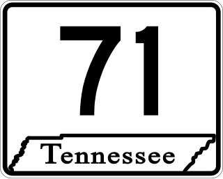
State Route 71 is a north–south state highway in Tennessee. For most of the length it is a "hidden" route, as it coincides with US 441 in all but a short section in Knoxville. The road begins at the North Carolina state line in Sevier County within the Great Smoky Mountains National Park at Newfound Gap and ends at an intersection with US 25W, SR 116, and SR 9 (hidden) in Rocky Top. Along its length SR 71 passes through Sevier County, a small portion of Blount County, Knox County, Anderson County, and in and out of Campbell County. Despite being signed on Hall of Fame Parkway in Knoxville, Tennessee, the Knox County TDOT map ignores SR 71 while SR 33 has a concurrency with US 441.

<span class="mw-page-title-main">U.S. Route 441 in Tennessee</span> U.S. Highway in Tennessee

U.S. Route 441 stretches for 83.28 miles (134.03 km) through the mountains of East Tennessee, connecting Rocky Top with Knoxville, Sevierville, Gatlinburg, and the Great Smoky Mountains National Park, crossing into North Carolina at Newfound Gap. Near its northern terminus, US 441 crosses over Norris Dam and passes through Norris Dam State Park.

<span class="mw-page-title-main">U.S. Route 129 in Tennessee</span>

U.S. Route 129 is a north–south United States highway that runs for 52.8 miles (85.0 km) in East Tennessee, from the North Carolina state line, near Tapoco, to Knoxville. In Tennessee, the highway is completely overlapped by unsigned State Route 115. In the Greater Knoxville area, US 129 serves as a six-lane controlled-access highway known as Alcoa Highway.

<span class="mw-page-title-main">U.S. Route 11 in Tennessee</span> Highway in Tennessee

U.S. Route 11 (US 11) in the U.S. state of Tennessee travels from the Georgia state line in Chattanooga to Knoxville, where it then splits into US 11E and US 11W. These two highways then travel to the Virginia state line near Kingsport and Bristol. During its length, it shares concurrencies with State Route 2 (SR 2) and SR 38.

<span class="mw-page-title-main">U.S. Route 441 in North Carolina</span> Highway in North Carolina

U.S. Route 441 (US 441) is a north–south United States Highway that runs from Miami, Florida to Rocky Top, Tennessee. In the U.S. state of North Carolina, US 441 travels for 64.5 miles (103.8 km) from the Georgia state line near Dillard, Georgia to the Tennessee state line in the Great Smoky Mountains National Park. US 441 is a primary route connecting the cities of Franklin, Sylva, and Cherokee in western North Carolina. The highway runs concurrently with other U.S. highways for much of its routing in North Carolina including US 23 from the Georgia state line to Dillsboro, US 64 in Franklin, US 74 from Dillsboro to near Qualla, and US 19 in Cherokee. US 441 has two business routes in North Carolina, in Franklin and Cherokee.

<span class="mw-page-title-main">Tennessee State Route 449</span>

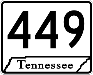
State Route 449 is a 6.2-mile-long (10.0 km) north–south state highway in Sevier County, within the eastern part of the U.S. state of Tennessee. It travels from US 411 overlaying Veterans Boulevard and some of Middle Creek Road in Sevierville south to US 441/US 321 (Parkway) in Pigeon Forge. It serves as a bypass around the busy tourist areas in Sevierville and Pigeon Forge.

<span class="mw-page-title-main">Tennessee State Route 33</span> State highway in Tennessee, United States

State Route 33 is a primary and secondary route in East Tennessee. It runs 176 miles, from the Georgia state line in Polk County, northeast to the Virginia state line north of Kyles Ford in Hancock County. South of Maryville, SR 33 is a "hidden" route which shares a concurrency with US 411.

<span class="mw-page-title-main">Tennessee State Route 32</span> State unsigned highway in Tennessee

State Route 32 is a state highway in East Tennessee. For most of its route, it is an unsigned companion route concurrent with U.S. Route 25E. The highway stretches 89 miles from the North Carolina state line to the Tennessee-Kentucky state line near the town of Cumberland Gap.

References

  1. Highway Planning Survey Division (1925). Biennial Report of the Commissioner of the Department of Highways and Public Works State of Tennessee for the Years 1923 and 1924 (PDF) (Report). Nashville: Tennessee Department of Highways and Public Works. pp. 39–44. Retrieved May 19, 2023.
  2. "Park Tiles". National Park Service. Retrieved 2016-04-12.
  3. "Park Tiles". National Park Service. Retrieved 2016-04-12.
  4. Sign located near 200 East Parkway across the road from Clarion Pointe Downtown Gatlinburg Hotel on a light pole.