Loudon County, Tennessee

Last updated

Loudon County
Loudon County, Tennessee Courthouse.JPG
The Loudon County Courthouse in Loudon
Map of Tennessee highlighting Loudon County.svg
Location within the U.S. state of Tennessee
Tennessee in United States.svg
Tennessee's location within the U.S.
Coordinates: 35°44′N84°19′W / 35.73°N 84.31°W / 35.73; -84.31
CountryFlag of the United States.svg United States
StateFlag of Tennessee.svg  Tennessee
Founded1870
Named for Fort Loudoun [1]
Seat Loudon
Largest city Lenoir City (population)
Loudon (area)
Government
  County MayorRollen "Buddy" Bradshaw
Area
  Total247 sq mi (640 km2)
  Land229 sq mi (590 km2)
  Water18 sq mi (50 km2)  7.3%
Population
 (2020)
  Total54,886 Increase2.svg
  Density212/sq mi (82/km2)
Time zone UTC−5 (Eastern)
  Summer (DST) UTC−4 (EDT)
Congressional district 2nd
Website www.loudoncounty-tn.gov

Loudon County is a county in the U.S. state of Tennessee. It is located in the central part of East Tennessee. As of the 2020 census, the population was 54,886. [2] Its county seat is Loudon. [3] Loudon County is included in the Knoxville, TN Metropolitan Statistical Area.

Contents

History

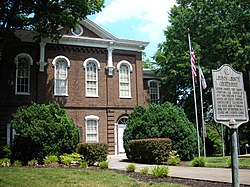
Loudon County was formed on May 27, 1870, from portions of Roane, Monroe and Blount counties. [4] Originally, it was named Christiana County, but a few days later the name was changed to Loudon in honor of nearby colonial-era Fort Loudoun. The fort was named for John Campbell, 4th Earl of Loudoun and a commander of British forces during the French and Indian Wars. In August 1870, the county officers were chosen. On September 5, 1870, the county court was organized at the Baptist Church in Loudon. This church became the temporary quarters of the county court until the new building, built by J. W. Clark & Brothers, was finished in 1872. [4] Bussell Island, at the mouth of the Little Tennessee River, was inhabited by Native Americans for several thousand years before the arrival of the region's first European settlers. [5] The Overhill Cherokee village of Mialoquo was located along the Little Tennessee near modern Tellico Village. [6] Fort Loudoun was constructed by the British near modern Vonore in 1756, and was destroyed by the Cherokee four years later.

Loudon County was formed from parts of Roane, Monroe and Blount counties. Loudon County Creation.svg
Loudon County was formed from parts of Roane, Monroe and Blount counties.

One of the earliest American settlements in what is now Loudon County was a river port and ferry known as Morganton, once located on the banks of the Little Tennessee River near modern Greenback. Morganton thrived during the early 19th century, but declined with the rise of the railroad in the latter half of the century. The town's remnants were inundated by Tellico Lake in the 1970s. [7]

Lenoir City is rooted in a plantation established by William Ballard Lenoir in 1810, which by the 1850s included a railroad stop known as Lenoir Station. The Lenoir City Company, established by Knoxville financiers Charles McClung McGhee and Edward J. Sanford, platted modern Lenoir City in the 1890s. [8]

The town of Loudon began as a ferry and later steamboat stop known as Blair's Ferry, established by James Blair and his brother-in-law, John Hudson Carmichael, in the 1810s. The town changed its name to "Loudon" during the early 1850s, when it expanded following the arrival of the railroad. [9] The railroad bridge at Loudon was one of eight bridges targeted for destruction by Union guerillas as part of the East Tennessee bridge-burning conspiracy in November 1861, at the outset of the Civil War. The bridge was too well-guarded by Confederate sentries, however, and the guerillas abandoned the effort. [10]

Geography

Creek in Philadelphia Philadelphia-Bacon-Creek-bridge-tn1.jpg
Creek in Philadelphia

According to the U.S. Census Bureau, the county has a total area of 247 square miles (640 km2), of which 229 square miles (590 km2) is land and 18 square miles (47 km2) (7.3%) is water. [11]

The Little Tennessee River joins the Tennessee River at Lenoir City. The lower part of the Little Tennessee River is part of Tellico Lake, created by Tellico Dam near the mouth of the river. Fort Loudoun Dam spans the Tennessee River just upstream from its confluence with the Little Tennessee, creating Fort Loudoun Lake. The section of the river downstream from Fort Loudoun Dam is part of Watts Bar Lake.

Adjacent counties

State protected areas

Demographics

Historical population
CensusPop.Note
1880 9,148
1890 9,2731.4%
1900 10,83816.9%
1910 13,61225.6%
1920 16,27519.6%
1930 17,8059.4%
1940 19,83811.4%
1950 23,18216.9%
1960 23,7572.5%
1970 24,2662.1%
1980 28,55317.7%
1990 31,2559.5%
2000 39,08625.1%
2010 48,55624.2%
2020 54,88613.0%
U.S. Decennial Census [12]
1790-1960 [13] 1900-1990 [14]
1990-2000 [15] 2010-2014 [2]
Age pyramid Loudon County USA Loudon County, Tennessee.csv age pyramid.svg
Age pyramid Loudon County

2020 census

Loudon County racial composition [17]
RaceNumberPercentage
White (non-Hispanic)46,41984.57%
Black or African American (non-Hispanic)5781.05%
Native American 950.17%
Asian 4500.82%
Pacific Islander 20.0%
Other/Mixed 1,9863.62%
Hispanic or Latino 5,3569.76%

As of the 2020 United States census, there were 54,886 people, 20,669 households, and 14,615 families residing in the county. Approximately, 30,449 people [18] are native to the state.

2010 census

As of the census of 2010, [19] there were 48,556 people, 19,826 households, and 14,483 families living in the county. The population density was 212.03 persons per square mile (81.87 persons/km2). The housing unit density was 86.58 units per square mile (33.43/km2). The racial makeup of the county was 95.35% White, 1.11% African American, 0.28% Native American, 0.59% Asian, 0.10% Pacific Islander, and 1.08% from two or more races. 6.99% were Hispanic or Latino of any race.

Of the 19,826 households, 23.52% had children under the age of 18 living in them, 60.10% were married couples, 4.13% had a male householder with no wife present, 8.82% had a female householder with no husband present, and 16.95% were non-families. 23.21% were one person and 11.17% were one person aged 65 or older. The average household size was 2.42 and the average family size was 2.82.

The age distribution was 20.32% under the age of 18, 58.19% ages 18 to 64, and 21.49% age 65 and older. The median age was 46.0 years. 50.93% of the population were females and 49.07% were males.

The median household income in the county was $49,343, and the median family income was $59,044. Males had a median income of $44,110, versus $29,441 for females. The per capita income for the county was $27,046. About 9.2% of families and 13.8% of the population were below the poverty line, including 23.8% of those under the age of 18 and 6.8% of those age 65 and over.

2000 census

At the 2000 census there were 39,086 people, 15,944 households, and 11,798 families living in the county. The population density was 171 people per square mile (66 people/km2). There were 17,277 housing units at an average density of 76 units per square mile (29/km2). The racial makeup of the county was 95.90% White, 1.14% Black or African American, 0.32% Native American, 0.21% Asian, 0.02% Pacific Islander, 1.43% from other races, and 0.98% from two or more races. 2.29% of the population were Hispanic or Latino of any race. [20] Of the 15,944 households 28.40% had children under the age of 18 living with them, 61.70% were married couples living together, 8.90% had a female householder with no husband present, and 26.00% were non-families. 22.80% of households were one person and 10.10% were one person aged 65 or older. The average household size was 2.42 and the average family size was 2.82.

The age distribution was 21.90% under the age of 18, 6.70% from 18 to 24, 27.50% from 25 to 44, 27.70% from 45 to 64, and 16.20% 65 or older. The median age was 41 years. For every 100 females, there were 95.10 males. For every 100 females age 18 and over, there were 92.10 males.

The median household income was $40,401 and the median family income was $46,517. Males had a median income of $33,567 versus $23,164 for females. The per capita income for the county was $21,061. About 6.90% of families and 10.00% of the population were below the poverty line, including 12.80% of those under age 18 and 9.00% of those age 65 or over.

Education

The public schools in all areas of the county except Lenoir City are operated by Loudon County Schools.

Loudon County Schools

Lenoir City Schools

Communities

Cities

Towns

Census-designated place

Unincorporated communities

Politics

United States presidential election results for Loudon County, Tennessee [21]
Year Republican Democratic Third party
No.%No.%No.%
2020 21,71373.99%6,94823.68%6862.34%
2016 17,61075.29%4,91921.03%8623.69%
2012 16,70775.69%5,05822.91%3081.40%
2008 15,81571.29%6,05827.31%3111.40%
2004 14,04170.69%5,70828.74%1150.58%
2000 10,26662.57%5,90535.99%2351.43%
1996 7,09751.69%5,55240.44%1,0817.87%
1992 6,44447.70%5,41440.07%1,65212.23%
1988 7,12266.69%3,48032.59%770.72%
1984 7,11368.36%3,22731.01%650.62%
1980 6,38261.51%3,69935.65%2952.84%
1976 4,45848.28%4,68350.72%921.00%
1972 5,35775.12%1,60422.49%1702.38%
1968 4,29954.58%1,58120.07%1,99625.34%
1964 4,14855.21%3,36544.79%00.00%
1960 5,35665.47%2,72233.27%1031.26%
1956 4,58360.91%2,84437.80%971.29%
1952 4,31166.52%2,13832.99%320.49%
1948 2,60557.70%1,67337.05%2375.25%
1944 3,14765.74%1,63234.09%80.17%
1940 2,22651.56%2,06847.90%230.53%
1936 2,34351.99%2,14647.61%180.40%
1932 1,81751.87%1,62946.50%571.63%
1928 2,12778.23%58921.66%30.11%
1924 1,53366.59%70330.54%662.87%
1920 1,87272.70%68626.64%170.66%
1916 69862.10%42337.63%30.27%
1912 32229.51%41538.04%35432.45%

See also

Related Research Articles

<span class="mw-page-title-main">Roane County, Tennessee</span> County in Tennessee, United States

Roane County is a county of the U.S. state of Tennessee. As of the 2020 census, the population was 53,404. Its county seat is Kingston. Roane County is included in the Knoxville, TN Metropolitan Statistical Area.

<span class="mw-page-title-main">Morgan County, Tennessee</span> County in Tennessee, United States

Morgan County is a county located in the U.S. state of Tennessee. As of the 2020 census, the population was 21,035. Its county seat is Wartburg. Morgan County is part of the Knoxville, TN Combined Statistical Area.

<span class="mw-page-title-main">Monroe County, Tennessee</span> County in Tennessee, United States

Monroe County is a county located on the eastern border of the U.S. state of Tennessee. As of the 2020 census, the population was 46,250. Its county seat is Madisonville, and its largest city is Sweetwater.

<span class="mw-page-title-main">Knox County, Tennessee</span> County in Tennessee, United States

Knox County is located in the U.S. state of Tennessee. As of the 2020 census, the population was 478,971, making it the third-most populous county in Tennessee. Its county seat is Knoxville, which is the third-most populous city in Tennessee. Knox County is included in the Knoxville metropolitan area. The county is located at the geographical center of the Great Valley of East Tennessee. Near the heart of the county is the origin of the Tennessee River, at the confluence of the Holston and French Broad rivers.

<span class="mw-page-title-main">Blount County, Tennessee</span> County in Tennessee, United States

Blount County is a county located in the East Tennessee Grand Division of the U.S. state of Tennessee. As of the 2020 census, its population was 135,280. The county seat is Maryville, which is also the county's largest city. Blount County is included in the Knoxville metropolitan area.

<span class="mw-page-title-main">Anderson County, Tennessee</span> County in Tennessee, United States

Anderson County is a county in the U.S. state of Tennessee. It is located in the northern part of the state in East Tennessee. As of the 2020 census, its population was 77,123. Its county seat is Clinton. Anderson County is included in the Knoxville, TN Metropolitan Statistical Area.

<span class="mw-page-title-main">Friendsville, Tennessee</span> City in Tennessee, United States

Friendsville is a city in Blount County, Tennessee. Its population was 896 at the 2020 census. It is included in the Knoxville, Tennessee Metropolitan Statistical Area.

<span class="mw-page-title-main">Louisville, Tennessee</span> Town in Tennessee, United States

Louisville is a suburban town in Blount County, Tennessee. Its population was 4,384 at the 2020 census. It is included in the Knoxville, Tennessee Metropolitan Statistical Area.

<span class="mw-page-title-main">Maryville, Tennessee</span> City in Tennessee, United States

Maryville is a city in and the county seat of Blount County, Tennessee. Its population was 31,907 at the 2020 census.

<span class="mw-page-title-main">Greenback, Tennessee</span> City in Tennessee, United States

Greenback is a city in Loudon County, Tennessee, United States. Its population was at 1,102, according to the 2020 census. It is included in the Knoxville Metropolitan Statistical Area.

<span class="mw-page-title-main">Lenoir City, Tennessee</span> City in Tennessee, United States

Lenoir City is a suburban city located in Loudon County, Tennessee. The population was 10,117 at the 2020 census. It is included in the Knoxville metropolitan area in East Tennessee, along the Tennessee River southwest of Knoxville.

<span class="mw-page-title-main">Loudon, Tennessee</span> City in Tennessee, United States

Loudon is a city in and the county seat of Loudon County, Tennessee, United States. Its population was 6,001 at the 2020 census. It is included in the Knoxville, Tennessee Metropolitan Statistical Area. The city is located in East Tennessee, southwest of Knoxville, on the Tennessee River. Fort Loudoun, the colonial era fort for which the city was named, is located several miles to the south in Monroe County.

<span class="mw-page-title-main">Philadelphia, Tennessee</span> City in Tennessee, United States

Philadelphia is a city in Loudon County, Tennessee, United States. Its population was 656 at the 2010 census. It is included in the Knoxville Metropolitan Statistical Area.

<span class="mw-page-title-main">Athens, Tennessee</span> City in Tennessee, United States

Athens is the county seat of McMinn County, Tennessee, United States and the principal city of the Athens Micropolitan Statistical Area has a population of 53,569. The city is located almost equidistantly between the major cities of Knoxville and Chattanooga. The population was 14,084 at the 2020 census. The population of the zipcode area is at 23,726

<span class="mw-page-title-main">Englewood, Tennessee</span> Town in Tennessee, United States

Englewood is a town in McMinn County, Tennessee, United States. The population was 1,550 in 2020.

<span class="mw-page-title-main">Tellico Plains, Tennessee</span> Town in Tennessee, United States

Tellico Plains is a town in Monroe County, Tennessee, United States. The population was 859 at the 2000 census and 880 at the 2010 census. Tellico Plains is home to several communities that include Coker Creek, Belltown, Rafter, Mount Vernon, Rural Vale, and more.

<span class="mw-page-title-main">Kingston, Tennessee</span> City in Tennessee, United States

Kingston is a city in and the county seat of Roane County, Tennessee, United States. This city is thirty-six miles southwest of Knoxville. It had a population of 5,934 at the 2010 United States census, and is included in the Harriman, Tennessee Micropolitan Statistical Area. Kingston is adjacent to Watts Bar Lake.

<span class="mw-page-title-main">Vonore, Tennessee</span> Town in Tennessee, United States

Vonore is a town in Monroe County, Tennessee, which is located on the southeast border of the state. The population was 1,574 as of the 2020 census. The city hall, library, community center, police department, and fire department are located on Church Street.

<span class="mw-page-title-main">Farragut, Tennessee</span> Town in Tennessee, United States

Farragut is a suburban town located in Knox and Loudon counties in the State of Tennessee, United States. The town's population was 23,506 at the 2020 census. It is included in the Knoxville Metropolitan Area. The town is named in honor of Union Admiral David Farragut, who was born just east of Farragut at Campbell's Station in 1801, and fought in the American Civil War.

<span class="mw-page-title-main">Morganton, Tennessee</span> Former town in Tennessee, United States

Morganton was a community that developed on the Little Tennessee River in Loudon County, Tennessee, in the southeastern United States. It was located 13.7 miles (22.0 km) above the mouth of the river at its confluence with Bakers Creek, flowing westward from Maryville. During its heyday in the 19th century, Morganton thrived as a flatboat port and regional business center. An important ferry operated at Morganton for nearly 170 years providing service across the river. The abandoned townsite was submerged in the late 20th century by creation of Tellico Lake, part of the Tellico Dam hydroelectric project completed in 1979 by the Tennessee Valley Authority (TVA).

References

  1. Origins Of Tennessee County Names, Tennessee Blue Book 2005-2006, pages 508-513
  2. 1 2 "State & County QuickFacts". United States Census Bureau. Archived from the original on June 7, 2011. Retrieved December 3, 2013.
  3. "Find a County". National Association of Counties. Retrieved June 7, 2011.
  4. 1 2 Joe Spence, "Loudon County," Tennessee Encyclopedia of History and Culture. Retrieved: October 22, 2013.
  5. M.R. Harrington, Cherokee and Earlier Remains on Upper Tennessee River (New York: Museum of the American Indian, Heye Foundation, 1922), pp. 61–82.
  6. Kurt Russ and Jefferson Chapman, Archaeological Investigations at the Eighteenth Century Overhill Cherokee Town of Mialoquo (40MR3) (University of Tennessee Department of Anthropology, Report of Investigations 37, 1983), pp. 16-18.
  7. James Polhemus and Richard Polhemus, An Assessment of the Archaeological Potential of Townsite of Morganton in Loudon County, Tennessee (Knoxville, Tenn.: Tennessee Valley Authority, 1978), pp. 1-2.
  8. John Benhart, Appalachian Aspirations: The Geography of Urbanization and Development in the Upper Tennessee River Valley, 1865-1900 (Knoxville, Tenn.: University of Tennessee Press, 2007), pp. 74-79.
  9. Benhart, Appalachian Aspirations, pp. 23-25.
  10. Oliver Perry Temple, East Tennessee and the Civil War (Cincinnati: The Robert Clark Company, 1899), pp. 370–406.
  11. "2010 Census Gazetteer Files". United States Census Bureau. August 22, 2012. Retrieved April 7, 2015.
  12. "U.S. Decennial Census". United States Census Bureau. Retrieved April 7, 2015.
  13. "Historical Census Browser". University of Virginia Library. Retrieved April 7, 2015.
  14. Forstall, Richard L., ed. (March 27, 1995). "Population of Counties by Decennial Census: 1900 to 1990". United States Census Bureau. Retrieved April 7, 2015.
  15. "Census 2000 PHC-T-4. Ranking Tables for Counties: 1990 and 2000" (PDF). United States Census Bureau. April 2, 2001. Archived (PDF) from the original on October 9, 2022. Retrieved April 7, 2015.
  16. Based on 2000 census data
  17. "Explore Census Data". data.census.gov. Retrieved December 26, 2021.
  18. "Explore Census Data". data.census.gov. Retrieved February 29, 2024.
  19. "U.S. Census website". United States Census Bureau . Retrieved September 19, 2019.
  20. "U.S. Census website". United States Census Bureau . Retrieved May 14, 2011.
  21. Leip, David. "Dave Leip's Atlas of U.S. Presidential Elections". uselectionatlas.org. Retrieved March 11, 2018.

35°44′N84°19′W / 35.73°N 84.31°W / 35.73; -84.31