Hardin County, Tennessee

Last updated

Hardin County
Hardin County, Tennessee courthouse in Savannah, Tennessee.jpg
Hardin County Courthouse in Savannah
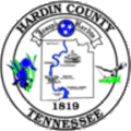
Hardin-co-tn.gif
Map of Tennessee highlighting Hardin County.svg
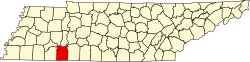
Location within the U.S. state of Tennessee
Tennessee in United States.svg
Tennessee's location within the U.S.
Coordinates: 35°12′N88°11′W / 35.2°N 88.19°W / 35.2; -88.19
CountryFlag of the United States.svg United States
StateFlag of Tennessee.svg  Tennessee
Founded1819
Named for Joseph Hardin, Sr. [1]
Seat Savannah
Largest citySavannah
Government
  MayorKevin Davis [2]
Area
  Total596 sq mi (1,540 km2)
  Land577 sq mi (1,490 km2)
  Water19 sq mi (50 km2)  3.2%
Population
 (2020)
  Total26,831 Increase2.svg
  Density45/sq mi (17/km2)
Time zone UTC−6 (Central)
  Summer (DST) UTC−5 (CDT)
Congressional district 8th

Hardin County is a county located in the U.S. state of Tennessee. As of the 2020 census, the population was 26,831. [3] The county seat is Savannah. [4] Hardin County is located north of and along the borders of Mississippi and Alabama. The county was founded in November 1819 and named posthumously for Col. Joseph Hardin, a Revolutionary War soldier and a legislative representative for the Province of North Carolina; the State of Franklin; and the Southwest Territory. [5] Hardin County was the site of the Battle of Shiloh (also known as the Battle of Pittsburg Landing) during the Civil War.

Contents

History

The dedication plaque for the Savannah, TN courthouse which is dedicated to Col. Joseph Hardin. Joseph Hardin Courthouse Plaque Savannah TN.JPG
The dedication plaque for the Savannah, TN courthouse which is dedicated to Col. Joseph Hardin.

The Hardin Expedition

Two parties of settlers (totaling 26) struck out from Knoxville, Tennessee in late spring of 1816 bound for the general area which would eventually become Savannah, Tennessee. The first party, traveling by boat, came by way of the Tennessee River, landing in May at "the easteward curve of the Tennessee"[ sic ] [6] at Cerro Gordo.

The second, and larger, party had traversed overland and encountered several delays. Upon the arrival of the second group, the parties finally rejoined at Johnson Creek, near present day Savannah. [Notes 1] [7] It was now July, and the pioneers set about the laying down of the first permanent settlement by non-Native Americans in the area. [8]

This second party was led by Joseph Hardin, Jr., son of Col. Joseph Hardin who had, before his death, accumulated several land grants to the area as rewards for his Revolutionary War service. Joseph, Jr. was accompanied on the trip by his brother, James Hardin. James was the founder of what would become the first county seat, Hardinville. [5] The settlement was created in 1817 on nearby Hardin’s Creek —on the site of what was later renamed Old Town, Tennessee. [8] Both men executed land grants in the area. [9] They had fought alongside their father in the war and had been likewise rewarded with their own land patents, as well as inheriting some of their father's unclaimed grants. [7] [10]

Other settlers in the expedition continued further downriver, establishing another community at Saltillo, in 1817.

County creation

For eleven days after its initial establishment (in November 1819), the boundaries of Hardin County reached from Wayne County west to the Mississippi River. The establishment of then neighboring Shelby County and others continued to diminish the size of Hardin until it reached its present boundaries. [5] The county was named for Revolutionary War veteran, Joseph Hardin, a former colonial assemblyman for the Province of North Carolina, Speaker of the House for the unrecognized State of Franklin and a territorial legislator of the Southwest Territory.

Civil War and Battle of Shiloh

Like several other counties along the Tennessee River, Hardin County was largely pro-Union during the Civil War, contrary to the generally pro-Confederate sympathies of West and Middle Tennessee. In Tennessee's Ordinance of Secession referendum on June 8, 1861, Hardin County voted to remain in the Union by a margin of 1,051 to 498, [11] being one of only eight counties in West or Middle Tennessee to support the Union. Earlier on February 9, 1861, Hardin County voters had voted against holding a secession convention by a margin of 791 to 395. [12]

Hardin County was the site of the 1862 Battle of Shiloh (also known as the Battle of Pittsburg Landing) during the Civil War. The battleground is several miles south of Savannah, and extends into Tishomingo County, Mississippi.

Geography

According to the U.S. Census Bureau, the county has a total area of 596 square miles (1,540 km2), of which 577 square miles (1,490 km2) is land and 19 square miles (49 km2) (3.2%) is water. [13]

Hardin County is located in western southern Tennessee (although part of the county is east of the Tennessee River, the county is considered part of the "Grand Division" of West Tennessee). The county is divided into two nearly equal divisions by the Tennessee River, which enters about midway on the south side and passes out near the northeast corner, flowing northwards. The length of the county from north to south is about 30 miles, and its greatest width, from east to west, about 21. [14]

Pickwick Dam and Lake Pickwick Landing Dam from Pickwick Inn 096.jpg
Pickwick Dam and Lake

Adjacent counties

National protected area

State protected areas

Demographics

Historical population
CensusPop.Note
1820 1,462
1830 4,868233.0%
1840 8,24569.4%
1850 10,32825.3%
1860 11,2148.6%
1870 11,7684.9%
1880 14,79325.7%
1890 17,69819.6%
1900 19,2468.7%
1910 17,521−9.0%
1920 17,291−1.3%
1930 16,213−6.2%
1940 17,8069.8%
1950 16,908−5.0%
1960 17,3972.9%
1970 18,2124.7%
1980 22,28022.3%
1990 22,6331.6%
2000 25,57813.0%
2010 26,0261.8%
2020 26,8313.1%
U.S. Decennial Census [15]
1790-1960 [16] 1900-1990 [17]
1990-2000 [18] 2010-2014 [3]
Age pyramid Hardin County USA Hardin County, Tennessee.csv age pyramid.svg
Age pyramid Hardin County

2020 census

Hardin County racial composition [20]
RaceNum.Perc.
White (non-Hispanic)24,27290.46%
Black or African American (non-Hispanic)8053.0%
Native American 810.3%
Asian 1480.55%
Other/Mixed 9603.58%
Hispanic or Latino 5652.11%

As of the 2020 United States census, there were 26,831 people, 10,137 households, and 7,203 families residing in the county.

2000 census

At the 2000 census there were 25,578 people, 10,426 households, and 7,444 families in the county. The population density was 44 people per square mile (17 people/km2). There were 12,807 housing units at an average density of 22 units per square mile (8.5 units/km2). The racial makeup of the county was 94.91% White, 3.69% Black or African American, 0.20% Native American, 0.16% Asian, 0.02% Pacific Islander, 0.30% from other races, and 0.72% from two or more races. 1.02%. [21] were Hispanic or Latino of any race. 45.1% were of American, 9.8% Irish, 9.7% English and 9.5% German ancestry according to Census 2000.

Of the 10,426 households 29.70% had children under the age of 18 living with them, 57.30% were married couples living together, 10.10% had a female householder with no husband present, and 28.60% were non-families. 25.50% of households were one person and 11.80% were one person aged 65 or older. The average household size was 2.41 and the average family size was 2.87.

The age distribution was 23.10% under the age of 18, 7.90% from 18 to 24, 26.60% from 25 to 44, 26.40% from 45 to 64, and 16.10% 65 or older. The median age was 40 years. For every 100 females there were 96.70 males. For every 100 females age 18 and over, there were 92.20 males.

The median household income was $27,819 and the median family income was $34,157. Males had a median income of $28,357 versus $18,806 for females. The per capita income for the county was $15,598. About 14.60% of families and 18.80% of the population were below the poverty line, including 25.80% of those under age 18 and 17.80% of those age 65 or over.

Politics

United States presidential election results for Hardin County, Tennessee [22]
Year Republican Democratic Third party
No.%No.%No.%
2020 9,55982.85%1,77515.38%2041.77%
2016 8,01280.53%1,62216.30%3153.17%
2012 7,88675.14%2,46723.51%1421.35%
2008 7,07770.52%2,79427.84%1641.63%
2004 6,08761.15%3,83438.52%330.33%
2000 4,95156.38%3,73542.53%961.09%
1996 3,98049.03%3,50843.22%6297.75%
1992 3,87545.10%3,92245.65%7959.25%
1988 4,25259.98%2,80839.61%290.41%
1984 4,63259.59%3,05139.25%901.16%
1980 4,15255.84%3,16442.56%1191.60%
1976 3,36249.07%3,43850.18%520.76%
1972 4,40176.29%1,20220.84%1662.88%
1968 2,91045.55%1,15318.05%2,32536.40%
1964 3,02553.59%2,62046.41%00.00%
1960 3,32365.18%1,69033.15%851.67%
1956 2,89861.92%1,73437.05%481.03%
1952 2,45959.28%1,67740.43%120.29%
1948 1,77954.29%1,27038.75%2286.96%
1944 2,12460.69%1,35838.80%180.51%
1940 2,26453.31%1,95746.08%260.61%
1936 1,34846.56%1,53853.13%90.31%
1932 1,03655.97%80643.54%90.49%
1928 1,58068.91%70730.83%60.26%
1924 1,17565.39%61834.39%40.22%
1920 3,07768.58%1,39831.16%120.27%
1916 1,81164.68%97934.96%100.36%
1912 95541.22%73831.85%62426.93%

Hardin County is overwhelmingly Republican, and, even before the rapid trend of the upland South away from the Democratic Party, was a Unionist Republican enclave in historically Democratic West Tennessee. This is due to the shallow, humus-poor and easily erodible Highland Rim soils, which were much less suitable for plantation farming than the rest of Middle and West Tennessee. [23] Since the Civil War, only three Democratic Presidential candidates have ever carried Hardin County – Franklin D. Roosevelt in 1936, Jimmy Carter in 1976, and Bill Clinton in 1992 – with only FDR achieving a margin of more than 100 votes.

Education

Hardin County has one community and several city elementary schools, and also has a middle school. The county has one high school, Hardin County High School, whose sports teams are nicknamed "The Tigers". The Savannah-Hardin County Center, a branch campus of Jackson State Community College, has operated in the City of Savannah, offering an Associate of Science degree in General Studies, since 1998. [24] The University of Memphis has occasionally offered classes at the Center in the past, but there were no classes scheduled there in the summer or fall of 2009. [25] There is also the Tennessee Technology Center at Crump.

Hardin County Schools

Private Schools

Emergency services

Hardin County maintains its own Level 4 Trauma Center out of Hardin Medical Center in Savannah. Emergency medical services to Savannah and the surrounding county are provided by a paid 24/7 ambulance service based out of this hospital. Fire protection to the city of Savannah is provided by a 24-hour paid Fire Department based out of two stations, with five pieces of apparatus. The County of Hardin is protected by a combination of paid and volunteer Firefighter/First-Responder and Firefighter/EMT-IV level engine companies, based out of 15 Fire Districts and with approximately 60 pieces of apparatus. The county also maintains a disaster/mass casualty team and a HAZMAT Team.

Communities

Cities

Towns

Census-designated places

Other unincorporated communities

Ghost Town

See also

Notes

  1. Three early surveys were made of vast tracts of land lying on the east bank of the Tennessee River, in and near the present site of Savannah, in what is now Hardin County. One of these was in behalf of Colonel Joseph Hardin (Sr) for 3,000 acres

Related Research Articles

<span class="mw-page-title-main">Wayne County, Tennessee</span> County in Tennessee, United States

Wayne County is a county located in south central Tennessee, along the Alabama border. As of the 2020 census, the population was 16,232. Its county seat is Waynesboro. The county is named after General "Mad Anthony" Wayne, a prominent military leader in the American Revolutionary War.

<span class="mw-page-title-main">Washington County, Tennessee</span> County in Tennessee, United States

Washington County is a county located in the U.S. state of Tennessee. As of the 2020 census, the population was 133,001. Its county seat is Jonesborough. The county's largest city and a regional educational, medical and commercial center is Johnson City. Washington County is Tennessee's oldest county, having been established in 1777 when the state was still part of North Carolina. Washington County is part of the Johnson City, TN Metropolitan Statistical Area, which is a component of the Johnson City–Kingsport–Bristol, TN-VA Combined Statistical Area, commonly known as the "Tri-Cities" region.

<span class="mw-page-title-main">McNairy County, Tennessee</span> County in Tennessee, United States

McNairy County is a county located in the U.S. state of Tennessee. As of the 2020 census, the population was 25,866. Its county seat and largest city is Selmer. McNairy County is located along Tennessee's border with the state of Mississippi.

<span class="mw-page-title-main">Hardeman County, Tennessee</span> County in Tennessee, United States

Hardeman County is a county located in the U.S. state of Tennessee. As of the 2020 census, the population was 25,462. Its county seat is Bolivar.

<span class="mw-page-title-main">Greene County, Tennessee</span> County in Tennessee, United States

Greene County is a county located on the eastern border of the U.S. state of Tennessee. As of the 2020 census, the population was 70,152. Its county seat is Greeneville. Greene County comprises the Greeneville, TN Micropolitan Statistical Area.

<span class="mw-page-title-main">Chester County, Tennessee</span> County in Tennessee, United States

Chester County is a county located in the U.S. state of Tennessee. As of the 2020 census, the population was 17,341. Its county seat is Henderson. The county was created in 1879 and organized in 1882. Chester County is included in the Jackson, TN Metropolitan Statistical Area.

<span class="mw-page-title-main">Carter County, Tennessee</span> County in Tennessee, United States

Carter County is a county located in the U.S. state of Tennessee. As of the 2020 census, the population was 56,356. Its county seat is Elizabethton. The county is named in honor of Landon Carter (1760-1800), an early settler active in the "Lost State of Franklin" 1784-1788 secession from the State of North Carolina. Carter County is part of the Johnson City, TN Metropolitan Statistical Area, which is a component of the Johnson City–Kingsport–Bristol, TN-VA Combined Statistical Area, located in northeastern Tennessee.

<span class="mw-page-title-main">Carroll County, Tennessee</span> County in Tennessee, United States

Carroll County is a county located in the western division of the U.S. state of Tennessee. As of the 2020 census, the population was 28,440. Its county seat is Huntingdon. The county was established by the Tennessee General Assembly on November 7, 1821, and was named for Governor William Carroll.

<span class="mw-page-title-main">Tishomingo County, Mississippi</span> County in Mississippi, United States

Tishomingo County is a county located in the northeastern corner of the U.S. state of Mississippi. As of the 2020 census, the population was 18,850. Its county seat is Iuka.

<span class="mw-page-title-main">Alcorn County, Mississippi</span> County in Mississippi, United States

Alcorn County is a county located in the northeastern portion of the U.S. state of Mississippi. As of the 2020 census, the population was 34,740. Its county seat is Corinth. The county is named in honor of Governor James L. Alcorn.

<span class="mw-page-title-main">Crump, Tennessee</span> City in Tennessee, United States

Crump is a city in Hardin County, Tennessee, United States. The population was 1,428 at the 2010 census, and 1,594 at the 2020 census.

<span class="mw-page-title-main">Savannah, Tennessee</span> City in Tennessee, United States

Savannah is a city in and the county seat of Hardin County, Tennessee, United States. The population was 7,213 at the 2020 census. Savannah is located along the east side of the Tennessee River.

<span class="mw-page-title-main">Michie, Tennessee</span> Town in Tennessee, United States

Michie is a town in McNairy County, Tennessee. The population was 647 at the 2000 census and 591 at the 2010 census.

<span class="mw-page-title-main">Selmer, Tennessee</span> Town in Tennessee, United States

Selmer is a city in and the county seat of McNairy County, Tennessee, in the southwestern part of the state. The population was 4,396 at the 2010 census and estimated at 4,400 at the 2018 census. It is named after Selma, Alabama.

<span class="mw-page-title-main">Atoka, Tennessee</span> Town

Atoka is a local government area with a town charter in Tipton County, Tennessee, United States. In 1888, Atoka was a stop on the Newport News & Mississippi Valley Railroad. Today the City of New Orleans Amtrak passenger train makes its daily route between New Orleans and Chicago, through Atoka. The population was 10,008 at the 2020 census, making the Town of Atoka the largest municipality in Tipton County.

<span class="mw-page-title-main">North Augusta, South Carolina</span> City in South Carolina, United States

North Augusta is a city in Aiken and Edgefield counties in the U.S. state of South Carolina, on the north bank of the Savannah River. It lies directly across the river, and state border, from Augusta, Georgia. The population was 24,379 at the 2020 census, making it the 21st most populous city in South Carolina. The city is included in the Central Savannah River Area (CSRA) and is part of the Augusta, Georgia, metropolitan area.

<span class="mw-page-title-main">Adamsville, Tennessee</span> Town in Tennessee, United States

Adamsville is a town in Hardin and McNairy counties, Tennessee, United States. The population was 2,207 at the 2010 census. Adamsville is named after George D. Adams, who operated an inn and stagecoach stop in the 1840s. Adamsville's nickname is the "Biggest Little Town in Tennessee" and was the home of Sheriff Buford Pusser.

<span class="mw-page-title-main">Pickwick Landing Dam</span> Dam in Tennessee, United States

Pickwick Landing Dam is a hydroelectric dam on the Tennessee River in Hardin County, in the U.S. state of Tennessee. The dam is one of nine dams on the river owned and operated by the Tennessee Valley Authority, which built the dam in the 1930s as part of a New Deal-era initiative to create a continuous navigation channel between the river's mouth and Knoxville, and bring economic development to the area. The dam impounds the 43,100-acre (17,400 ha) Pickwick Lake and its tailwaters are part of Kentucky Lake.

Joseph Hardin Sr. was an Assemblyman for the Province of North Carolina, and was a signatory of the Tryon Resolves. Early in the War for Independence, as a member of the militia from Tryon County, Hardin fought the Cherokee allies of Britain along the western frontier. Later in the war, having taken his family over the Appalachian Mountains to the Washington District for safety against the advance of the Red Coats out of South Carolina, Hardin joined the Overmountain Men. He saw action at the Battle of Ramsour's Mill and the decisive Battle of Kings Mountain. Following the peace with Britain, Hardin was a co-founder and second Speaker of the House for the State of Franklin; and an Assemblyman in the Southwest Territory before its statehood as Tennessee.

Cerro Gordo is an unincorporated community in Hardin County, Tennessee. Cerro Gordo is located on the east bank of the Tennessee River, north of Savannah. It is most notable as the May 1816 landing site of the Hardin Expedition. Cerro Gordo is Spanish for large hill.

References

  1. James B. Phillips, "Hardin County," Tennessee Encyclopedia of History and Culture. Retrieved: October 16, 2013.
  2. Official Hardin County Government website
  3. 1 2 "State & County QuickFacts". United States Census Bureau. Archived from the original on June 7, 2011. Retrieved December 2, 2013.
  4. "Find a County". National Association of Counties. Retrieved June 7, 2011.
  5. 1 2 3 "Tennessee Genealogy" . Retrieved April 30, 2011.
  6. Brazelton, B.G. (2008) [1885; Cumberland Presbyterian Publishing House, Nashville, TN]. A History of Hardin County, Tennessee. Kissinger. ISBN   978-1-4374-5605-9.
  7. 1 2 North Carolina State (April 5, 1784). Land Warrants of North Carolina State, North Carolina Grants and North Carolina Military Grants, 1788-1903.; no. 317- 400 acres (1.6 km2) ("withdrawn"), 318- 600 acres (2.4 km2), 445- 800 acres (3.2 km2), 670- 1,000 acres (4.0 km2), 924- 200 acres (0.81 km2), 1619- 3,000 acres (12 km2), 2118- 1,000 acres (4.0 km2), 2119- 1,000 acres (4.0 km2) and 2129- 500 acres (2.0 km2)
  8. 1 2 "The Tennessee on-line encyclopedia". Archived from the original on June 10, 2007. Retrieved April 30, 2011.
  9. North Carolina State (May 10, 1784). Land Warrants of North Carolina State, North Carolina Grants and North Carolina Military Grants, 1788-1903.; entry No. 2128; 1,000 acres (4.0 km2)
  10. Goodspeed (1886). History of Tennessee: From the Earliest Time to the Present; Together with an Historical and a Biographical Sketch of Henderson, Chester, McNairy, Decatur, and Hardin Counties. Goodspeed Publishing Company; Nashville, TN. ISBN   978-0-89308-098-3. pp. 829-841
  11. "Tennessee Secession Referendum, 1861". Vote Archive.
  12. "Tennessee Vote on Secession Convention, 1861". Fayetteville Observer. March 21, 1861.
  13. "2010 Census Gazetteer Files". United States Census Bureau. August 22, 2012. Retrieved April 5, 2015.
  14. Brazelton, B.G. (1885). A History of Hardin County, Tennessee (re-print: Kissinger, 2008). Cumberland Presbyterian Publishing House; Nashville, TN. ISBN   1-4374-5605-7.
  15. "U.S. Decennial Census". United States Census Bureau. Retrieved April 5, 2015.
  16. "Historical Census Browser". University of Virginia Library. Retrieved April 5, 2015.
  17. Forstall, Richard L., ed. (March 27, 1995). "Population of Counties by Decennial Census: 1900 to 1990". United States Census Bureau. Retrieved April 5, 2015.
  18. "Census 2000 PHC-T-4. Ranking Tables for Counties: 1990 and 2000" (PDF). United States Census Bureau. April 2, 2001. Archived (PDF) from the original on October 9, 2022. Retrieved April 5, 2015.
  19. Based on 2000 census data
  20. "Explore Census Data". data.census.gov. Retrieved December 8, 2021.
  21. "U.S. Census website". United States Census Bureau . Retrieved May 14, 2011.
  22. Leip, David. "Dave Leip's Atlas of U.S. Presidential Elections". uselectionatlas.org. Retrieved November 6, 2018.
  23. Wright, John K.; ‘Voting Habits in the United States: A Note on Two Maps’; Geographical Review, vol. 22, no. 4 (October 1932), pp. 666-672
  24. JSCC Savannah-Hardin County Center
  25. University of Memphis - Extended Programs: Off-Campus Classes - West Tennessee Archived December 14, 2009, at the Wayback Machine Retrieved March 11, 2009

Further reading

35°12′N88°11′W / 35.20°N 88.19°W / 35.20; -88.19