History
Lauderdale County was named in honor of Col. James Lauderdale [4] who was born in Virginia in about 1780. In the early 19th century, Lauderdale, who moved to West Tennessee, became a major in General John Coffee's cavalry of volunteers. Later promoted to lieutenant colonel, he commanded a brigade of mounted riflemen, serving under Andrew Jackson. According to reliable historians, Col. Lauderdale did not die in the Battle of New Orleans, but was wounded in the Battle of Talladega and died on December 23, 1814, seventeen days before Jackson's decisive defeat of the British at New Orleans. Several towns and counties in the southern states were named in his honor, though it is said that he never set foot in Lauderdale County.
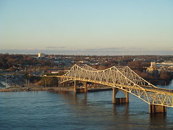
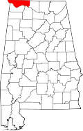
Lauderdale County was established in 1818, [1] a year before Alabama became a state. Florence, the county seat of Lauderdale County, was also established in 1818. At this time a group of investors, under the name of Cypress Land Company purchased from the government 5,515 acres (22.32 km2) of land consisting of the original town site. Other towns in Lauderdale County competing for early settlers because of their proximity to the river were Savage's Spring, nine miles (14 km) below Florence and Waterloo, some 20 miles (32 km) downriver.
Among the older settlements in the county is Center Star, located between Killen and Rogersville. This area was once claimed by both the Chickasaws and Cherokees, necessitating a cession of territory from each tribe before the settlement could be established. At one time, the remains of an old Indian village could be seen southwest of Center Star. Other old settlements included Middleton and Elgin, the latter known first as Ingram's Elgin Cross Roads.
Rogersville, lying some 23 miles (37 km) to the east of Florence, was named for John Rogers, an Indian trader, whose sons were fast friends of the great Sam Houston. The late Will Rogers is said to have been a descendant of this same family. An early ferry that operated for many years was Lamb's Ferry near Rogersville.
Lexington, Springfield, and Anderson lie to the north of the Lee Highway, the town of Lexington being a part of the territory once claimed by the Cherokee. Many of the settlers of that area came from Tennessee and the Carolinas. The first post office of record at Lexington was on the Loretto Road, north of town, in 1880. Mail at that time was brought in from Loretto, Tennessee, by horseback and carts.
The town of St. Florian was established in 1872 on the Jackson Highway and named by its Catholic founders (of German descent) for their patron saint.
Four Alabama governors were from the county - Hugh McVay, Robert M. Patton, Edward A. O'Neal and Emmett O'Neal. [5]
Demographics
Historical population| Census | Pop. | Note | %± |
|---|
| 1820 | 4,963 | | — |
|---|
| 1830 | 11,781 | | 137.4% |
|---|
| 1840 | 14,485 | | 23.0% |
|---|
| 1850 | 17,172 | | 18.6% |
|---|
| 1860 | 17,420 | | 1.4% |
|---|
| 1870 | 15,091 | | −13.4% |
|---|
| 1880 | 21,035 | | 39.4% |
|---|
| 1890 | 23,739 | | 12.9% |
|---|
| 1900 | 26,559 | | 11.9% |
|---|
| 1910 | 30,936 | | 16.5% |
|---|
| 1920 | 39,556 | | 27.9% |
|---|
| 1930 | 41,130 | | 4.0% |
|---|
| 1940 | 46,230 | | 12.4% |
|---|
| 1950 | 54,179 | | 17.2% |
|---|
| 1960 | 61,622 | | 13.7% |
|---|
| 1970 | 68,111 | | 10.5% |
|---|
| 1980 | 80,546 | | 18.3% |
|---|
| 1990 | 79,661 | | −1.1% |
|---|
| 2000 | 87,966 | | 10.4% |
|---|
| 2010 | 92,709 | | 5.4% |
|---|
| 2020 | 93,564 | | 0.9% |
|---|
| 2024 (est.) | 97,502 | [7] | 4.2% |
|---|
|
2020 census
Lauderdale County, Alabama – Racial and ethnic composition
Note: the US Census treats Hispanic/Latino as an ethnic category. This table excludes Latinos from the racial categories and assigns them to a separate category. Hispanics/Latinos may be of any race.| Race / Ethnicity (NH = Non-Hispanic) | Pop 2000 [12] | Pop 2010 [13] | Pop 2020 [14] | % 2000 | % 2010 | % 2020 |
|---|
| White alone (NH) | 77,240 | 79,228 | 76,491 | 87.81% | 85.46% | 81.75% |
| Black or African American alone (NH) | 8,624 | 9,190 | 9,164 | 9.80% | 9.91% | 9.79% |
| Native American or Alaska Native alone (NH) | 219 | 323 | 295 | 0.25% | 0.35% | 0.32% |
| Asian alone (NH) | 305 | 675 | 748 | 0.35% | 0.73% | 0.80% |
| Pacific Islander alone (NH) | 13 | 23 | 31 | 0.01% | 0.02% | 0.03% |
| Other race alone (NH) | 47 | 40 | 204 | 0.05% | 0.04% | 0.22% |
| Mixed race or Multiracial (NH) | 624 | 1,148 | 3,553 | 0.71% | 1.24% | 3.80% |
| Hispanic or Latino (any race) | 894 | 2,082 | 3,078 | 1.02% | 2.25% | 3.29% |
| Total | 87,966 | 92,709 | 93,564 | 100.00% | 100.00% | 100.00% |
As of the 2020 United States census, there were 93,564 people, 38,761 households, and 23,883 families residing in the county.
2000
As of the census of 2000, [15] there were 87,966 people, 36,088 households and 25,153 families residing in the county. The population density was 131 people per square mile (51 people/km2). There were 40,424 housing units at an average density of 60 units per square mile (23 units/km2). The racial make-up was 84.38% White or European American, 13.85% Black or African American, 0.25% Native American, 0.35% Asian, 0.02% Pacific Islander, 0.36% from other races and 0.79% from two or more races. 1.02% of the population were Hispanic or Latino of any race.
In 2005, 87.8% of the county population was non-Hispanic whites. African Americans were 11.7% of the population and Latinos 1.2% of the population.
According to the 2000 census, [16] the largest ancestry groups in Lauderdale County were English 41.9%, African 13.85%, Scots-Irish 9.66%, Scottish 4.11%, Irish 3.19% and Welsh 2.5%
In 2000, there were 36,088 households, of which 30.40% had children under the age of 18 living with them, 55.80% were married couples living together, 10.80% had a female householder with no husband present, and 30.30% were non-families. 26.40% of all households were made up of individuals, and 11.00% had someone living alone who was 65 years of age or older. The average household size was 2.39 and the average family size was 2.89.
23.00% of the population were under the age of 18, 10.10% from 18 to 24, 27.90% from 25 to 44, 23.90% from 45 to 64 and 15.10% were 65 years of age or older. The median age was 38 years. For every 100 females, there were 91.70 males. For every 100 females age 18 and over, there were 88.20 males.
The median household income was $33,354 and the median family income was $41,438. Males had a median income of $33,943 and females $20,804. The per capita income was $18,626. About 10.50% of families and 14.40% of the population were below the poverty line, including 18.50% of those under age 18 and 11.30% of those age 65 or over.
This page is based on this
Wikipedia article Text is available under the
CC BY-SA 4.0 license; additional terms may apply.
Images, videos and audio are available under their respective licenses.