Covington County | |
---|---|
![]() The Covington County Courthouse in Andalusia | |
![]() Location within the U.S. state of Alabama | |
![]() Alabama's location within the U.S. | |
Coordinates: 31°14′31″N86°27′09″W / 31.2419°N 86.4525°W | |
Country | ![]() |
State | ![]() |
Founded | December 17, 1821 |
Named for | Leonard Covington |
Seat | Andalusia |
Largest city | Andalusia |
Area | |
• Total | 1,044 sq mi (2,700 km2) |
• Land | 1,030 sq mi (2,700 km2) |
• Water | 13 sq mi (30 km2) 1.3% |
Population (2020) | |
• Total | 37,570 |
• Estimate (2023) | 37,952 ![]() |
• Density | 36/sq mi (14/km2) |
Time zone | UTC−6 (Central) |
• Summer (DST) | UTC−5 (CDT) |
Congressional district | 1st |
Website | www |
|
Covington County (briefly Jones County) is a county located in the south central portion of the U.S. state of Alabama. As of the 2020 census the population was 37,570. [1] Its county seat is Andalusia. [2] Its name is in honor of Brigadier General Leonard Covington of Maryland [3] and Mississippi, who died in the War of 1812.
Covington County was established on December 17, 1821. The Alabama state legislature changed the name to Jones County on August 6, 1868. Two months later on October 10, 1868, the original name was restored. [4]
The county was declared a disaster area in September 1979 due to damage from Hurricane Frederic and again in October 1995 due to Hurricane Opal.
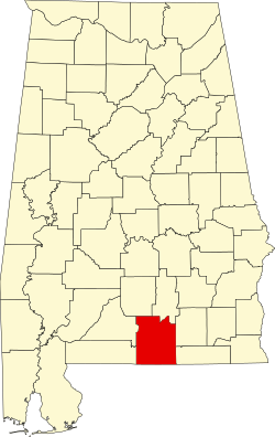
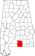
According to the United States Census Bureau, the county has a total area of 1,044 square miles (2,700 km2), of which 1,030 square miles (2,700 km2) is land and 13 square miles (34 km2) (1.3%) is water. [5] The county is located in the Gulf Coastal Plain region of the state. It is drained by the Conecuh and Yellow rivers. [6]
Census | Pop. | Note | %± |
---|---|---|---|
1830 | 1,522 | — | |
1840 | 2,435 | 60.0% | |
1850 | 3,645 | 49.7% | |
1860 | 6,469 | 77.5% | |
1870 | 4,868 | −24.7% | |
1880 | 5,639 | 15.8% | |
1890 | 7,536 | 33.6% | |
1900 | 15,346 | 103.6% | |
1910 | 32,124 | 109.3% | |
1920 | 38,103 | 18.6% | |
1930 | 41,356 | 8.5% | |
1940 | 42,417 | 2.6% | |
1950 | 40,373 | −4.8% | |
1960 | 35,631 | −11.7% | |
1970 | 34,079 | −4.4% | |
1980 | 36,850 | 8.1% | |
1990 | 36,478 | −1.0% | |
2000 | 37,631 | 3.2% | |
2010 | 37,765 | 0.4% | |
2020 | 37,570 | −0.5% | |
2023 (est.) | 37,952 | [7] | 1.0% |
U.S. Decennial Census [8] 1790–1960 [9] 1900–1990 [10] 1990–2000 [11] 2010–2020 [1] |
Race / Ethnicity (NH = Non-Hispanic) | Pop 2000 [12] | Pop 2010 [13] | Pop 2020 [14] | % 2000 | % 2010 | % 2020 |
---|---|---|---|---|---|---|
White alone (NH) | 32,247 | 31,751 | 30,657 | 85.69% | 84.08% | 81.60% |
Black or African American alone (NH) | 4,618 | 4,685 | 4,563 | 12.27% | 12.41% | 12.15% |
Native American or Alaska Native alone (NH) | 180 | 196 | 140 | 0.48% | 0.52% | 0.37% |
Asian alone (NH) | 64 | 148 | 240 | 0.17% | 0.39% | 0.64% |
Pacific Islander alone (NH) | 3 | 1 | 0 | 0.01% | 0.00% | 0.00% |
Other race alone (NH) | 11 | 13 | 71 | 0.03% | 0.03% | 0.19% |
Mixed race or Multiracial (NH) | 216 | 488 | 1,245 | 0.57% | 1.29% | 3.31% |
Hispanic or Latino (any race) | 292 | 483 | 654 | 0.78% | 1.28% | 1.74% |
Total | 37,631 | 37,765 | 37,570 | 100.00% | 100.00% | 100.00% |
As of the census of 2020, there were 37,570 people, 14,852 households, and 9,924 families residing in the county.
As of the census [15] of 2010, there were 37,765 people, 15,531 households, and 10,791 families living in the county. The population density was 37 people per square mile (14 people/km2). There were 18,829 housing units at an average density of 18 units per square mile (6.9 units/km2). The racial makeup of the county was 84.8% White, 12.5% Black or African American, 0.6% Native American, 0.4% Asian, 0.0% Pacific Islander, 0.4% from other races, and 1.4% from two or more races. 1.3% of the population were Hispanic or Latino of any race.
There were 15,531 households, out of which 26.0% had children under the age of 18 living with them, 50.2% were married couples living together, 13.1% had a female householder with no husband present, and 32.1% were non-families. 28.1% of all households were made up of individuals, and 12.6% had someone living alone who was 65 years of age or older. The average household size was 2.39 and the average family size was 2.91.
In the county, the population was spread out, with 22.6% under the age of 18, 7.8% from 18 to 24, 22.8% from 25 to 44, 28.4% from 45 to 64, and 18.4% who were 65 years of age or older. The median age was 42.4 years. For every 100 females there were 93.9 males. For every 100 females age 18 and over, there were 96.4 males.
The median income for a household in the county was $33,852, and the median income for a family was $43,468. Males had a median income of $32,463 versus $26,241 for females. The per capita income for the county was $19,822. About 15.7% of families and 19.0% of the population were below the poverty line, including 28.3% of those under age 18 and 12.8% of those age 65 or over.
As of 2012 [update] the largest self-reported European ancestry group in Covington County is English with 41.2% of people in Covington County citing that they were of English descent. They were followed by people who wrote that they were of "American" ancestry, who made up 16.0% of Covington county. Irish was the third largest self-reported European ancestry with 14.5% of people in the county writing that they were of Irish descent.
As of the census [16] of 2000, there were 37,631 people, 15,640 households, and 10,791 families living in the county. The population density was 36 people per square mile (14 people/km2). There were 18,578 housing units at an average density of 18 units per square mile (6.9 units/km2). The racial makeup of the county was 86.2% White, 12.4% Black or African American, 0.5% Native American, 0.2% Asian, <0.1% Pacific Islander, 0.2% from other races, and 0.6% from two or more races. 0.8% of the population were Hispanic or Latino of any race.
There were 15,640 households, out of which 29.5% had children under the age of 18 living with them, 54.1% were married couples living together, 11.3% had a female householder with no husband present, and 31.0% were non-families. 28.6% of all households were made up of individuals, and 14.1% had someone living alone who was 65 years of age or older. The average household size was 2.37 and the average family size was 2.90.
In the county, the population was spread out, with 23.5% under the age of 18, 8.1% from 18 to 24, 26.1% from 25 to 44, 24.3% from 45 to 64, and 17.9% who were 65 years of age or older. The median age was 40 years. For every 100 females there were 91.60 males. For every 100 females age 18 and over, there were 88.00 males.
The median income for a household in the county was $26,336, and the median income for a family was $33,201. Males had a median income of $27,453 versus $19,640 for females. The per capita income for the county was $15,365. About 14.1% of families and 18.4% of the population were below the poverty line, including 23.9% of those under age 18 and 19.2% of those age 65 or over.
Covington County is reliably Republican at the presidential level. The last Democrat to win the county in a presidential election is Jimmy Carter, who won it by a majority in 1976.
Year | Republican | Democratic | Third party(ies) | |||
---|---|---|---|---|---|---|
No. | % | No. | % | No. | % | |
2024 | 14,677 | 85.86% | 2,314 | 13.54% | 104 | 0.61% |
2020 | 14,586 | 83.68% | 2,721 | 15.61% | 123 | 0.71% |
2016 | 13,267 | 83.23% | 2,387 | 14.97% | 286 | 1.79% |
2012 | 12,153 | 78.72% | 3,158 | 20.45% | 128 | 0.83% |
2008 | 12,444 | 78.82% | 3,240 | 20.52% | 103 | 0.65% |
2004 | 11,119 | 76.02% | 3,423 | 23.40% | 85 | 0.58% |
2000 | 8,961 | 65.83% | 4,440 | 32.62% | 212 | 1.56% |
1996 | 6,035 | 50.66% | 4,543 | 38.13% | 1,335 | 11.21% |
1992 | 6,840 | 48.99% | 5,004 | 35.84% | 2,118 | 15.17% |
1988 | 8,130 | 67.34% | 3,845 | 31.85% | 98 | 0.81% |
1984 | 9,944 | 71.63% | 3,812 | 27.46% | 127 | 0.91% |
1980 | 7,014 | 51.54% | 6,305 | 46.33% | 289 | 2.12% |
1976 | 4,977 | 40.71% | 7,081 | 57.93% | 166 | 1.36% |
1972 | 9,278 | 85.27% | 1,547 | 14.22% | 56 | 0.51% |
1968 | 831 | 6.33% | 791 | 6.03% | 11,506 | 87.64% |
1964 | 7,554 | 82.33% | 0 | 0.00% | 1,621 | 17.67% |
1960 | 2,047 | 26.16% | 5,744 | 73.42% | 33 | 0.42% |
1956 | 2,257 | 30.13% | 4,887 | 65.25% | 346 | 4.62% |
1952 | 1,581 | 24.11% | 4,956 | 75.57% | 21 | 0.32% |
1948 | 154 | 5.25% | 0 | 0.00% | 2,782 | 94.75% |
1944 | 256 | 7.92% | 2,972 | 91.98% | 3 | 0.09% |
1940 | 186 | 3.86% | 4,635 | 96.08% | 3 | 0.06% |
1936 | 167 | 3.76% | 4,265 | 95.91% | 15 | 0.34% |
1932 | 99 | 2.49% | 3,855 | 97.15% | 14 | 0.35% |
1928 | 1,681 | 45.60% | 2,000 | 54.26% | 5 | 0.14% |
1924 | 156 | 7.54% | 1,776 | 85.88% | 136 | 6.58% |
1920 | 548 | 20.65% | 2,039 | 76.83% | 67 | 2.52% |
1916 | 305 | 14.03% | 1,738 | 79.94% | 131 | 6.03% |
1912 | 110 | 6.47% | 1,251 | 73.54% | 340 | 19.99% |
1908 | 315 | 21.18% | 1,054 | 70.88% | 118 | 7.94% |
1904 | 310 | 23.24% | 907 | 67.99% | 117 | 8.77% |
Butler County is a county located in the south central portion of the U.S. state of Alabama. As of the 2020 census, the population was 19,051. Its county seat is Greenville. Its name is in honor of Captain William Butler, who was born in Virginia and fought in the Creek War, and who was killed in May 1818.
Cherokee County, Alabama is a county located in the northeastern part of the U.S. state of Alabama. As of the 2020 census, the population was 24,971. Its county seat is Centre. The county is named for the Cherokee tribe.
Morgan County is a county in the north-central part of the U.S. state of Alabama. As of the 2020 census, its population was 123,421. The county seat is Decatur. On June 14, 1821, it was renamed in honor of American Revolutionary War General Daniel Morgan of Virginia. It is a prohibition or dry county, although alcohol sales are allowed in the cities of Decatur, Hartselle, and Priceville. Morgan County is included in the Decatur, AL Metropolitan Statistical Area, which is also included in the Huntsville-Decatur-Albertville, AL Combined Statistical Area. It is a part of the North, Northwest, and North-Central regions of Alabama.
Conecuh County is a county located in the south-central portion of the U.S. state of Alabama. As of the 2020 census the population was 11,597. Its county seat is Evergreen. Its name is believed to be derived from a Creek Indian term meaning "land of cane."
Coosa County is a county located in the east central portion of the U.S. state of Alabama. As of the 2020 census the population was 10,387. Its county seat is Rockford. Its name derives from a town of the Creek tribe and the Coosa River, which forms one of the county borders.
Crenshaw County is a county located in the south central portion of the U.S. state of Alabama. It is located immediately south of the Montgomery metropolitan area. As of the 2020 census, the population was 13,194. Its county seat is Luverne. Its name is in honor of an Alabama judge, Anderson Crenshaw.
Escambia County is a county located in the south central portion of the U.S. state of Alabama. As of the 2020 census, the population was 36,757. Its county seat is Brewton.
Franklin County is a county located in the U.S. state of Alabama. As of the 2020 census, the population was 32,113. Its county seat is Russellville. Its name is in honor of Benjamin Franklin, famous statesman, scientist, and printer. It is a dry county, although the city of Russellville is wet.
Geneva County is a county located in the southeastern part of the U.S. state of Alabama. As of the 2020 census, the population was 26,659. Its county seat is Geneva. The county was named after its county seat, which in turn was named after Geneva, New York which was named after Geneva, Switzerland, by Walter H. Yonge, an early town resident and Swiss native. Geneva County is a dry county. However, beer and wine are sold in the city limits of Geneva, Samson, Slocomb, and most recently in Hartford, after residents voted to become wet in a 2022 election.
Lamar County is a county in the U.S. state of Alabama. As of the 2020 census, the population was 13,972. Its county seat is Vernon and it is a dry county. It is named in honor of Lucius Quintus Cincinnatus Lamar, a former Confederate officer and former member of both houses of the United States Congress from Mississippi.
Henry County is a county in the southeastern part of the U.S. state of Alabama. As of the 2020 census, its population was 17,146. Its county seat is Abbeville. The county was named for Patrick Henry (1736–1799), famous orator and Governor of Virginia.
Randolph County is a county on the central eastern border of the U.S. state of Alabama. As of the 2020 census, the population was 21,967. Its county seat is Wedowee. Its name is in honor of John Randolph, a member of the United States Senate from Virginia. Randolph County was a prohibition or dry county until 2012, when the citizens of Randolph County voted to repeal prohibition.
McKenzie is a town in Butler and Conecuh counties in the U.S. state of Alabama. The population was 530 at the 2010 census.
Repton is a town in Conecuh County, Alabama, United States. It was incorporated on January 10, 1899. At the 2020 census, the population was 235.
Andalusia is a city in and the county seat of Covington County, Alabama, United States. At the 2020 census, the population was 8,805.
Gantt is a town in Covington County, Alabama, United States. At the 2020 census, the population was 196.
River Falls is a town in Covington County, Alabama, United States. At the 2020 census, the population was 479.
Dozier is a town in Crenshaw County, Alabama, United States. At the 2020 census, the population was 285. Dozier was incorporated in 1907.
Riverview is a town in Escambia County, Alabama, United States. At the 2010 census the population was 184, up from 99 at the 2000 census.
Rock Creek is a census-designated place in Jefferson County, Alabama, United States. Its location is northwest of Hueytown. At the 2020 census, the population was 1,471. This area was damaged by an F5 tornado on April 8, 1998. An EF2 tornado struck northwest from here on January 23, 2012.