Hoover, Alabama

Last updated

Hoover, Alabama
Center Court of the Riverchase Galleria.jpg
Riverchase Galleria
Jefferson County and Shelby County Alabama Incorporated and Unincorporated areas Hoover Highlighted 0135896.svg
Location of Hoover in Jefferson County and Shelby County, Alabama
Coordinates: 33°23′11″N86°48′18″W / 33.38639°N 86.80500°W / 33.38639; -86.80500
CountryUnited States
State Alabama
Counties Jefferson, Shelby
Settled1853 [1]
Founded1954 [2]
IncorporatedApril 28, 1967
Incorporated May 18, 1967 [3]
Named for William H. Hoover
Government
   Mayor Frank V. Brocato (R)
   City Council Curt Posey
Sam Swiney
John Lyda
Khristi Driver
Derrick Murphy
Casey Middlebrooks
Steve McClinton
Area
[4]
   City 50.326 sq mi (130.344 km2)
  Land49.354 sq mi (127.827 km2)
  Water0.972 sq mi (2.518 km2)
Elevation
[5]
495 ft (151 m)
Population
 (2020) [6]
   City 92,606
  Estimate 
(2022) [7]
92,435
  RankUS: 367th
AL: 6th
  Density1,874/sq mi (723.5/km2)
   Urban
774,956 (US: 58th)
  Urban density1,522/sq mi (587.5/km2)
   Metro
1,181,196 (US: 47th)
  Metro density248.8/sq mi (96.07/km2)
  Combined
1,362,731 (US: 43rd)
  Combined density200.3/sq mi (77.35/km2)
Time zone UTC–6 (Central (CST))
  Summer (DST) UTC–5 (CDT)
ZIP Codes
35022, 35080, 35124, 35142, 35216, 35222, 35226, 35236, 35242, 35244
Area code(s) 205 and 659
FIPS code 01-35896
GNIS feature ID2404725 [5]
Website hooveralabama.gov

Hoover is a city in the Jefferson and Shelby counties in north central Alabama, United States. Hoover is the largest suburban city in Alabama and the 6th largest city in Alabama. The population was 92,606 at the 2020 census. [6] Hoover is part of the Birmingham, AL Metropolitan Statistical Area and is also included in the Birmingham-Cullman-Talladega, AL Combined Statistical Area. [8] Hoover's territory is along the foothills of the Appalachian Mountains.

Contents

The Birmingham Barons Minor League Baseball team, which traces its history to 1885, played its home games at the 10,800-seat Hoover Metropolitan Stadium from 1988 through 2013, when it moved to Regions Field in the Parkside District of Birmingham.

History

Hoover Public Library, 2007 Hoover AL Public Library hallway.jpg
Hoover Public Library, 2007

This suburban area near the foothills of the Appalachian Mountains had been known as the Green Valley community since the 1930s; it was mostly a bedroom or residential community into the late 1970s and early 1980s. The City of Hoover was incorporated in 1967, named for William H. Hoover (1890–1979), a local insurance company owner. [9]

On September 8, 1980, the city annexed the Riverchase business and residential community, [10] gaining large office buildings, employers, and workers to increase the city's tax base. When Interstate I-459 was opened, a major interchange with Interstate I-65 was constructed within the borders of Hoover, improving access.

In 1986 the Riverchase Galleria multi-use complex opened; it has significantly increased the tax revenue for the city. It has also attracted new residents and businesses to the area. The city has grown extremely fast, aided by its annexations of territory as well as new developments. The city has expanded its facilities, and now operates a Municipal Center, Library, and Public Safety Center. The city expects to continue to increase in population, which has risen significantly since 2008. It numbered 92,606 as of the 2020 census.

Geography

Hoover is located at 33°23′11″N86°48′18″W / 33.386435°N 86.804938°W / 33.386435; -86.804938 . [11]

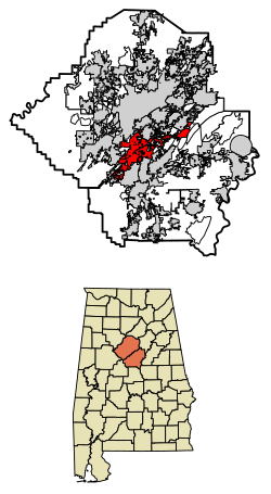
According to the United States Census Bureau, the city has a total area of 50.326 square miles (130.34 km2), of which 49.354 square miles (127.83 km2) is land and 0.972 square miles (2.52 km2), is water. [4]

Many major highways pass through the city limits, including I-65, I-459, and U.S. Route 31. Via I-65 or US-31, downtown Birmingham is 11 mi (18 km) north, and Montgomery is 82 mi (132 km) south. Via I-459, Atlanta, GA is 152 mi (245 km) east, and Tuscaloosa is 53 mi (85 km) west.

Government

Mayor Frank Brocato Frank Brocato - 2020.jpg
Mayor Frank Brocato

The municipal government has operated under the Mayor-Council form of government since incorporation. The Mayor and City Council are elected on a non-partisan basis to concurrent four-year terms of office, which begin on October 1 of election year. Policy-making and legislative authority is vested in the City Council, which consists of seven "at-large" elected members (prior to 2004, the council consisted of five at-large members.) (Candidates for at-large elections must gain a majority of voters; such a system has been found in other cities in Alabama to limit the ability of minority voters to elect candidates of their choice.)

The city council is responsible for considering local resolutions and ordinances, adopting an annual budget, and appointing members to local boards and committees. The Mayor is responsible for carrying out and enforcing the city's policies and ordinances.

Current Mayor
Frank Brocato
Current City Council Membership
Council PlaceRepresentativePosition
1Curt PoseyCouncil President Pro-Tem
2Sam SwineyCouncilor
3John LydaCouncil President
4Khristi DriverCouncilor (appointed 11/21/22 to fill the remainder of Mike Shaw's term, who won a special election to the Alabama House of Representatives) [12]
5Derrick MurphyCouncilor
6Casey MiddlebrooksCouncilor
7Steve McClintonCouncilor

Economy

The Riverchase Galleria shopping-hotel-office complex generates tax revenues for the city; it is also the location of numerous retail, hotel, and office workers. The Riverchase Office Park, and other office parks and buildings throughout Hoover, house many large corporations. Major shopping centers in the city include Riverchase Galleria on US 31, Patton Creek on SR 150, and Village at Lee Branch on US 280. The Central Business District is intersected by US 31, SR 150, and US 280. I-65 and I-459 intersect in the city.

Top employers

According to the City's 2022 Comprehensive Annual Financial Report, [13] the largest employers in the city are:

#Employer# of Employees
1 Regions Bank 2,644
2 Hoover City Schools 1,869
3 Blue Cross and Blue Shield of Alabama 1,711
4 AT&T of Alabama1,170
5 Walmart and Sam's Club 950
6 Publix 868
7McLeod Software700
8City of Hoover667
9SS&C Health438
10Doster Construction184

Public safety

Decatur
Crime rates* (2022)
Violent crimes
Homicide 2
Rape 18
Robbery 13
Aggravated assault 59
Total violent crime 92
Property crimes
Burglary 115
Larceny-theft 1,304
Motor vehicle theft 80
Arson 1
Total property crime 1,500
Notes

*Number of reported crimes per 100,000 population.

2022 population: 92,435

Source: 2022 FBI UCR Data
The falls at Moss Rock Preserve Moss Rock Preserve falls Hoover AL.jpg
The falls at Moss Rock Preserve

Hoover Fire Department is a full-time career department operating from 11 fire stations throughout the city. The city has one battalion. There are eight engine companies, two quints, one ladder truck, three ALS rescue/ambulances, and two battalion chief cars. All engine companies are staffed with a minimum of three people, with at least two being firefighter/paramedics. All engines are classified ALS (Advanced Life Support). The department also operates one heavy rescue truck, and one hazmat unit. Hoover Fire Department holds a Class 1 ISO rating. In 2016, the department responded to over 10,000 calls.

Hoover operates its own enhanced 911 emergency call center, which has 24 operator positions, 2 communication supervisors, 1 department manager and is staffed 24/7.[ citation needed ]

Hoover provides traffic, severe weather, disaster information, and details on special events on low-power AM radio (1610 kHz). [14]

Demographics

Historical population
CensusPop.Note
1970 688
1980 18,9962,661.0%
1990 39,788109.5%
2000 62,74257.7%
2010 81,61930.1%
2020 92,60613.5%
2022 (est.)92,435 [7] −0.2%
U.S. Decennial Census [15]
2020 Census [6]

2020 census

Hoover, Alabama – Racial and ethnic composition
Note: the US Census treats Hispanic/Latino as an ethnic category. This table excludes Latinos from the racial categories and assigns them to a separate category. Hispanics/Latinos may be of any race.
Race / Ethnicity (NH = Non-Hispanic)Pop 2000 [16] Pop 2010 [17] Pop 2020 [18] % 2000% 2010% 2020
White alone (NH)53,61659,25462,84185.45%72.60%67.86%
Black or African American alone (NH)4,23012,00815,5136.74%14.71%16.75%
Native American or Alaska Native alone (NH)761431140.12%0.18%0.12%
Asian alone (NH)1,8114,1205,9132.89%5.05%6.39%
Pacific Islander alone (NH)1616170.03%0.02%0.02%
Some Other Race alone (NH)511233330.08%0.15%0.36%
Mixed Race or Multi-Racial (NH)5621,0403,1710.90%1.27%3.42%
Hispanic or Latino (any race)2,3804,9154,7043.79%6.02%5.08%
Total62,74281,61992,606100.00%100.00%100.00%

As of the 2020 census, there were 92,606 people, 36,799 households, and 25,337 families residing in the city. [19] The population density was 1,926.6 inhabitants per square mile (744/km2) There were 39,008 housing units.

2010 census

As of the 2010 census, there were 81,619 people in 32,478 households, including 22,476 families, in the city. The population density was 1,870.3 inhabitants per square mile (722.1/km2). There were 35,474 housing units at an average density of 812.9 per square mile (313.9/km2). The racial makeup of the city was 75.1% White, 14.8% Black, 0.2% Native American, 5.1% Asian, 0.0% Pacific Islander, 3.2% from other races, and 1.5% from two or more races. 6.0% of the population were Hispanic or Latino of any race.

Of the 32,478 households 33.0% had children under the age of 18 living with them, 56.1% were married couples living together, 10.0% had a female householder with no husband present, and 30.8% were non-families. 25.8% of households were one person and 7.6% were one person aged 65 or older. The average household size was 2.50 and the average family size was 3.02.

The age distribution was 25.0% under the age of 18, 7.8% from 18 to 24, 28.7% from 25 to 44, 26.6% from 45 to 64, and 12.0% 65 or older. The median age was 37 years. For every 100 females, there were 92.5 males. For every 100 females age 18 and over, there were 92.4 males.

The median household income was $72,960 and the median family income was $94,066. Males had a median income of $65,023 versus $44,525 for females. The per capita income for the city was $39,141. About 3.4% of families and 5.6% of the population were below the poverty line, including 6.6% of those under age 18 and 3.5% of those age 65 or over.

2000 census

As of the 2000 census, there were 62,742 people in 25,191 households, including 17,406 families, in the city. The population density was 1,454.6 inhabitants per square mile (561.6/km2). There were 27,150 housing units at an average density of 629.4 per square mile (243.0/km2). The racial makeup of the city was 87.66% White, 6.77% Black, 0.16% Native American, 2.89% Asian, 0.03% Pacific Islander, 1.40% from other races, and 1.09% from two or more races. 3.79% of the population were Hispanic or Latino of any race.

Of the 25,191 households 33.4% had children under the age of 18 living with them, 59.4% were married couples living together, 7.2% had a female householder with no husband present, and 30.9% were non-families. 25.9% of households were one person and 6.3% were one person aged 65 or older. The average household size was 2.47 and the average family size was 3.00.

The age distribution was 24.8% under the age of 18, 7.9% from 18 to 24, 32.6% from 25 to 44, 23.8% from 45 to 64, and 10.9% 65 or older. The median age was 36 years. For every 100 females, there were 95.1 males. For every 100 females age 18 and over, there were 91.5 males.

According to a 2007 estimate, The median household income was $75,365, and the median family income was $89,513. Males had a median income of $55,660 versus $34,836 for females. The per capita income for the city was $33,361. About 2.1% of families and 3.4% of the population were below the poverty line, including 2.7% of those under age 18 and 3.9% of those age 65 or over.

Transportation

A sign designating the exit to Hoover on Interstate 459 Int459sRoad-Exit10-AL150 (34804698540).jpg
A sign designating the exit to Hoover on Interstate 459

Hoover is served by two interstate highways, 65 and 459, with a major interchange near the center of the city. Major arterial roads include U.S. Route 31 as a north–south route through the middle of the city, U.S. Route 280 in the eastern portion of the city, Route 150 as an east–west road connecting the city center to the western side, and Valleydale Road connecting Route 31 and Route 280. Hoover is also served by the Birmingham-Jefferson County Transit Authority.

Communities

Parks

Education

Primary and secondary schools

Hoover High School Hoover High School Facade.PNG
Hoover High School

Hoover is served by Hoover City Schools. It has ten elementary schools, three middle schools, and two high schools, Spain Park High School and Hoover High School. Both schools have ranked high for excellent academics, being rated close to the top five hundred schools in the country. During the 2022–2023 school year, some 2,841 students enrolled in Hoover High School, [21] 1,503 in Spain Park High School, [22] with a total of 13,557 students in the Hoover City School system. [23] Spain Park received the National Blue Ribbon Award in 2008. [24]

Berry Middle School, which served as the city's first high school before the present Hoover High was constructed, was closed after the 2005–2006 academic year. Students were moved to a new Berry Middle School constructed near the site of Spain Park High School. A poll of residents in 2007 favored selling the school, possibly to the independent Shades Mountain Christian School. [25] Simmons Middle School and Bumpus Middle School are the city's other middle schools.

Given the population expansion, the city built Riverchase Elementary to relieve overcrowding of some schools. The student population bubble is advancing in the system, and in the 2011–2012 academic year, Bumpus Middle School and its students were relocated to the former freshman center of Hoover High School. The former Bumpus site became Brock's Gap Intermediate School in 2011. The former Berry site became the current Bumpus Middle School in 2011. Brock's Gap served 5th and 6th graders until 2018 when Hoover Rezoning went into effect. They now serve 3rd, 4th, and 5th graders. Bumpus Middle School served only 7th and 8th graders until 2018 because of Hoover Rezoning. They now serve 6th, 7th, and 8th graders.

Colleges and universities

The Shelby-Hoover campus of the Jefferson State Community College is in Shelby County, is in Hoover, near Spain Park High School. [26] [27] Faulkner University has a campus on Valleydale Road; The University of Alabama in Birmingham (UAB) in downtown Birmingham is only 8–10 miles away, and features the premier medical school of Alabama.

Miscellaneous education

The Birmingham Supplementary School Inc. (BSS, バーミングハム日本語補習校 Bāminguhamu Nihongo Hoshūkō), a part-time Japanese school, holds its classes at the Shelby-Hoover campus. Its office is at the Honda Manufacturing of Alabama, LLC facility in unincorporated Talladega County, near Lincoln. The school opened on September 1, 2001. [28]

Media

Hoover has one television station, WBMA, branded as ABC 33/40, with its studio within the Hoover city limits. The metro area has TV broadcasting stations that serve the Birmingham-Anniston-Tuscaloosa Designated Market Area (DMA), as defined by Nielsen Media Research. Charter Communications, Bright House Networks, and AT&T U-verse provide cable television service to specific communities in Hoover. DirecTV and Dish Network provide direct broadcast satellite television, including both local and national channels.

No radio stations operate from Hoover, although residents are served by numerous stations from the Birmingham market. (WERC-FM is licensed to Hoover but its studio is located in Birmingham.)

Two newspapers serve Hoover: the Over the Mountain Journal newspaper, published twice monthly and delivered for free to select neighborhoods in Hoover and nearby communities; and the Hoover Sun, published monthly and mailed for free to roughly 24,000 homes and businesses in Hoover.

Enjoy Hoover , a 6x/year magazine, is distributed freely at hundreds of locations throughout the city, editorially focused on dining, entertainment, shopping, and healthy living in Hoover.

Notable people

Points of interest

Related Research Articles

<span class="mw-page-title-main">Chilton County, Alabama</span> County in Alabama, United States

Chilton County is a county located in the central portion of the U.S. state of Alabama. As of the 2020 census, the population was 45,014. The county seat is Clanton. Its name is in honor of William Parish Chilton, Sr. (1810–1871), a lawyer who became Chief Justice of the Alabama Supreme Court and later represented Montgomery County in the Congress of the Confederate States of America.

<span class="mw-page-title-main">Coosa County, Alabama</span> County in Alabama, United States

Coosa County is located in the east central portion of the U.S. state of Alabama. As of the 2020 census the population was 10,387. Its county seat is Rockford. Its name derives from a town of the Creek tribe and the Coosa River, which forms one of the county borders.

<span class="mw-page-title-main">Cullman County, Alabama</span> County in Alabama, United States

Cullman County is a county located in the north central portion of the U.S. state of Alabama. As of the 2020 census, the population was 87,866. Its county seat and largest city is Cullman. Its name is in honor of Colonel John G. Cullmann.

<span class="mw-page-title-main">Franklin County, Alabama</span> County in Alabama, United States

Franklin County is a county located in the U.S. state of Alabama. As of the 2020 census, the population was 32,113. Its county seat is Russellville. Its name is in honor of Benjamin Franklin, famous statesman, scientist, and printer. It is a dry county, although the city of Russellville is wet.

<span class="mw-page-title-main">Lawrence County, Alabama</span> County in Alabama, United States

Lawrence County is a county in the northern part of the U.S. state of Alabama. As of the 2020 census, the population was 33,073. The county seat is Moulton. The county was named after James Lawrence, a captain in the United States Navy from New Jersey.

<span class="mw-page-title-main">Shelby County, Alabama</span> County in Alabama, United States

Shelby County is located in the central portion of the U.S. state of Alabama. As of the 2020 census the population was 223,024, making it the sixth-most populous county in Alabama. The county seat is Columbiana. Its largest city is Alabaster. The county is named in honor of Isaac Shelby, Governor of Kentucky from 1792 to 1796 and again from 1812 to 1816. Shelby County is included in the Birmingham–Hoover, AL Metropolitan Statistical Area.

<span class="mw-page-title-main">Talladega County, Alabama</span> County in Alabama, United States

Talladega County is one of the sixty-seven counties located in the east central portion of the U.S. state of Alabama. As of the 2020 census, the population was 82,149. Its county seat is Talladega.

<span class="mw-page-title-main">Calera, Alabama</span> City in Alabama, United States

Calera is a city in Shelby and Chilton counties in the U.S. state of Alabama. It is the location of the Shelby County Airport.

<span class="mw-page-title-main">Heflin, Alabama</span> City in Alabama, United States

Heflin is a city and the county seat of Cleburne County, Alabama, United States. At the 2020 census, the population was 3,431. It is located approximately halfway between Birmingham and Atlanta along Interstate 20.

<span class="mw-page-title-main">Homewood, Alabama</span> City in Alabama, United States

Homewood is a city in southeastern Jefferson County, Alabama, United States. It is a suburb of Birmingham, located on the other side of Red Mountain due south of the city center. The population was 26,414 at the 2020 census.

<span class="mw-page-title-main">Pleasant Grove, Alabama</span> City in Alabama, United States

Pleasant Grove is a city in western Jefferson County, Alabama, United States. It is part of the Birmingham metropolitan area. The population was 9,544 at the 2020 census.

<span class="mw-page-title-main">Tarrant, Alabama</span> City in Alabama, United States

Tarrant is a city in Jefferson County, Alabama, bordering Birmingham to the north. At the 2020 census, the population was 6,124. It is home to the ABC Coke plant owned by the Drummond Company, "the largest single producer of foundry coke in the U.S.".

<span class="mw-page-title-main">Vestavia Hills, Alabama</span> City in Alabama, United States

Vestavia Hills, colloquially known simply as Vestavia, is a city in Jefferson and Shelby counties in the U.S. state of Alabama. It is a suburb of Birmingham and it is made up of Vestavia, Liberty Park, and Cahaba Heights. The population was 39,102 at the 2020 census. Vestavia Hills is the third largest city in Jefferson County in 2020, after Birmingham and Hoover. Vestavia Hills is the thirteenth largest city in Alabama.

<span class="mw-page-title-main">Alabaster, Alabama</span> City in Alabama, United States

Alabaster is a city and southern suburb of Birmingham in Shelby County, Alabama, United States. At the 2020 census, the population was 33,284. Alabaster is the 16th largest city in Alabama by number of residents.

<span class="mw-page-title-main">Columbiana, Alabama</span> City in and county seat of Shelby County, Alabama

Columbiana is a city and the county seat of Shelby County, Alabama, United States. At the 2020 census, the population was 4,462.

<span class="mw-page-title-main">Pelham, Alabama</span> City in Alabama, United States

Pelham is a city in Shelby County, Alabama, United States. It incorporated in July 1964 and is a suburb located in the Birmingham metropolitan area, Alabama which was home to over 1.1 million residents as of the 2020 census. At the 2000 census the population was 14,369, and has grown to 24,318 by the 2020 census, nearly doubling. It was named for Confederate Civil War officer John Pelham.

<span class="mw-page-title-main">Wilton, Alabama</span> Town in Alabama, United States

Wilton, also known by the previous names of Birmingham Junction, Bismark, and Catoosa, is a town in Shelby County, Alabama, United States. It was incorporated in 1918. This town is part of the Birmingham–Hoover–Cullman Combined Statistical Area. At the 2010 census the population was 687, up from 580 in 2000.

<span class="mw-page-title-main">Lincoln, Alabama</span> City in Alabama, United States

Lincoln is a city in Talladega County, Alabama, United States. It was incorporated in 1911. At the 2020 census, the population was 6,845. It was named for Major General Benjamin Lincoln, who served in the American army during the Revolutionary War.

<span class="mw-page-title-main">Parkville, Missouri</span> City in Missouri, United States

Parkville is a city in Platte County, Missouri, United States and is a part of the Kansas City Metropolitan Area. The population was 7,177 at the 2020 census, According to 2022 census estimates, the city is estimated to have a population of 8,541. Parkville is known for its antique shops, art galleries, and historic downtown. The city is home to Park University, English Landing Park, Platte Landing Park, and the National Golf Club of Kansas City. Large neighborhoods in Parkville include: Riss Lake, The National, Thousand Oaks, Creekside, Parkville Heights, River Hills, Riverchase, The Bluffs, Downtown, and Pinecrest.

<span class="mw-page-title-main">St. Clair County, Alabama</span> County in Alabama, United States

St. Clair County is a county located in the central portion of the U.S. state of Alabama. As of the 2020 census, the population was 91,103. It has two county seats: Ashville and Pell City. It is one of two counties in Alabama, and one of 33 in the United States, with more than one county seat. Its name is in honor of General Arthur St. Clair, an officer in the French and Indian War. St. Clair County is included in the Birmingham, Alabama Metropolitan Statistical Area.

References

  1. Vadie Honea. "A History of Hoover". City of Hoover, AL. Archived from the original on September 28, 2007. Retrieved July 18, 2007.
  2. "Patch Call: Hoover, Alabama, Police Department". FBI. Retrieved March 9, 2024.
  3. "Municipalities of Alabama Incorporation Dates" (PDF). Alabama League of Municipalities. Retrieved March 9, 2024.
  4. 1 2 "2023 U.S. Gazetteer Files". United States Census Bureau. Retrieved March 9, 2024.
  5. 1 2 U.S. Geological Survey Geographic Names Information System: Hoover, Alabama
  6. 1 2 3 "Explore Census Data". United States Census Bureau . Retrieved March 9, 2024.
  7. 1 2 "City and Town Population Totals: 2020–2022". United States Census Bureau. March 9, 2024. Retrieved March 9, 2024.
  8. "OMB Bulletin No. 23-01, Revised Delineations of Metropolitan Statistical Areas, Micropolitan Statistical Areas, and Combined Statistical Areas, and Guidance on Uses of Delineations of These Areas" (PDF). United States Office of Management and Budget. July 21, 2023. Retrieved July 25, 2023.
  9. Thornton, J. Mills (2002). Dividing Lines: Municipal Politics and the Struggle for Civil Rights in Montgomery, Birmingham, and Selma. Tuscaloosa: University of Alabama Press. p. 190. ISBN   978-0-8173-1170-4.
  10. "A History of Hoover" . Retrieved November 15, 2014.
  11. "US Gazetteer files: 2010, 2000, and 1990". United States Census Bureau. February 12, 2011. Retrieved April 23, 2011.
  12. "Hoover council appoints Khristi Driver to replace Mike Shaw on council". November 21, 2022.
  13. "City of Hoover 2022 Comprehensive Annual Financial Report". March 9, 2024.
  14. "City of Hoover website". Archived from the original on October 6, 2006. Retrieved March 27, 2006.
  15. "Census of Population and Housing". United States Census Bureau. Retrieved June 4, 2015.
  16. "P004 Hispanic or Latino, and Not Hispanic or Latino by Race – 2000: DEC Summary File 1 – Hoover city, Alabama". United States Census Bureau .
  17. "P2 Hispanic or Latino, and Not Hispanic or Latino by Race – 2010: DEC Redistricting Data (PL 94-171) – Hoover city, Alabama". United States Census Bureau .
  18. "P2 Hispanic or Latino, and Not Hispanic or Latino by Race – 2020: DEC Redistricting Data (PL 94-171) – Hoover city, Alabama". United States Census Bureau .
  19. "US Census Bureau, Table P16: Household Type". United States Census Bureau. Retrieved March 9, 2024.
  20. Facebook page of trail
  21. "Hoover High School". schooldigger.com. 2023. Retrieved March 9, 2024.
  22. "Spain Park High School". schooldigger.com. 2023. Retrieved March 9, 2024.
  23. "Hoover City Schools" . Retrieved March 9, 2024.
  24. "No Child Left Behind-Blue Ribbon Schools Program - 2008 Schools", U.S. Department of Education
  25. "Joint offer made for Berry site". The Birmingham News. 2007. Retrieved November 9, 2007.
  26. "2010 CENSUS - CENSUS BLOCK MAP: Hoover city, AL." (Archive). United States Census Bureau. Retrieved on May 11, 2014.
  27. "Shelby-Hoover Campus." Jefferson State Community College. Retrieved on May 11, 2014. Use the Google Maps function to see the buildings and where they are in relation to the city limits.
  28. "About Birmingham Supplementary School" (Archive). Birmingham Supplementary School. Retrieved on May 11, 2014. "Mailing Address 1800 Honda Drive Lincoln, AL 35096 c/o Honda Manufacturing of Alabama, LLC" and "Facility Jefferson State Community College, Shelby Campus 4600 Valleydale Road Birmingham, AL 35242 " Japanese page: "学校の概要" (Archive).