Cardiff, Alabama

Last updated

Cardiff, Alabama
EXTERIOR VIEW, FRONT (EAST) ELEVATION - Cardiff Town Hall, Old County Road 109, Cardiff, Jefferson County, AL HABS ALA,37-CARD,1-1.tif
Cardiff Town Hall, taken as part of the Historic American Buildings Survey
Jefferson County Alabama Incorporated and Unincorporated areas Cardiff Highlighted 0112040.svg
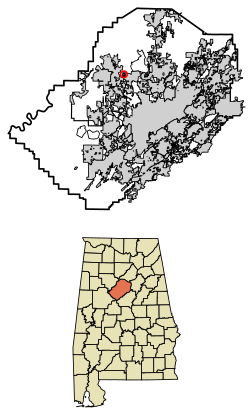
Location of Cardiff in Jefferson County, Alabama.
Coordinates: 33°38′43″N86°55′58″W / 33.64528°N 86.93278°W / 33.64528; -86.93278
Country United States
State Alabama
County Jefferson
Area
[1]
  Total0.21 sq mi (0.54 km2)
  Land0.21 sq mi (0.54 km2)
  Water0.00 sq mi (0.00 km2)
Elevation
358 ft (109 m)
Population
 (2020)
  Total52
  Density248.80/sq mi (96.10/km2)
Time zone UTC-6 (Central (CST))
  Summer (DST) UTC-5 (CDT)
ZIP code
35041
Area code(s) 205 & 659
FIPS code 01-12040
GNIS feature ID0115614

Cardiff is a town in Jefferson County, Alabama, United States west of Gardendale. At the 2010 census the population was 55, placing it as the least-populated incorporated area in Jefferson County. It is named after the capital of Wales. [2] It is one of four Jefferson County cities named after cities in Great Britain, the others being Birmingham, Leeds and Brighton.

Contents

Geography

Cardiff is located at 33°38′43″N86°55′59″W / 33.64528°N 86.93306°W / 33.64528; -86.93306 (33.645384, −86.932965). [3] on Five Mile Creek, a tributary of the Locust Fork of the Black Warrior River. It is immediately downstream of Brookside. The region is part of the Cumberland Plateau, with shallow but deeply incised stream valleys dissecting sedimentary rock, including significant seams of bituminous coal.

According to the U.S. Census Bureau, the town has a total area of 0.2 square miles (0.52 km2), all land.

Demographics

Historical population
CensusPop.Note
1890 203
1900 562176.8%
1910 426−24.2%
1920 4638.7%
1930 146−68.5%
1940 24668.5%
1950 204−17.1%
1960 202−1.0%
1970 127−37.1%
1980 14010.2%
1990 72−48.6%
2000 8213.9%
2010 55−32.9%
2020 52−5.5%
U.S. Decennial Census [4]

As of the census of 2000, there were 82 people, 33 households, and 26 families residing in the town. The population density was 401.3 inhabitants per square mile (154.9/km2). There were 38 housing units at an average density of 186.0 per square mile (71.8/km2). The racial makeup of the town was 93.90% White and 6.10% Black or African American.

There were 33 households, out of which 27.3% had children under the age of 18 living with them, 60.6% were married couples living together, 12.1% had a female householder with no husband present, and 21.2% were non-families. 18.2% of all households were made up of individuals, and 12.1% had someone living alone who was 65 years of age or older. The average household size was 2.48 and the average family size was 2.85.

In the town, the population was spread out, with 22.0% under the age of 18, 8.5% from 18 to 24, 32.9% from 25 to 44, 18.3% from 45 to 64, and 18.3% who were 65 years of age or older. The median age was 40 years. For every 100 females, there were 86.4 males. For every 100 females age 18 and over, there were 88.2 males.

The median income for a household in the town was $34,107, and the median income for a family was $45,000. Males had a median income of $28,906 versus $18,125 for females. The per capita income for the town was $16,067. There were 5.6% of families and 8.1% of the population living below the poverty line, including no under eighteens and none of those over 64.

History

Coal mining was the historical basis of the economy. The town, for years the smallest incorporated town in the State of Alabama, declined along with the decline of underground coal mining and the rise of strip mining. The epochal flood of May 2003 destroyed a number of buildings in that part of Cardiff close to Five Mile Creek. The town is now but a dent in the land; scarce of life with a scant 20–30 people and covered with kudzu. Cardiff is becoming a ghost town.[ citation needed ]

Related Research Articles

<span class="mw-page-title-main">Walker County, Alabama</span> County in Alabama, United States

Walker County is a county located in the central portion of the U.S. state of Alabama. As of the 2020 census, the population was 65,342. Its county seat is Jasper. Its name is in honor of John Williams Walker, the first U.S. senator elected from Alabama.

<span class="mw-page-title-main">Adamsville, Alabama</span> City in Alabama, United States

Adamsville is a city in western Jefferson County, Alabama. It is north from the Birmingham suburb of Pleasant Grove. It initially incorporated in 1901, but disincorporated in 1915. It later reincorporated in 1953. According to the 2010 census, this town had a population of 4,522, down from its peak population of 4,965 in 2000.

<span class="mw-page-title-main">Argo, Alabama</span> Town in Alabama, United States

Argo is a town in Jefferson and St. Clair counties, Alabama, United States. It incorporated in 1987. At the 2020 census, the population was 4,368.

<span class="mw-page-title-main">Graysville, Alabama</span> City in Alabama, United States

Graysville is a city in northwestern Jefferson County, Alabama, United States, located north of Adamsville. At the 2020 census, the population was 1,950.

<span class="mw-page-title-main">Kimberly, Alabama</span> City in Alabama, United States

Kimberly is a city in Jefferson County, Alabama, United States. At the 2020 census, the population was 3,841.

<span class="mw-page-title-main">Midfield, Alabama</span> Town in Alabama, United States

Midfield is a town in Jefferson County, Alabama, United States, located two miles south of the Birmingham suburb of Fairfield. It incorporated in 1953. As of the 2020 census, it had a population of 5,211.

<span class="mw-page-title-main">Mulga, Alabama</span> Town in Alabama, United States

Mulga is a town in western Jefferson County, Alabama, United States. It is north from the Birmingham suburb of Pleasant Grove. It includes the community of Bayview. Mulga was a company town operated by Birmingham Coal and Iron Company around the Mulga Mine and Mulga was also the name of an independent community in the area. The company town was incorporated in 1947.

<span class="mw-page-title-main">North Johns, Alabama</span> Town in Alabama, United States

North Johns is the second smallest incorporated town in Jefferson County, Alabama, United States. It is located approximately eight miles southwest from the Birmingham suburb of Hueytown. North Johns was a thriving mining town at the beginning of the 20th century, when more than 2000 people lived in and around the community. It is named after a Welsh-born mining engineer, Llewellyn Johns, who opened coal mining operations throughout the area in the 1880s. At the 2020 census the population was 127, an decrease of 18 persons from 2010.

<span class="mw-page-title-main">Pleasant Grove, Alabama</span> City in Alabama, United States

Pleasant Grove is a city in western Jefferson County, Alabama, United States. It is part of the Birmingham metropolitan area. The population was 9,544 at the 2020 census.

<span class="mw-page-title-main">Bartonville, Illinois</span> Village in Illinois, United States

Bartonville is a village in Peoria County, Illinois, United States. The population was 6,471 at the 2010 census. Bartonville is a suburb of Peoria and is part of the Peoria, Illinois Metropolitan Statistical Area.

<span class="mw-page-title-main">Wallins Creek, Kentucky</span> Census-designated place in Kentucky, United States

Wallins Creek is an unincorporated community and census-designated place (CDP) in Harlan County, Kentucky, United States. The population was 156 at the 2010 census, when it was still a city, having dropped from 257 at the 2000 census.

<span class="mw-page-title-main">Cavetown, Maryland</span> CDP in Maryland, United States

Cavetown is a census-designated place (CDP) in Washington County, Maryland, United States. The population was 1,486 at the 2000 census.

<span class="mw-page-title-main">Magnolia, Minnesota</span> Town in Minnesota, United States

Magnolia is a town in Rock County, Minnesota, United States. The population was 222 at the 2010 census. According to the United States Census Bureau, the city has a total area of 0.78 square miles (2.02 km2), all land.

<span class="mw-page-title-main">Artesia, Mississippi</span> Town in Mississippi, United States

Artesia is a town in Lowndes County, Mississippi. The population was 304 at the 2020 census, down from 440 at the 2010 census.

<span class="mw-page-title-main">Lionville, Pennsylvania</span> Census-designated place in Pennsylvania, United States

Lionville is a census-designated place (CDP) in Uwchlan Township, Chester County, Pennsylvania, United States. The population was 6,189 at the 2010 census. Prior to 2010 the CDP was recorded as Lionville-Marchwood. "Marchwood", however, refers only to the housing development begun in the early 1960s that is located south of the 100-113 intersection.

<span class="mw-page-title-main">Marysville, Pennsylvania</span> Borough in Pennsylvania, United States

Marysville is a borough in Perry County, Pennsylvania, United States. The population was 2,652 at the 2020 census. It is part of the Harrisburg–Carlisle Metropolitan Statistical Area.

<span class="mw-page-title-main">Chapman Township, Snyder County, Pennsylvania</span> Township in Pennsylvania, United States

Chapman Township is a township in Snyder County, Pennsylvania, United States. The population was 1,565 at the 2020 census.

<span class="mw-page-title-main">Laceyville, Pennsylvania</span> Borough in Pennsylvania, United States

Laceyville is a borough that is located in Wyoming County, Pennsylvania, United States. The population was 363 at the time of the 2020 census.

<span class="mw-page-title-main">White Stone, Virginia</span> Town in Virginia, United States

White Stone is a town in Lancaster County, Virginia, United States. The population was 380 at the 2020 census. White Stone is one of many small towns located in Virginia's Northern Neck region.

<span class="mw-page-title-main">Bramwell, West Virginia</span> Town in West Virginia, United States

Bramwell is a town in Mercer County, West Virginia, United States, along the Bluestone River. The population was 277 at the 2020 census. It is part of the Bluefield, WV-VA micropolitan area which has a population of 107,578.

References

  1. "2020 U.S. Gazetteer Files". United States Census Bureau. Retrieved October 29, 2021.
  2. Gannett, Henry (1905). The Origin of Certain Place Names in the United States. Govt. Print. Off. pp.  69.
  3. "US Gazetteer files: 2010, 2000, and 1990". United States Census Bureau. February 12, 2011. Retrieved April 23, 2011.
  4. United States Census Bureau. "Census of Population and Housing". Archived from the original on April 26, 2015. Retrieved August 10, 2013.

33°38′43″N86°55′59″W / 33.645384°N 86.932965°W / 33.645384; -86.932965