Edgewater, Alabama

Last updated

Edgewater, Alabama
CDP
Jefferson County Alabama Incorporated and Unincorporated areas Edgewater Highlighted.svg
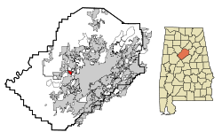
Location in Jefferson County and the state of Alabama
Coordinates: 33°31′23″N86°57′23″W / 33.52306°N 86.95639°W / 33.52306; -86.95639
Country United States
State Alabama
County Jefferson
Area
[1]
  Total1.18 sq mi (3.07 km2)
  Land1.16 sq mi (3.00 km2)
  Water0.02 sq mi (0.06 km2)
Elevation
531 ft (162 m)
Population
 (2020)
  Total746
  Density643.10/sq mi (248.29/km2)
Time zone UTC-6 (Central (CST))
  Summer (DST) UTC-5 (CDT)
ZIP code
35224 [2]
Area code(s) 205 and 659
FIPS code 01-23032
GNIS feature ID0117862

Edgewater is a census-designated place in Jefferson County, Alabama, United States. It is northeast from the Birmingham suburb of Pleasant Grove. Its population was 883 at the 2010 census. [3] This area was damaged by tornadoes on April 15, 1956 and April 8, 1998. The 1998 tornado was rated F5 on the Fujita scale. [4] [5]

Contents

History

Edgwater was originally built as a company town by Tennessee Coal, Iron and Railroad Company.

Geography

Edgewater is located at 33°31′23″N86°57′23″W / 33.52306°N 86.95639°W / 33.52306; -86.95639 (33.523106, -86.956525). [6]

According to the U.S. Census Bureau, the CDP has a total area of 1.2 square miles (3.1 km2), of which 1.2 square miles (3.1 km2) is land and 0.04 square miles (0.10 km2) (1.67%) is water.

Demographics

Historical population
CensusPop.Note
1950 1,984
2000 730
2010 88321.0%
2020 746−15.5%
U.S. Decennial Census [7]

Edgewater was initially listed on the 1950 [8] U.S. Census as an unincorporated community. It did not appear again until 2000 when it was designated a CDP (Census Designated Place).

2020 census

Edgewater racial composition [9]
RaceNum.Perc.
White (non-Hispanic)18224.4%
Black or African American (non-Hispanic)51969.57%
Native American 10.13%
Asian 30.4%
Other/Mixed 212.82%
Hispanic or Latino 202.68%

As of the 2020 United States census, there were 746 people, 253 households, and 214 families residing in the CDP.

2000 census

As of the census [10] of 2000, there were 730 people, 295 households, and 192 families residing in the CDP. The population density was 622.3 inhabitants per square mile (240.3/km2). There were 323 housing units at an average density of 275.3 per square mile (106.3/km2). The racial makeup of the CDP was 37.95% White, 61.10% Black or African American, 0.14% from other races, and 0.82% from two or more races. 1.10% of the population were Hispanic or Latino of any race.

There were 295 households, out of which 25.1% had children under the age of 18 living with them, 34.6% were married couples living together, 24.1% had a female householder with no husband present, and 34.6% were non-families. 31.9% of all households were made up of individuals, and 14.9% had someone living alone who was 65 years of age or older. The average household size was 2.47 and the average family size was 3.12.

In the CDP, the population was spread out, with 22.5% under the age of 18, 7.4% from 18 to 24, 25.2% from 25 to 44, 27.8% from 45 to 64, and 17.1% who were 65 years of age or older. The median age was 42 years. For every 100 females, there were 97.3 males. For every 100 females age 18 and over, there were 85.6 males.

The median income for a household in the CDP was $21,322, and the median income for a family was $47,240. Males had a median income of $26,786 versus $20,962 for females. The per capita income for the CDP was $14,240. About 2.5% of families and 10.2% of the population were below the poverty line, including 9.3% of those under age 18 and 14.4% of those age 65 or over.

Notable people

Related Research Articles

<span class="mw-page-title-main">Blue Ridge, Alabama</span> Census-designated place in Alabama, United States

Blue Ridge is an unincorporated community and census-designated place (CDP) in Elmore County, Alabama, United States. At the 2020 census, the population was 1,485. It is part of the Montgomery Metropolitan Statistical Area.

<span class="mw-page-title-main">Cahaba Heights, Vestavia Hills</span> Neighborhood in Jefferson, Alabama, United States

Cahaba Heights is a neighborhood of Vestavia Hills, a city in Jefferson County, Alabama, United States. Before annexation in 2002, it was a census-designated place (CDP) in 1990 and 2000; the population was 5,203 at the 2000 census.

<span class="mw-page-title-main">Center Point, Alabama</span> City in Alabama, United States

Center Point is a city and a former census-designated place (CDP) in northeastern Jefferson County, Alabama, United States. It is part of the Birmingham metropolitan area. At the 2020 census, the population was 16,406. However, after its incorporation in 2002, the city's boundaries are much smaller than those of the CDP. As of the 2010 census, the population of the incorporated city was 16,921. The public high school for Center Point is Center Point High School grades 9th-12th. The public middle school for Center Point is Erwin Middle School grades 6th-8th. Center Point has 2 public elementary schools, Erwin Intermediate School grades 3rd-5th and Center Point Elementary School grades K-2nd.

<span class="mw-page-title-main">Clay, Alabama</span> City in Alabama, United States

Clay is a city in northeastern Jefferson County, Alabama, United States. It is part of the Birmingham–Hoover–Cullman Combined Statistical Area in the north-central part of the state. Local government is run by a mayor and city council.

<span class="mw-page-title-main">Forestdale, Alabama</span> Unincorporated community in Alabama, United States

Forestdale is an unincorporated community and census-designated place (CDP) in Jefferson County, Alabama, United States. It is north of the Birmingham city neighborhood of Ensley. At the 2020 census, the population was 10,409.

<span class="mw-page-title-main">McDonald Chapel, Alabama</span> CDP in Alabama, United States

McDonald Chapel is a census-designated place in Jefferson County, Alabama, United States. It is northeast of the Birmingham suburb of Pleasant Grove. At the 2020 census, the population was 739. Large portions of this area were damaged by violent tornadoes in 1956, 1998, and 2011. The 1998 tornado was rated F5 on the Fujita scale.

<span class="mw-page-title-main">Minor, Alabama</span> CDP in Alabama, United States

Minor is a census-designated place (CDP) in Jefferson County, Alabama, United States. It is located north of the Birmingham suburb, Pleasant Grove and has a population of 1,094. Minor was damaged by an F5 tornado on April 8, 1998, including damage inflicted on the non-denominational Open Door Church.

<span class="mw-page-title-main">Mount Olive, Jefferson County, Alabama</span> Unincorporated community in Alabama, United States

Mount Olive, also spelled Mt. Olive is an unincorporated community and a census-designated place (CDP) in Jefferson County, Alabama. Its location is in the suburbs of Birmingham. As of the 2010 census, the population of the community is 4,079. Mount Olive is bordered on the south and the east by the town of Gardendale, and in fact, some areas that had previously been in Mount Olive have been annexed into Gardendale over the years. Running along part of the border between Mt. Olive and Gardendale is the major expressway, Interstate 65. Eventually, part of Birmingham's Northern Beltline will cut through northwestern sections of Mt. Olive. Mt. Olive has its own elementary school, and was formerly the home of a junior high school.

<span class="mw-page-title-main">Pinson, Alabama</span> City in Alabama, United States

Pinson is a city in Jefferson County near Birmingham, Alabama, United States, northwest of Center Point. As of the 2010 census, the population was 7,163.

<span class="mw-page-title-main">Rock Creek, Alabama</span> CDP in Alabama, United States

Rock Creek is a census-designated place in Jefferson County, Alabama, United States. Its location is northwest of Hueytown. At the 2020 census, the population was 1,471. This area was damaged by an F5 tornado on April 8, 1998. An EF2 tornado struck northwest from here on January 23, 2012.

<span class="mw-page-title-main">Smiths Station, Alabama</span> City in Alabama, United States

Smiths Station is a city in Lee County, Alabama, United States. It is part of the Columbus, Georgia metropolitan area. At the time of the 2000 census, it was still a census-designated place (CDP), and its population was 6,756. The area that incorporated as Smiths Station in 2001 was much smaller than the CDP, and contained a population of 4,926 by the 2010 census. Smiths Station, known to locals as "Smiths", is a bedroom community of Columbus, Georgia, and Phenix City, Alabama. Smiths Station High School has an enrollment of over 1,800 students and is the 11th-largest high school in the state.

<span class="mw-page-title-main">Meridianville, Alabama</span> Census-designated place in Alabama, United States

Meridianville is an unincorporated community and census-designated place (CDP) in Madison County, Alabama, United States, and is included in the Huntsville-Decatur Combined Statistical Area. As of the 2020 census, the population of the CDP was 8,209.

<span class="mw-page-title-main">Moores Mill, Alabama</span> Census-designated place in Alabama, United States

Moores Mill is an unincorporated community and census-designated place (CDP) in Madison County, Alabama, United States, and is included in the Huntsville-Decatur Combined Statistical Area. The population was 6,729 at the 2020 census, up from 5,682 at the 2010 census.

<span class="mw-page-title-main">Indian Springs Village, Alabama</span> Rural Area in Alabama, United States

Indian Springs Village is a rural town in Shelby County, Alabama, United States, in the Birmingham metropolitan area. It incorporated effective November 14, 1990. At the 2010 census the population was 2,363, up from 2,225 in 2000.

<span class="mw-page-title-main">Meadowbrook, Alabama</span> Census-designated place & Unincorporated community in Alabama, United States

Meadowbrook is an unincorporated community and census-designated place (CDP) in Shelby County, Alabama, United States. At the 2020 census, the population was 9,688. It is part of the Birmingham metropolitan area.

<span class="mw-page-title-main">Ragland, Alabama</span> Town in Alabama, United States

Ragland is a town in St. Clair County, Alabama, United States southeast of Ashville. It incorporated in 1899. At the 2020 census, the population was 1,693, up slightly from 1,639 in 2010. It is part of the Birmingham-Hoover-Cullman Combined Statistical Area.

<span class="mw-page-title-main">Mignon, Alabama</span> CDP in Alabama, United States

Mignon is a census-designated place (CDP) in Talladega County, Alabama, United States. At the 2020 census, the population was 1,186.

<span class="mw-page-title-main">East Riverdale, Maryland</span> Census-designated place in Maryland, United States

East Riverdale is an unincorporated area and census-designated place (CDP) in Prince George's County, Maryland, United States. The population was 18,459 at the 2020 census.

<span class="mw-page-title-main">La Jara, New Mexico</span> CDP in New Mexico, United States

La Jara is a census-designated place (CDP) in Sandoval County, New Mexico, United States. The population was 209 at the 2000 census. It is part of the Albuquerque Metropolitan Statistical Area.

<span class="mw-page-title-main">Meridian, Pennsylvania</span> Census-designated place in Pennsylvania, United States

Meridian is a census-designated place (CDP) in Butler County, Pennsylvania, United States. The population was 3,881 at the 2010 census.

References

  1. "2020 U.S. Gazetteer Files". United States Census Bureau. Retrieved October 29, 2021.
  2. "Edgewater AL ZIP Code". zipdatamaps.com. 2023. Retrieved February 17, 2023.
  3. "U.S. Census website". United States Census Bureau . Retrieved May 14, 2011.
  4. "Other Birmingham Area Tornadoes". Archived from the original on June 3, 2011. Retrieved May 30, 2017.
  5. "NOAA's National Weather Service - Birmingham, Alabama". Archived from the original on May 10, 2009. Retrieved May 10, 2009.
  6. "US Gazetteer files: 2010, 2000, and 1990". United States Census Bureau. February 12, 2011. Retrieved April 23, 2011.
  7. "U.S. Decennial Census". Census.gov. Retrieved June 6, 2013.
  8. "General Characteristics : Alabama : List of Tables" (PDF). 2.census.gov. Retrieved June 15, 2016.
  9. "Explore Census Data". data.census.gov. Retrieved December 11, 2021.
  10. "U.S. Census website". United States Census Bureau . Retrieved January 31, 2008.
  11. "Music Maker Revue: Cool John Ferguson with Sam Frazier, Jr". Duke Performances. Duke University. Retrieved April 29, 2015.
  12. "Mule Suttles Negro League Statistics & History". Baseballreference.com. foxsports.com. Retrieved April 29, 2015.