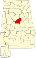
Eagle Point, Alabama

Last updated
Eagle Point, Alabama
USA Alabama location map.svg
Red pog.svg
Eagle Point
Usa edcp location map.svg
Red pog.svg
Eagle Point
Coordinates: 33°23′39″N86°40′36″W / 33.39417°N 86.67667°W / 33.39417; -86.67667 Coordinates: 33°23′39″N86°40′36″W / 33.39417°N 86.67667°W / 33.39417; -86.67667
Country United States
State Alabama
County Shelby
Area
[1]
  Total2.25 sq mi (5.84 km2)
  Land2.21 sq mi (5.72 km2)
  Water0.04 sq mi (0.11 km2)
Elevation
690 ft (210 m)
Population
 (2020)
  Total2,903
  Density1,313.57/sq mi (507.19/km2)
Time zone UTC-6 (Central (CST))
  Summer (DST) UTC-5 (CDT)
ZIP code
35242 [2]
Area code(s) 205, 659
GNIS feature ID2805893 [3]
FIPS code 01-22088 [1]

Eagle Point is a census-designated place in Shelby County, Alabama, United States. It was first listed as a CDP prior to the 2020 census and is part of the Birmingham Metropolitan Area. The area was struck by a long-tracked low-end EF3 tornado on March 25, 2021, damaging or destroying several homes and downing trees. Five people were injured by the tornado. [4]

Contents

It was first named as a CDP in the 2020 Census which listed a population of 2,903. [5]

Geography

The community is in northern Shelby County. It is bordered to the north by the city of Birmingham, to the east by Highland Lakes, to the south by Pelham, and to the west by Meadowbrook.

According to the U.S. Census Bureau, the Eagle Point CDP has a total area of 2.2 square miles (5.8 km2), of which 0.04 square miles (0.11 km2), or 1.94%, are water. [1]

Demographics

Historical population
CensusPop.
2020 2,903
U.S. Decennial Census [6]
2020 [7]

2020 census

Eagle Point CDP, Alabama - Demographic Profile
(NH = Non-Hispanic)
Race / EthnicityPop 2020 [7] % 2020
White alone (NH)2,45284.46%
Black or African American alone (NH)1113.82%
Native American or Alaska Native alone (NH)30.10%
Asian alone (NH)1585.44%
Pacific Islander alone (NH)00.00%
Some Other Race alone (NH)80.28%
Mixed Race/Multi-Racial (NH)953.27%
Hispanic or Latino (any race)762.62%
Total2,903100.00%

Note: the US Census treats Hispanic/Latino as an ethnic category. This table excludes Latinos from the racial categories and assigns them to a separate category. Hispanics/Latinos can be of any race.

Related Research Articles

<span class="mw-page-title-main">Edgewater, Alabama</span> CDP in Alabama, United States

Edgewater is a census-designated place in Jefferson County, Alabama, United States. It is northeast from the Birmingham suburb of Pleasant Grove. Its population was 883 at the 2010 census. This area was damaged by tornadoes on April 15, 1956 and April 8, 1998. The 1998 tornado was rated F5 on the Fujita scale.

<span class="mw-page-title-main">McDonald Chapel, Alabama</span> CDP in Alabama, United States

McDonald Chapel is a census-designated place in Jefferson County, Alabama, United States. It is northeast of the Birmingham suburb of Pleasant Grove. At the 2020 census, the population was 739. Large portions of this area were damaged by violent tornadoes in 1956, 1998, and 2011. The 1998 tornado was rated F5 on the Fujita scale.

<span class="mw-page-title-main">Landmark, Arkansas</span> CDP in Arkansas, United States

Landmark is a census-designated place (CDP) in Pulaski County, Arkansas, United States. Per the 2020 census, the population was 3,585. It is part of the Little Rock–North Little Rock–Conway Metropolitan Statistical Area.

<span class="mw-page-title-main">Pinewood, Florida</span> Census-designated place in Florida, United States

Pinewood is an unincorporated community and census-designated place (CDP) in Miami-Dade County, Florida, United States. The population was 17,246 at the 2020 census.

<span class="mw-page-title-main">Westview, Florida</span> Census-designated place in Florida, United States

Westview is a census-designated place (CDP) in Miami-Dade County, Florida, United States. The population was 9,923 at the 2020 census.

<span class="mw-page-title-main">South Apopka, Florida</span> Census-designated place in Florida, United States

South Apopka is a census-designated place and an unincorporated area in Orange County, Florida, United States. Per the 2020 census, the population was 6,803. It is part of the Orlando–Kissimmee Metropolitan Statistical Area.

Gages Lake is a census-designated place (CDP) in Warren Township, Lake County, Illinois, United States. The population was 10,637 at the 2020 census.

<span class="mw-page-title-main">Fairland, Maryland</span> Census-designated place in Maryland, United States

Fairland is a census-designated place and an unincorporated area in Montgomery County, Maryland, United States. It had a population of 25,396 per the 2020 census.

<span class="mw-page-title-main">Juliette, Georgia</span> Census-designated place in Georgia, United States

Juliette is an unincorporated community and census-designated place (CDP) in Monroe County, Georgia, United States. The community is part of the Macon Metropolitan Statistical Area. Named for Juliette McCracken, daughter of a railroad engineer, the town formed with the merging of Brownsville and Iceberg. The film Fried Green Tomatoes was filmed there, and the town has been the focal point of three popular Southern humor books. After the filming of Fried Green Tomatoes, the sets used for the town's main street were renovated into a tourist district, complete with a fully operational "Whistle Stop Cafe".

<span class="mw-page-title-main">Eulonia, Georgia</span> Census-designated place in Georgia, United States

Eulonia is an unincorporated community and census-designated place (CDP) in McIntosh County in the U.S. state of Georgia. Part of the Brunswick, Georgia Metropolitan Statistical Area, it is in the Low Country between Savannah and Brunswick near Interstate 95.

Bolingbroke, founded in 1867, is an unincorporated community and census-designated place (CDP) in Monroe County, Georgia, United States. It lies just north of Macon, between Interstates 475 and 75. The community is part of the Macon Metropolitan Statistical Area.

Smarr is an unincorporated community and census-designated place (CDP) in Monroe County, in the U.S. state of Georgia. It was first listed as a CDP in the 2020 census with a population of 218.

Konterra is an unincorporated area and census-designated place (CDP) in Prince George's County, Maryland, United States. The population was 3,158 at the 2020 census.

<span class="mw-page-title-main">Yarborough Landing, Arkansas</span> Census-designated place in Arkansas, United States

Yarborough Landing is a census-designated place in Little River County, Arkansas, United States. Per the 2020 census, the population was 457.

<span class="mw-page-title-main">Marlboro Meadows, Maryland</span> Census-designated place in Maryland

Marlboro Meadows is an unincorporated community and census-designated place (CDP) in Prince George's County, Maryland, United States. Per the 2020 census, the population was 3,655. It was newly delineated for the 2010 census prior to which the area was part of the Greater Upper Marlboro census-designated place.

Pea Ridge is a census-designated place in Shelby County, Alabama, United States. The community is named for Pea Ridge, the broadest ridge in the Cahaba Coal Field. This ridge divides the waters of the Cahaba River and Little Cahaba River. Pea Ridge has maintained a volunteer fire department since 1972.

Cleary is an unincorporated community and census-designated place in Rankin County, Mississippi, United States. Per the 2020 census, the population was 1,688.

Robinhood is an unincorporated community and census-designated place in Rankin County, Mississippi, United States. Per the 2020 census, the population was 1,491.

Edisto is an unincorporated community and census-designated place in Orangeburg County, South Carolina, United States. Its population was 2,058 as of the 2020 census. U.S. Route 601 passes through the community.

Georgetown is an unincorporated community and census-designated place in western Kent County, Maryland, United States.Per the 2020 census, the population was 117. It should not be confused with the community of the same name 22 miles (35 km) to the northeast on the Kent/Cecil County border.

References

  1. 1 2 3 "2020 U.S. Gazetteer Files". United States Census Bureau. Retrieved October 29, 2021.
  2. "Eagle Point AL ZIP Code". zipdatamaps.com. 2023. Retrieved January 26, 2023.
  3. "Eagle Point Census Designated Place". Geographic Names Information System . United States Geological Survey, United States Department of the Interior.
  4. "ArcGIS Web Application". apps.dat.noaa.gov. Retrieved 26 March 2021.
  5. "Eagle Point CDP, Alabama". United States Census Bureau . Retrieved March 13, 2022.
  6. "Decennial Census of Population and Housing by Decades". US Census Bureau.
  7. 1 2 "P2 HISPANIC OR LATINO, AND NOT HISPANIC OR LATINO BY RACE - 2020: DEC Redistricting Data (PL 94-171) - Eagle Point CDP, Alabama". United States Census Bureau .