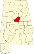
Arkwright, Alabama

Last updated

Arkwright, Alabama
USA Alabama location map.svg
Red pog.svg
Arkwright, Alabama
Usa edcp location map.svg
Red pog.svg
Arkwright, Alabama
Coordinates: 33°22′17″N86°24′09″W / 33.37139°N 86.40250°W / 33.37139; -86.40250
Country United States
State Alabama
County Shelby
Elevation
459 ft (140 m)
Time zone UTC-6 (Central (CST))
  Summer (DST) UTC-5 (CDT)
Area codes 205, 659
GNIS feature ID156003 [1]
Official nameArkwright Heritage Area
DesignatedAugust 25, 2011

Arkwright was an unincorporated community in Shelby County, Alabama, United States. The community lies near the banks of the Coosa River and is now within the city limits of Vincent. Arkwright was founded in 1907 and was named for Preston Stanley Arkwright, who served as founder and president of Georgia Railway and Power Company and as an official with the Atlanta, Birmingham and Atlantic Railway. [2] At one point, the community was home to a railroad station, post office, bank, cotton gin, gristmill, general store, furniture store, and school. The post office was in operation from 1909 to 1926. [3] In 1924, the railroad company raised the railroad bed, eliminating the need for a depot. The population soon began to decline and the post office was closed shortly afterwards. [4] The Arkwright Baptist Church and Arkwright Heritage Area, which includes multiple structures and cemeteries, were added to the Alabama Register of Landmarks and Heritage in 2011. [5]

Demographics

According to the returns from 1850 [6] -2010 [7] for Alabama, it has never reported a population figure separately on the U.S. Census. [8] It has since been annexed into the adjacent city of Vincent.

Related Research Articles

<span class="mw-page-title-main">Jackson County, Alabama</span> County in Alabama, United States

Jackson County is the northeasternmost county in the U.S. state of Alabama. As of the 2020 census, the population was 52,579. The county seat is Scottsboro. The county was named for Andrew Jackson, general in the United States Army and afterward President of the United States of America. Jackson County is a prohibition or dry county, but three cities within the county are "wet", allowing alcohol sales. Jackson County comprises the Scottsboro, AL Micropolitan Statistical Area, and Jackson county is included in the Scottsboro-Fort Payne combined statistical areas. It is the site of Russell Cave National Monument, an archeological site with evidence of 8,000 years of human occupation in the Southeast.

<span class="mw-page-title-main">Shelby County, Alabama</span> County in Alabama, United States

Shelby County is located in the central portion of the U.S. state of Alabama. As of the 2020 census the population was 223,024, making it the sixth-most populous county in Alabama. The county seat is Columbiana. Its largest city is Alabaster. The county is named in honor of Isaac Shelby, Governor of Kentucky from 1792 to 1796 and again from 1812 to 1816. Shelby County is included in the Birmingham–Hoover, AL Metropolitan Statistical Area.

<span class="mw-page-title-main">Talladega County, Alabama</span> County in Alabama, United States

Talladega County is one of the sixty-seven counties located in the east central portion of the U.S. state of Alabama. As of the 2020 census, the population was 82,149. Its county seat is Talladega.

<span class="mw-page-title-main">Birmingham, Alabama</span> Major city in Alabama, United States

Birmingham is a city in the north central region of the U.S. state of Alabama. Birmingham is the seat of Jefferson County, Alabama's most populous county. As of the 2022 census estimates, Birmingham had a population of 196,910, down 2% from the 2020 census, making it Alabama's third-most populous city after Huntsville and Montgomery. The broader Birmingham metropolitan area had a 2020 population of 1,115,289, and is the largest metropolitan area in Alabama as well as the 50th-most populous in the United States. Birmingham serves as an important regional hub and is associated with the Deep South, Piedmont, and Appalachian regions of the nation.

<span class="mw-page-title-main">Calera, Alabama</span> City in Alabama, United States

Calera is a city in Shelby and Chilton counties in the U.S. state of Alabama. It is the location of the Shelby County Airport.

<span class="mw-page-title-main">Atmore, Alabama</span> City in Alabama, United States

Atmore is a city in Escambia County, Alabama, United States. The population was 8,391 at the 2020 census. It was incorporated on May 9, 1907.

<span class="mw-page-title-main">Wilton, Alabama</span> Town in Alabama, United States

Wilton, also known by the previous names of Birmingham Junction, Bismark, and Catoosa, is a town in Shelby County, Alabama, United States. It was incorporated in 1918. This town is part of the Birmingham–Hoover–Cullman Combined Statistical Area. At the 2010 census the population was 687, up from 580 in 2000.

<span class="mw-page-title-main">Shelby, Nebraska</span> Village in Polk County, Nebraska, United States

Shelby is a village in Polk County, Nebraska, United States. The population was 714 at the 2010 census. Shelby lies along the north side of U.S. Highway 81 near the eastern edge of Polk County. It is 6 miles (9.7 km) east of Osceola, and just 17 miles (27 km) south and 3 miles (4.8 km) west of Columbus. Nebraska's center of population is near Shelby.

<span class="mw-page-title-main">Heart of Dixie Railroad Museum</span>

The Heart of Dixie Railroad Museum is the official state railroad museum of Alabama. Dedicated to the preservation, restoration, and operation of historically significant railway equipment, the museum is located at 1919 Ninth Street, Calera, Alabama, on I-65 approximately 30 miles (48 km) south of Birmingham.

<span class="mw-page-title-main">Outline of Alabama</span> 22nd U.S. state, located in Southern U.S.

The following outline is provided as an overview of and topical guide to the U.S. state of Alabama:

<span class="mw-page-title-main">St. Clair County, Alabama</span> County in Alabama, United States

St. Clair County is a county located in the central portion of the U.S. state of Alabama. As of the 2020 census, the population was 91,103. It has two county seats: Ashville and Pell City. It is one of two counties in Alabama, and one of 33 in the United States, with more than one county seat. Its name is in honor of General Arthur St. Clair, an officer in the French and Indian War. St. Clair County is included in the Birmingham, Alabama Metropolitan Statistical Area.

<span class="mw-page-title-main">Vandiver, Alabama</span> Census-designated place & Unincorporated community in Alabama, United States

Vandiver is a census-designated place (CDP) and unincorporated community in Shelby County, Alabama, United States. Its population was 1,084 as of the 2020 census. One structure in Vandiver, the Falkner School, is listed on the Alabama Register of Landmarks and Heritage.

<span class="mw-page-title-main">Shelby, Alabama</span> Census-designated place in Alabama, United States

Shelby is a census-designated place and unincorporated community in Shelby County, Alabama, United States. Its population was 1,044 as of the 2010 census. The area is near Lay Lake and Waxahatchee Creek. Shelby Iron Park is located at the heart of the area. Two sites in Shelby, The Brick House and the Old Shelby Hotel, are listed on the Alabama Register of Landmarks and Heritage.

Maylene is an unincorporated community in Shelby County, Alabama, United States. While the community was once unincorporated, it is now part of southern Alabaster. Maylene has a post office with ZIP code 35114. One site in Maylene, the Meredith-McLaughlin House, is listed on the Alabama Register of Landmarks and Heritage.

<span class="mw-page-title-main">Calcis, Alabama</span> Unincorporated community in Alabama, United States

Calcis is an unincorporated community in Shelby County, Alabama, United States, located along Alabama State Route 25, 3 miles (4.8 km) north-northwest of Vincent.

Fourmile, also known as Redlawn, is an unincorporated community in Shelby County, Alabama, United States. Fourmile is located 4 miles (6.4 km) northeast of Columbiana and 3 miles (4.8 km) west of Wilsonville. Some of the early settlers of Fourmile came from Lexington County and Newberry County, South Carolina.

Aldrich is an unincorporated community in Shelby County, Alabama, United States, that is now part of Montevallo.

The Aldrich Coal Mine Museum is a historical museum located in the former company store of Montevallo, Alabama. Aldrich was once a coal mining town, but is now a part of Montevallo. The museum contains historical photographs, artifacts, and displays from Aldrich's coal mine, churches, school, prison, stores, and post office. The only coal miner monument in Alabama is on display outside of the museum The museum is housed in the former Montevallo Mine Company commissary, containing the original sales counter and cash register, and documented by the Historic American Engineering Record as part of the Birmingham District. The Montevallo Coal Mine Company Store is listed on the Alabama Register of Landmarks and Heritage.

Bemiston is an unincorporated community and former company town in Talladega County, Alabama, United States. Bemiston now lies within the city limits of Talladega.

Acton is an unincorporated community in Shelby County, in the U.S. state of Alabama. It is partially located within the city of Hoover. It is not to be confused with the village of Acton, approximately 6+12 miles to the northeast in Jefferson County.

References

  1. "Arkwright". Geographic Names Information System . United States Geological Survey, United States Department of the Interior.
  2. "Shelby County approves historical marker for Arkwright area near Vincent | al.com". Blog.al.com. May 13, 2013. Retrieved June 5, 2014.
  3. "Shelby County". Jim Forte Postal History. Archived from the original on October 22, 2014. Retrieved October 21, 2014.
  4. "Lost village of Arkwright found". Shelby County Reporter. October 17, 2011. Retrieved June 5, 2014.
  5. "Properties on the Alabama Register of Landmarks & Heritage". Alabama Historical Commission. www.preserveala.org. Archived from the original on September 4, 2012. Retrieved June 5, 2014.
  6. 1850 Census (places) [ permanent dead link ]
  7. 2010 AL Census
  8. "Archived copy". Archived from the original on March 11, 2014. Retrieved November 7, 2019.{{cite web}}: CS1 maint: archived copy as title (link)