Nelson, Alabama | |
|---|---|
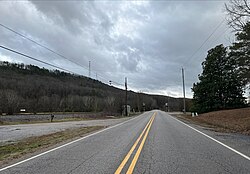 Norfolk Southern Railway crossing Alabama Highway 25 in Nelson | |
 Nelson, Alabama  Nelson, Alabama | |
| Coordinates: 33°12′55″N86°34′52″W / 33.21528°N 86.58111°W | |
| Country | United States |
| State | Alabama |
| County | Shelby |
| Elevation | 463 ft (141 m) |
| Time zone | UTC-6 (Central (CST)) |
| • Summer (DST) | UTC-5 (CDT) |
| Area codes | 205, 659 |
| GNIS feature ID | 156773 [1] |
Nelson, also known as Nelson Switch, or Cates Crossing, is an unincorporated community in Shelby County, Alabama, United States. Nelson is located at the crossing of Alabama State Route 25 and the Norfolk Southern Railway, between Columbiana and Wilsonville.
