Wilsonville, Alabama

Last updated

Wilsonville, Alabama
Shelby County Alabama Incorporated and Unincorporated areas Wilsonville Highlighted 0182848.svg
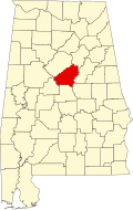
Location of Wilsonville in Shelby County, Alabama.
Coordinates: 33°14′6″N86°29′11″W / 33.23500°N 86.48639°W / 33.23500; -86.48639
Country United States
State Alabama
County Shelby
Area
[1]
  Total10.86 sq mi (28.12 km2)
  Land10.63 sq mi (27.54 km2)
  Water0.22 sq mi (0.58 km2)
Elevation
423 ft (129 m)
Population
 (2020)
  Total1,857
  Density174.66/sq mi (67.44/km2)
Time zone UTC-6 (Central (CST))
  Summer (DST) UTC-5 (CDT)
ZIP code
35186
Area code(s) 205, 659
FIPS code 01-82848
GNIS feature ID0129101
Website www.wilsonvilleal.com

Wilsonville is a town in southeastern Shelby County, Alabama, United States, located northeast of Columbiana. At the 2020 census, the population was 1,857. Wilsonville is named after the earliest settler in the area, Elisha Wilson. [2]

Contents

The town was incorporated in 1897. [3] 3 years later in 1900, it had the distinction of being the largest community in Shelby County with 1,095, edging out the county seat of Columbiana by 20 people. It lost the distinction to Columbiana in 1910 and would not exceed its 1900 population again until 1990. [4]

Geography

Wilsonville is located at 33°14′6″N86°29′11″W / 33.23500°N 86.48639°W / 33.23500; -86.48639 (33.234924, -86.486283). [5]

The town is located in the southeastern part of Shelby County, with parts of its city limits extending east to the western shore of the Coosa River. Alabama State Route 25 is the main highway through the town, running northeast to southwest through the downtown area. Via AL 25, Harpersville is 9 mi (14 km) northeast, and Columbiana, the Shelby County seat, is 9 mi (14 km) southwest.

According to the U.S. Census Bureau, the town has a total area of 11.0 square miles (28 km2), of which 9.9 square miles (26 km2) is land and 1.1 square miles (2.8 km2) (10.21%) is water.

Demographics

Historical population
CensusPop.Note
1880 93
1900 1,095
1910 933−14.8%
1920 815−12.6%
1930 770−5.5%
1940 749−2.7%
1950 692−7.6%
1960 683−1.3%
1970 659−3.5%
1980 91438.7%
1990 1,18529.6%
2000 1,55130.9%
2010 1,82717.8%
2020 1,8571.6%
U.S. Decennial Census [6]
2013 Estimate [7]

2020 census

Wilsonville racial composition [8]
RaceNum.Perc.
White (non-Hispanic)1,61486.91%
Black or African American (non-Hispanic)854.58%
Native American 60.32%
Asian 80.43%
Other/Mixed 894.79%
Hispanic or Latino 552.96%

As of the 2020 United States census, there were 1,857 people, 841 households, and 603 families residing in the town.

2010 census

At the time of the census [9] of 2010, there were 1,867 people, 610 households, and 486 families residing in the town. The population density was 157.5 inhabitants per square mile (60.8/km2). There were 699 housing units at an average density of 71.0 per square mile (27.4/km2). The racial makeup of the town was 92.52% White, 5.22% Black or African American, 0.90% Native American, 0.77% Asian, 0.26% from other races, and 0.32% from two or more races. 0.58% of the population were Hispanic or Latino of any race.

There were 610 households, out of which 31.3% had children under the age of 18 living with them, 66.9% were married couples living together, 8.5% had a female householder with no husband present, and 20.3% were non-families. 18.2% of all households were made up of individuals, and 8.7% had someone living alone who was 65 years of age or older. The average household size was 2.54 and the average family size was 2.84.

In the town, the population was spread out, with 23.5% under the age of 18, 6.0% from 18 to 24, 27.9% from 25 to 44, 26.6% from 45 to 64, and 16.0% who were 65 years of age or older. The median age was 41 years. For every 100 females, there were 97.1 males. For every 100 females age 18 and over, there were 94.7 males.

The median income for a household in the town was $42,105, and the median income for a family was $48,409. Males had a median income of $40,263 versus $25,598 for females. The per capita income for the town was $21,112. About 4.5% of families and 7.4% of the population were below the poverty line, including 7.8% of those under age 18 and 5.8% of those age 65 or over.

Notable people

Related Research Articles

<span class="mw-page-title-main">Coosa County, Alabama</span> County in Alabama, United States

Coosa County is located in the east central portion of the U.S. state of Alabama. As of the 2020 census the population was 10,387. Its county seat is Rockford. Its name derives from a town of the Creek tribe and the Coosa River, which forms one of the county borders.

<span class="mw-page-title-main">Shelby County, Alabama</span> County in Alabama, United States

Shelby County is located in the central portion of the U.S. state of Alabama. As of the 2020 census the population was 223,024, making it the sixth-most populous county in Alabama. The county seat is Columbiana. Its largest city is Alabaster. The county is named in honor of Isaac Shelby, Governor of Kentucky from 1792 to 1796 and again from 1812 to 1816. Shelby County is included in the Birmingham–Hoover, AL Metropolitan Statistical Area.

<span class="mw-page-title-main">Nectar, Alabama</span> Town in Alabama, United States

Nectar is a town in Blount County, Alabama, United States. At the 2020 census, the population was 379.

<span class="mw-page-title-main">Rosa, Alabama</span> Town in Alabama, United States

Rosa is a town in Blount County, Alabama, United States. At the 2020 census, the population was 376.

<span class="mw-page-title-main">Trafford, Alabama</span> Town in Alabama, United States

Trafford is a town in Jefferson County, Alabama, United States. A small portion extends into Blount County. The town was incorporated in 1948. At the 2020 census, the population was 613.

<span class="mw-page-title-main">Childersburg, Alabama</span> City in Alabama, United States

Childersburg is a city in Talladega County in the U.S. state of Alabama. It was incorporated in 1889. At the 2020 census, the population was 4,754. It has a history dating back before 1540, when it was noted as a village of the Coosa Nation visited by the Spanish explorer Hernando de Soto. It is said a member of De Soto’s crew fell ill and was left to settle in the area of present day Childersburg where the Coosa people cared for the ill explorer. The Alabama Army Ammunition Plant, important during World War II, was located 4 miles (6 km) north of Childersburg.

<span class="mw-page-title-main">Columbiana, Alabama</span> City in and county seat of Shelby County, Alabama

Columbiana is a city and the county seat of Shelby County, Alabama, United States. At the 2020 census, the population was 4,462.

<span class="mw-page-title-main">Harpersville, Alabama</span> Town in Alabama, United States

Harpersville is a town in Shelby County, Alabama, United States. According to the 1950 U.S. Census, it formally incorporated in 1943. At the 2020 census the population was 1,614, compared to 1,637 in 2010 and 1,620 in 2000. It is located southeast of the Birmingham metro area.

<span class="mw-page-title-main">Indian Springs Village, Alabama</span> Rural Area in Alabama, United States

Indian Springs Village is a rural town in Shelby County, Alabama, United States, in the Birmingham metropolitan area. It incorporated effective November 14, 1990. At the 2010 census the population was 2,363, up from 2,225 in 2000.

<span class="mw-page-title-main">Meadowbrook, Alabama</span> Census-designated place & Unincorporated community in Alabama, United States

Meadowbrook is an unincorporated community and census-designated place (CDP) in Shelby County, Alabama, United States. At the 2020 census, the population was 9,688. It is part of the Birmingham metropolitan area.

<span class="mw-page-title-main">Pelham, Alabama</span> City in Alabama, United States

Pelham is a city in Shelby County, Alabama, United States. The population was 24,318 at the 2020 census, It incorporated on July 10, 1964 and is a suburb located in the Birmingham metropolitan area, Alabama which was home to nearly 1.2 million residents as of the 2020 census. It was named for Confederate Civil War officer John Pelham.

<span class="mw-page-title-main">Vincent, Alabama</span> City in Alabama, United States

Vincent, originally known as Propel, is a city in Shelby, St. Clair, and Talladega counties in the U.S. state of Alabama. At the 2020 census, the population was 1,982. The community was first known as Propel, but later named Vincent in honor of the Vincent family, who were early settlers of the area. It was incorporated in 1897.

<span class="mw-page-title-main">Wilton, Alabama</span> Town in Alabama, United States

Wilton, also known by the previous names of Birmingham Junction, Bismark, and Catoosa, is a town in Shelby County, Alabama, United States. It was incorporated in 1918. This town is part of the Birmingham–Hoover–Cullman Combined Statistical Area. At the 2010 census the population was 687, up from 580 in 2000.

<span class="mw-page-title-main">Margaret, Alabama</span> City in Alabama, United States

Margaret is a city in St. Clair County, Alabama, United States. At the 2020 census, the population was 5,106. As of the 2010 census, the population is 4,428, an increase of 278.8%. Margaret incorporated in 1960 and became a city in October 2011.

<span class="mw-page-title-main">Waldo, Alabama</span> Town in Alabama, United States

Waldo is a town in Talladega County, Alabama, United States. It incorporated in 1972. At the 2020 census, the population was 258.

<span class="mw-page-title-main">Holt, Alabama</span> Census-designated place & Unincorporated community in Alabama, United States

Holt is an unincorporated community and census-designated place (CDP) in Tuscaloosa County, Alabama, United States. At the 2020 census, the population was 3,413. It is part of the Tuscaloosa, Alabama Metropolitan Statistical Area. Holt appeared on the 1930 census.

<span class="mw-page-title-main">Jamestown, Pennsylvania</span> Borough in Pennsylvania, United States

Jamestown is a borough in northwestern Mercer County, Pennsylvania, United States, along the Shenango River. The population was reported as 580 on the 2020 census. It is part of the Hermitage micropolitan area.

<span class="mw-page-title-main">Thompsons, Texas</span> Town in Texas, United States

Thompsons is a town in Fort Bend County, Texas, United States, within the Houston–Sugar Land–Baytown metropolitan area. The population was 246 at the 2010 census.

<span class="mw-page-title-main">Cross Timber, Texas</span> Town in Texas, United States

Cross Timber is a town in Johnson County, Texas, United States. As of the 2010 census the population was 268.

<span class="mw-page-title-main">St. Clair County, Alabama</span> County in Alabama, United States

St. Clair County is a county located in the central portion of the U.S. state of Alabama. As of the 2020 census, the population was 91,103. It has two county seats: Ashville and Pell City. It is one of two counties in Alabama, and one of 33 in the United States, with more than one county seat. Its name is in honor of General Arthur St. Clair, an officer in the French and Indian War. St. Clair County is included in the Birmingham, Alabama Metropolitan Statistical Area.

References

  1. "2020 U.S. Gazetteer Files". United States Census Bureau. Retrieved October 29, 2021.
  2. Foscue, Virginia (1989). Place Names in Alabama. Tuscaloosa: The University of Alabama Press. p. 149. ISBN   0-8173-0410-X.
  3. "Wilsonville".
  4. 1820-2010 U.S. Censuses research on Shelby County, Alabama communities
  5. "US Gazetteer files: 2010, 2000, and 1990". United States Census Bureau. February 12, 2011. Retrieved April 23, 2011.
  6. "U.S. Decennial Census". Census.gov. Retrieved June 6, 2013.
  7. "Annual Estimates of the Resident Population: April 1, 2010 to July 1, 2013" . Retrieved June 3, 2014.
  8. "Explore Census Data". data.census.gov. Retrieved December 11, 2021.
  9. "U.S. Census website". United States Census Bureau . Retrieved January 31, 2008.

33°14′06″N86°29′11″W / 33.234924°N 86.486283°W / 33.234924; -86.486283