Vincent, Alabama | |
---|---|
Coordinates: 33°23′9″N86°24′36″W / 33.38583°N 86.41000°W | |
Country | United States |
State | Alabama |
Counties | Shelby, St. Clair, Talladega |
Government | |
• Mayor | James D Latimer |
Area | |
• Total | 20.96 sq mi (54.29 km2) |
• Land | 20.58 sq mi (53.31 km2) |
• Water | 0.38 sq mi (0.98 km2) |
Elevation | 466 ft (142 m) |
Population (2020) | |
• Total | 1,982 |
• Density | 96.29/sq mi (37.18/km2) |
Time zone | UTC-6 (CST) |
• Summer (DST) | UTC-5 (CDT) |
ZIP code | 35178 |
Area code(s) | 205, 659 |
FIPS code | 01-79008 |
GNIS feature ID | 2406802 [2] |
Website | www |
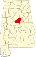
Vincent, originally known as Propel, is a city in Shelby, St. Clair, and Talladega counties in the U.S. state of Alabama. At the 2020 census, the population was 1,982. The community was first known as Propel, but later named Vincent in honor of the Vincent family, who were early settlers of the area. [3] It was incorporated in 1897. [4]
Vincent is located at 33°23′9″N86°24′36″W / 33.38583°N 86.41000°W (33.385719, -86.409919). [5]
The city is located mostly in the northeastern part of Shelby County, with portions of the city limits extending into neighboring St. Clair and Talladega counties. U.S. Route 231 is the main highway through the city, leading northeast 17 mi (27 km) to Pell City and southwest 3 mi (5 km) to Harpersville. Alabama State Route 25 also runs through the city, splitting off from US 231 north of town and leading northwest 7 mi (11 km) to Sterrett.
According to the U.S. Census Bureau, the town has a total area of 20.0 square miles (51.7 km2), of which 19.6 square miles (50.7 km2) is land and 0.39 square miles (1.0 km2), or 1.90%, is water. [6]
Census | Pop. | Note | %± |
---|---|---|---|
1900 | 765 | — | |
1910 | 995 | 30.1% | |
1920 | 1,034 | 3.9% | |
1930 | 1,192 | 15.3% | |
1940 | 1,108 | −7.0% | |
1950 | 1,240 | 11.9% | |
1960 | 1,402 | 13.1% | |
1970 | 1,419 | 1.2% | |
1980 | 1,652 | 16.4% | |
1990 | 1,767 | 7.0% | |
2000 | 1,853 | 4.9% | |
2010 | 1,988 | 7.3% | |
2020 | 1,982 | −0.3% | |
U.S. Decennial Census [7] 2013 Estimate [8] |
Race | Num. | Perc. |
---|---|---|
White (non-Hispanic) | 1,493 | 75.33% |
Black or African American (non-Hispanic) | 384 | 19.37% |
Native American | 8 | 0.4% |
Asian | 2 | 0.1% |
Other/Mixed | 58 | 2.93% |
Hispanic or Latino | 37 | 1.87% |
As of the 2020 United States census, there were 1,982 people, 722 households, and 490 families residing in the town.
As of the census of 2010, there were 1,988 people, 802 households, and 575 families residing in the town. The population density was 101.4 inhabitants per square mile (39.2/km2). There were 895 housing units at an average density of 45.7 per square mile (17.6/km2). The racial makeup of the town was 78.7% White, 19.8% Black or African American, 0.4% Native American, 0.1% Asian, 0.1% some other race, and 1.0% from two or more races. 0.7% of the population were Hispanic or Latino of any race. [10]
There were 802 households, out of which 31.7% had children under the age of 18 living with them, 52.1% were headed by married couples living together, 16.7% had a female householder with no husband present, and 28.3% were non-families. 25.4% of all households were made up of individuals, and 9.2% were someone living alone who was 65 years of age or older. The average household size was 2.48 and the average family size was 2.95. [6]
In the town, the population was spread out, with 22.7% under the age of 18, 7.4% from 18 to 24, 23.9% from 25 to 44, 31.2% from 45 to 64, and 14.6% who were 65 years of age or older. The median age was 42.0 years. For every 100 females, there were 87.9 males. For every 100 females age 18 and over, there were 84.0 males. [6]
For the period 2007–2011, the estimated median annual income for a household in the town was $43,125, and the median income for a family was $54,640. Male full-time workers had a median income of $44,310 versus $31,467 for females. The per capita income for the town was $22,782. About 2.7% of families and 6.2% of the population were below the poverty line, including 0% of those under age 18 and 14.4% of those age 65 or over. [11]
The City of Vincent operates under a Mayor-Council form of government. [12]
In August 2022, the city council disbanded its three-member police department following an incident where a racist text circulated on social media. [13]
County Line is a town in Blount and Jefferson counties in the State of Alabama. At the 2020 census, the population was 311.
Garden City is a town in Cullman and Blount counties in the U.S. state of Alabama. At the 2020 census, the population was 528. Garden City was founded by Johann Cullmann, namesake of Cullman County in 1873 after founding Cullman, Alabama. It was located in Blount County and was incorporated in 1878. Cullman County was created in 1877. Garden City was annexed by Cullman County with a shift in county borders until 1901. After a lapse in its incorporation, it was re-incorporated in 1950.
Nectar is a town in Blount County, Alabama, United States. At the 2020 census, the population was 379.
Rosa is a town in Blount County, Alabama, United States. At the 2020 census, the population was 376.
Goodwater is a town in Coosa County, Alabama, United States. At the 2020 census, the population was 1,291. It is part of the Talladega-Sylacauga Micropolitan Statistical Area.
Babbie is a town in Covington County, Alabama, United States. At the 2020 census, the population was 625. It incorporated in 1957.
Florala is a town in Covington County, Alabama, United States. At the 2020 census, the population was 1,923.
Gantt is a town in Covington County, Alabama, United States. At the 2020 census, the population was 196.
Libertyville is a town in Covington County, Alabama, United States. At the 2020 census, the population was 108.
Opp is a city in Covington County, Alabama, United States. At the 2020 census, the population was 6,771. Opp is named after Henry Opp, a lawyer for the Louisville and Nashville Railroad.
Dozier is a town in Crenshaw County, Alabama, United States. At the 2020 census, the population was 285. Dozier was incorporated in 1907.
Baileyton is a town in Cullman County, Alabama, United States. At the 2020 census, the population was 649.
Dodge City is a town in Cullman County, Alabama, United States. At the 2020 census, the population was 548. It was incorporated in 1993.
Fairview is a town in Cullman County, Alabama, United States. At the 2010 census the population was 446, down from 522 in 2000. It incorporated in 1968.
Deatsville is a town in Elmore County, Alabama, United States. Although Deatsville initially incorporated in 1903, it lapsed at some point after the 1910 U.S. Census and did not appear again as incorporated until 2000. As of the 2020 census, the population was 1,679.
Reece City is a town in Etowah County, Alabama, United States. It was incorporated in May 1956. It is part of the Gadsden Metropolitan Statistical Area. At the 2020 census, the population was 615.
Oak Grove is a town in Talladega County, Alabama, United States. It incorporated in 1966. At the 2020 census, the population was 564.
Central Heights-Midland City is an unincorporated community and census-designated place (CDP) in Gila County, Arizona, United States. The area is home to the Pinal Cemetery which serves the community in gereneral but also contains Croatian and Serbian dedicated sections. The Gila County Health and Human Services offices are located within the region. One of the communities few nurseries is located along Golden Hill Road, a notable road in the Central Heights-Midland City area. The population was 2,534 at the 2010 census.
Warrington is a census-designated place (CDP) in Escambia County, Florida, United States. Warrington is located between downtown Pensacola and the state line with Alabama; it is 6 miles (10 km) away from both.
Glenmore is a town in Brown County in the U.S. state of Wisconsin. The population was 1,045 at the 2020 census.