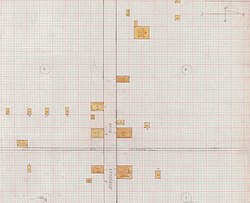
Whitney, Alabama

Last updated
Whitney, Alabama
USA Alabama location map.svg
Red pog.svg
Whitney, Alabama
Usa edcp location map.svg
Red pog.svg
Whitney, Alabama
Coordinates: 33°52′04″N86°17′29″W / 33.86778°N 86.29139°W / 33.86778; -86.29139 Coordinates: 33°52′04″N86°17′29″W / 33.86778°N 86.29139°W / 33.86778; -86.29139
Country United States
State Alabama
County St. Clair
Elevation
597 ft (182 m)
Time zone UTC-6 (Central (CST))
  Summer (DST) UTC-5 (CDT)
Area code(s) 205, 659
GNIS feature ID164909 [1]

Whitney is an unincorporated community in St. Clair County, Alabama, United States.

History

Whitney was named for Charles Whitney, a member of the Alabama Legislature following the Civil War. [2] A post office was established under the name Whitney in 1875 and was in operation until 1967. [3]

Related Research Articles

Arthur St. Clair American soldier and politician

Arthur St. Clair was a Scottish-American soldier and politician. Born in Thurso, Scotland, he served in the British Army during the French and Indian War before settling in Pennsylvania, where he held local office. During the American Revolutionary War, he rose to the rank of major general in the Continental Army, but lost his command after a controversial retreat from Fort Ticonderoga.

St. Clair County, Michigan U.S. county in Michigan

St. Clair County is a county located in the U.S. state of Michigan and bordering the west bank of the St. Clair River. As of the 2010 census, the population was 163,040. It is the 13th-most populous county in the state. The county seat is Port Huron, located at the north end of the St. Clair River at Lake Huron. The county was created September 10, 1820, and its government was organized in 1821.

Vincent, Alabama City in Alabama, United States

Vincent, originally known as Propel or Propel, is a city in Shelby, St. Clair, and Talladega counties in the U.S. state of Alabama. At the 2010 census the population was 1,988. The community was first known as Propel, but later named Vincent in honor of the Vincent family, who were early settlers of the area. It was incorporated in 1897.

Ashville, Alabama City in Alabama, United States

Ashville is a city in St. Clair County, Alabama, United States. Its population was 2,212 at the 2010 census, down from 2,260, at which time it was a town. Ashville is the county seat of St. Clair County along with Pell City. It incorporated in 1822.

St. Clair County is the name of four counties in the United States:

National Register of Historic Places listings in St. Clair County, Alabama

This is a list of the National Register of Historic Places listings in St. Clair County, Alabama.

Alabamas 3rd congressional district

Alabama's 3rd congressional district is a United States congressional district in Alabama that elects a representative to the United States House of Representatives. It is based in east central Alabama and encompasses portions of Montgomery and the entirety of Calhoun, Chambers, Cherokee, Clay, Cleburne, Lee, Macon, Randolph, Russell, St. Clair, Talladega, and Tallapoosa counties.

Alabamas 6th congressional district

Alabama's 6th congressional district is a United States congressional district in Alabama that elects a representative to the United States House of Representatives. It is composed of the wealthier portions of Birmingham, nearly all of Jefferson County outside Birmingham, and the entirety of Bibb, Blount, Chilton, Coosa, and Shelby counties.

St. Clair County Airport

St. Clair County Airport is a public use airport located three nautical miles southeast of the central business district of Pell City, in St. Clair County, Alabama, United States. It is owned by the St. Clair County Airport Authority. According to the FAA's National Plan of Integrated Airport Systems for 2009–2013, it is categorized as a reliever airport for the Birmingham-Shuttlesworth International Airport.

St. Vincent's Health System, based in Birmingham, Alabama, United States is an operator of acute care hospitals located in the Birmingham area and a health ministry of Ascension Health. St. Vincent's Health System is made up of six facilities: St. Vincent's Birmingham, St. Vincent's Blount, St. Vincent's Chilton, St. Vincent's East, St. Vincent's St. Clair, and St. Vincent's One Nineteen. The company employs over 4,700 people throughout its six facilities.

Gallant, Alabama Census-designated place in Alabama, United States

Gallant, also known as Clear Springs or Greasy Cove, is a census-designated place and unincorporated community in Etowah, and St. Clair counties, Alabama, United States. It lies west of the city of Gadsden, the county seat of Etowah County. As of the 2010 census, its population was 855. Its elevation is 814 feet (248 m). Although it is unincorporated, it has a post office, with the ZIP code of 35972.

St. Clair County, Alabama U.S. county in Alabama

St. Clair County is a county located in the central portion of the U.S. state of Alabama. As of the 2010 census, the population was 83,593. It has two county seats in Ashville and another in Pell City. It is one of two counties in Alabama, and one of 33 in the United States, with more than one county seat. Its name is in honor of General Arthur St. Clair, an officer in the French and Indian War.

Cropwell, Alabama Neighborhood in St. Clair, Alabama, United States

Cropwell, also known as Coosa or Coosa Valley, is a neighborhood of Pell City, Alabama, United States. Cropwell is a small town and an unincorporated community. Cropwell is located along Alabama State Route 34, 2.5 miles (4.0 km) south-southwest of downtown Pell City. Cropwell has its own post office with ZIP code 35054. Cropwell was originally called Coosa or Coosa Valley until 1837, when it began to be called Cropwell. A post office operated under the name Coosa during 1833 and 1834. A post office was then established under the name Cropwell in 1837.

Cooks Springs, Alabama Unincorporated community in Alabama, United States

Cooks Springs is an unincorporated community in St. Clair County, Alabama, United States. Cooks Springs is located along Interstate 20 and U.S. Route 78, 6.3 miles (10.1 km) west of Pell City. Cooks Springs had a post office until November 19, 2011; it still has its own ZIP code, 35052. Cooks Springs was named for William Proctor Cooke, who settled here in 1854.

Wattsville, Alabama Unincorporated community in Alabama, United States

Wattsville is an unincorporated community in St. Clair County, Alabama, United States. Wattsville is located along U.S. Route 231, 6.6 miles (10.6 km) north of Pell City. Wattsville has a post office with ZIP code 35182.

1976 United States presidential election in Alabama

The 1976 United States presidential election in Alabama took place on November 2, 1976, as part of the 1976 presidential election. Voters chose nine representatives, or electors, to the Electoral College, who voted for president and vice president.

New London, Alabama Unincorporated community in Alabama, United States

New London, also known as London, Kelly's Creek, or Kellys Creek, is an unincorporated community in St. Clair County, Alabama, United States.

Acmar, Alabama Unincorporated community in Alabama, United States

Acmar is a former unincorporated community and neighborhood within the city of Moody in St. Clair County, in the U.S. state of Alabama.

St. Clair Springs, Alabama Unincorporated community in Alabama, United States

St. Clair Springs is an unincorporated community and historic district in St. Clair County, Alabama, United States.

Prescott, Alabama Unincorporated community in Alabama, United States

Prescott is an unincorporated community in St. Clair County, Alabama, United States.

References

  1. "Whitney". Geographic Names Information System . United States Geological Survey.
  2. Foscue, Virginia (1989). Place Names in Alabama. Tuscaloosa: The University of Alabama Press. p. 148. ISBN   0-8173-0410-X.
  3. "St. Clair". Jim Forte Postal History. Retrieved 8 November 2014.