Meadowbrook, Alabama

Last updated

Meadowbrook, Alabama
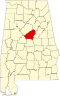
Shelby County Alabama Incorporated and Unincorporated areas Meadowbrook Highlighted.svg
Location in Shelby County and the state of Alabama
Coordinates: 33°24′13″N86°41′26″W / 33.40361°N 86.69056°W / 33.40361; -86.69056
Country United States
State Alabama
County Shelby
Area
[1]
  Total4.37 sq mi (11.32 km2)
  Land4.36 sq mi (11.29 km2)
  Water0.01 sq mi (0.03 km2)
Elevation
627 ft (191 m)
Population
 (2020)
  Total9,688
  Density2,222.53/sq mi (858.17/km2)
Time zone UTC-6 (Central (CST))
  Summer (DST) UTC-5 (CDT)
ZIP code
35242 [2]
Area code(s) 205 and 659
FIPS code 01-47740
GNIS feature ID1866929

Meadowbrook is an unincorporated community and census-designated place (CDP) in Shelby County, Alabama, United States. At the 2020 census, the population was 9,688. It is part of the Birmingham metropolitan area.

Contents

Geography

Meadowbrook is located at 33°24′14″N86°41′27″W / 33.40389°N 86.69083°W / 33.40389; -86.69083 (33.403788, -86.690758). [3]

The community is located within the southeastern suburbs of Birmingham, generally bounded by U.S. Route 280 to the north, Alabama State Route 119 to the east, Valleydale Rd to the west, and Meadow Brook Rd to the south. Downtown Birmingham is 13 mi (21 km) to the northwest via US 280.

According to the U.S. Census Bureau, the community has a total area of 4.2 square miles (11 km2), all land.

Demographics

Historical population
CensusPop.Note
1990 4,621
2000 4,6971.6%
2010 8,76986.7%
2020 9,68810.5%
source: [4]

At the 2000 census there were 4,697 people, 1,659 households, and 1,373 families living in the community. The population density was 1,909.9 inhabitants per square mile (737.4/km2). There were 1,695 housing units at an average density of 689.2 per square mile (266.1/km2). The racial makeup of the community was 94.29% White, 2.87% Black or African American, 0.04% Native American, 2.09% Asian, 0.06% from other races, and 0.64% from two or more races. 0.66% of the population were Hispanic or Latino of any race. [5] Of the 1,659 households 46.7% had children under the age of 18 living with them, 74.6% were married couples living together, 6.0% had a female householder with no husband present, and 17.2% were non-families. 14.9% of households were one person and 2.4% were one person aged 65 or older. The average household size was 2.83 and the average family size was 3.17.

The age distribution was 30.8% under the age of 18, 5.0% from 18 to 24, 29.0% from 25 to 44, 28.8% from 45 to 64, and 6.4% 65 or older. The median age was 38 years. For every 100 females, there were 96.0 males. For every 100 females age 18 and over, there were 92.8 males.

The median household income was $83,715 and the median family income was $92,579. Males had a median income of $70,462 versus $35,179 for females. The per capita income for the community was $35,511. About 1.3% of families and 1.3% of the population were below the poverty line, including 0.6% of those under age 18 and 2.7% of those age 65 or over.

2010 census

At the 2010 census there were 8,769 people, 3,187 households, and 2,523 families living in the community. The population density was 2,100 inhabitants per square mile (810/km2). There were 3,325 housing units at an average density of 791.7 per square mile (305.7/km2). The racial makeup of the community was 92.8% White, 3.9% Black or African American, 0.1% Native American, 2.1% Asian, 0.3% from other races, and 0.8% from two or more races. 1.6% of the population were Hispanic or Latino of any race. [6] Of the 3,187 households 40.2% had children under the age of 18 living with them, 69.2% were married couples living together, 7.8% had a female householder with no husband present, and 20.8% were non-families. 17.7% of households were one person and 3.1% were one person aged 65 or older. The average household size was 2.75 and the average family size was 3.15.

The age distribution was 27.5% under the age of 18, 6.7% from 18 to 24, 23.2% from 25 to 44, 34.6% from 45 to 64, and 8.1% 65 or older. The median age was 40.3 years. For every 100 females, there were 97.6 males. For every 100 females age 18 and over, there were 91.5 males.

The median household income was $98,862 and the median family income was $103,602. Males had a median income of $83,039 versus $52,460 for females. The per capita income for the community was $40,393. About 1.3% of families and 1.4% of the population were below the poverty line, including 1.2% of those under age 18 and 0% of those age 65 or over.

Related Research Articles

<span class="mw-page-title-main">Argo, Alabama</span> Town in Alabama, United States

Argo is a town in Jefferson and St. Clair counties, Alabama, United States. It incorporated in 1987. At the 2020 census, the population was 4,368.

<span class="mw-page-title-main">Chalkville, Alabama</span> CDP in Alabama, United States

Chalkville is a former census-designated place in Jefferson County, Alabama, United States. At the 2000 census the population was 3,829. The area is now part of the city of Clay.

<span class="mw-page-title-main">Mount Olive, Jefferson County, Alabama</span> Unincorporated community in Alabama, United States

Mount Olive, also spelled Mt. Olive is an unincorporated community and a census-designated place (CDP) in Jefferson County, Alabama. Its location is in the suburbs of Birmingham. As of the 2010 census, the population of the community is 4,079. Mount Olive is bordered on the south and the east by the town of Gardendale, and in fact, some areas that had previously been in Mount Olive have been annexed into Gardendale over the years. Running along part of the border between Mt. Olive and Gardendale is the major expressway, Interstate 65. Eventually, part of Birmingham's Northern Beltline will cut through northwestern sections of Mt. Olive. Mt. Olive has its own elementary school, and was formerly the home of a junior high school.

<span class="mw-page-title-main">Pinson, Alabama</span> City in Alabama, United States

Pinson is a city in Jefferson County near Birmingham, Alabama, United States, northwest of Center Point. As of the 2010 census, the population was 7,163.

<span class="mw-page-title-main">Brook Highland, Alabama</span> Census-designated place & Unincorporated community in Alabama, United States

Brook Highland is an unincorporated community and census-designated place in Shelby County, Alabama, United States. At the 2020 census, the population was 7,406.

<span class="mw-page-title-main">Bellair-Meadowbrook Terrace, Florida</span> Census-designated place in Florida, United States

Bellair-Meadowbrook Terrace is an unincorporated area and census-designated place (CDP) in Clay County, Florida, United States. The population was 13,343 at the 2010 census.

<span class="mw-page-title-main">Macedonia, Iowa</span> City in Iowa, United States

Macedonia is a city in Pottawattamie County, Iowa, United States. The population was 267 at the time of the 2020 census.

<span class="mw-page-title-main">Meadowbrook Farm, Kentucky</span> City in Kentucky, United States

Meadowbrook Farm is a neighborhood of Louisville, Kentucky, United States. It is separately incorporated as a home rule-class city. The population was 136 as of the 2010 census.

<span class="mw-page-title-main">Sand Beach Township, Michigan</span> Civil township in Michigan, United States

Sand Beach Township is a civil township of Huron County in the U.S. state of Michigan. The population was 1,470 at the 2000 census.

<span class="mw-page-title-main">Sherman Township, Huron County, Michigan</span> Civil township in Michigan, United States

Sherman Township is a civil township of Huron County in the U.S. state of Michigan. The population was 1,083 at the 2010 census.

<span class="mw-page-title-main">Cooper Township, Michigan</span> Charter township in Michigan, United States

Cooper Charter Township is a charter township of Kalamazoo County in the U.S. state of Michigan. The population was 10,111 at the 2010 census, up from 8,754 at the 2000 census. The township was organized in 1837.

<span class="mw-page-title-main">Beechwood, Michigan</span> Census-designated place & Unincorporated community in Michigan, United States

Beechwood is an unincorporated community in Ottawa County in the U.S. state of Michigan. It is a census-designated place (CDP) for statistical purposes, but is not an incorporated municipality. The population was 3,121 at the 2020 census.

<span class="mw-page-title-main">Aullville, Missouri</span> Village in Missouri, United States

Aullville is a village in Lafayette County, Missouri, and is part of the Kansas City metropolitan area within the United States. The population was 77 at the 2020 census.

<span class="mw-page-title-main">Morrisonville, New York</span> Census-designated place in New York, United States

Morrisonville is a hamlet and census-designated place in Clinton County, New York, United States. The population was 1,545 at the 2010 census.

<span class="mw-page-title-main">Corfu, New York</span> Village in New York, United States

Corfu is a village in Genesee County, New York, United States. The population was 709 at the 2010 census. It is named after the Greek island of Corfu.

<span class="mw-page-title-main">Lore City, Ohio</span> Village in Ohio, United States

Lore City is a village in Guernsey County, Ohio, United States. The population was 282 at the 2020 census.

<span class="mw-page-title-main">Senecaville, Ohio</span> Village in Ohio, United States

Senecaville is a village in Guernsey County, Ohio, United States. The population was 422 at the 2020 census.

<span class="mw-page-title-main">Clearview, West Virginia</span> Village in West Virginia, United States

Clearview is a village in Ohio County, West Virginia, United States. It is part of the Wheeling, West Virginia Metropolitan Statistical Area. The population was 565 at the 2010 census.

<span class="mw-page-title-main">Lester, West Virginia</span> Town in West Virginia, United States

Lester is a town in Raleigh County, West Virginia, United States. The population was 337 at the 2020 census. The community was named after Champ Lester, a local pioneer.

<span class="mw-page-title-main">Livermore Falls (CDP), Maine</span> Census-designated place in Maine, United States

Livermore Falls is a census-designated place (CDP) in the town of Livermore Falls in Androscoggin County, Maine, United States. The population of the CDP was 1,594 at the 2010 census, out of a population of 3,187 within the full town.

References

  1. "2020 U.S. Gazetteer Files". United States Census Bureau. Retrieved October 29, 2021.
  2. "Meadowbrook AL ZIP Code". zipdatamaps.com. 2023. Retrieved January 26, 2023.
  3. "US Gazetteer files: 2010, 2000, and 1990". United States Census Bureau. February 12, 2011. Retrieved April 23, 2011.
  4. "CENSUS OF POPULATION AND HOUSING (1790-2000)". U.S. Census Bureau . Retrieved August 8, 2010.
  5. "U.S. Census website". United States Census Bureau . Retrieved January 31, 2008.
  6. "U.S. Census website". United States Census Bureau . Retrieved August 8, 2015.

33°24′14″N86°41′27″W / 33.403788°N 86.690758°W / 33.403788; -86.690758