Vandiver, Alabama

Last updated

Vandiver, Alabama
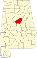
Shelby County Alabama Incorporated and Unincorporated areas Vandiver Highlighted 0178312.svg
Location of Vandiver in Shelby County, Alabama.
USA Alabama location map.svg
Red pog.svg
Vandiver, Alabama
Usa edcp location map.svg
Red pog.svg
Vandiver, Alabama
Coordinates: 33°28′14″N86°30′48″W / 33.4706617°N 86.5133163°W / 33.4706617; -86.5133163
Country United States
State Alabama
County Shelby
Area
[1]
  Total20.85 sq mi (54.01 km2)
  Land20.31 sq mi (52.60 km2)
  Water0.54 sq mi (1.41 km2)
Elevation
531 ft (162 m)
Population
 (2020)
  Total1,084
  Density53.37/sq mi (20.61/km2)
Time zone UTC-6 (Central (CST))
  Summer (DST) UTC-5 (CDT)
Area code(s) 205, 659
GNIS feature ID128408 [2]

Vandiver is a census-designated place (CDP) and unincorporated community in Shelby County, Alabama, United States. Its population was 1,084 as of the 2020 census. One structure in Vandiver, the Falkner School, is listed on the Alabama Register of Landmarks and Heritage. [3]
Contents

Geography

The community is in the northeastern part of Shelby County. Alabama State Route 25 runs through the community, leading southeast 10 mi (16 km) to Vincent and north 10 mi (16 km) on an winding and mountainous route to the city of Leeds.

Demographics

Historical population
CensusPop.Note
2020 1,084
U.S. Decennial Census [4]

Notable people

Related Research Articles

<span class="mw-page-title-main">Chilton County, Alabama</span> County in Alabama, United States

Chilton County is a county located in the central portion of the U.S. state of Alabama. As of the 2020 census, the population was 45,014. The county seat is Clanton. Its name is in honor of William Parish Chilton, Sr. (1810–1871), a lawyer who became Chief Justice of the Alabama Supreme Court and later represented Montgomery County in the Congress of the Confederate States of America.

<span class="mw-page-title-main">Choctaw County, Alabama</span> County in Alabama, United States

Choctaw County is a county located in the southwestern portion of the U.S. state of Alabama. As of the 2020 census, the population was 12,665. The county seat is Butler. The county was established on December 29, 1847, and named for the Choctaw tribe of Native Americans.

<span class="mw-page-title-main">Coosa County, Alabama</span> County in Alabama, United States

Coosa County is located in the east central portion of the U.S. state of Alabama. As of the 2020 census the population was 10,387. Its county seat is Rockford. Its name derives from a town of the Creek tribe and the Coosa River, which forms one of the county borders.

<span class="mw-page-title-main">Limestone County, Alabama</span> County in Alabama

Limestone County is a county of the U.S. state of Alabama. As of the 2020 census, the county's population was 103,570. Its county seat is Athens. The county is named after Limestone Creek. Limestone County is included in the Huntsville, AL Metropolitan Statistical Area.

<span class="mw-page-title-main">Marengo County, Alabama</span> County in Alabama, United States

Marengo County is a county located in the west central portion of the U.S. state of Alabama. As of the 2020 census, the population was 19,323. The largest city is Demopolis, and the county seat is Linden. It is named in honor of the Battle of Marengo near Turin, Italy, where French leader Napoleon Bonaparte defeated the Austrians on June 14, 1800.

<span class="mw-page-title-main">Shelby County, Alabama</span> County in Alabama, United States

Shelby County is located in the central portion of the U.S. state of Alabama. As of the 2020 census the population was 223,024, making it the sixth-most populous county in Alabama. The county seat is Columbiana. Its largest city is Alabaster. The county is named in honor of Isaac Shelby, Governor of Kentucky from 1792 to 1796 and again from 1812 to 1816. Shelby County is included in the Birmingham–Hoover, AL Metropolitan Statistical Area.

<span class="mw-page-title-main">Talladega County, Alabama</span> County in Alabama, United States

Talladega County is one of the sixty-seven counties located in the east central portion of the U.S. state of Alabama. As of the 2020 census, the population was 82,149. Its county seat is Talladega.

<span class="mw-page-title-main">Calera, Alabama</span> City in Alabama, United States

Calera is a city in Shelby and Chilton counties in the U.S. state of Alabama. It is the location of the Shelby County Airport.

<span class="mw-page-title-main">Rockford, Alabama</span> Town in Alabama, United States

Rockford is a town in Coosa County, Alabama, United States. At the 2020 census, the population was 349. The town is the county seat of Coosa County and is part of the Talladega-Sylacauga Micropolitan Statistical Area.

<span class="mw-page-title-main">Vincent, Alabama</span> City in Alabama, United States

Vincent, originally known as Propel, is a city in Shelby, St. Clair, and Talladega counties in the U.S. state of Alabama. At the 2020 census, the population was 1,982. The community was first known as Propel, but later named Vincent in honor of the Vincent family, who were early settlers of the area. It was incorporated in 1897.

<span class="mw-page-title-main">Wilsonville, Alabama</span> Town in Alabama, United States

Wilsonville is a town in southeastern Shelby County, Alabama, United States, located northeast of Columbiana. At the 2020 census, the population was 1,857. Wilsonville is named after the earliest settler in the area, Elisha Wilson.

<span class="mw-page-title-main">Camp Hill, Alabama</span> Town in Alabama, United States

Camp Hill is a town in Tallapoosa County, Alabama, United States. It was incorporated in 1895. At the 2010 census the population was 1,014, down from 1,273 in 2000. Camp Hill is the home to Southern Preparatory Academy.

<span class="mw-page-title-main">Westover, Alabama</span> City in Alabama, United States

Westover is a city in Shelby County, Alabama, United States. The city is part of the Birmingham Metropolitan Statistical Area. The city was officially incorporated on January 31, 2001 although it was established in 1901 and had a population of 961 when it was incorporated in 2001.

<span class="mw-page-title-main">St. Clair County, Alabama</span> County in Alabama, United States

St. Clair County is a county located in the central portion of the U.S. state of Alabama. As of the 2020 census, the population was 91,103. It has two county seats: Ashville and Pell City. It is one of two counties in Alabama, and one of 33 in the United States, with more than one county seat. Its name is in honor of General Arthur St. Clair, an officer in the French and Indian War. St. Clair County is included in the Birmingham-Hoover, Alabama Metropolitan Statistical Area.

<span class="mw-page-title-main">Chunchula, Alabama</span> Census-designated place in Alabama, United States

Chunchula is an unincorporated community and census-designated place (CDP) in Mobile County, Alabama, United States. As of the 2020 census, its population was 195. It has a post office with the 36521 ZIP code. The community has one site listed on the Alabama Register of Landmarks and Heritage, the Chunchula School.

<span class="mw-page-title-main">Dunnavant, Alabama</span> Census-designated place in Alabama, United States

Dunnavant, also spelled Dunavant, is a census-designated place and unincorporated community in Shelby County, Alabama, United States. Its population was 981 as of the 2010 census. The community's name is probably derived from a local family. A post office was established in 1897 and was in operation until it was closed in 1958.

<span class="mw-page-title-main">Highland Lakes, Alabama</span> Census-designated place in Alabama, United States

Highland Lakes is a census-designated place in Shelby County, Alabama, United States. Its population was 3,926 as of the 2010 census.

<span class="mw-page-title-main">Shelby, Alabama</span> Census-designated place in Alabama, United States

Shelby is a census-designated place and unincorporated community in Shelby County, Alabama, United States. Its population was 1,044 as of the 2010 census. The area is near Lay Lake and Waxahatchee Creek. Shelby Iron Park is located at the heart of the area. Two sites in Shelby, The Brick House and the Old Shelby Hotel, are listed on the Alabama Register of Landmarks and Heritage.

<span class="mw-page-title-main">Sterrett, Alabama</span> Census-designated place in Alabama, United States

Sterrett is a census-designated place and unincorporated community in Shelby County, Alabama, United States. Its population was 712 as of the 2010 census. Sterrett was named in honor of a prominent local family, which included Alphonso A. Sterrett, who served in the Alabama Legislature. At one point in its history, Sterrett was a center of pottery production in central Alabama. Also known as Jugtown, Sterrett was once home to at least ten potters. The pottery produced here was classified as being part of the East Alabama style of pottery, which used high quality clay and a two-toned glaze decoration. William Hilliard Falkner purchased the Sterrett Pottery Works in 1874 and operated it until 1903. His father, Joel Falkner, was also a potter in Sterrett.

Arkwright was an unincorporated community in Shelby County, Alabama, United States. The community lies near the banks of the Coosa River and is now within the city limits of Vincent. Arkwright was founded in 1907 and was named for Preston Stanley Arkwright, who served as founder and president of Georgia Railway and Power Company and as an official with the Atlanta, Birmingham and Atlantic Railway. At one point, the community was home to a railroad station, post office, bank, cotton gin, gristmill, general store, furniture store, and school. The post office was in operation from 1909 to 1926. In 1924, the railroad company raised the railroad bed, eliminating the need for a depot. The population soon began to decline and the post office was closed shortly afterwards. The Arkwright Baptist Church and Arkwright Heritage Area, which includes multiple structures and cemeteries, were added to the Alabama Register of Landmarks and Heritage in 2011.

References

  1. "2020 U.S. Gazetteer Files". United States Census Bureau. Retrieved October 29, 2021.
  2. "Vandiver". Geographic Names Information System . United States Geological Survey, United States Department of the Interior.
  3. "Properties on the Alabama Register of Landmarks & Heritage". Alabama Historical Commission. www.preserveala.org. Archived from the original on September 4, 2012. Retrieved June 5, 2014.
  4. "Census of Population and Housing". Census.gov. Retrieved June 4, 2016.