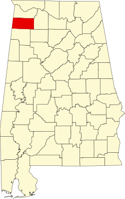
Franklin County, Alabama

Last updated

Franklin County
Franklin County Courthouse in Russelville, Alabama.jpg
Franklin County Courthouse in Russelville, Alabama
Map of Alabama highlighting Franklin County.svg
Location within the U.S. state of Alabama
Alabama in United States.svg
Alabama's location within the U.S.
Coordinates: 34°26′00″N87°51′00″W / 34.4333°N 87.85°W / 34.4333; -87.85
CountryFlag of the United States.svg United States
StateFlag of Alabama.svg  Alabama
FoundedFebruary 6, 1818
Named for Benjamin Franklin
Seat Russellville
Largest cityRussellville
Area
  Total647 sq mi (1,680 km2)
  Land634 sq mi (1,640 km2)
  Water13 sq mi (30 km2)  2.0%
Population
 (2020)
  Total32,113
  Estimate 
(2023)
31,802 Decrease2.svg
  Density50/sq mi (19/km2)
Time zone UTC−6 (Central)
  Summer (DST) UTC−5 (CDT)
Congressional district 4th
Website www.franklincountyal.org
  • County Number 33 on Alabama Licence Plates

Franklin County is a county located in the U.S. state of Alabama. As of the 2020 census, the population was 32,113. [1] Its county seat is Russellville. [2] Its name is in honor of Benjamin Franklin, famous statesman, scientist, and printer. [3] It is a dry county, although the city of Russellville is wet.

Contents

History

Franklin County was established on February 6, 1818.

Colbert County

Once part of Franklin County, Colbert County was originally established on February 6, 1867, after it split from Franklin County over political issues after the American Civil War. It was abolished eight months later by an Alabama constitutional convention and then reestablished on February 24, 1870. [4]

Musical history

Many musicians and songwriters are from Franklin County including Billy Sherrill, Ricky Pierce, Eddie Martin and many others.

Geography

According to the United States Census Bureau, the county has a total area of 647 square miles (1,680 km2), of which 634 square miles (1,640 km2) is land and 13 square miles (34 km2) (2.0%) is water. [5]

Adjacent Counties

National protected area

Transportation

Major highways

Rail

Demographics

Historical population
CensusPop.Note
1820 4,988
1830 11,078122.1%
1840 14,27028.8%
1850 19,61037.4%
1860 18,627−5.0%
1870 8,006−57.0%
1880 9,15514.4%
1890 10,68116.7%
1900 16,51154.6%
1910 19,36917.3%
1920 22,01113.6%
1930 25,37215.3%
1940 27,5528.6%
1950 25,705−6.7%
1960 21,988−14.5%
1970 23,9338.8%
1980 28,35018.5%
1990 27,814−1.9%
2000 31,22312.3%
2010 31,7041.5%
2020 32,1131.3%
2023 (est.)31,802 [6] −1.0%
U.S. Decennial Census [7]
1790–1960 [8] 1900–1990 [9]
1990–2000 [10] 2010–2020 [1]

2020 census

Franklin County, Alabama – Racial and Ethnic Composition
(NH = Non-Hispanic)
Note: the US Census treats Hispanic/Latino as an ethnic category. This table excludes Latinos from the racial categories and assigns them to a separate category. Hispanics/Latinos may be of any race.
Race / EthnicityPop 2000 [11] Pop 2010 [12] Pop 2020 [13] % 2000% 2010% 2020
White alone (NH)27,26825,24923,58187.33%79.64%73.43%
Black or African American alone (NH)1,3071,2111,1394.19%3.82%3.55%
Native American or Alaska Native alone (NH)871211280.28%0.38%0.40%
Asian alone (NH)3251670.10%0.16%0.21%
Pacific Islander alone (NH)3220.01%0.01%0.01%
Some Other Race alone (NH)532770.02%0.10%0.24%
Mixed Race/Multi-Racial (NH)2053288600.66%1.03%2.68%
Hispanic or Latino (any race)2,3164,7106,2597.42%14.86%19.49%
Total31,22331,70432,113100.00%100.00%100.00%

As of the census of 2020, there were 32,113 people, 11,048 households, and 7,669 families residing in the county.

2010 census

At the 2010 census there were 31,704 people, 12,286 households, and 8,741 families living in the county. The population density was 57 people per square mile (22 people/km2). There were 14,022 housing units at an average density of 21.7 units per square mile (8.4 units/km2). The racial makeup of the county was 83.0% White (non-Hispanic), 3.9% Black or African American, 0.7% Native American, 0.2% Asian, 0.0% Pacific Islander, 10.5% from other races, and 1.7% from two or more races. 14.9% of the population were Hispanic or Latino of any race. [14] Of the 12,286 households 30.0% had children under the age of 18 living with them, 53.5% were married couples living together, 12.3% had a female householder with no husband present, and 28.9% were non-families. 26.1% of households were one person and 12.3% were one person aged 65 or older. The average household size was 2.56 and the average family size was 3.05

The age distribution was 24.8% under the age of 18, 8.9% from 18 to 24, 25.8% from 25 to 44, 25.3% from 45 to 64, and 15.2% 65 or older. The median age was 37.8 years. For every 100 females there were 99.7 males. For every 100 females age 18 and over, there were 104.3 males.

The median household income was $33,942 and the median family income was $44,352. Males had a median income of $31,997 versus $22,747 for females. The per capita income for the county was $18,094. About 14.9% of families and 19.5% of the population were below the poverty line, including 26.2% of those under age 18 and 13.2% of those age 65 or over.

2000 census

As of the census of 2000, there were 31,223 people, 12,259 households, and 8,949 families living in the county. The population density was 49 people per square mile (19 people/km2). There were 13,749 housing units at an average density of 22 units per square mile (8.5 units/km2). The racial makeup of the county was 89.68% White (non-Hispanic), 4.21% Black or African American, 0.33% Native American, 0.11% Asian, 0.10% Pacific Islander, 4.62% from other races, and 0.96% from two or more races. 5.82% of the population were Hispanic or Latino of any race. [15] Of the 12,259 households 32.50% had children under the age of 18 living with them, 59.20% were married couples living together, 10.40% had a female householder with no husband present, and 27.00% were non-families. 24.50% of households were one person and 12.10% were one person aged 65 or older. The average household size was 2.51 and the average family size was 2.97.

The age distribution was 24.50% under the age of 18, 9.20% from 18 to 24, 28.00% from 25 to 44, 23.40% from 45 to 64, and 14.90% 65 or older. The median age was 37 years. For every 100 females there were 96.40 males. For every 100 females age 18 and over, there were 92.80 males.

The median household income was $27,177 and the median family income was $34,274. Males had a median income of $27,497 versus $18,631 for females. The per capita income for the county was $14,814. About 15.20% of families and 18.90% of the population were below the poverty line, including 24.60% of those under age 18 and 24.10% of those age 65 or over.

Education

There are two school systems and one community college in Franklin County; Russellville City Schools and Franklin County Schools. Northwest Shoals Community College has a campus in Phil Campbell.

Russellville City Schools [16] include:

Franklin County Schools [17] include:

There is also the Franklin County Career-Technical Center, located next to Belgreen High School.

Government

Like most rural counties in Alabama, Franklin County has gone solidly Republican in the 21st century, but it has flirted with the party at a federal level since the 1950s. In a pattern typical of most rural Alabama counties, Franklin County supported the Dixiecrats in 1948 and George Wallace in 1968, but unlike other counties, had been won by Republicans in 1956 and 1960, cracking the wall of the Solid South before full-fledged turnover in 1964 and beyond.

As is the case with most rural counties nationwide that supported Bill Clinton in the 1996 election, the county has turned on the Democratic Party. In the 2020 election, Donald Trump won convincingly over Joe Biden, 83–17, continuing a backsliding trend for Democratic candidates in the rural South.

In 2018, Democrat Johnny Mack Morrow, a longtime state legislator from Red Bay, easily beat Republican Larry Stutts in this otherwise heavily Republican county, defying the county's rightward trend. [18]

United States presidential election results for Franklin County, Alabama [19]
Year Republican Democratic Third party
No.%No.%No.%
2020 10,37682.49%2,08616.58%1160.92%
2016 9,46678.62%2,19718.25%3773.13%
2012 7,56769.54%3,17129.14%1431.31%
2008 8,04868.83%3,46929.67%1761.51%
2004 7,69062.68%4,51436.79%650.53%
2000 6,11955.11%4,79343.17%1911.72%
1996 4,44942.44%5,02847.97%1,0059.59%
1992 4,79440.43%5,95350.20%1,1119.37%
1988 5,14650.25%4,96148.44%1341.31%
1984 5,30452.90%4,60145.89%1221.22%
1980 4,44841.33%6,13657.01%1791.66%
1976 3,34534.41%6,27964.59%971.00%
1972 5,87775.23%1,84023.55%951.22%
1968 2,52427.75%5886.46%5,98465.79%
1964 4,02556.41%00.00%3,11043.59%
1960 4,06954.20%3,42245.58%160.21%
1956 3,39950.21%3,35449.55%160.24%
1952 2,42441.13%3,46158.73%80.14%
1948 2,55544.10%00.00%3,23955.90%
1944 1,85340.56%2,70959.30%60.13%
1940 1,98935.95%3,52363.67%210.38%
1936 1,87537.77%3,05961.62%300.60%
1932 1,54734.71%2,87664.53%340.76%
1928 2,93756.24%2,27943.64%60.11%
1924 221.06%1,98595.66%683.28%
1920 2,93057.58%2,09441.15%651.28%
1916 98447.44%1,04450.34%462.22%
1912 30917.14%84947.09%64535.77%
1908 65247.84%65047.69%614.48%
1904 66844.33%76750.90%724.78%

Communities

Cities

Towns

Census-designated places

Unincorporated communities

See also

Related Research Articles

<span class="mw-page-title-main">Clay County, Georgia</span> County in Georgia, United States

Clay County is a county located in the southwestern part of the U.S. state of Georgia. As of the 2020 census, the population was 2,848, making it the fourth-least populous county in Georgia. The county seat is Fort Gaines.

<span class="mw-page-title-main">Butler County, Alabama</span> County in Alabama, United States

Butler County is a county located in the south central portion of the U.S. state of Alabama. As of the 2020 census, the population was 19,051. Its county seat is Greenville. Its name is in honor of Captain William Butler, who was born in Virginia and fought in the Creek War, and who was killed in May 1818.

<span class="mw-page-title-main">Chambers County, Alabama</span> County in Alabama, United States

Chambers County is a county located in the east central portion of the U.S. state of Alabama. As of the 2020 census the population was 34,772. Its county seat is LaFayette. Its largest city is Valley. Its name is in honor of Henry H. Chambers, who served as a United States Senator from Alabama.

<span class="mw-page-title-main">Cherokee County, Alabama</span> County in Alabama, United States

Cherokee County, Alabama is a county located in the northeastern part of the U.S. state of Alabama. As of the 2020 census, the population was 24,971. Its county seat is Centre. The county is named for the Cherokee tribe.

<span class="mw-page-title-main">Winston County, Alabama</span> County in Alabama, United States

Winston County is a county of the U.S. state of Alabama. As of the 2020 census, the population was 23,540. Its county seat is Double Springs. Known as Hancock County before 1858, the county is named in honor of John A. Winston, the fifteenth Governor of Alabama.

<span class="mw-page-title-main">Morgan County, Alabama</span> County in Alabama, United States

Morgan County is a county in the north-central part of the U.S. state of Alabama. As of the 2020 census, its population was 123,421. The county seat is Decatur. On June 14, 1821, it was renamed in honor of American Revolutionary War General Daniel Morgan of Virginia. It is a prohibition or dry county, although alcohol sales are allowed in the cities of Decatur, Hartselle, and Priceville. Morgan County is included in the Decatur, AL Metropolitan Statistical Area, which is also included in the Huntsville-Decatur-Albertville, AL Combined Statistical Area. It is a part of the North, Northwest, and North-Central regions of Alabama.

<span class="mw-page-title-main">Cleburne County, Alabama</span> County in Alabama, United States

Cleburne County is a county located in the east central portion of the U.S. state of Alabama. As of the 2020 census, the population was 15,056. Its county seat is Heflin. Its name is in honor of Patrick R. Cleburne of Arkansas who rose to the rank of major general in the Confederate States Army. The eastern side of the county borders the state of Georgia.

<span class="mw-page-title-main">Coosa County, Alabama</span> County in Alabama, United States

Coosa County is located in the east central portion of the U.S. state of Alabama. As of the 2020 census the population was 10,387. Its county seat is Rockford. Its name derives from a town of the Creek tribe and the Coosa River, which forms one of the county borders.

<span class="mw-page-title-main">Covington County, Alabama</span> County in Alabama, United States

Covington County, is a county located in the south central portion of the U.S. state of Alabama. As of the 2020 census the population was 37,570. Its county seat is Andalusia. Its name is in honor of Brigadier General Leonard Covington of Maryland and Mississippi, who died in the War of 1812.

<span class="mw-page-title-main">Cullman County, Alabama</span> County in Alabama, United States

Cullman County is a county located in the north central portion of the U.S. state of Alabama. As of the 2020 census, the population was 87,866. Its county seat and largest city is Cullman. Its name is in honor of Colonel John G. Cullmann.

<span class="mw-page-title-main">Dale County, Alabama</span> County in Alabama, United States

Dale County is a county located in the southeastern part of the U.S. state of Alabama. As of the 2020 census the population was 49,326. Its county seat and largest city is Ozark. Its name is in honor of General Samuel Dale.

<span class="mw-page-title-main">Lawrence County, Alabama</span> County in Alabama, United States

Lawrence County is a county in the northern part of the U.S. state of Alabama. As of the 2020 census, the population was 33,073. The county seat is Moulton. The county was named after James Lawrence, a captain in the United States Navy from New Jersey.

<span class="mw-page-title-main">Marion County, Alabama</span> County in Alabama, United States

Marion County is a county of the U.S. state of Alabama. As of the 2020 census the population was 29,341. The county seat is Hamilton. The county was created by an act of the Alabama Territorial General Assembly on February 13, 1818. The county seat was originally established in Pikeville in 1820, and moved to Hamilton in 1881. The county was named by planter and US Indian agent John Dabney Terrell, Sr., in recognition of General Francis Marion of South Carolina.

<span class="mw-page-title-main">Marshall County, Alabama</span> County in Alabama, United States

Marshall County is a county of the state of Alabama, United States. As of the 2020 census the population was 97,612. Its county seat is Guntersville. A second courthouse is in Albertville. Its name is in honor of John Marshall, famous Chief Justice of the United States. Marshall County is a dry county, with the exception of the five cities of Albertville, Arab, Grant, Guntersville, and Boaz. Marshall County comprises the Albertville, AL Micropolitan Statistical Area, which is also included in the Huntsville-Decatur-Albertville, AL Combined Statistical Area.

<span class="mw-page-title-main">Talladega County, Alabama</span> County in Alabama, United States

Talladega County is one of the sixty-seven counties located in the east central portion of the U.S. state of Alabama. As of the 2020 census, the population was 82,149. Its county seat is Talladega.

<span class="mw-page-title-main">Tallapoosa County, Alabama</span> County in Alabama, United States

Tallapoosa County is located in the east-central portion of the U.S. state of Alabama. As of the 2020 census, the population was 41,311. Its county seat is Dadeville. Its largest city is Alexander City.

<span class="mw-page-title-main">Walker County, Alabama</span> County in Alabama, United States

Walker County is a county located in the central portion of the U.S. state of Alabama. As of the 2020 census, the population was 65,342. Its county seat is Jasper. Its name is in honor of John Williams Walker, the first U.S. senator elected from Alabama.

<span class="mw-page-title-main">Franklin County, Georgia</span> County in Georgia, United States

Franklin County is a county located in the northeastern part of the U.S. state of Georgia. As of the 2020 census, the population was 23,424. The county seat is Carnesville. On February 25, 1784, Franklin and Washington became Georgia's eighth and ninth counties, with Franklin named in honor of patriot Benjamin Franklin.

<span class="mw-page-title-main">Russellville, Alabama</span> City in Alabama, United States

Russellville is a city in Franklin County in the U.S. state of Alabama. At the 2020 census, the population of the city was 10,855, up from 9,830 at the 2010 census. The city is the county seat of Franklin County.

<span class="mw-page-title-main">St. Clair County, Alabama</span> County in Alabama, United States

St. Clair County is a county located in the central portion of the U.S. state of Alabama. As of the 2020 census, the population was 91,103. It has two county seats: Ashville and Pell City. It is one of two counties in Alabama, and one of 33 in the United States, with more than one county seat. Its name is in honor of General Arthur St. Clair, an officer in the French and Indian War. St. Clair County is included in the Birmingham, Alabama Metropolitan Statistical Area.

References

  1. 1 2 "State & County QuickFacts". United States Census Bureau. Retrieved September 13, 2023.
  2. "Find a County". National Association of Counties. Archived from the original on May 31, 2011. Retrieved June 7, 2011.
  3. Gannett, Henry (1905). The Origin of Certain Place Names in the United States. Govt. Print. Off. pp.  131.
  4. "Colbert County Website" . Retrieved May 16, 2007.
  5. "2010 Census Gazetteer Files". United States Census Bureau. August 22, 2012. Retrieved August 22, 2015.
  6. "Annual Estimates of the Resident Population for Counties: April 1, 2020 to July 1, 2023". United States Census Bureau. Retrieved March 27, 2024.
  7. "U.S. Decennial Census". United States Census Bureau. Retrieved August 22, 2015.
  8. "Historical Census Browser". University of Virginia Library. Retrieved August 22, 2015.
  9. Forstall, Richard L., ed. (March 24, 1995). "Population of Counties by Decennial Census: 1900 to 1990". United States Census Bureau. Retrieved August 22, 2015.
  10. "Census 2000 PHC-T-4. Ranking Tables for Counties: 1990 and 2000" (PDF). United States Census Bureau. April 2, 2001. Retrieved August 22, 2015.
  11. "P004 HISPANIC OR LATINO, AND NOT HISPANIC OR LATINO BY RACE – 2000: DEC Summary File 1 – Franklin County, Alabama". United States Census Bureau .
  12. "P2 HISPANIC OR LATINO, AND NOT HISPANIC OR LATINO BY RACE – 2010: DEC Redistricting Data (PL 94-171) – Franklin County, Alabama". United States Census Bureau .
  13. "P2 HISPANIC OR LATINO, AND NOT HISPANIC OR LATINO BY RACE - 2020: DEC Redistricting Data (PL 94-171) – Franklin County, Alabama". United States Census Bureau .
  14. "U.S. Census website". United States Census Bureau . Retrieved July 24, 2015.
  15. "U.S. Census website". United States Census Bureau . Retrieved May 14, 2011.
  16. "Russellville City Schools Website". Archived from the original on April 3, 2007.
  17. "Franklin County Schools Website".
  18. "Our Campaigns - AL State Senate 06 Race - November 06, 2018". www.ourcampaigns.com. Retrieved August 20, 2023.
  19. "Dave Leip's Atlas of U.S. Presidential Elections" . Retrieved November 16, 2016.

34°26′N87°51′W / 34.433°N 87.850°W / 34.433; -87.850