Coffee County, Alabama

Last updated

Coffee County
Coffee County Courthouse.jpg
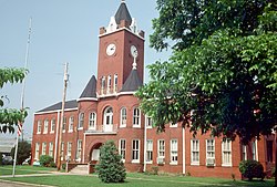
Original Coffee County Courthouse (Elba)
Map of Alabama highlighting Coffee County.svg
Location within the U.S. state of Alabama
Alabama in United States.svg
Alabama's location within the U.S.
Coordinates: 31°24′12″N85°59′12″W / 31.403333333333°N 85.986666666667°W / 31.403333333333; -85.986666666667
CountryFlag of the United States.svg United States
StateFlag of Alabama.svg  Alabama
FoundedDecember 29, 1841
Named for John Coffee
Seat Elba (de facto)
Enterprise (annex) [1]
Largest cityEnterprise
Area
  Total680 sq mi (1,800 km2)
  Land679 sq mi (1,760 km2)
  Water1.5 sq mi (4 km2)  0.2%
Population
 (2020)
  Total53,465
  Estimate 
(2023)
55,643 Increase2.svg
  Density79/sq mi (30/km2)
Time zone UTC−6 (Central)
  Summer (DST) UTC−5 (CDT)
Congressional district 2nd
Website www.coffeecounty.us
  • County Number 19 on Alabama Licence Plates

Coffee County is a county located in the southeastern part of the U.S. state of Alabama. As of the 2020 census, the population was 53,465. [2] Its name is in honor of General John Coffee.

Contents

Coffee County comprises the Enterprise, Micropolitan Statistical Area, which was originally Enterprise–Ozark micropolitan area in 2010 censuses before being split off. [3] It was originally included in the Dothan-Enterprise-Ozark, Combined Statistical Area in its 2012 statistics but the area in its recent years has been separated from the Dothan metropolitan area and Ozark micropolitan area in later censuses and is its own primary statistical area now. [4] [5] Despite the census change of the statistics by the United States Census Bureau, the county still remains culturally connected alongside the two core based areas as it is commonly described as part of what is called the Wiregrass region together and also it shares its locations of United States Army base, Fort Novosel. The county seat is mostly known as Elba, although Enterprise contains a second county courthouse as well. [6]

History

The land in Coffee County was originally part of Dale County, which was incorporated in 1824. Coffee County was formed from the western part of Dale County on December 29, 1841. [7] It was named after John R. Coffee, [8] a soldier in the Creek War of 1813—14. The first county seat was in Wellborn. After the courthouse was destroyed by fire in 1851, the county seat was moved to Elba.

Geography

According to the United States Census Bureau, the county has a total area of 680 square miles (1,800 km2), of which 679 square miles (1,760 km2) is land and 1.5 square miles (3.9 km2) (0.2%) is water. [9] The county is located in the Wiregrass region of southeast Alabama.

Major highways

Adjacent counties

Demographics

Historical population
CensusPop.Note
1850 5,940
1860 9,62362.0%
1870 6,171−35.9%
1880 8,11931.6%
1890 12,17049.9%
1900 20,97272.3%
1910 26,11924.5%
1920 30,07015.1%
1930 32,5568.3%
1940 31,987−1.7%
1950 30,720−4.0%
1960 30,583−0.4%
1970 34,87214.0%
1980 38,53310.5%
1990 40,2404.4%
2000 43,6158.4%
2010 49,94814.5%
2020 53,4657.0%
2023 (est.)55,643 [10] 4.1%
U.S. Decennial Census [11]
1790–1960 [12] 1900–1990 [13]
1990–2000 [14] 2010–2020 [2]

2020 Census

Coffee County, Alabama – Racial and Ethnic Composition
(NH = Non-Hispanic)
Note: the US Census treats Hispanic/Latino as an ethnic category. This table excludes Latinos from the racial categories and assigns them to a separate category. Hispanics/Latinos may be of any race.
Race / EthnicityPop 2000 [15] Pop 2010 [16] Pop 2020 [17] % 2000% 2010% 2020
White alone (NH)32,97136,13435,75975.60%72.34%66.88%
Black or African American alone (NH)7,9508,2578,64318.23%16.53%16.17%
Native American or Alaska Native alone (NH)3866024050.89%1.21%0.76%
Asian alone (NH)4096298920.94%1.26%1.67%
Pacific Islander alone (NH)4051570.09%0.10%0.11%
Some Other Race alone (NH)58521950.13%0.10%0.36%
Mixed Race/Multi-Racial (NH)6181,0432,6271.42%2.09%4.91%
Hispanic or Latino (any race)1,1833,1804,8872.71%6.37%9.14%
Total43,61549,94853,465100.00%100.00%100.00%

As of the 2020 United States census, there were 53,465 people, 19,924 households, and 13,747 families residing in the county.

2010 census

As of the census [18] of 2010, there were 49,948 people, 19,849 households, and 13,837 families residing in the county. The population density was 74 people per square mile (29 people/km2). There were 22,330 housing units at an average density of 33 units per square mile (13 units/km2). The racial makeup of the county was 74.7% White, 16.7% Black or African American, 1.3% Native American, 1.3% Asian, 0.2% Pacific Islander, 3.2% from other races, and 2.5% from two or more races. 6.4% of the population were Hispanic or Latino of any race.

The largest self-reported ancestry groups in Coffee County were English (59.9%), German (4.4%), Irish (3.3%), "American" (3.1%), (1.8%), Scottish (1.2%) and Portuguese (1.0%).

There were 19,849 households, out of which 30.1% had children under the age of 18 living with them, 52.6% were married couples living together, 12.9% had a female householder with no husband present, and 30.3% were non-families. 25.4% of all households were made up of individuals, and 9.8% had someone living alone who was 65 years of age or older. The average household size was 2.49 and the average family size was 2.98.

In the county, the population was spread out, with 24.2% under the age of 18, 8.6% from 18 to 24, 27.1% from 25 to 44, 25.7% from 45 to 64, and 14.4% who were 65 years of age or older. The median age was 37.6 years. For every 100 females, there were 97.7 males. For every 100 females age 18 and over, there were 101.3 males.

The median income for a household in the county was $42,253, and the median income for a family was $54,929. Males had a median income of $41,635 versus $29,082 for females. The per capita income for the county was $22,797. About 14.1% of families and 17.2% of the population were below the poverty line, including 26.4% of those under age 18 and 13.4% of those age 65 or over.

Government

Coffee County is reliably Republican at the presidential level. The last Democrat to win the county in a presidential election is Jimmy Carter, who won it by a majority in 1976.

United States presidential election results for Coffee County, Alabama [19]
Year Republican Democratic Third party
No.%No.%No.%
2020 16,89975.87%5,07622.79%3001.35%
2016 15,87576.44%4,22120.33%6713.23%
2012 14,66673.99%4,92524.85%2301.16%
2008 14,91974.12%5,07925.23%1300.65%
2004 13,01973.90%4,48025.43%1170.66%
2000 9,93864.39%5,22033.82%2761.79%
1996 7,80555.12%5,16836.50%1,1868.38%
1992 7,59148.87%5,77637.19%2,16613.94%
1988 8,89066.57%4,31932.34%1461.09%
1984 10,55869.84%4,37028.91%1901.26%
1980 6,76050.45%6,14045.82%4993.72%
1976 4,68337.02%7,84462.00%1240.98%
1972 9,07680.06%2,16019.05%1000.88%
1968 6826.33%1,0719.95%9,01383.72%
1964 4,91080.19%00.00%1,21319.81%
1960 1,38123.54%4,47076.19%160.27%
1956 97318.47%4,16379.02%1322.51%
1952 69915.13%3,91984.83%20.04%
1948 1135.25%00.00%2,03994.75%
1944 1153.88%2,84696.02%30.10%
1940 1456.12%2,22693.88%00.00%
1936 1103.33%3,17896.16%170.51%
1932 953.20%2,86896.73%20.07%
1928 1,03639.17%1,60960.83%00.00%
1924 32316.61%1,59782.11%251.29%
1920 67327.95%1,72171.47%140.58%
1916 42617.21%2,02981.95%210.85%
1912 683.76%1,27770.67%46225.57%
1908 34118.08%1,30569.19%24012.73%
1904 22613.15%1,10664.34%38722.51%

Communities

Cities

Towns

Unincorporated communities

Education

School districts include: [20]

Fort Novosel residents are within the Department of Defense Education Activity (DoDEA) system, [20] for elementary school. Students on-post in Fort Novosel beyond the elementary level may attend non-DoDEA schools for secondary levels, with an on-post family choosing one of the following three options: Enterprise City, Daleville City School System, or Ozark City Schools. [21]

Notable people

The county is referred to in Joe David Brown's 1971 novel Addie Pray, which inspired the movie Paper Moon.

See also

Related Research Articles

<span class="mw-page-title-main">Butler County, Alabama</span> County in Alabama, United States

Butler County is a county located in the south central portion of the U.S. state of Alabama. As of the 2020 census, the population was 19,051. Its county seat is Greenville. Its name is in honor of Captain William Butler, who was born in Virginia and fought in the Creek War, and who was killed in May 1818.

<span class="mw-page-title-main">Morgan County, Alabama</span> County in Alabama, United States

Morgan County is a county in the north-central part of the U.S. state of Alabama. As of the 2020 census, its population was 123,421. The county seat is Decatur. On June 14, 1821, it was renamed in honor of American Revolutionary War General Daniel Morgan of Virginia. It is a prohibition or dry county, although alcohol sales are allowed in the cities of Decatur, Hartselle, and Priceville. Morgan County is included in the Decatur, AL Metropolitan Statistical Area, which is also included in the Huntsville-Decatur-Albertville, AL Combined Statistical Area. It is a part of the North, Northwest, and North-Central regions of Alabama.

<span class="mw-page-title-main">Coosa County, Alabama</span> County in Alabama, United States

Coosa County is located in the east central portion of the U.S. state of Alabama. As of the 2020 census the population was 10,387. Its county seat is Rockford. Its name derives from a town of the Creek tribe and the Coosa River, which forms one of the county borders.

<span class="mw-page-title-main">Crenshaw County, Alabama</span> County in Alabama, United States

Crenshaw County is a county located in the south central portion of the U.S. state of Alabama. It is located immediately south of the Montgomery metropolitan area. As of the 2020 census, the population was 13,194. Its county seat is Luverne. Its name is in honor of an Alabama judge, Anderson Crenshaw.

<span class="mw-page-title-main">Dale County, Alabama</span> County in Alabama, United States

Dale County is a county located in the southeastern part of the U.S. state of Alabama. As of the 2020 census the population was 49,326. Its county seat and largest city is Ozark. Its name is in honor of General Samuel Dale.

<span class="mw-page-title-main">Escambia County, Alabama</span> County in Alabama, United States

Escambia County is a county located in the south central portion of the U.S. state of Alabama. As of the 2020 census, the population was 36,757. Its county seat is Brewton.

<span class="mw-page-title-main">Jackson County, Alabama</span> County in Alabama, United States

Jackson County is the northeasternmost county in the U.S. state of Alabama. As of the 2020 census, the population was 52,579. The county seat is Scottsboro. The county was named for Andrew Jackson, general in the United States Army and afterward President of the United States of America. Jackson County is a prohibition or dry county, but three cities within the county are "wet", allowing alcohol sales. Jackson County comprises the Scottsboro, AL Micropolitan Statistical Area, and Jackson county is included in the Scottsboro-Fort Payne combined statistical areas. It is the site of Russell Cave National Monument, an archeological site with evidence of 8,000 years of human occupation in the Southeast.

<span class="mw-page-title-main">Marshall County, Alabama</span> County in Alabama, United States

Marshall County is a county of the state of Alabama, United States. As of the 2020 census the population was 97,612. Its county seat is Guntersville. A second courthouse is in Albertville. Its name is in honor of John Marshall, famous Chief Justice of the United States. Marshall County is a dry county, with the exception of the five cities of Albertville, Arab, Grant, Guntersville, and Boaz. Marshall County comprises the Albertville, AL Micropolitan Statistical Area, which is also included in the Huntsville-Decatur-Albertville, AL Combined Statistical Area.

<span class="mw-page-title-main">Talladega County, Alabama</span> County in Alabama, United States

Talladega County is one of the sixty-seven counties located in the east central portion of the U.S. state of Alabama. As of the 2020 census, the population was 82,149. Its county seat is Talladega.

<span class="mw-page-title-main">Elba, Alabama</span> City in and county seat of Coffee County, Alabama

Elba is a city in and the county seat of Coffee County, Alabama, United States. It is the official seat, although there are two county courthouses, with the other one being located in the city of Enterprise. At the time of the 2010 U.S. census, Elba's population was 3,940. Elba is part of the Enterprise micropolitan statistical area.

<span class="mw-page-title-main">Enterprise, Alabama</span> City in Coffee County, Alabama, US

Enterprise is a city in the southeastern part of Coffee County and the southwestern part of Dale County in Southeastern Alabama, United States. Its population was 28,711 at the 2020 census. Enterprise is the primary city of the Enterprise micropolitan statistical area. It was originally a part of Enterprise–Ozark micropolitan area before being split; for a longer while it was originally part of the Dothan-Enterprise-Ozark combined statistical area but is now its own separate primary statistical area in later censuses.

<span class="mw-page-title-main">Kinston, Alabama</span> Town in Alabama, United States

Kinston is a town in Coffee County, Alabama, United States. At the 2020 census, the population was 580. It is part of the Enterprise Micropolitan Statistical Area.

<span class="mw-page-title-main">New Brockton, Alabama</span> Town in Alabama, United States

New Brockton is a town in Coffee County, Alabama, United States. At the 2020 census, the population was 1,428. The community was named for Huey E. Brock, a settler who came to the region in 1871.

<span class="mw-page-title-main">Daleville, Alabama</span> City in Alabama, United States

Daleville is a city in Dale County, Alabama, United States. At the 2010 census the population was 5,295, up from 4,653 in 2000. It is part of the Ozark Micropolitan Statistical Area. The city's nickname is "Gateway to Fort Rucker", as this U.S. Army post is located just north of town. Cairns Army Airfield is located to the south of Daleville on the road to nearby Clayhatchee.

<span class="mw-page-title-main">Level Plains, Alabama</span> City in Alabama, United States

Level Plains is a small town in Dale County, Alabama, United States. At the 2020 census, the population was 1,825. It is part of the Ozark micropolitan statistical area. Level Plains was ranked as a city from 2010 to 2020, but due to a population decline reverted to a town after the 2020 Census.

<span class="mw-page-title-main">Midland City, Alabama</span> Town in Alabama, United States

Midland City is a town in Dale County, Alabama, United States. At the 2010 U.S. Census the population was 2,344. It incorporated in 1890. It is part of the Ozark Micropolitan Statistical Area.

<span class="mw-page-title-main">Newton, Alabama</span> Town in Alabama, United States

Newton is a town in Dale County, Alabama, United States. At the 2010 census its population was 1,511. Once the county seat of Dale County, Newton lost this distinction to nearby Ozark in 1870, and is now a small farming community. It incorporated in 1887. The city currently forms a part of the Ozark micropolitan statistical area.

<span class="mw-page-title-main">Ozark, Alabama</span> City in Alabama, United States

Ozark is a city in and the county seat of Dale County, Alabama. As of the 2010 census, the population of the city was 14,907.

<span class="mw-page-title-main">Dothan–Enterprise–Ozark Combined Statistical Area</span>

The Dothan–Enterprise–Ozark Combined Statistical Area was a CSA made up of five counties in the southeastern corner of the U.S. state of Alabama. The once statistical area includes one metropolitan area and originally one micropolitan area which then was split off as two. As of the 2010 census, the CSA had a population of 245,838. Currently an updated area called the Dothan-Ozark Combined Statistical area is used instead and Enterprise micropolitan area is now split as its own statistical area.

<span class="mw-page-title-main">Enterprise–Ozark micropolitan area</span>

The Enterprise–Ozark Micropolitan Statistical Area, as defined by the United States Census Bureau, was an area consisting of two counties in southeastern Alabama, anchored by the cities of Enterprise and Ozark. As of the 2000 census, the μSA had a population of 92,744.

References

  1. Coffee County, Alabama. "History of Coffee County". Archived from the original on October 27, 2011. Retrieved August 19, 2011.
  2. 1 2 "State & County QuickFacts". United States Census Bureau. Retrieved September 12, 2023.
  3. "Table 1. Annual Estimates of the Population of Metropolitan and Micropolitan Statistical Areas: April 1, 2000 to July 1, 2009 (CBSA-EST2009-01)". 2009 Population Estimates. United States Census Bureau, Population Division. March 23, 2010. Archived from the original (CSV) on March 26, 2010. Retrieved March 24, 2010.
  4. www.2census.gov. United States Census Bureau https://www2.census.gov/geo/maps/econ/ec2012/csa/EC2012_330M200US222M.pdf . Retrieved December 14, 2021.{{cite web}}: Missing or empty |title= (help)
  5. "OMB Bulletin No. 20-01: Revised Delineations of Metropolitan Statistical Areas, Micropolitan Statistical Areas, and Combined Statistical Areas, and Guidance on Uses of the Delineations of These Areas" (PDF). United States Office of Management and Budget. March 6, 2020. Retrieved September 21, 2020.
  6. "Find a County". National Association of Counties. Archived from the original on May 31, 2011. Retrieved June 7, 2011.
  7. "Alabama Counties: Coffee County". Alabama Department of Archives and History. Montgomery, AL. April 9, 2010. Archived from the original on March 5, 2012. Retrieved April 30, 2012.
  8. Gannett, Henry (1905). The Origin of Certain Place Names in the United States. Govt. Print. Off. pp.  86.
  9. "2010 Census Gazetteer Files". United States Census Bureau. August 22, 2012. Retrieved August 22, 2015.
  10. "Annual Estimates of the Resident Population for Counties: April 1, 2020 to July 1, 2023". United States Census Bureau. Retrieved March 27, 2024.
  11. "U.S. Decennial Census". United States Census Bureau. Retrieved August 22, 2015.
  12. "Historical Census Browser". University of Virginia Library. Archived from the original on August 11, 2012. Retrieved August 22, 2015.
  13. Forstall, Richard L., ed. (March 24, 1995). "Population of Counties by Decennial Census: 1900 to 1990". United States Census Bureau. Retrieved August 22, 2015.
  14. "Census 2000 PHC-T-4. Ranking Tables for Counties: 1990 and 2000" (PDF). United States Census Bureau. April 2, 2001. Retrieved August 22, 2015.
  15. "P004 HISPANIC OR LATINO, AND NOT HISPANIC OR LATINO BY RACE – 2000: DEC Summary File 1 – Coffee County, Alabama". United States Census Bureau .
  16. "P2 HISPANIC OR LATINO, AND NOT HISPANIC OR LATINO BY RACE – 2010: DEC Redistricting Data (PL 94-171) – Coffee County, Alabama". United States Census Bureau .
  17. "P2 HISPANIC OR LATINO, AND NOT HISPANIC OR LATINO BY RACE - 2020: DEC Redistricting Data (PL 94-171) – Coffee County, Alabama". United States Census Bureau .
  18. "U.S. Census website". United States Census Bureau . Retrieved July 18, 2015.
  19. "Dave Leip's Atlas of U.S. Presidential Elections" . Retrieved November 16, 2016.
  20. 1 2 "2020 CENSUS - SCHOOL DISTRICT REFERENCE MAP: Coffee County, AL" (PDF). United States Census Bureau . Retrieved July 5, 2022. - Text list - "Fort Rucker School District" refers to the DoDEA schools.
  21. "Fort Rucker Education". Military One Source . Retrieved July 5, 2022. - From a .mil site.

31°24′12″N85°59′12″W / 31.40333°N 85.98667°W / 31.40333; -85.98667