Walker County, Alabama

Last updated

Walker County
Walker County Courthouse.jpg
Walker County Courthouse in Jasper
Map of Alabama highlighting Walker County.svg
Location within the U.S. state of Alabama
Alabama in United States.svg
Alabama's location within the U.S.
Coordinates: 33°48′13″N87°17′52″W / 33.803611111111°N 87.297777777778°W / 33.803611111111; -87.297777777778
CountryFlag of the United States.svg United States
StateFlag of Alabama.svg  Alabama
FoundedDecember 26, 1823 [1]
Named for John Williams Walker
Seat Jasper
Largest cityJasper
Area
  Total805 sq mi (2,080 km2)
  Land791 sq mi (2,050 km2)
  Water14 sq mi (40 km2)  1.7%
Population
 (2020)
  Total65,342
  Estimate 
(2023)
64,728 Decrease2.svg
  Density81/sq mi (31/km2)
Time zone UTC−6 (Central)
  Summer (DST) UTC−5 (CDT)
Congressional district 4th
Website www.walkercounty.com
  • County Number 64 on Alabama Licence Plates

Walker County is a county located in the central portion of the U.S. state of Alabama. [1] As of the 2020 census, the population was 65,342. [2] Its county seat is Jasper. [3] Its name is in honor of John Williams Walker, the first U.S. senator elected from Alabama. [1]

Contents

Walker County comprises the entirety of the Jasper, AL Micropolitan Statistical Area.

History

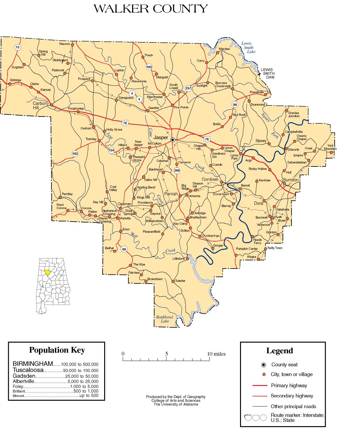
Walker County was established on December 26, 1823, and formed from sections of Marion and Tuscaloosa counties. [1] It was named after Senator John Walker, who represented Alabama in the U.S. Senate from 1819 to 1822. [1] The county was greatly reduced in size on February 12, 1850, when its northern half became the county of Winston. Jasper is the county seat, and was named after William Jasper, a Revolutionary War hero from South Carolina. [1]

National Register of Historic Places

Walker County has sites listed on the National Register of Historic Places. They include the Bankhead House, Boshell's Mill, the First United Methodist Church of Jasper, the Gilchrist House, the Jasper Downtown Historic District, the Stephenson House, and Walker County Hospital. [4]

Geography

According to the United States Census Bureau, the county has a total area of 805 square miles (2,080 km2), of which 791 square miles (2,050 km2) is land and 14 square miles (36 km2) (1.7%) is water. [5] The county is located in the Cumberland Plateau region, with many plateaus and valleys, along with many forested areas, covering the county. [6]

Adjacent counties

Demographics

Historical population
CensusPop.Note
1830 2,202
1840 4,03283.1%
1850 5,12427.1%
1860 7,98055.7%
1870 6,543−18.0%
1880 9,47944.9%
1890 16,07869.6%
1900 25,16256.5%
1910 37,01347.1%
1920 50,59336.7%
1930 59,44517.5%
1940 64,2018.0%
1950 63,769−0.7%
1960 54,211−15.0%
1970 56,2463.8%
1980 68,66022.1%
1990 67,670−1.4%
2000 70,7134.5%
2010 67,023−5.2%
2020 65,342−2.5%
2023 (est.)64,728 [7] −0.9%
U.S. Decennial Census [8]
1790–1960 [9] 1900–1990 [10]
1990–2000 [11] 2010–2020 [2]

2020 census

Walker County, Alabama – Racial and Ethnic Composition
(NH = Non-Hispanic)
Note: the US Census treats Hispanic/Latino as an ethnic category. This table excludes Latinos from the racial categories and assigns them to a separate category. Hispanics/Latinos may be of any race.
Race / EthnicityPop 2000 [12] Pop 2010 [13] Pop 2020 [14] % 2000% 2010% 2020
White alone (NH)64,85560,58756,39491.72%90.40%86.31%
Black or African American alone (NH)4,3233,8853,8896.11%5.80%5.95%
Native American or Alaska Native alone (NH)1972331870.28%0.35%0.29%
Asian alone (NH)1401902830.20%0.28%0.43%
Pacific Islander alone (NH)132620.02%0.04%0.00%
Some Other Race alone (NH)18361360.03%0.05%0.21%
Mixed Race/Multi-Racial (NH)5607592,2990.79%1.13%3.52%
Hispanic or Latino (any race)6071,3072,1520.86%1.95%3.29%
Total70,71367,02365,342100.00%100.00%100.00%

As of the census of 2020, there were 65,342 people, 25,153 households, and 17,410 families residing in the county.

2010 census

As of the census of 2010, there were 67,023 people, 26,571 households, and 18,741 families living in the county. The population density was 85 people per square mile (33 people/km2). There were 30,816 housing units at an average density of 38 units per square mile (15 units/km2). The racial makeup of the county was 91.2% White, 5.9% Black or African American, 0.4% Native American, 0.3% Asian, 0.1% Pacific Islander, 1.0% from other races, and 1.2% from two or more races. Nearly 2.0% of the population were Hispanic or Latino of any race. [15] There were 26,571 households, 26.8% had children under the age of 18 living with them; 52.0% were married couples living together, 13.3% had a female householder with no husband present, and 29.5% were non-families. 25.8% of households were made up of individuals, and 11.2% were one person aged 65 or older. The average household size was 2.49, and the average family size was 2.97.

The age distribution was 22.5% under the age of 18, 8.1% from 18 to 24, 24.4% from 25 to 44, 28.7% from 45 to 64, and 16.3% 65 or older. The median age was 41.2 years. For every 100 females, there were 95.1 males. For every 100 females age 18 and over, there were 97.8 males.

The median household income was $37,191 and the median family income was $45,788. Males had a median income of $43,671 versus $27,662 for females. The per capita income for the county was $20,516. About 14.7% of families and 18.6% of the population were below the poverty line, including 27.5% of those under age 18 and 12.4% of those age 65 or over.

2000 census

As of the census of 2000, there were 70,713 people, 28,364 households, and 20,478 families living in the county. The population density was 89 people per square mile (34 people/km2). There were 32,417 housing units at an average density of 41 units per square mile (16 units/km2). The racial makeup of the county was 92.15% White, 6.17% Black or African American, 0.28% Native American, 0.20% Asian, 0.02% Pacific Islander, 0.31% from other races, and 0.86% from two or more races. Nearly 0.86% of the population were Hispanic or Latino of any race. [16] In 2000 the largest reported ancestry groups in Walker County, AL were:

There were 28,364 households, 30.70% had children under the age of 18 living with them; 56.30% were married couples living together, 11.90% had a female householder with no husband present, and 27.80% were non-families. 25.30% of households were made up of individuals, and 11.20% were one person aged 65 or older. The average household size was 2.46, and the average family size was 2.93.

The age distribution was 23.50% under the age of 18, 8.60% from 18 to 24, 28.00% from 25 to 44, 25.10% from 45 to 64, and 14.80% 65 or older. The median age was 38 years. For every 100 females, there were 93.20 males. For every 100 females age 18 and over, there were 89.80 males.

The median household income was $29,076 and the median family income was $35,221. Males had a median income of $31,242 versus $20,089 for females. The per capita income for the county was $15,546. About 13.20% of families and 16.50% of the population were below the poverty line, including 21.00% of those under age 18 and 17.40% of those age 65 or over.

Economy

Local officials have described coal mining as "literally at the core" of the county's economy. [17]

Government

United States presidential election results for Walker County, Alabama [18]
Year Republican Democratic Third party
No.%No.%No.%
2020 26,00283.42%4,83415.51%3341.07%
2016 24,26682.34%4,49715.26%7092.41%
2012 21,65175.74%6,55722.94%3771.32%
2008 20,72272.32%7,42025.90%5101.78%
2004 19,16767.57%9,01631.78%1840.65%
2000 13,48652.60%11,62145.32%5342.08%
1996 9,83739.44%12,92951.84%2,1738.71%
1992 11,30138.26%14,83150.22%3,40211.52%
1988 11,01148.51%11,33849.95%3511.55%
1984 12,85254.11%10,59144.59%3101.31%
1980 8,79538.53%13,61659.65%4171.83%
1976 7,38931.16%16,23268.46%890.38%
1972 14,58178.79%3,72420.12%2021.09%
1968 2,62813.56%1,97110.17%14,78676.28%
1964 8,58258.41%00.00%6,11041.59%
1960 5,46340.25%8,10959.75%00.00%
1956 5,17940.09%7,66159.30%790.61%
1952 3,49033.45%6,86265.78%800.77%
1948 1,85230.72%00.00%4,17669.28%
1944 2,24132.45%4,61966.87%470.68%
1940 2,00725.18%5,94074.52%240.30%
1936 1,69922.70%5,69776.12%881.18%
1932 1,58324.85%4,73474.31%540.85%
1928 3,63546.23%4,22853.77%00.00%
1924 2,44639.85%3,35154.59%3415.56%
1920 4,48847.75%4,70350.04%2082.21%
1916 1,86043.25%2,31453.80%1272.95%
1912 88124.64%2,06357.71%63117.65%
1908 1,36744.66%1,63253.32%622.03%
1904 1,02437.90%1,63960.66%391.44%

Transportation

Major highways

Rail

Communities

Cities

Towns

Unincorporated communities

Places of interest

Walker County is home to the William B. Bankhead National Forest and Lewis Smith Lake, in addition to the Alabama Mining Museum.

See also

Related Research Articles

<span class="mw-page-title-main">Clay County, Georgia</span> County in Georgia, United States

Clay County is a county located in the southwestern part of the U.S. state of Georgia. As of the 2020 census, the population was 2,848, making it the fourth-least populous county in Georgia. The county seat is Fort Gaines.

<span class="mw-page-title-main">Blount County, Alabama</span> County in Alabama, United States

Blount County is a county located in the U.S. state of Alabama. As of the 2020 census, the population was 59,134. Its county seat is Oneonta.

<span class="mw-page-title-main">Chambers County, Alabama</span> County in Alabama, United States

Chambers County is a county located in the east central portion of the U.S. state of Alabama. As of the 2020 census the population was 34,772. Its county seat is LaFayette. Its largest city is Valley. Its name is in honor of Henry H. Chambers, who served as a United States Senator from Alabama.

<span class="mw-page-title-main">Cherokee County, Alabama</span> County in Alabama, United States

Cherokee County, Alabama is a county located in the northeastern part of the U.S. state of Alabama. As of the 2020 census, the population was 24,971. Its county seat is Centre. The county is named for the Cherokee tribe.

<span class="mw-page-title-main">Etowah County, Alabama</span> County in Alabama, United States

Etowah County is a county located in the northeastern part of the U.S. state of Alabama. As of the 2020 census the population was 103,436. Its county seat is Gadsden. Its name is from a Cherokee word meaning "edible tree". In total area, it is the smallest county in Alabama, but one of the most densely populated. Etowah County comprises the Gadsden Metropolitan Statistical Area.

<span class="mw-page-title-main">Winston County, Alabama</span> County in Alabama, United States

Winston County is a county of the U.S. state of Alabama. As of the 2020 census, the population was 23,540. Its county seat is Double Springs. Known as Hancock County before 1858, the county is named in honor of John A. Winston, the fifteenth Governor of Alabama.

<span class="mw-page-title-main">Morgan County, Alabama</span> County in Alabama, United States

Morgan County is a county in the north-central part of the U.S. state of Alabama. As of the 2020 census, its population was 123,421. The county seat is Decatur. On June 14, 1821, it was renamed in honor of American Revolutionary War General Daniel Morgan of Virginia. It is a prohibition or dry county, although alcohol sales are allowed in the cities of Decatur, Hartselle, and Priceville. Morgan County is included in the Decatur, AL Metropolitan Statistical Area, which is also included in the Huntsville-Decatur-Albertville, AL Combined Statistical Area. It is a part of the North, Northwest, and North-Central regions of Alabama.

<span class="mw-page-title-main">Cleburne County, Alabama</span> County in Alabama, United States

Cleburne County is a county located in the east central portion of the U.S. state of Alabama. As of the 2020 census, the population was 15,056. Its county seat is Heflin. Its name is in honor of Patrick R. Cleburne of Arkansas who rose to the rank of major general in the Confederate States Army. The eastern side of the county borders the state of Georgia.

<span class="mw-page-title-main">Coosa County, Alabama</span> County in Alabama, United States

Coosa County is located in the east central portion of the U.S. state of Alabama. As of the 2020 census the population was 10,387. Its county seat is Rockford. Its name derives from a town of the Creek tribe and the Coosa River, which forms one of the county borders.

<span class="mw-page-title-main">Covington County, Alabama</span> County in Alabama, United States

Covington County, is a county located in the south central portion of the U.S. state of Alabama. As of the 2020 census the population was 37,570. Its county seat is Andalusia. Its name is in honor of Brigadier General Leonard Covington of Maryland and Mississippi, who died in the War of 1812.

<span class="mw-page-title-main">Crenshaw County, Alabama</span> County in Alabama, United States

Crenshaw County is a county located in the south central portion of the U.S. state of Alabama. It is located immediately south of the Montgomery metropolitan area. As of the 2020 census, the population was 13,194. Its county seat is Luverne. Its name is in honor of an Alabama judge, Anderson Crenshaw.

<span class="mw-page-title-main">Fayette County, Alabama</span> County in Alabama, United States

Fayette County is a county located in the U.S. state of Alabama. As of the 2020 census, the population was 16,321. Its county seat is Fayette. Its name is in honor of the Marquis de Lafayette, who aided General George Washington in the American Revolutionary War.

<span class="mw-page-title-main">Franklin County, Alabama</span> County in Alabama, United States

Franklin County is a county located in the U.S. state of Alabama. As of the 2020 census, the population was 32,113. Its county seat is Russellville. Its name is in honor of Benjamin Franklin, famous statesman, scientist, and printer. It is a dry county, although the city of Russellville is wet.

<span class="mw-page-title-main">Marion County, Alabama</span> County in Alabama, United States

Marion County is a county of the U.S. state of Alabama. As of the 2020 census the population was 29,341. The county seat is Hamilton. The county was created by an act of the Alabama Territorial General Assembly on February 13, 1818. The county seat was originally established in Pikeville in 1820, and moved to Hamilton in 1881. The county was named by planter and US Indian agent John Dabney Terrell, Sr., in recognition of General Francis Marion of South Carolina.

<span class="mw-page-title-main">Marshall County, Alabama</span> County in Alabama, United States

Marshall County is a county of the state of Alabama, United States. As of the 2020 census the population was 97,612. Its county seat is Guntersville. A second courthouse is in Albertville. Its name is in honor of John Marshall, famous Chief Justice of the United States. Marshall County is a dry county, with the exception of the five cities of Albertville, Arab, Grant, Guntersville, and Boaz. Marshall County comprises the Albertville, AL Micropolitan Statistical Area, which is also included in the Huntsville-Decatur-Albertville, AL Combined Statistical Area.

<span class="mw-page-title-main">Pike County, Alabama</span> County in Alabama, United States

Pike County is located in the U.S. state of Alabama. As of the 2020 census the population was 33,009. Its county seat is Troy. Its name is in honor of General Zebulon Pike, of New Jersey, who led an expedition to southern Colorado and encountered Pikes Peak in 1806.

<span class="mw-page-title-main">Randolph County, Alabama</span> County in Alabama, United States

Randolph County is a county on the central eastern border of the U.S. state of Alabama. As of the 2020 census, the population was 21,967. Its county seat is Wedowee. Its name is in honor of John Randolph, a member of the United States Senate from Virginia. Randolph County was a prohibition or dry county until 2012, when the citizens of Randolph County voted to repeal prohibition.

<span class="mw-page-title-main">Tallapoosa County, Alabama</span> County in Alabama, United States

Tallapoosa County is located in the east-central portion of the U.S. state of Alabama. As of the 2020 census, the population was 41,311. Its county seat is Dadeville. Its largest city is Alexander City.

<span class="mw-page-title-main">Walker County, Georgia</span> County in Georgia, United States

Walker County is a county located in the northwestern part of the U.S. state of Georgia. As of the 2020 census, the population was 67,654, down from 68,756 in 2010. The county seat is LaFayette. The county was created on December 18, 1833, from land formerly belonging to the Cherokee Indian Nation.

<span class="mw-page-title-main">St. Clair County, Alabama</span> County in Alabama, United States

St. Clair County is a county located in the central portion of the U.S. state of Alabama. As of the 2020 census, the population was 91,103. It has two county seats: Ashville and Pell City. It is one of two counties in Alabama, and one of 33 in the United States, with more than one county seat. Its name is in honor of General Arthur St. Clair, an officer in the French and Indian War. St. Clair County is included in the Birmingham, Alabama Metropolitan Statistical Area.

References

  1. 1 2 3 4 5 6 "ACES Walker County Office" (links/history), Alabama Cooperative Extension System (ACES), 2007, webpage: ACES-Walker.
  2. 1 2 "State & County QuickFacts". United States Census Bureau. Retrieved September 14, 2023.
  3. "Find a County". National Association of Counties. Retrieved June 7, 2011.
  4. "National Register Information System". National Register of Historic Places . National Park Service. July 9, 2010.
  5. "2010 Census Gazetteer Files". United States Census Bureau. August 22, 2012. Retrieved August 22, 2015.
  6. "Walker County".
  7. "Annual Estimates of the Resident Population for Counties: April 1, 2020 to July 1, 2023". United States Census Bureau. Retrieved March 27, 2024.
  8. "U.S. Decennial Census". United States Census Bureau. Retrieved August 22, 2015.
  9. "Historical Census Browser". University of Virginia Library. Retrieved August 22, 2015.
  10. Forstall, Richard L., ed. (March 24, 1995). "Population of Counties by Decennial Census: 1900 to 1990". United States Census Bureau. Retrieved August 22, 2015.
  11. "Census 2000 PHC-T-4. Ranking Tables for Counties: 1990 and 2000" (PDF). United States Census Bureau. April 2, 2001. Retrieved August 22, 2015.
  12. "P004 HISPANIC OR LATINO, AND NOT HISPANIC OR LATINO BY RACE – 2000: DEC Summary File 1 – Walker County, Alabama". United States Census Bureau .
  13. "P2 HISPANIC OR LATINO, AND NOT HISPANIC OR LATINO BY RACE – 2010: DEC Redistricting Data (PL 94-171) – Walker County, Alabama". United States Census Bureau .
  14. "P2 HISPANIC OR LATINO, AND NOT HISPANIC OR LATINO BY RACE - 2020: DEC Redistricting Data (PL 94-171) – Walker County, Alabama". United States Census Bureau .
  15. "U.S. Census website". United States Census Bureau . Retrieved August 13, 2015.
  16. "U.S. Census website". United States Census Bureau . Retrieved May 14, 2011.
  17. Ross, Sean (April 2, 2021). "Reed, South spearhead bill into law providing critical support for Alabama's coal counties". Yellowhammer News. Retrieved April 3, 2021.
  18. "Dave Leip's Atlas of U.S. Presidential Elections" . Retrieved November 21, 2016.

33°48′13″N87°17′52″W / 33.80361°N 87.29778°W / 33.80361; -87.29778