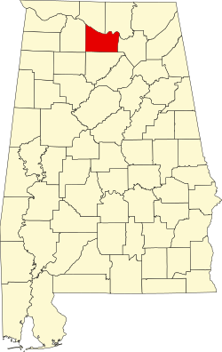
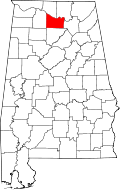
Morgan County, Alabama

Last updated

Morgan County
Morgan County, Alabama Courthouse.jpg
The Morgan County Courthouse in Decatur
Map of Alabama highlighting Morgan County.svg
Location within the U.S. state of Alabama
Alabama in United States.svg
Alabama's location within the U.S.
Coordinates: 34°27′06″N86°51′26″W / 34.451666666667°N 86.857222222222°W / 34.451666666667; -86.857222222222
CountryFlag of the United States.svg United States
StateFlag of Alabama.svg  Alabama
FoundedFebruary 6 [1] , 1818 [1]
Named for Daniel Morgan
Seat Decatur
Largest cityDecatur
Area
  Total599 sq mi (1,550 km2)
  Land579 sq mi (1,500 km2)
  Water20 sq mi (50 km2)  3.3%
Population
 (2020)
  Total123,421
  Estimate 
(2023)
125,133 Increase2.svg
  Density210/sq mi (80/km2)
Time zone UTC−6 (Central)
  Summer (DST) UTC−5 (CDT)
Congressional district 5th
Website morgancounty-al.gov
  • County Number 52 on Alabama Licence Plates

Morgan County is a county in the north-central part of the U.S. state of Alabama. As of the 2020 census, its population was 123,421. [2] The county seat is Decatur. [3] On June 14, 1821, it was renamed in honor of American Revolutionary War General Daniel Morgan of Virginia. [4] It is a prohibition or dry county, although alcohol sales are allowed in the cities of Decatur, Hartselle, and Priceville. Morgan County is included in the Decatur, AL Metropolitan Statistical Area, which is also included in the Huntsville-Decatur-Albertville, AL Combined Statistical Area. It is a part of the North, Northwest, and North-Central regions of Alabama.

Contents

History

The county was created by the Alabama territorial legislature on February 6, 1818, from land acquired from the Cherokee people in the Treaty of Turkeytown, and was originally called Cotaco County. [1]

Geography

According to the United States Census Bureau, the county has a total area of 599 square miles (1,550 km2), of which 20 square miles (52 km2) (3.3%) are covered by water. [5]

River

Adjacent counties

National protected area

Demographics

Historical population
CensusPop.Note
1820 5,263
1830 9,06272.2%
1840 9,8418.6%
1850 10,1252.9%
1860 11,33512.0%
1870 12,1877.5%
1880 16,42834.8%
1890 24,08946.6%
1900 28,82019.6%
1910 33,78117.2%
1920 40,19619.0%
1930 46,17614.9%
1940 48,1484.3%
1950 52,9249.9%
1960 60,45414.2%
1970 77,30627.9%
1980 90,23116.7%
1990 100,04310.9%
2000 111,06411.0%
2010 119,4907.6%
2020 123,4213.3%
2023 (est.)125,133 [6] 1.4%
U.S. Decennial Census [7]
1790–1960 [8] 1900–1990 [9]
1990–2000 [10] 2010–2020 [2]

2020 census

Morgan County, Alabama – Racial and Ethnic Composition
(NH = Non-Hispanic)
Note: the US Census treats Hispanic/Latino as an ethnic category. This table excludes Latinos from the racial categories and assigns them to a separate category. Hispanics/Latinos may be of any race.
Race / EthnicityPop 2000 [11] Pop 2010 [12] Pop 2020 [13] % 2000% 2010% 2020
White alone (NH)92,58492,58588,23883.36%77.48%71.49%
Black or African American alone (NH)12,38314,05915,30711.15%11.77%12.40%
Native American or Alaska Native alone (NH)7279286310.65%0.78%0.51%
Asian alone (NH)4916658290.44%0.56%0.67%
Pacific Islander alone (NH)2569790.02%0.06%0.06%
Some Other Race alone (NH)62803760.06%0.07%0.30%
Mixed Race/Multi-Racial (NH)1,1471,9485,5841.03%1.63%4.52%
Hispanic or Latino (any race)3,6459,15612,3773.28%7.66%10.03%
Total111,064119,490123,421100.00%100.00%100.00%

As of the census of 2020, there were 123,421 people, 46,470 households, and 31,752 families residing in the county.

2010 census

As of the census of 2010, there were 119,490 people, 47,030 households, and 33,135 families living in the county. The population density was 206.4 inhabitants per square mile (79.7 inhabitants/km2). There were 51,193 housing units at an average density of 88 units per square mile (34 units/km2). The racial makeup of the county was 79.8% White, 11.9% Black or African American, 0.9% Native American, 0.6% Asian, 0.1% Pacific Islander, 4.8% from other races, and 2.0% from two or more races. 7.7% of the population were Hispanic or Latino of any race. [14] Of the 47,030 households 30.0% had children under the age of 18 living with them, 52.9% were married couples living together, 12.9% had a female householder with no husband present, and 29.5% were non-families. 25.9% of households were one person and 9.8% were one person aged 65 or older. The average household size was 2.50 and the average family size was 2.99.

The age distribution was 24.0% under the age of 18, 8.4% from 18 to 24, 26.1% from 25 to 44, 27.5% from 45 to 64, and 14.1% 65 or older. The median age was 39 years. For every 100 females, there were 97.2 males. For every 100 females age 18 and over, there were 100.4 males.

The median household income was $44,349 and the median family income was $54,653. Males had a median income of $43,455 versus $29,270 for females. The per capita income for the county was $23,090. About 10.9% of families and 15.0% of the population were below the poverty line, including 21.9% of those under age 18 and 12.0% of those age 65 or over.

2000 census

As of the census of 2000, there were 111,064 people, 43,602 households, and 31,437 families living in the county. The population density was 191 inhabitants per square mile (74 inhabitants/km2). There were 47,388 housing units at an average density of 81 units per square mile (31 units/km2). The racial makeup of the county was 85.07% White, 11.24% Black or African American, 0.67% Native American, 0.45% Asian, 0.07% Pacific Islander, 1.25% from other races, and 1.25% from two or more races. 3.28% of the population were Hispanic or Latino of any race. [15] According to the census [16] of 2000, the largest ancestry groups in Morgan County were English 60.1%, Scots-Irish 12.71%, and African 11.24%

Of the 43,602 households 33.50% had children under the age of 18 living with them, 57.40% were married couples living together, 11.20% had a female householder with no husband present, and 27.90% were non-families. 24.80% of households were one person and 9.40% were one person aged 65 or older. The average household size was 2.51 and the average family size was 2.99.

The age distribution was 25.30% under the age of 18, 8.40% from 18 to 24, 30.10% from 25 to 44, 23.80% from 45 to 64, and 12.30% 65 or older. The median age was 37 years. For every 100 females, there were 96.20 males. For every 100 females age 18 and over, there were 93.50 males.

The median household income was $37,803 and the median family income was $45,827. Males had a median income of $35,759 versus $21,885 for females. The per capita income for the county was $19,223. About 9.70% of families and 12.30% of the population were below the poverty line, including 15.90% of those under age 18 and 12.80% of those age 65 or over.

Government

United States presidential election results for Morgan County, Alabama [17] [18]
Year Republican Democratic Third party
No.%No.%No.%
2020 39,66473.83%13,23424.63%8241.53%
2016 37,48674.02%11,25422.22%1,9043.76%
2012 35,39171.56%13,43927.17%6291.27%
2008 36,01471.26%13,89527.49%6331.25%
2004 32,47769.09%14,13130.06%3990.85%
2000 25,77460.39%16,06037.63%8471.98%
1996 21,76554.39%14,61636.53%3,6329.08%
1992 21,07347.92%15,09134.31%7,81417.77%
1988 18,67963.54%10,59436.04%1240.42%
1984 24,30167.99%11,32431.68%1160.32%
1980 13,21445.14%14,70350.23%1,3544.63%
1976 9,05834.86%16,54763.68%3811.47%
1972 18,10076.85%5,00421.25%4491.91%
1968 3,04313.66%1,8788.43%17,35677.91%
1964 7,01356.64%00.00%5,36843.36%
1960 4,35735.71%7,82264.11%210.17%
1956 2,97427.35%7,67170.56%2272.09%
1952 2,33524.89%7,02974.94%160.17%
1948 51211.68%00.00%3,87088.32%
1944 66413.72%4,12485.24%501.03%
1940 5008.51%5,34590.93%330.56%
1936 4327.13%5,59792.39%290.48%
1932 65611.43%4,98686.88%971.69%
1928 4,08554.76%3,36645.12%90.12%
1924 51916.53%2,24771.58%37311.88%
1920 1,20122.54%4,05776.13%711.33%
1916 36414.19%2,12082.62%823.20%
1912 24110.16%1,68671.11%44418.73%
1908 49722.48%1,54870.01%1667.51%
1904 41620.83%1,43771.96%1447.21%
1900 1,50045.03%1,74752.45%842.52%
1896 1,46238.10%2,12855.46%2476.44%
1892 30.07%2,16050.07%2,15149.86%
1888 50722.77%1,70776.65%130.58%
1884 85332.78%1,57360.45%1766.76%
1880 64427.53%1,42060.71%27511.76%
1876 77335.06%1,43264.94%00.00%
1872 1,01850.30%1,00649.70%00.00%
1868 51843.49%67356.51%00.00%
1860 00.00%54544.02%69355.98%
1856 00.00%80878.45%22221.55%
1852 20830.14%48269.86%00.00%
1848 36151.87%33548.13%00.00%
1844 27128.44%68271.56%00.00%
1840 35830.81%80469.19%00.00%
1836 47645.59%56854.41%00.00%
1832 00.00%531100.00%00.00%

Transportation

Major highways

Rail

Communities

Cities

Towns

Unincorporated communities

Former city

Former town

Ghost town

Education

School districts include: [19]

See also

Related Research Articles

<span class="mw-page-title-main">Bibb County, Alabama</span> County in Alabama, United States

Bibb County is a county in the central portion of the U.S. state of Alabama. The county is included in the ARC's definition of Appalachia. As of the 24th decennial 2020 census, its population was 22,293. The county seat is Centreville. The county is named in honor of William W. Bibb (1781–1820), the Governor of Alabama Territory (1817–1819) and the first Governor of Alabama. He is also the namesake for Bibb County, Georgia, where he began his political career. It is a "prohibition" or dry county; however, a few towns have become "wet" by allowing the sale of alcoholic beverages: Woodstock, West Blocton, Centreville, and Brent. The Bibb County Courthouse is located in the county seat of Centreville.

<span class="mw-page-title-main">Covington County, Alabama</span> County in Alabama, United States

Covington County, is a county located in the south central portion of the U.S. state of Alabama. As of the 2020 census the population was 37,570. Its county seat is Andalusia. Its name is in honor of Brigadier General Leonard Covington of Maryland and Mississippi, who died in the War of 1812.

<span class="mw-page-title-main">Crenshaw County, Alabama</span> County in Alabama, United States

Crenshaw County is a county located in the south central portion of the U.S. state of Alabama. It is located immediately south of the Montgomery metropolitan area. As of the 2020 census, the population was 13,194. Its county seat is Luverne. Its name is in honor of an Alabama judge, Anderson Crenshaw.

<span class="mw-page-title-main">Lawrence County, Alabama</span> County in Alabama, United States

Lawrence County is a county in the northern part of the U.S. state of Alabama. As of the 2020 census, the population was 33,073. The county seat is Moulton. The county was named after James Lawrence, a captain in the United States Navy from New Jersey.

<span class="mw-page-title-main">Limestone County, Alabama</span> County in the United States

Limestone County is a county of the U.S. state of Alabama. As of the 2020 census, the county's population was 103,570. Its county seat is Athens. The county is named after Limestone Creek. Limestone County is included in the Huntsville, AL Metropolitan Statistical Area.

<span class="mw-page-title-main">Marshall County, Alabama</span> County in Alabama, United States

Marshall County is a county of the state of Alabama, United States. As of the 2020 census the population was 97,612. Its county seat is Guntersville. A second courthouse is in Albertville. Its name is in honor of John Marshall, famous Chief Justice of the United States. Marshall County is a dry county, with the exception of the five cities of Albertville, Arab, Grant, Guntersville, and Boaz. Marshall County comprises the Albertville, AL Micropolitan Statistical Area, which is also included in the Huntsville-Decatur-Albertville, AL Combined Statistical Area.

<span class="mw-page-title-main">Pike County, Alabama</span> County in Alabama, United States

Pike County is located in the U.S. state of Alabama. As of the 2020 census the population was 33,009. Its county seat is Troy. Its name is in honor of General Zebulon Pike, of New Jersey, who led an expedition to southern Colorado and encountered Pikes Peak in 1806.

<span class="mw-page-title-main">Randolph County, Alabama</span> County in Alabama, United States

Randolph County is a county on the central eastern border of the U.S. state of Alabama. As of the 2020 census, the population was 21,967. Its county seat is Wedowee. Its name is in honor of John Randolph, a member of the United States Senate from Virginia. Randolph County was a prohibition or dry county until 2012, when the citizens of Randolph County voted to repeal prohibition.

<span class="mw-page-title-main">Tallapoosa County, Alabama</span> County in Alabama, United States

Tallapoosa County is located in the east-central portion of the U.S. state of Alabama. As of the 2020 census, the population was 41,311. Its county seat is Dadeville. Its largest city is Alexander City.

<span class="mw-page-title-main">Decatur County, Iowa</span> County in Iowa, United States

Decatur County is a county located in the U.S. state of Iowa. As of the 2020 census, the population was 7,645. The county seat is Leon. This county is named for Stephen Decatur Jr., a hero in the War of 1812.

<span class="mw-page-title-main">Tuscumbia, Alabama</span> City in Alabama

Tuscumbia is a city in and the county seat of Colbert County, Alabama, United States. As of the 2010 census, the population was 8,423. The city is part of The Shoals metropolitan area.

<span class="mw-page-title-main">Hillsboro, Alabama</span> Town in Alabama, United States

Hillsboro is a town in Lawrence County, Alabama, and is included in the Decatur Metropolitan Area, as well as the Huntsville-Decatur Combined Statistical Area. It was incorporated in 1899. As of the 2010 census, the population of the town is 552, down from its record high of 608 in 2000. Along with North Courtland, it is one of two majority black communities in Lawrence County out of its six populated communities as of 2010.

<span class="mw-page-title-main">North Courtland, Alabama</span> Town in Alabama, United States

North Courtland is a town in Lawrence County, Alabama, United States, and is included in the Decatur Metropolitan Area, as well as the Huntsville-Decatur Combined Statistical Area. It incorporated in 1981. At the 2010 census, the population of the town was 632, down from 799 in 2000. Along with Hillsboro, it is one of two majority black communities in Lawrence County out of its six populated communities as of 2010.

<span class="mw-page-title-main">Moores Mill, Alabama</span> Census-designated place in Alabama, United States

Moores Mill is an unincorporated community and census-designated place (CDP) in Madison County, Alabama, United States, and is included in the Huntsville-Decatur Combined Statistical Area. The population was 6,729 at the 2020 census, up from 5,682 at the 2010 census.

<span class="mw-page-title-main">Eva, Alabama</span> Town in Alabama, United States

Eva is a town in Morgan County, Alabama, United States, and is included in the Decatur Metropolitan Area and the Huntsville-Decatur Combined Statistical Area. As of the 2020 census, the population of the town was 589, up from 519 in 2010. The mayor currently is Gary Livingston.

<span class="mw-page-title-main">Falkville, Alabama</span> Town in Alabama, United States

Falkville is a town in Morgan County, Alabama, United States, and is included in the Decatur Metropolitan Area and Huntsville-Decatur Combined Statistical Area. As of the 2020 census, the population of the town was 1,197.

<span class="mw-page-title-main">Hartselle, Alabama</span> City in Alabama, United States

Hartselle is the second largest city in Morgan County, Alabama, United States, 13 miles (21 km) south of Decatur. It is part of the Decatur Metropolitan Area and the Huntsville-Decatur Combined Statistical Area.

<span class="mw-page-title-main">Priceville, Alabama</span> City in Alabama, United States

Priceville is the third largest municipality in Morgan County, Alabama, United States and is included in the Decatur Metropolitan Area, as well as the Huntsville-Decatur Combined Statistical Area. The 2020 census counted a population of 3,513, up from 2,658 in 2010.

<span class="mw-page-title-main">Somerville, Alabama</span> Town in Alabama, United States

Somerville is a town in Morgan County, Alabama, United States. It is included in the Decatur Metropolitan Area and the Huntsville-Decatur Combined Statistical Area. As of the 2020 census, the population of the town was 796.

<span class="mw-page-title-main">Trinity, Alabama</span> Town in Alabama, United States

Trinity is a town in Morgan County, Alabama, United States. It is included in the Decatur Metropolitan Area and the Huntsville-Decatur Combined Statistical Area. As of the 2020 census, the population of the town was 2,526, up from 2,095 in 2010. It was incorporated in 1901.

References

  1. 1 2 3 Acts Passed at the First Session of the First General Assembly, of the Alabama Territory: In the Forty Second Year of American Independence (1818). St. Stephens, Alabama, printed by Thomas Eastin. Reprinted T.L. Cole, Washington, D.C., July 1912. Pages 8-12. "An Act to establish the counties of Cotaco, Lawrence and Franklin...Approved-6th February, 1818." Archived December 4, 2010, at the Wayback Machine
  2. 1 2 "State & County QuickFacts". United States Census Bureau. Retrieved September 13, 2023.
  3. "Find a County". National Association of Counties. Retrieved June 7, 2011.
  4. Acts Passed at the Called Session of the General Assembly of the State of Alabama Begun and Held in the Town of Cahawba, on the First Monday in June, One Thousand Eight Hundred and Twenty One (1821). Cahawba, Alabama: Printed by Allen & Brickell, State Printers. Reprint by Statute Law Book Co., Washington, D.C. Nov. 1913. Page 40. "An Act to change the name of Ococoposa, and for other purposes...Approved, June 14, 1821." Archived December 4, 2010, at the Wayback Machine
  5. "2010 Census Gazetteer Files". United States Census Bureau. August 22, 2012. Retrieved August 22, 2015.
  6. "Annual Estimates of the Resident Population for Counties: April 1, 2020 to July 1, 2023". United States Census Bureau. Retrieved March 27, 2024.
  7. "U.S. Decennial Census". United States Census Bureau. Retrieved August 22, 2015.
  8. "Historical Census Browser". University of Virginia Library. Retrieved August 22, 2015.
  9. Forstall, Richard L., ed. (March 24, 1995). "Population of Counties by Decennial Census: 1900 to 1990". United States Census Bureau. Retrieved August 22, 2015.
  10. "Census 2000 PHC-T-4. Ranking Tables for Counties: 1990 and 2000" (PDF). United States Census Bureau. April 2, 2001. Retrieved August 22, 2015.
  11. "P004 Hispanic or Latino, and Not Hispanic or Latino by Race – 2000: DEC Summary File 1 – Morgan County, Alabama". United States Census Bureau .
  12. "P2 Hispanic or Latino, and Not Hispanic or Latino by Race – 2010: DEC Redistricting Data (PL 94-171) – Morgan County, Alabama". United States Census Bureau .
  13. "P2 Hispanic or Latino, and Not Hispanic or Latino by Race - 2020: DEC Redistricting Data (PL 94-171) – Morgan County, Alabama". United States Census Bureau .
  14. "U.S. Census website". United States Census Bureau . Retrieved August 5, 2015.
  15. "U.S. Census website". United States Census Bureau . Retrieved May 14, 2011.
  16. "U.S. Census website". United States Census Bureau . Retrieved January 31, 2008.
  17. "Dave Leip's Atlas of U.S. Presidential Elections" . Retrieved November 21, 2016.
  18. Burnham, Walter Dean. "Presidential ballots, 1836-1892". archive.org. Retrieved January 16, 2021.
  19. "2020 CENSUS - SCHOOL DISTRICT REFERENCE MAP: Morgan County, AL" (PDF). United States Census Bureau . Retrieved August 1, 2022. - Text list

34°27′06″N86°51′26″W / 34.45167°N 86.85722°W / 34.45167; -86.85722