Morgan City, Alabama | |
|---|---|
 Morgan City  Morgan City | |
| Coordinates: 34°28′19″N86°34′11″W / 34.47194°N 86.56972°W | |
| Country | United States |
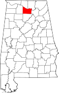
| State | Alabama |
| County | Marshall & Morgan |
| Elevation | 1,191 ft (363 m) |
| Time zone | UTC-6 (Central (CST)) |
| • Summer (DST) | UTC-5 (CDT) |
| Area codes | 256 & 938 |
| GNIS feature ID | 123040 [1] |
Morgan City, also known as New Rescue, is an unincorporated community located in Morgan and Marshall counties, Alabama, United States. It is included in the Huntsville-Decatur Combined Statistical Area, as well as the Decatur Metropolitan Area.
Contents
It is located atop Brindlee Mountain which is approximately halfway between Arab and Huntsville along U.S. 231. Morgan City houses many shops, ranging from a dental and animal clinic to an antique shop. A Fire station sits inside Morgan City known as Brindlee Mountain Volunteer Fire Department Station #1. Going south towards Arab, there is a bow repair shop as well as a carpet business. Brindlee Mountain Fire Apparatus sits inside Morgan City as well, but on the boundaries between Morgan City and Union Grove. Dollar General, a small drug store, a cafe, and Food 4 Less operate in a small strip mall in the area's limits. There also is 2 gas stations, a Rob Austin Alfa agency office, 4 churches, as well as several mechanic shops.