Russellville, Alabama

Last updated

Russellville
Russellville-Jackson-Ave-al.jpg
Jackson Avenue
Franklin County Alabama Incorporated and Unincorporated areas Russellville Highlighted 0167056.svg
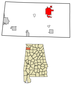
Location of Russellville in Franklin County, Alabama.
Coordinates: 34°30′20″N87°43′45″W / 34.50556°N 87.72917°W / 34.50556; -87.72917
Country United States
State Alabama
County Franklin
IncorporatedNovember 27, 1819 [1]
Named for Major William Russell
Government
  TypeMunicipality
  MayorDavid Grissom
  City CouncilDavid Palmer
Darren Woodruff
Gary Cummings
Dexter Hamilton
Jamie Harris
Area
[2]
  Total13.52 sq mi (35.00 km2)
  Land13.41 sq mi (34.73 km2)
  Water0.11 sq mi (0.27 km2)
Elevation
764 ft (233 m)
Population
 (2020)
  Total10,855
  Density809.47/sq mi (312.55/km2)
Time zone UTC-6 (Central (CST))
  Summer (DST) UTC-5 (CDT)
ZIP codes
35653-35654
Area code 256
FIPS code 01-67056
GNIS feature ID0126047
Website www.russellvilleal.org

Russellville is a city in Franklin County in the U.S. state of Alabama. At the 2020 census, the population of the city was 10,855, [3] up from 9,830 at the 2010 census. [4] The city is the county seat of Franklin County.

Contents

History

After the War of 1812, the U.S. government appropriated money to improve a route from Nashville to New Orleans. It was named Jackson's Military Road after Andrew Jackson, and it passed through what became Russellville. (Present-day Jackson Avenue and Jackson Highway, U.S. Route 43, follow portions of the original road.) [5]

Russellville is named after Major William Russell, [6] an early settler in the area who helped in the construction of Jackson's Military Road. The town grew at this road's intersection with the Gaines Trace.

Russellville was incorporated on November 27, 1819. [1]

Russellville served as the first county seat from 1818-1849 before it was removed to Frankfort (which served from 1849-1879). After the fire at the courthouse in the third county seat of Belgreen in 1890, the seat was returned to Russellville in 1891. [7]

Geography

Russellville is located in northeastern Franklin County. U.S. Route 43 passes through the eastern side of the city, leading north 18 miles (29 km) to Muscle Shoals on the Tennessee River and southwest 31 miles (50 km) to Hamilton. Alabama State Route 24 passes through the south side of the city, leading east 47 miles (76 km) to Decatur on the Tennessee River and west 26 miles (42 km) to Red Bay at the Mississippi border.

According to the U.S. Census Bureau, Russellville has a total area of 13.5 square miles (35.0 km2), of which 13.4 square miles (34.7 km2) is land and 0.1 square miles (0.3 km2), or 0.79%, is water. [4]

Climate

Climate data for Russellville, Alabama, 1991–2020 normals, extremes 1953present
MonthJanFebMarAprMayJunJulAugSepOctNovDecYear
Record high °F (°C)78
(26)
84
(29)
87
(31)
92
(33)
95
(35)
106
(41)
103
(39)
106
(41)
102
(39)
98
(37)
86
(30)
85
(29)
106
(41)
Mean maximum °F (°C)68.5
(20.3)
73.6
(23.1)
80.6
(27.0)
85.6
(29.8)
89.8
(32.1)
94.4
(34.7)
96.3
(35.7)
96.9
(36.1)
93.6
(34.2)
86.5
(30.3)
78.2
(25.7)
70.0
(21.1)
97.9
(36.6)
Mean daily maximum °F (°C)51.1
(10.6)
55.9
(13.3)
64.7
(18.2)
73.2
(22.9)
80.9
(27.2)
88.0
(31.1)
90.9
(32.7)
90.5
(32.5)
85.4
(29.7)
74.8
(23.8)
63.0
(17.2)
54.0
(12.2)
72.7
(22.6)
Daily mean °F (°C)41.4
(5.2)
45.0
(7.2)
52.5
(11.4)
60.9
(16.1)
69.2
(20.7)
76.8
(24.9)
80.3
(26.8)
79.6
(26.4)
73.6
(23.1)
62.4
(16.9)
51.4
(10.8)
44.1
(6.7)
61.4
(16.3)
Mean daily minimum °F (°C)31.7
(−0.2)
34.2
(1.2)
40.3
(4.6)
48.6
(9.2)
57.5
(14.2)
65.7
(18.7)
69.8
(21.0)
68.8
(20.4)
61.8
(16.6)
50.1
(10.1)
39.8
(4.3)
34.3
(1.3)
50.2
(10.1)
Mean minimum °F (°C)12.6
(−10.8)
17.3
(−8.2)
23.1
(−4.9)
31.6
(−0.2)
41.5
(5.3)
53.8
(12.1)
61.2
(16.2)
59.2
(15.1)
47.3
(8.5)
33.3
(0.7)
24.0
(−4.4)
18.7
(−7.4)
10.4
(−12.0)
Record low °F (°C)−24
(−31)
−12
(−24)
5
(−15)
22
(−6)
31
(−1)
36
(2)
45
(7)
46
(8)
30
(−1)
19
(−7)
10
(−12)
−7
(−22)
−24
(−31)
Average precipitation inches (mm)5.00
(127)
5.08
(129)
5.43
(138)
5.12
(130)
5.38
(137)
3.82
(97)
4.48
(114)
4.66
(118)
3.99
(101)
3.76
(96)
4.54
(115)
5.44
(138)
56.7
(1,440)
Average snowfall inches (cm)0.3
(0.76)
0.2
(0.51)
0.1
(0.25)
0.0
(0.0)
0.0
(0.0)
0.0
(0.0)
0.0
(0.0)
0.0
(0.0)
0.0
(0.0)
0.0
(0.0)
0.0
(0.0)
0.0
(0.0)
0.6
(1.52)
Average precipitation days (≥ 0.01 in)9.28.89.08.08.38.18.77.36.06.37.78.796.1
Average snowy days (≥ 0.1 in)0.20.20.00.00.00.00.00.00.00.00.00.20.6
Source 1: NOAA [8]
Source 2: National Weather Service [9]

Demographics

Historical population
CensusPop.Note
1870 180
1880 1863.3%
1890 920394.6%
1900 1,60274.1%
1910 2,04627.7%
1920 2,26910.9%
1930 3,14638.7%
1940 3,51011.6%
1950 6,01271.3%
1960 6,62810.2%
1970 7,81417.9%
1980 8,1954.9%
1990 7,812−4.7%
2000 8,97114.8%
2010 9,8309.6%
2020 10,85510.4%
U.S. Decennial Census [10]

2010 census

At the 2010 census, [11] there were 9,830 people and 3,556 households. The population density was 677.9 inhabitants per square mile (261.7/km2). There were 3,882 housing units at an average density of 293.3 per square mile (113.2/km2). The racial makeup of the city was 73.68% White, 11.25% Black or African American, 0.35% Native American, 0.12% Asian, 0.27% Pacific Islander, 7.54% from other races, and 1.17% from two or more races. 12.64% of the population were Hispanic or Latino of any race.

There were 3,556 households, of which 30.6% had children under the age of 18 living with them, 50.9% were married couples living together, 12.6% had a female householder with no husband present, and 33.5% were non-families. 30.8% of all households were made up of individuals, and 16.0% had someone living alone who was 65 years of age or older. The average household size was 2.44 and the average family size was 3.03.

Age distribution was 24.2% under the age of 18, 9.8% from 18 to 24, 26.5% from 25 to 44, 21.6% from 45 to 64, and 17.9% who were 65 years of age or older. The median age was 37 years. For every 100 females, there are 89.6 males. For every 100 females age 18 and over, there were 85.3 males.

The median household income was $25,333, and the median family income was $35,799. Males had a median income of $27,238 versus $18,551 for females. The per capita income for the city was $14,871. About 16.7% of families and 22.2% of the population were below the poverty line, including 29.2% of those under age 18 and 24.9% of those age 65 or over.

2020 census

Russellville racial composition [12]
RaceNum.Perc.
White (non-Hispanic)5,51550.81%
Black or African American (non-Hispanic)8708.01%
Native American 420.39%
Asian 290.27%
Other/Mixed 2852.63%
Hispanic or Latino 4,11437.9%

As of the 2020 United States census, there were 10,855 people, 3,238 households, and 2,244 families residing in the city.

Local features

Watermelon Festival - The annual "Watermelon Festival" is held each August in downtown Russellville, and includes music and entertainment, car and tractor shows, and arts and crafts. [13]

Roxy Theater - Built in 1949, the theater originally served primarily as a movie cinema, but saw a major decline in the early 1980s. It now has been revitalized as an entertainment venue due to the efforts of The Franklin County Arts and Humanities Council and the support of local citizens. [14] [15]

King Drive-In - The King Drive-In is located just north of Russellville on Highway 43. One of the few drive-in movie theaters still operating in Alabama, it plays currently released films throughout the spring and summer on Friday, Saturday and Sunday nights. The theater features old-style speakers that hang on car windows, but also offers the soundtrack of films through FM radio broadcasts, as well. [16]

The Strip - From the 1960s until approximately 2000, "The Downtown Strip" had been a source of entertainment for local teenagers throughout Franklin County. This strip is best described as having the atmosphere of George Lucas' iconic film, American Graffiti . Cruising the strip ended near the end of 2004 due to an increased local police presence in the area. [17]

RHS stadium - Russellville High School Stadium is a place where local residents watch the high school football team play. Russellville's football team ranks as one of the most successful teams in Alabama in terms of all-time playoff wins. [18]

Local media

WMTY-TV features area events about the Russellville area including news and weather, though most programming is religious. Its translator station is W46DF-D. Radio stations include WKAX AM 1500, WGOL AM 920, and WPMR-LP 99.7 FM. Russellville's newspapers are The Franklin Free Press and the Franklin County Times .

Notable people

Related Research Articles

<span class="mw-page-title-main">Franklin County, Alabama</span> County in Alabama, United States

Franklin County is a county located in the U.S. state of Alabama. As of the 2020 census, the population was 32,113. Its county seat is Russellville. Its name is in honor of Benjamin Franklin, famous statesman, scientist, and printer. It is a dry county, although the city of Russellville is wet.

<span class="mw-page-title-main">Tallapoosa County, Alabama</span> County in Alabama, United States

Tallapoosa County is located in the east-central portion of the U.S. state of Alabama. As of the 2020 census, the population was 41,311. Its county seat is Dadeville. Its largest city is Alexander City.

<span class="mw-page-title-main">Logan County, Kentucky</span> County in Kentucky, United States

Logan County is a county in the southwest Pennyroyal Plateau area of the U.S. Commonwealth of Kentucky. As of the 2020 census, the population was 27,432. Its county seat is Russellville.

<span class="mw-page-title-main">Ohatchee, Alabama</span> Town in Alabama, United States

Ohatchee is a town in Calhoun County, Alabama, United States. At the 2020 census, the population was 1,157. It is included in the Anniston–Oxford, Alabama Metropolitan Statistical Area.

<span class="mw-page-title-main">Jackson, Alabama</span> City in Alabama, United States

Jackson is a city in Clarke County, Alabama, United States. The population was 5,557 at the 2020 census. It was one of three wet settlements in an otherwise-dry county.

<span class="mw-page-title-main">Sheffield, Alabama</span> City in Alabama, United States

Sheffield is a city in Colbert County, Alabama, United States, and is included in the Florence-Shoals metropolitan area. As of the 2010 census, the population of the city was 9,039. Sheffield is the birthplace of "country-soul pioneer" and songwriter Arthur Alexander, French horn player Willie Ruff, notable attorney, actor, former senator and presidential contender Fred Thompson, Watergate committee U.S. Senator Howell Heflin and U.S. Senator Mitch McConnell, whose father was working in nearby Athens when he was born. It sometimes is referred to as "the City of Senators" due to the births of Heflin, McConnell and Thompson within its borders. Col. Harland Sanders worked in the Sheffield depot for Southern Railway in the 1907. It is also home to the Muscle Shoals Sound Studio where many popular 20th century musicians recorded their work, including Alexander and Ruff. It is the site of historic Helen Keller Hospital, formerly known as Colbert County Hospital and originally constructed in 1921. It was changed to Helen Keller Hospital in 1979, and Keller's birthplace Ivy Green is located less than one mile southwest of the hospital in adjacent Tuscumbia.

<span class="mw-page-title-main">Tuscumbia, Alabama</span> City in Alabama

Tuscumbia is a city in and the county seat of Colbert County, Alabama, United States. As of the 2010 census, the population was 8,423. The city is part of The Shoals metropolitan area.

<span class="mw-page-title-main">Henagar, Alabama</span> City in Alabama, United States

Henagar is a city in DeKalb County, Alabama, United States. At the 2020 census, the population was 2,292.

<span class="mw-page-title-main">Phil Campbell, Alabama</span> Town in Alabama, United States

Phil Campbell is a town in Franklin County, Alabama, United States. At the 2020 census, the population was 992. It is one of two towns in Alabama to have the first and last name of an individual; the other being Susan Moore. It is the largest city in southern Franklin County.

<span class="mw-page-title-main">Red Bay, Alabama</span> City in Alabama, United States

Red Bay is a city in Franklin County, Alabama, United States. It was founded in 1907; its western boundary line is integral with the state line between Mississippi and Alabama. The population was 3,232 at the 2020 census. The town's name comes from the area's red clay soil and the many redbay trees in this area of north Alabama.

<span class="mw-page-title-main">Greensboro, Alabama</span> City in Alabama, United States

Greensboro is a city in Hale County, Alabama, United States. At the 2010 census the population was 2,497, down from 2,731 at the 2000 census. The city is the county seat of Hale County, Alabama, which was not organized until 1867. It is part of the Tuscaloosa, Alabama Metropolitan Statistical Area.

<span class="mw-page-title-main">Stevenson, Alabama</span> City in Alabama, United States

Stevenson is a city in Jackson County, Alabama, United States, and is included in the Chattanooga-Cleveland-Dalton, TN-GA-AL Combined Statistical Area. Sources listed either 1866 or 1867 as the year of incorporation, but that seems to conflict with the dates given for the town being granted a charter. It did not first appear on the U.S. Census until 1880, where it was the second largest town in Jackson County behind Scottsboro. Since 1900, it has been the third largest town behind either Scottsboro and Bridgeport or vice versa. At the 2020 census, the population of the city was 1,955, down from 2,046 in 2010.

<span class="mw-page-title-main">Bear Creek, Alabama</span> Town in Alabama, United States

Bear Creek is a town in Marion County, Alabama, United States. It incorporated in 1907, although the 1910 U.S. Census records indicated 1909. At the 2020 census, the population was 1,047.

<span class="mw-page-title-main">Hackleburg, Alabama</span> Town in Alabama, United States

Hackleburg is a town in Marion County, Alabama, United States. It incorporated on August 23, 1909. At the 2020 census, its population was 1,425, down from 1,516 at the 2010 census.

<span class="mw-page-title-main">Grand Bay, Alabama</span> Census-designated place in Alabama, United States

Grand Bay is an unincorporated community and census-designated place (CDP) in Mobile County, Alabama, United States. It is part of the Mobile metropolitan area. The population was 3,460 at the 2020 census.

<span class="mw-page-title-main">London, Arkansas</span> City in Arkansas, United States

London is a city in Pope County, Arkansas, United States. The population was 1,039 at the 2010 census. It is part of the Russellville Micropolitan Statistical Area.

<span class="mw-page-title-main">Pottsville, Arkansas</span> City in Arkansas, United States

Pottsville is a city in Pope County, Arkansas, United States. As of the 2020 census the population was 3,140. It is part of the Russellville Micropolitan Statistical Area.

<span class="mw-page-title-main">Russellville, Indiana</span> Town in Indiana, United States

Russellville is a town in Russell Township, Putnam County, in the U.S. state of Indiana. The population was 358 at the 2010 census.

<span class="mw-page-title-main">Russellville, Missouri</span> City in Missouri, United States

Russellville is a city in Cole County, Missouri, United States. The population was 778 at the 2020 census. It is part of the Jefferson City, Missouri Metropolitan Statistical Area.

<span class="mw-page-title-main">Winchester, Tennessee</span> City in Tennessee, United States

Winchester is a city in and the county seat of Franklin County, Tennessee, United States. It is part of the Tullahoma micropolitan area. The population of Winchester as of the 2020 census was 9,375.

References

  1. 1 2 'A Digest of the Laws of the State of Alabama: Containing the Statutes and Resolutions in Force at the End of the General Assembly in January 1823. Published by Ginn & Curtis, J. & J. Harper, Printers, New-York, 1828. Title 62. Chapter XXIV. Pages 812-813. "An Act to Establish and Incorporate the Town of Russelville, in County of Franklin.—Passed November 27, 1819." (Google Books)
  2. "2020 U.S. Gazetteer Files". United States Census Bureau. Retrieved October 29, 2021.
  3. "Explore Census Data". data.census.gov. Retrieved October 7, 2022.
  4. 1 2 "Geographic Identifiers: 2010 Census Summary File 1 (G001): Russellville city, Alabama". American Factfinder. U.S. Census Bureau. Archived from the original on February 13, 2020. Retrieved April 12, 2016.
  5. RussellvilleGov.com (2004). "History of Russellville". Archived page of March 22, 2004.
  6. "Announcements". Times Daily. October 20, 1932. p. 3. Retrieved May 28, 2015.
  7. Our History, Franklin County official website. Accessed September 27, 2018.
  8. "U.S. Climate Normals Quick Access – Station: Russellville #2, AL". National Oceanic and Atmospheric Administration. Retrieved March 4, 2023.
  9. "NOAA Online Weather Data – NWS Huntsville". National Weather Service. Retrieved March 4, 2023.
  10. "U.S. Decennial Census". Census.gov. Retrieved June 6, 2013.
  11. "U.S. Census website". United States Census Bureau . Retrieved January 31, 2008.
  12. "Explore Census Data". data.census.gov. Retrieved December 11, 2021.
  13. Watermelon Festival, Franklin County Chamber of Commerce official site. Accessed September 27, 2018.
  14. "Roxy Theatre Receives Lasting Impression Awards," Franklin County Times, October 7, 2015.
  15. John Pilati, "Baldwin to Perform Benefit Concert This Saturday at Roxy," Franklin Free Press, May 15, 2018.
  16. Pounders, Vicki (April 20, 1989). "Russellville drive-in still going after 40 years". Times-Daily . Florence, AL: Tennessee Valley Printing Co. pp. 1A, 5A. Retrieved March 28, 2013.
  17. Jim Hannon, "Cruisin' the Strip," Florence TimesDaily, March 13, 2011.
  18. Playoff Team Records, Alabama High School Football Historical Society. Accessed September 27, 2018.
  19. Smith, Jack D., "Information and Inspiration: An Early History of the Alabama Cooperative Extension Service," (Unpublished Manuscript Prepared for Alabama Extension's 75th Anniversary), March 29, 1989.