Greenville, Alabama

Last updated

Greenville
Greenville AL Butler Co Court House.JPG
Butler County Courthouse in Greenville
Seal of Greenville, Alabama.png
Nickname: 
Camellia City
Butler County Alabama Incorporated and Unincorporated areas Greenville Highlighted 0131912.svg
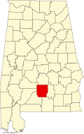
Location of Greenville in Butler County, Alabama.
Coordinates: 31°49′52″N86°37′39″W / 31.83111°N 86.62750°W / 31.83111; -86.62750
CountryUnited States
State Alabama
County Butler
Founded1819
Named for Greenville, South Carolina
Government
  TypeMayor/Council
  MayorDexter McLendon
Area
[1]
  Total21.53 sq mi (55.76 km2)
  Land21.35 sq mi (55.31 km2)
  Water0.18 sq mi (0.46 km2)
Elevation
440 ft (134 m)
Population
 (2020)
  Total7,374
  Density345.32/sq mi (133.33/km2)
Time zone UTC-6 (Central (CST))
  Summer (DST) UTC-5 (CDT)
ZIP code
36037
Area code 334
FIPS code 01-31912
GNIS feature ID0119376
Website greenvilleal.gov

Greenville is a city and the county seat of Butler County, Alabama, United States. At the 2020 census, the population was 7,374. Greenville is known as the Camellia City, wherein originated the movement to change the official Alabama state flower from the goldenrod to the camellia with legislative sponsors LaMont Glass and H.B. Taylor. [2]

Contents

History

Greenville was first settled in 1819. Its original name was Buttsville, [3] but after becoming the county seat in 1822, its name was changed to Greenville, in remembrance of the former locale in South Carolina of many of the original settlers. [4] [5] The first county seat was at Fort Dale, a fortification that was named for Sam Dale, who fought to defend the area during the Creek War. The site of Fort Dale lies on the north of the city near the Fort Dale Cemetery, along what is now Alabama Highway 185.

The namesake of the county, Captain William Butler, was killed during the Creek War. He is buried in the Pioneer Cemetery, which is across from the oldest church in Butler County, the First United Methodist Church of Greenville.

During World War II, a satellite camp for German prisoners was based in Greenville. [6]

Geography

Interstate 65 and U.S. Route 31 pass through the city. Montgomery, the state capital, is 44 miles (71 km) northeast, the closest city to Greenville with a population above 50,000. [7]

According to the U.S. Census Bureau, Greenville has a total area of 21.5 square miles (55.8 km2), of which 21.4 square miles (55.3 km2) is land and 0.19 square miles (0.5 km2), or 0.82%, is water. [8]

Climate

The city of Greenville has a humid subtropical climate, with an average high temperature of 77.3 °F (25.2 °C) and an average low temperature of 53.8 °F (12.1 °C). The city averages 4.80 inches (122 mm) of precipitation per month. [9]

Climate data for Greenville, Alabama (1991–2020 normals, extremes 1927–present)
MonthJanFebMarAprMayJunJulAugSepOctNovDecYear
Record high °F (°C)87
(31)
86
(30)
89
(32)
96
(36)
100
(38)
108
(42)
106
(41)
105
(41)
103
(39)
100
(38)
91
(33)
86
(30)
108
(42)
Mean daily maximum °F (°C)59.9
(15.5)
64.3
(17.9)
71.4
(21.9)
77.9
(25.5)
84.8
(29.3)
89.8
(32.1)
91.7
(33.2)
91.5
(33.1)
87.6
(30.9)
79.3
(26.3)
69.3
(20.7)
62.2
(16.8)
77.5
(25.3)
Daily mean °F (°C)46.9
(8.3)
50.8
(10.4)
57.1
(13.9)
63.6
(17.6)
71.4
(21.9)
77.7
(25.4)
80.2
(26.8)
79.9
(26.6)
75.7
(24.3)
65.7
(18.7)
55.2
(12.9)
49.2
(9.6)
64.5
(18.1)
Mean daily minimum °F (°C)33.9
(1.1)
37.3
(2.9)
42.9
(6.1)
49.4
(9.7)
58.1
(14.5)
65.6
(18.7)
68.8
(20.4)
68.4
(20.2)
63.7
(17.6)
52.0
(11.1)
41.1
(5.1)
36.3
(2.4)
51.5
(10.8)
Record low °F (°C)−1
(−18)
9
(−13)
15
(−9)
28
(−2)
37
(3)
48
(9)
56
(13)
50
(10)
38
(3)
28
(−2)
11
(−12)
5
(−15)
−1
(−18)
Average precipitation inches (mm)5.72
(145)
4.72
(120)
5.45
(138)
4.98
(126)
4.16
(106)
5.32
(135)
5.81
(148)
5.25
(133)
3.97
(101)
3.95
(100)
4.97
(126)
5.52
(140)
59.82
(1,519)
Average snowfall inches (cm)0.1
(0.25)
0.0
(0.0)
0.2
(0.51)
0.0
(0.0)
0.0
(0.0)
0.0
(0.0)
0.0
(0.0)
0.0
(0.0)
0.0
(0.0)
0.0
(0.0)
0.0
(0.0)
0.2
(0.51)
0.5
(1.3)
Average precipitation days (≥ 0.01 in)10.89.79.18.48.310.813.012.48.46.98.110.6116.5
Average snowy days (≥ 0.1 in)0.10.00.00.00.00.00.00.00.00.00.00.00.1
Source: NOAA [10] [11]

Demographics

Historical population
CensusPop.Note
1870 2,856
1880 2,471−13.5%
1890 2,80613.6%
1900 3,16212.7%
1910 3,3776.8%
1920 3,4712.8%
1930 3,98514.8%
1940 5,07527.4%
1950 6,73132.6%
1960 6,8942.4%
1970 8,03316.5%
1980 7,807−2.8%
1990 7,492−4.0%
2000 7,228−3.5%
2010 8,13512.5%
2020 7,374−9.4%
U.S. Decennial Census [12]

2020 census

Greenville Racial Composition [13]
RaceNum.Perc.
Black or African American 4,29258.2%
White 2,62435.58%
Hispanic or Latino 1331.8%
Asian 1181.6%
Native American 80.11%
Pacific Islander 20.03%
Other/Mixed 1972.67%

As of the 2020 United States Census, there were 7,374 people, 2,356 households, and 1,496 families residing in the city.

2010 census

As of the census [14] of 2010, there were 8,135 people, 3,332 households, and 2,126 families residing in the city. The racial makeup of the city was 55.5% Black or African American, 41.7% White, 0.0% Native American, 1.8% Asian, 0.5% from other races, and 0.5% from two or more races. 1.3% of the population were Hispanic or Latino of any race.

In the city, 27.3% of the population was under the age of 18, 8.6% were 18 to 24, 25.0% were 25 to 44, 24.4% were 45 to 64, and 14.8% were 65 years of age or older. The median age was 35.3. For every 100 females, there were 82.2 males. For every 100 females age 18 and over, there were 78.7 males.

There were 3,332 households. Of those, 31.6% had children under the age of 18 living with them, 35.0% were married couples living together, 25.3% had a female householder with no husband present, and 36.2% were non-families. 33.3% of all households were made up of individuals, and 13.1% had someone living alone who was 65 years of age or older. The average household size was 2.40 and the average family size was 3.06.

The median income for a household in the city was $26,664, and the median income for a family was $31,107. Males had a median income of $33,716 versus $24,928 for females. The per capita income for the city was $15,649. About 20.3% of families and 24.9% of the population were below the poverty line, including 30.1% of those under age 18 and 20.9% of those age 65 or over.

Economy

Prior to the Civil War, cotton farming was the main occupation in Butler County. Due to this, slave trade was very prominent in the surrounding areas such as the Alabama riverboat in Montgomery which paraded new slaves through the streets of downtown Montgomery. During the 1850s, the Mobile and Ohio Railroad constructed a line through Greenville, enabling it to became the center of commerce between Montgomery and south Alabama. During the late nineteenth century, the construction of the Louisville and Nashville Railroad through Greenville contributed further to Greenville's prosperity. In 1900, Gulf Red Cedar Company and Factory in Greenville was a bucket manufacturer in Greenville.[ citation needed ]

As of 2009, Greenville had a diverse industrial manufacturing base of companies in the textile, wood products, automobile, and other industries. Major employers included Hwashin American Corporation, Hysco America Corporation, CorStone Industry, and Connector Manufacturing. [15]

Arts and culture

The Ritz Theatre in Greenville hosts community events, plays, [16] and an annual musical revue called "Puttin' on the Ritz". [17]

Each September, the city hosts the Butler County Fair, which includes the "Old Time Farm Day" featuring tractor races, blacksmithing and quilting demonstrations. [18]

Parks and recreation

Cambrian Ridge is a golf course in Greenville. Sherling Lake Park and Campground has 41 campsites and surrounds two lakes east of the golf course.

Government

The local government of Greenville is run by the Mayor and City Council. The city council consists of five members each elected from single member districts. The city is located in Alabama's 2nd Congressional District and is currently represented by U.S. Representative Barry Moore.

Education

Primary and secondary education

Public education is provided by the Butler County Board of Education. [19]

Private schools in Greenville include Fort Dale Academy [20] and Camellia City Christian School.

Post-secondary education

Media

Radio stations

Newspaper

Weekly newspapers include The Greenville Standard, [22] and Greenville Advocate. [23]

Media filmed in Greenville

Residents were featured in the premiere episode of My Kind of Town (2005).[ citation needed ]

The movie Honeydripper (2007), was filmed in locations around Greenville in 2006. [24]

Notable people

See also

Related Research Articles

<span class="mw-page-title-main">Montgomery County, Illinois</span> County in Illinois, United States

Montgomery County is a county located in the U.S. state of Illinois. According to the 2020 census, it had a population of 28,288. Its county seat is Hillsboro.

<span class="mw-page-title-main">Bullock County, Alabama</span> County in Alabama, United States

Bullock County is a county of the U.S. state of Alabama. As of the 2020 census, the population was 10,357. Union Springs was chosen as the county seat in 1867, and presently is the county's only incorporated city. The county was named for Confederate Army Colonel Edward C. Bullock who was a state senator and outspoken secessionist who died during the American Civil War.

<span class="mw-page-title-main">Butler County, Alabama</span> County in Alabama, United States

Butler County is a county located in the south central portion of the U.S. state of Alabama. As of the 2020 census, the population was 19,051. Its county seat is Greenville. Its name is in honor of Captain William Butler, who was born in Virginia and fought in the Creek War, and who was killed in May 1818.

<span class="mw-page-title-main">Clarke County, Alabama</span> County in Alabama, United States

Clarke County is a county located in the southwestern part of the U.S. state of Alabama. As of the 2020 census, the population was 23,087. The county seat is Grove Hill. The county's largest city is Jackson. The county was created by the legislature of the Mississippi Territory in 1812. It is named in honor of General John Clarke of Georgia, who was later elected governor of that state.

<span class="mw-page-title-main">Coffee County, Alabama</span> County in Alabama, United States

Coffee County is a county located in the southeastern part of the U.S. state of Alabama. As of the 2020 census, the population was 53,465. Its name is in honor of General John Coffee.

<span class="mw-page-title-main">Crenshaw County, Alabama</span> County in Alabama, United States

Crenshaw County is a county located in the south central portion of the U.S. state of Alabama. It is located immediately south of the Montgomery metropolitan area. As of the 2020 census, the population was 13,194. Its county seat is Luverne. Its name is in honor of an Alabama judge, Anderson Crenshaw.

<span class="mw-page-title-main">Dale County, Alabama</span> County in Alabama, United States

Dale County is a county located in the southeastern part of the U.S. state of Alabama. As of the 2020 census the population was 49,326. Its county seat and largest city is Ozark. Its name is in honor of General Samuel Dale.

<span class="mw-page-title-main">Elmore County, Alabama</span> County in Alabama, United States

Elmore County is a county located in the east central portion of the U.S. state of Alabama. As of the 2020 census, the population was 87,977. Its county seat is Wetumpka. Its name is in honor of General John A. Elmore.

<span class="mw-page-title-main">Lowndes County, Alabama</span> County in Alabama, United States

Lowndes County is in the central part of the U.S. state of Alabama. As of the 2020 census, the county's population was 10,311. Its county seat is Hayneville. The county is named in honor of William Lowndes, a member of the United States Congress from South Carolina.

<span class="mw-page-title-main">Darke County, Ohio</span> County in Ohio, United States

Darke County is a county in the U.S. state of Ohio. As of the 2020 census, the population was 51,881. Its county seat and largest city is Greenville. The county was created in 1809 and later organized in 1817. It is named for William Darke, an officer in the American Revolutionary War. Darke County comprises the Greenville, OH Micropolitan Statistical Area, which is also included in the Dayton-Springfield-Sidney, OH Combined Statistical Area.

<span class="mw-page-title-main">Union Springs, Alabama</span> City in Alabama, United States

Union Springs is a city in and county seat of Bullock County, Alabama, United States. The population was 3,980 at the 2010 census.

<span class="mw-page-title-main">McKenzie, Alabama</span> Town in Alabama, United States

McKenzie is a town in Butler and Conecuh counties in the U.S. state of Alabama. The population was 530 at the 2010 census.

<span class="mw-page-title-main">Butler, Alabama</span> City in and county seat of Choctaw County, Alabama

Butler is a town in and the county seat of Choctaw County, Alabama, United States. The population was 1,894 at the 2010 census.

<span class="mw-page-title-main">Luverne, Alabama</span> City in Alabama, United States

Luverne is a city in and the county seat of Crenshaw County, Alabama, United States. The city describes itself as "The Friendliest City in the South", a slogan that appears on its "welcome" signs. At the 2020 census, the population was 2,765.

<span class="mw-page-title-main">Daleville, Alabama</span> City in Alabama, United States

Daleville is a city in Dale County, Alabama, United States. At the 2010 census the population was 5,295, up from 4,653 in 2000. It is part of the Ozark Micropolitan Statistical Area. The city's nickname is "Gateway to Fort Rucker", as this U.S. Army post is located just north of town. Cairns Army Airfield is located to the south of Daleville on the road to nearby Clayhatchee.

<span class="mw-page-title-main">Ozark, Alabama</span> City in Alabama, United States

Ozark is a city in and the county seat of Dale County, Alabama. As of the 2010 census, the population of the city was 14,907.

<span class="mw-page-title-main">East Greenville, Pennsylvania</span> Borough in Pennsylvania, United States

East Greenville is a borough in Montgomery County, Pennsylvania. The population was 2,951 at the 2010 census. It is one of a strip of small towns that run together along Route 29, including Red Hill, Pennsburg, and East Greenville. The borough is part of the Upper Perkiomen School District.

<span class="mw-page-title-main">Bellevue, Ohio</span> City in Ohio, United States

Bellevue is a city in Erie, Huron, Seneca, and Sandusky counties in the U.S. state of Ohio, located 61 miles southwest of Cleveland and 45 miles southeast of Toledo. The population was 8,249 at the 2020 census. The National Arbor Day Foundation has designated Bellevue as a Tree City USA.

<span class="mw-page-title-main">Dayton metropolitan area</span> Metropolitan Statistical Area in Ohio, United States

Metro Dayton or the Miami Valley, or more formally the Dayton–Kettering–Beavercreek, OH Metropolitan Statistical Area, as defined by the United States Census Bureau, is an area consisting of three counties in the Miami Valley region of Ohio and is anchored by the city of Dayton. As of 2020, it is the fourth-largest metropolitan area in Ohio and the 73rd-largest metropolitan area by population in the United States with a population of 814,049.

<span class="mw-page-title-main">Fort Dale</span> Stockade fort built in present-day Butler County, Alabama, United States

Fort Dale was a stockade fort built in present-day Butler County, Alabama by Alabama Territory settlers. The fort was constructed in response to Creek Indian attacks on settlers in the surrounding area.

References

  1. "2020 U.S. Gazetteer Files". United States Census Bureau. Retrieved October 29, 2021.
  2. "Camellia Day". The Office of Alabama Governor Robert Bentley. Archived from the original on January 6, 2016. Retrieved January 15, 2016.
  3. "Alabama Counties: Butler County". Alabama Department of Archives and History. Archived from the original on January 12, 2007. Retrieved January 7, 2010.
  4. "History". City of Greenville, Alabama. Archived from the original on July 11, 2011. Retrieved January 7, 2010.
  5. Gannett, Henry (1905). The Origin of Certain Place Names in the United States. Govt. Print. Off. pp.  144.
  6. Hutchinson, Daniel (October 6, 2009). "World War II POW Camps in Alabama". Encyclopedia of Alabama. Retrieved January 7, 2010.
  7. "Greenville-Alabama" Archived March 11, 2010, at the Wayback Machine Retrieved April 14, 2010
  8. "Geographic Identifiers: 2010 Demographic Profile Data (G001): Greenville city, Alabama". U.S. Census Bureau, American Factfinder. Archived from the original on February 12, 2020. Retrieved September 18, 2013.
  9. "Climate-Charts" Archived February 27, 2012, at the Wayback Machine Retrieved April 13, 2010
  10. "NOWData - NOAA Online Weather Data". National Oceanic and Atmospheric Administration. Retrieved November 4, 2023.
  11. "Summary of Monthly Normals 1991-2020". National Oceanic and Atmospheric Administration. Retrieved November 4, 2023.
  12. "U.S. Decennial Census". Census.gov. Retrieved June 6, 2013.
  13. "Explore Census Data". data.census.gov. Retrieved December 8, 2021.
  14. "U.S. Census website". United States Census Bureau . Retrieved July 9, 2015.
  15. "Butler County". Encyclopedia of Alabama. December 10, 2009. Retrieved January 7, 2010.
  16. "Archived copy". Archived from the original on August 22, 2016. Retrieved July 25, 2016.{{cite web}}: CS1 maint: archived copy as title (link)
  17. "Greenville Area Arts Council". Gaac-ritz.com. Retrieved December 28, 2023.
  18. "Visiting". Archived from the original on March 11, 2010. Retrieved December 28, 2023.
  19. "Butler County Schools / Homepage". Butlerco.k12.al.us.
  20. "Fort Dale Academy". Fortdale.com.
  21. "About LBWCC". Lurleen B. Wallace Community College. Archived from the original on June 15, 2011. Retrieved January 8, 2010.
  22. "Home". The Greenville Standard. Retrieved April 7, 2023.
  23. "The Greenville Advocate". The Greenville Advocate. Retrieved April 7, 2023.
  24. "Alabama Blurs Project : Honeydripper". Archived from the original on September 17, 2010. Retrieved December 28, 2023.