Georgiana, Alabama

Last updated

Georgiana, Alabama
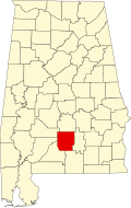
Butler County Alabama Incorporated and Unincorporated areas Georgiana Highlighted 0129560.svg
Location of Georgiana in Butler County, Alabama.
Coordinates: 31°38′24″N86°44′21″W / 31.64000°N 86.73917°W / 31.64000; -86.73917
CountryUnited States
State Alabama
County Butler
Area
[1]
  Total
6.24 sq mi (16.15 km2)
  Land6.24 sq mi (16.15 km2)
  Water0.00 sq mi (0.00 km2)
Elevation
292 ft (89 m)
Population
 (2020)
  Total
1,324
  Density212.28/sq mi (81.96/km2)
Time zone UTC-6 (Central (CST))
  Summer (DST) UTC-5 (CDT)
ZIP code
36033
Area code 334
FIPS code 01-29560
GNIS feature ID0118914

Georgiana is a town in Butler County, Alabama, United States. As of the 2010 census, the population of the town was 1,738. [2]

Contents

Geography

Georgiana is located in southern Butler County at 31°38'24.313" North, 86°44'21.991" West (31.640087, -86.739442). [3] Interstate 65 passes to the northwest of the town, with access from exit 114 (State Route 106). U.S. Route 31 (Mobile Road) passes through the east side of the town, leading north 16 miles (26 km) to Greenville, the county seat. Via I-65, it is 58 miles (93 km) north to Montgomery, the state capital, and 110 miles (180 km) southwest to Mobile.

According to the U.S. Census Bureau, the town has a total area of 6.3 square miles (16 km2), all land.

Demographics

Historical population
CensusPop.Note
1880 277
1890 45664.6%
1900 56724.3%
1910 99976.2%
1920 1,55055.2%
1930 1,480−4.5%
1940 1,6279.9%
1950 1,596−1.9%
1960 2,09331.1%
1970 2,1482.6%
1980 1,993−7.2%
1990 1,933−3.0%
2000 1,737−10.1%
2010 1,7380.1%
2020 1,324−23.8%
U.S. Decennial Census [4]
2013 Estimate [5]

2020 census

Georgiana Racial Composition [6]
RaceNum.Perc.
White 32124.24%
Black or African American 96072.51%
Native American 30.23%
Other/Mixed 312.34%
Hispanic or Latino 90.68%

As of the 2020 United States Census, there were 1,324 people, 524 households, and 319 families residing in the town.

2010 census

As of the census [7] of 2010, there were 738 people, 249 households, and 220 families residing in the town. The population density was 279 inhabitants per square mile (108/km2). There were 777 housing units at an average density of 123.3 per square mile (47.6/km2). The racial makeup of the town was 65.4% Black or African American, 33.1% White, 0.3% Native American, and 0.8% from two or more races. 0.3% of the population were Hispanic or Latino of any race.

There were 249 households, out of which 25.9% had children under the age of 18 living with them, 34.1% were married couples living together, 25.0% had a female householder with no husband present, and 35.9% were non-families. 32.7% of all households were made up of individuals, and 16.2% had someone living alone who was 65 years of age or older. The average household size was 2.42 and the average family size was 3.06.

In the town, the age distribution of the population shows 21.3% under the age of 18, 8.2% from 18 to 24, 22.1% from 25 to 44, 24.2% from 45 to 64, and 24.1% who were 65 years of age or older. The median age was 43.3 years. For every 100 females, there were 82.2 males. For every 100 women age 18 and over, there were 88.8 men.

The median income for a household in the town was $38,694, and the median income for a family was $40,139. Males had a median income of $30,625 versus $28,519 for females. The per capita income for the town was $31,181. About 39.4% of families and 13.6% of the population were below the poverty line, including 54.1% of those under age 18 and 32.5% of those age 65 or over.

Notable people

See also

Related Research Articles

<span class="mw-page-title-main">Butler County, Alabama</span> County in Alabama, United States

Butler County is a county located in the south central portion of the U.S. state of Alabama. As of the 2020 census, the population was 19,051. Its county seat is Greenville. Its name is in honor of Captain William Butler, who was born in Virginia and fought in the Creek War, and who was killed in May 1818.

<span class="mw-page-title-main">Nectar, Alabama</span> Town in Alabama, United States

Nectar is a town in Blount County, Alabama, United States. At the 2020 census, the population was 379.

<span class="mw-page-title-main">McKenzie, Alabama</span> Town in Alabama, United States

McKenzie is a town in Butler and Conecuh counties in the U.S. state of Alabama. The population was 530 at the 2010 census.

<span class="mw-page-title-main">Babbie, Alabama</span> Town in Alabama, United States

Babbie is a town in Covington County, Alabama, United States. At the 2020 census, the population was 625. It incorporated in 1957.

<span class="mw-page-title-main">Florala, Alabama</span> Town in Alabama, United States

Florala is a town in Covington County, Alabama, United States. At the 2020 census, the population was 1,923.

<span class="mw-page-title-main">Onycha, Alabama</span> Town in Alabama, United States

Onycha is a town in Covington County, Alabama, United States. At the 2020 census, the population was 167.

<span class="mw-page-title-main">Opp, Alabama</span> City in Alabama, United States

Opp is a city in Covington County, Alabama, United States. At the 2020 census, the population was 6,771. Opp is named after Henry Opp, a lawyer for the Louisville and Nashville Railroad.

<span class="mw-page-title-main">Sanford, Alabama</span> Town in Alabama, United States

Sanford is a town in Covington County, Alabama, United States. At the 2020 census, the population was 257. Sanford was originally incorporated in 1902 and was on the 1910 U.S. Census. It did not appear again on the census until 1960.

<span class="mw-page-title-main">Glenwood, Alabama</span> Town in Alabama, United States

Glenwood is a town in Crenshaw County, Alabama, United States. At the 2020 census, the population was 152. Glenwood was incorporated in 1907.

<span class="mw-page-title-main">Holly Pond, Alabama</span> Town in Alabama, United States

Holly Pond is a town in Cullman County, Alabama, United States with a population of 798 as of the 2010 census. The town was incorporated in 1906.

<span class="mw-page-title-main">Deatsville, Alabama</span> Town in Alabama, United States

Deatsville is a town in Elmore County, Alabama, United States. Although Deatsville initially incorporated in 1903, it lapsed at some point after the 1910 U.S. Census and did not appear again as incorporated until 2000. As of the 2020 census, the population was 1,679.

<span class="mw-page-title-main">Elmore, Alabama</span> Town in Alabama, United States

Elmore is a town in Elmore County, Alabama, United States. Although initially incorporated in 1906, it lapsed and was not reincorporated again until 1997. At the 2010 census the population was 1,262, up from 199 in 2000. It is part of the Montgomery Metropolitan Statistical Area.

<span class="mw-page-title-main">Sardis City, Alabama</span> Town in Alabama, United States

Sardis City is a town in Etowah and Marshall counties in the U.S. state of Alabama. It is part of the Gadsden Metropolitan Statistical Area. It originally incorporated in May 1963 under the name of "Sardis". It became Sardis City in the 1980s. At the 2020 census, the population was 1,814.

<span class="mw-page-title-main">Fort Deposit, Alabama</span> Town in Alabama, United States

Fort Deposit is a town in Lowndes County, Alabama, United States. Since 1890, it has been the largest town in Lowndes County. At the 2010 census the population was 1,344, up from 1,270 in 2000. It is part of the Montgomery Metropolitan Statistical Area.

<span class="mw-page-title-main">Gordonville, Alabama</span> Town in Alabama, United States

Gordonville is a town in Lowndes County, Alabama, United States. At the 2010 census the population was 326, up from 318 in 2000. It is part of the Montgomery Metropolitan Statistical Area. It incorporated effective January 20, 1990.

<span class="mw-page-title-main">Mosses, Alabama</span> Town in Alabama, United States

Mosses is a town in Lowndes County, Alabama, United States. At the 2010 census the population was 1,029, down from 1,101 in 2000. It is part of the Montgomery Metropolitan Statistical Area. It incorporated in 1979.

<span class="mw-page-title-main">White Hall, Alabama</span> Town in Alabama, United States

White Hall is a town in Lowndes County, Alabama, United States. The community was named for a plantation that was destroyed in an 1882 tornado. At the 2010 census the population was 858, down from its record high of 1,014 in 2000. It is part of the Montgomery Metropolitan Statistical Area.

<span class="mw-page-title-main">Pelham, Alabama</span> City in Alabama, United States

Pelham is a city in Shelby County, Alabama, United States. The population was 24,318 at the 2020 census, It incorporated on July 10, 1964 and is a suburb located in the Birmingham metropolitan area, Alabama which was home to nearly 1.2 million residents as of the 2020 census. It was named for Confederate Civil War officer John Pelham.

<span class="mw-page-title-main">Margaret, Alabama</span> City in Alabama, United States

Margaret is a city in St. Clair County, Alabama, United States. At the 2020 census, the population was 5,106. As of the 2010 census, the population is 4,428, an increase of 278.8%. Margaret incorporated in 1960 and became a city in October 2011.

<span class="mw-page-title-main">Springville, Alabama</span> City in Alabama, United States

Springville is a city in St. Clair County, Alabama, United States. It incorporated in December 1880. At the 2020 census the population was 4,786, up from 4,080 in 2010.

References

  1. "2020 U.S. Gazetteer Files". United States Census Bureau. Retrieved October 29, 2021.
  2. "Geographic Identifiers: 2010 Demographic Profile Data (G001): Georgiana town, Alabama". U.S. Census Bureau, American Factfinder. Archived from the original on February 12, 2020. Retrieved September 18, 2013.
  3. "US Gazetteer files: 2010, 2000, and 1990". United States Census Bureau. February 12, 2011. Retrieved April 23, 2011.
  4. "U.S. Decennial Census". Census.gov. Retrieved June 6, 2013.
  5. "Annual Estimates of the Resident Population: April 1, 2010 to July 1, 2013". Archived from the original on May 22, 2014. Retrieved June 3, 2014.
  6. "Explore Census Data". data.census.gov. Retrieved December 8, 2021.
  7. "U.S. Census website". United States Census Bureau . Retrieved July 9, 2015.

31°38′24″N86°44′22″W / 31.640087°N 86.739442°W / 31.640087; -86.739442