Wedowee, Alabama

Last updated

Wedowee, Alabama
Wedowee.JPG
Randolph County Alabama Incorporated and Unincorporated areas Wedowee Highlighted 0180496.svg
Location of Wedowee in Randolph County, Alabama.
Coordinates: 33°18′31″N85°29′8″W / 33.30861°N 85.48556°W / 33.30861; -85.48556
Country United States
State Alabama
County Randolph
Area
[1]
  Total3.52 sq mi (9.13 km2)
  Land3.49 sq mi (9.05 km2)
  Water0.03 sq mi (0.08 km2)
Elevation
856 ft (261 m)
Population
 (2020)
  Total737
  Density210.93/sq mi (81.44/km2)
Time zone UTC-6 (Central (CST))
  Summer (DST) UTC-5 (CDT)
ZIP code
36278
Area code 256
FIPS code 01-80496
GNIS feature ID0153913

Wedowee is a town in Randolph County, Alabama, United States. At the 2010 census the population was 823, up from 818 in 2000. The small town is the county seat of Randolph County. [2] It was initially incorporated in 1836, but its charter lapsed by the late 19th century. It was reincorporated in 1901. [3]

Contents

Randolph County High School is located in Wedowee.

History

Wedowee, which means "old water" in the Creek language, was named after a Muscogee Creek Indian chief. This area was historically occupied by the Muscogee Creek people.

Following Indian Removal of the Creek in the 1830s to Indian Territory west of the Mississippi River by the US government, this area was settled by European Americans. The town of Wedowee was designated as the county seat of Randolph County in 1835. The county was developed for the cultivation of cotton as a commodity crop, with labor primarily done by enslaved African Americans, many of whom had been sold to the Deep South from the Upper South in the domestic slave trade.

Since the late 20th century, Lake Wedowee was created by the impoundment of the Tallapoosa River. This has enhanced the tourist drawing power of the town. Also known as the R. L. Harris Reservoir, the lake draws thousands of visitors to Wedowee every year. [4]

Geography

Wedowee is located on the Piedmont plateau at 33°18′31″N85°29′8″W / 33.30861°N 85.48556°W / 33.30861; -85.48556 (33.308603, -85.485447). [5] It is also located in the foothills of the Appalachian Mountains.

The city is located in the central part of Randolph County along U.S. Route 431, which is the main route through the city. U.S. 431 leads northwest 34 mi (55 km) to Oxford and southeast 13 mi (21 km) to Roanoke. Alabama State Route 48 also runs through the city, leading northeast 9 mi (14 km) to Woodland and west 16 mi (26 km) to Lineville.

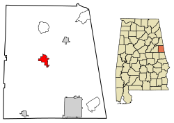
According to the U.S. Census Bureau, the town has a total area of 3.5 square miles (9.1 km2), of which 3.5 square miles (9.1 km2) is land and 0.04 square miles (0.10 km2) (0.85%) is water.

Demographics

Historical population
CensusPop.Note
1870 130
1910 435
1920 51017.2%
1930 396−22.4%
1940 52532.6%
1950 5596.5%
1960 91764.0%
1970 842−8.2%
1980 9087.8%
1990 796−12.3%
2000 8182.8%
2010 8230.6%
2020 737−10.4%
U.S. Decennial Census [6]
2013 Estimate [7]

As of the census [8] of 2000, there were 818 people, 337 households, and 200 families residing in the town. The population density was 233.4 inhabitants per square mile (90.1/km2). There were 378 housing units at an average density of 107.8 per square mile (41.6/km2). The racial makeup of the town was 68.70% White, 30.20% Black or African American, 0.12% Native American, 0.49% Asian, 0.24% from other races, and 0.24% from two or more races. 0.12% of the population were Hispanic or Latino of any race.

There were 337 households, out of which 26.1% had children under the age of 18 living with them, 43.0% were married couples living together, 13.6% had a female householder with no husband present, and 40.4% were non-families. 36.5% of all households were made up of individuals, and 22.0% had someone living alone who was 65 years of age or older. The average household size was 2.23 and the average family size was 2.95.

In the town, the population was spread out, with 21.8% under the age of 18, 8.9% from 18 to 24, 27.4% from 25 to 44, 21.6% from 45 to 64, and 20.3% who were 65 years of age or older. The median age was 39 years. For every 100 females, there were 97.6 males. For every 100 females age 18 and over, there were 95.1 males.

The median income for a household in the town was $26,136, and the median income for a family was $37,292. Males had a median income of $24,250 versus $22,250 for females. The per capita income for the town was $12,638. About 17.1% of families and 20.9% of the population were below the poverty line, including 25.7% of those under age 18 and 21.4% of those age 65 or over.

Notable people


Related Research Articles

<span class="mw-page-title-main">Clay County, Alabama</span> County in Alabama, United States

Clay County is a county in the east central part of the U.S. state of Alabama. As of the 2020 census the population was 14,236. Its county seat is Ashland. Its name is in honor of Henry Clay, famous American statesman, member of the United States Senate from Kentucky and United States Secretary of State in the 19th century. It was the last dry county in Alabama with no wet cities within its boundaries, until a vote on March 1, 2016, approved the sale of alcohol in Lineville and Ashland.

<span class="mw-page-title-main">Chambers County, Alabama</span> County in Alabama, United States

Chambers County is a county located in the east central portion of the U.S. state of Alabama. As of the 2020 census the population was 34,772. Its county seat is LaFayette. Its largest city is Valley. Its name is in honor of Henry H. Chambers, who served as a United States Senator from Alabama.

<span class="mw-page-title-main">Cleburne County, Alabama</span> County in Alabama, United States

Cleburne County is a county located in the east central portion of the U.S. state of Alabama. As of the 2020 census, the population was 15,056. Its county seat is Heflin. Its name is in honor of Patrick R. Cleburne of Arkansas who rose to the rank of major general in the Confederate States Army. The eastern side of the county borders the state of Georgia.

<span class="mw-page-title-main">Randolph County, Alabama</span> County in Alabama, United States

Randolph County is a county on the central eastern border of the U.S. state of Alabama. As of the 2020 census, the population was 21,967. Its county seat is Wedowee. Its name is in honor of John Randolph, a member of the United States Senate from Virginia. Randolph County was a prohibition or dry county until 2012, when the citizens of Randolph County voted to repeal prohibition.

<span class="mw-page-title-main">Tallapoosa County, Alabama</span> County in Alabama, United States

Tallapoosa County is located in the east-central portion of the U.S. state of Alabama. As of the 2020 census, the population was 41,311. Its county seat is Dadeville. Its largest city is Alexander City.

<span class="mw-page-title-main">Alexandria, Alabama</span> Unincorporated community in Alabama, United States

Alexandria is a census-designated place and unincorporated community in Calhoun County, Alabama, United States. At the 2020 census, the population was 4,032. It is included in the Anniston–Oxford, Alabama Metropolitan Statistical Area.

<span class="mw-page-title-main">Ohatchee, Alabama</span> Town in Alabama, United States

Ohatchee is a town in Calhoun County, Alabama, United States. At the 2020 census, the population was 1,157. It is included in the Anniston–Oxford, Alabama Metropolitan Statistical Area.

<span class="mw-page-title-main">Lineville, Alabama</span> City in Alabama, United States

Lineville is a city in Clay County, Alabama, United States. At the 2020 census, the population was 2,489.

<span class="mw-page-title-main">Rockford, Alabama</span> Town in Alabama, US

Rockford is a town in Coosa County, Alabama, United States. At the 2020 census, the population was 349. The town is the county seat of Coosa County and is part of the Talladega-Sylacauga Micropolitan Statistical Area.

<span class="mw-page-title-main">Newville, Alabama</span> Town in Alabama, United States

Newville is a town in Henry County, Alabama, United States. It is part of the Dothan, Alabama Metropolitan Statistical Area. At the 2020 census, the population was 544.

<span class="mw-page-title-main">Kinsey, Alabama</span> Town in the United States

Kinsey is a town in Houston County, Alabama, United States. It was initially located and incorporated in Henry County in February 1893. In 1903, it was redrawn into newly created Houston County and was later reincorporated in August 1957. It is part of the Dothan, Alabama Metropolitan Statistical Area. At the 2010 census the population was 2,198, up from 1,796 in 2000.

<span class="mw-page-title-main">Roanoke, Alabama</span> City in Alabama, United States

Roanoke is a city in Randolph County, which is in the Piedmont region of eastern Alabama, United States. As of the 2020 census, the population of the city was 5,311, down from 6,074 in 2010 and 6,563 in 2000.

<span class="mw-page-title-main">Wadley, Alabama</span> Town in Alabama, United States

Wadley is a town in Randolph County, Alabama, United States. It is home to the Wadley campus of Southern Union State Community College. As of the 2010 census, the population of the town was 751, up from 640 in 2000. According to the 1910 U.S. Census, the town was incorporated in 1908.

<span class="mw-page-title-main">Woodland, Alabama</span> Town in Alabama, United States

Woodland is a town in Randolph County, Alabama, United States. At the 2010 census the population was 184, down from 192 in 2000. It incorporated in 1967.

<span class="mw-page-title-main">Daviston, Alabama</span> Town in Alabama, United States

Daviston is a town in Tallapoosa County, Alabama, United States. At the 2010 census the population was 214, down from 267 in 2000.

<span class="mw-page-title-main">Indian River Estates, Florida</span> CDP in Florida, United States

Indian River Estates is a census-designated place (CDP) in St. Lucie County, Florida, United States. The population was 6,220 at the 2010 census. It is part of the Port St. Lucie Metropolitan Statistical Area.

<span class="mw-page-title-main">Fort Gaines, Georgia</span> City in Georgia, United States

Fort Gaines is a city in and the county seat of Clay County, Georgia, United States. It has a population of 1,107 as of the 2010 census.

<span class="mw-page-title-main">Berlin Charter Township, Michigan</span> Charter township in Michigan, United States

Berlin Charter Township is a charter township of Monroe County in the U.S. state of Michigan. At the 2020 census, the township population was 9,890.

<span class="mw-page-title-main">Kellogg, Minnesota</span> City in Minnesota, United States

Kellogg is a city in Wabasha County, Minnesota, along the Zumbro River. The population was 456 at the 2010 census.

<span class="mw-page-title-main">Village Green, New York</span> Census-designated place in New York, United States

Village Green is a hamlet in Onondaga County, New York, United States. The population was 3,891 at the 2010 census.

References

  1. "2020 U.S. Gazetteer Files". United States Census Bureau. Retrieved October 29, 2021.
  2. "Find a County". National Association of Counties. Retrieved June 7, 2011.
  3. "Supplement for Alabama" (PDF). 2.census.gov. Retrieved September 16, 2017.
  4. Small Town Historic Markers, Alabama Tourism Department, archived from the original on February 3, 2011, retrieved February 2, 2011
  5. "US Gazetteer files: 2010, 2000, and 1990". United States Census Bureau. February 12, 2011. Retrieved April 23, 2011.
  6. "U.S. Decennial Census". Census.gov. Retrieved June 6, 2013.
  7. "Annual Estimates of the Resident Population: April 1, 2010 to July 1, 2013" . Retrieved June 3, 2014.
  8. "U.S. Census website". United States Census Bureau . Retrieved January 31, 2008.
  9. Alabama Governors -- William Hugh Smith, Alabama Department of Archives and History, archived from the original on May 7, 2016, retrieved March 24, 2011
  10. "Jordan Scales". Clay Lacy Aviation. Retrieved August 30, 2023.

33°18′31″N85°29′08″W / 33.308603°N 85.485447°W / 33.308603; -85.485447