Rock Mills, Alabama

Last updated

Rock Mills, Alabama
CDP
Rock Mills, Alabama.JPG
Wehadkee Creek at Rock Mills. Winter 2011.
Randolph County Alabama Incorporated and Unincorporated areas Rock Mills Highlighted.svg
Location in Randolph County and the state of Alabama
Coordinates: 33°9′37″N85°17′25″W / 33.16028°N 85.29028°W / 33.16028; -85.29028
Country United States
State Alabama
County Randolph
Area
[1]
  Total6.33 sq mi (16.39 km2)
  Land6.33 sq mi (16.38 km2)
  Water0.00 sq mi (0.01 km2)
Elevation
781 ft (238 m)
Population
 (2020)
  Total603
  Density95.34/sq mi (36.81/km2)
Time zone UTC-6 (Central (CST))
  Summer (DST) UTC-5 (CDT)
ZIP code
36274
Area code 334
FIPS code 01-65592
GNIS feature ID0153181

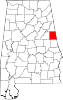
Rock Mills is a census-designated place (CDP) in Randolph County, Alabama, United States. At the 2010 census the population was 600, down from 676 in 2000. [2] According to the U.S. Census, from 1890 until the 1920s, Rock Mills was an incorporated community. It was later designated a CDP beginning in 2000.

Contents

Geography

Rock Mills is located at 33°9′37″N85°17′26″W / 33.16028°N 85.29056°W / 33.16028; -85.29056 (33.160348, -85.290469). [3]

According to the U.S. Census Bureau, the CDP has a total area of 6.3 square miles (16 km2), all land.

Climate

Climate data for Rock Mills, Alabama, 1991–2020 normals, extremes 1941present
MonthJanFebMarAprMayJunJulAugSepOctNovDecYear
Record high °F (°C)83
(28)
83
(28)
88
(31)
92
(33)
98
(37)
105
(41)
107
(42)
104
(40)
100
(38)
99
(37)
86
(30)
80
(27)
107
(42)
Mean maximum °F (°C)71.3
(21.8)
74.7
(23.7)
82.3
(27.9)
86.1
(30.1)
91.0
(32.8)
95.4
(35.2)
96.5
(35.8)
96.4
(35.8)
92.6
(33.7)
87.4
(30.8)
79.4
(26.3)
72.6
(22.6)
98.4
(36.9)
Mean daily maximum °F (°C)54.2
(12.3)
60.0
(15.6)
67.6
(19.8)
75.3
(24.1)
82.3
(27.9)
87.4
(30.8)
88.7
(31.5)
88.8
(31.6)
84.6
(29.2)
75.0
(23.9)
64.8
(18.2)
57.1
(13.9)
73.8
(23.2)
Daily mean °F (°C)43.2
(6.2)
47.9
(8.8)
54.7
(12.6)
61.6
(16.4)
69.6
(20.9)
76.1
(24.5)
78.1
(25.6)
78.1
(25.6)
72.9
(22.7)
62.2
(16.8)
52.1
(11.2)
45.8
(7.7)
61.9
(16.6)
Mean daily minimum °F (°C)32.2
(0.1)
35.7
(2.1)
41.8
(5.4)
47.9
(8.8)
56.8
(13.8)
64.8
(18.2)
67.5
(19.7)
67.5
(19.7)
61.1
(16.2)
49.4
(9.7)
39.5
(4.2)
34.6
(1.4)
49.9
(9.9)
Mean minimum °F (°C)13.1
(−10.5)
19.6
(−6.9)
23.3
(−4.8)
30.6
(−0.8)
41.2
(5.1)
54.2
(12.3)
58.9
(14.9)
58.1
(14.5)
47.2
(8.4)
31.0
(−0.6)
22.3
(−5.4)
17.7
(−7.9)
11.7
(−11.3)
Record low °F (°C)0
(−18)
6
(−14)
11
(−12)
24
(−4)
31
(−1)
42
(6)
51
(11)
47
(8)
32
(0)
21
(−6)
6
(−14)
−1
(−18)
−1
(−18)
Average precipitation inches (mm)5.27
(134)
5.34
(136)
5.23
(133)
4.37
(111)
4.11
(104)
4.85
(123)
4.47
(114)
4.02
(102)
3.39
(86)
2.78
(71)
4.12
(105)
5.08
(129)
53.03
(1,348)
Average precipitation days (≥ 0.01 in)9.69.38.78.07.59.811.09.26.35.95.99.2100.4
Source 1: NOAA [4]
Source 2: National Weather Service [5]

Demographics

Historical population
CensusPop.Note
1890 385
1900 4209.1%
1910 349−16.9%
1920 267−23.5%
2000 676
2010 600−11.2%
2020 6030.5%
U.S. Decennial Census [6]

As of the census [7] of 2000, there were 676 people, 282 households, and 192 families residing in the CDP. The population density was 106.8 inhabitants per square mile (41.2/km2). There were 313 housing units at an average density of 49.4 per square mile (19.1/km2). The racial makeup of the CDP was 97.63% White, 2.22% Black or African American, 0.15% from other races. 1.63% of the population were Hispanic or Latino of any race.

There were 282 households, out of which 29.8% had children under the age of 18 living with them, 53.9% were married couples living together, 10.6% had a female householder with no husband present, and 31.9% were non-families. 27.7% of all households were made up of individuals, and 14.2% had someone living alone who was 65 years of age or older. The average household size was 2.40 and the average family size was 2.93.

In the CDP, the population was spread out, with 24.7% under the age of 18, 8.6% from 18 to 24, 28.1% from 25 to 44, 23.4% from 45 to 64, and 15.2% who were 65 years of age or older. The median age was 38 years. For every 100 females, there were 87.8 males. For every 100 females age 18 and over, there were 89.2 males.

The median income for a household in the CDP was $40,714, and the median income for a family was $48,393. Males had a median income of $31,944 versus $20,117 for females. The per capita income for the CDP was $13,093. About 12.3% of families and 16.2% of the population were below the poverty line, including 15.4% of those under age 18 and 52.3% of those age 65 or over.

Rock Mills Industry

The photo of Wehadkee Mill is of a yarn and twine mill which until recent times made yarn, twine and employed a steady number of Rock Mills employees for many decades.

Rock Mills Pottery

In town and nearby (communities of Bacon Level, Alabama and old Cedric, Alabama) was also a larger pottery community making esp. urns, churns, jugs for whiskey, molasses, sugar, milk and the water pitchers and washing bowls needed in every home. These potters still widely known today. And potters from this location moved further West to Mississippi and Texas. The immigration road to the West (to Mississippi, Arkansas, esp Texas) passed along here and so this pottery industry allowed immigrants to buy needed urns, churns, pots for storage. Local potters included well known Pittman Brothers, Boggs Family, WD Pound and Jessie Weathers.

Related Research Articles

<span class="mw-page-title-main">Saks, Alabama</span> Census-designated place & Unincorporated Community in Alabama, United States

Saks is a census-designated place (CDP) and Unincorporated community in Calhoun County, Alabama, United States. At the 2020 census, the population was 9,956. The community of Saks is served by the City of Anniston police and fire coverage. It is included in the Anniston-Oxford Metropolitan Statistical Area.

West End-Cobb Town is a census-designated place (CDP) and unincorporated community in Calhoun County, Alabama, United States. At the 2020 census, the population was 3,128. It is included in the Anniston-Oxford Metropolitan Statistical Area.

<span class="mw-page-title-main">Edgewater, Alabama</span> CDP in Alabama, United States

Edgewater is a census-designated place in Jefferson County, Alabama, United States. It is northeast from the Birmingham suburb of Pleasant Grove. Its population was 883 at the 2010 census. This area was damaged by tornadoes on April 15, 1956 and April 8, 1998. The 1998 tornado was rated F5 on the Fujita scale.

<span class="mw-page-title-main">Rock Creek, Alabama</span> CDP in Alabama, United States

Rock Creek is a census-designated place in Jefferson County, Alabama, United States. Its location is northwest of Hueytown. At the 2020 census, the population was 1,471. This area was damaged by an F5 tornado on April 8, 1998. An EF2 tornado struck northwest from here on January 23, 2012.

<span class="mw-page-title-main">Meridianville, Alabama</span> Census-designated place in Alabama, United States

Meridianville is an unincorporated community and census-designated place (CDP) in Madison County, Alabama, United States, and is included in the Huntsville-Decatur Combined Statistical Area. As of the 2020 census, the population of the CDP was 8,209.

<span class="mw-page-title-main">Moores Mill, Alabama</span> Census-designated place in Alabama, United States

Moores Mill is an unincorporated community and census-designated place (CDP) in Madison County, Alabama, United States, and is included in the Huntsville-Decatur Combined Statistical Area. The population was 6,729 at the 2020 census, up from 5,682 at the 2010 census.

<span class="mw-page-title-main">Brundidge, Alabama</span> City in Alabama, United States

Brundidge is the second-largest city in Pike County, Alabama, United States. The population was 2,076 at the 2010 census, down from 2,341 in 2000.

<span class="mw-page-title-main">Munford, Alabama</span> Town in Alabama, United States

Munford is a town in Talladega County, Alabama, United States. At the 2020 census, the population was 1,351. It is the location of what has been called the last battle of the Civil War east of the Mississippi, the Battle of Munford on April 23, 1865.

<span class="mw-page-title-main">Holt, Alabama</span> Census-designated place & Unincorporated community in Alabama, United States

Holt is an unincorporated community and census-designated place (CDP) in Tuscaloosa County, Alabama, United States. At the 2020 census, the population was 3,413. It is part of the Tuscaloosa, Alabama Metropolitan Statistical Area. Holt appeared on the 1930 census.

<span class="mw-page-title-main">Rough Rock, Arizona</span> CDP in Apache County, Arizona

Rough Rock is a census-designated place (CDP) in Apache County, Arizona, United States. The population was 414 at the 2010 census.

<span class="mw-page-title-main">Andover, Illinois</span> Village in Illinois, United States

Andover is a village in Henry County, Illinois, United States. The population was 578 at the 2010 census, down from 594 in 2000.

<span class="mw-page-title-main">Naval Academy, Maryland</span> Census-designated place in Maryland, United States

Naval Academy is a census-designated place (CDP) in Anne Arundel County, Maryland, United States, which covers the campus of the United States Naval Academy. The population was 4,802 at the 2010 census.

<span class="mw-page-title-main">Milford Mill, Maryland</span> Census-designated place in Maryland, United States

Milford Mill is an unincorporated community and census-designated place in Baltimore County, Maryland, United States. Per the 2020 census, the population was 30,622.

<span class="mw-page-title-main">North Woodbridge, California</span> Former census-designated place in California, United States

North Woodbridge was a former census-designated place (CDP) in San Joaquin County, California, United States. The population was 1,320 at the 2000 census. For the 2010 census, the CDP's of South Woodbridge and North Woodbridge were merged into Woodbridge.

Tribes Hill is a census-designated place (CDP) located in the Towns of Mohawk (80%) and Amsterdam (20%) in Montgomery County, New York, United States. The population was 1,003 at the 2010 census. One theory is the name is based on this location having been a gathering spot for the Mohawk nation, the dominant Iroquois tribe in the area during colonial times. Tribes Hill spans the border of the Town of Mohawk and Town of Amsterdam, approximately five miles west of the City of Amsterdam on Route 5.

<span class="mw-page-title-main">Guys Mills, Pennsylvania</span> Census-designated place in Pennsylvania, United States

Guys Mills is a census-designated place in Crawford County, Pennsylvania, United States. The population was 124 at the 2010 census.

<span class="mw-page-title-main">Gayle Mill, South Carolina</span> Census-designated place in South Carolina, United States

Gayle Mill is a census-designated place (CDP) in Chester County, South Carolina, United States. The population was 913 at the 2010 census, down from 1,094 at the 2000 census.

<span class="mw-page-title-main">Clarks Hill, South Carolina</span> CDP in South Carolina, United States

Clarks Hill is a census-designated place (CDP) in McCormick County, South Carolina, United States. The population was 376 at the 2000 census.

<span class="mw-page-title-main">South Hill, Washington</span> CDP in Washington, United States

South Hill is a census-designated place (CDP) in Pierce County, Washington, immediately south of Puyallup. The population was 64,708 at time of the 2020 census, up from 52,431 in 2010. The area primarily consists of suburban housing and shopping with several retail shopping centers, residential neighborhoods, and apartment/condo complexes throughout. Because South Hill is unincorporated, its addresses are part of the Puyallup "postal city" or ZCTA.

<span class="mw-page-title-main">Potter Lake, Wisconsin</span> CDP in Wisconsin, United States

Potter Lake is a census-designated place (CDP) in the town of East Troy, Walworth County, Wisconsin, United States. The population was 1,117 at the 2020 census.

References

  1. "2020 U.S. Gazetteer Files". United States Census Bureau. Retrieved October 29, 2021.
  2. "U.S. Census website". United States Census Bureau . Retrieved May 14, 2011.
  3. "US Gazetteer files: 2010, 2000, and 1990". United States Census Bureau. February 12, 2011. Retrieved April 23, 2011.
  4. "U.S. Climate Normals Quick Access – Station: Rock Mills, AL". National Oceanic and Atmospheric Administration. Retrieved March 4, 2023.
  5. "NOAA Online Weather Data – NWS Birmingham". National Weather Service. Retrieved March 4, 2023.
  6. "U.S. Decennial Census". Census.gov. Retrieved June 6, 2013.
  7. "U.S. Census website". United States Census Bureau . Retrieved January 31, 2008.

33°09′37″N85°17′26″W / 33.160348°N 85.290469°W / 33.160348; -85.290469

http://randolphcountyalabamapottery.com/rock-mills/jesse-weathers/