
Russellville is a city in Franklin County in the U.S. state of Alabama. At the 2020 census, the population of the city was 10,855, up from 9,830 at the 2010 census. The city is the county seat of Franklin County.

Demopolis is the largest city in Marengo County, in west-central Alabama. The population was 7,162 at the 2020 census.

Amory is a city in Monroe County, Mississippi, United States. The population was 6,666 at the 2020 census, down from 7,316 in 2010. Located in the northeastern part of the state near the Alabama border, it was founded in 1887 as a railroad town by the Kansas City, Memphis and Birmingham Railroad. As a result, Cotton Gin Port, along the Tombigbee River to the east, was abandoned as businesses and people moved for railroad access.

The Territory of Mississippi was an organized incorporated territory of the United States that was created under an organic act passed by both upper and lower chambers of the Congress of the United States, meeting at the United States Capitol on Capitol Hill, in the federal national capital city of Washington, D.C.. It was approved and signed into law by second President John Adams 1735-1826, served 1797-1801), on April 7, 1798.

The Tombigbee River is a tributary of the Mobile River, approximately 200 mi (325 km) long, in the U.S. states of Mississippi and Alabama. Together with the Alabama, it merges to form the short Mobile River before the latter empties into Mobile Bay on the Gulf of Mexico. The Tombigbee watershed encompasses much of the rural coastal plain of western Alabama and northeastern Mississippi, flowing generally southward. The river provides one of the principal routes of commercial navigation in the southern United States, as it is navigable along much of its length through locks and connected in its upper reaches to the Tennessee River via the Tennessee-Tombigbee Waterway.
There are many historic trails and roads in the United States which were important to the settlement and development of the United States including those used by American Indians.

The Natchez District was one of two areas established in the Kingdom of Great Britain's West Florida colony during the 1770s – the other being the Tombigbee District. The first Anglo settlers in the district came primarily from other parts of British America. The district was recognized to be the area east of the Mississippi River from Bayou Sara in the south and Bayou Pierre in the north.
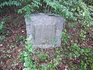
Cotton Gin Port is a ghost town in Monroe County, Mississippi, United States.

George Strother Gaines was a federal Indian agent in the Mississippi Territory. He began as the US Indian agent to the Choctaw, explored the country west of the Mississippi River, and supervised the removal of the Choctaw to Indian Territory in the 1830s. He worked as a banker, and served as a state senator and railroad lobbyist, becoming even more influential in the early history of the region.

The Tennessee–Tombigbee Waterway is a 234-mile (377 km) artificial U.S. waterway built in the 20th century from the Tennessee River to the junction of the Black Warrior-Tombigbee River system near Demopolis, Alabama. The Tennessee–Tombigbee Waterway links commercial navigation from the nation's midsection to the Gulf of Mexico. The major features of the waterway are 234 miles (377 km) of navigation channels, a 175-foot-deep (53 m) cut between the watersheds of the Tombigbee and Tennessee rivers, and ten locks and dams. The locks are 9 by 110 by 600 feet, the same dimension as those on the Mississippi above Lock and Dam 26 at Alton, Illinois. Under construction for 12 years by the U.S. Army Corps of Engineers, the Tennessee–Tombigbee Waterway was completed in December 1984 at a total cost of nearly $2 billion.
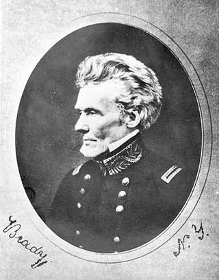
Edmund Pendleton Gaines was a career United States Army officer who served for nearly fifty years, and attained the rank of major general by brevet. He was one of the Army's senior commanders during its formative years in the early to mid-1800s, and was a veteran of the War of 1812, Seminole Wars, Black Hawk War, and Mexican–American War.

Jackson's Military Road was a 19th-century route connecting Nashville, Tennessee, with New Orleans, Louisiana. After the War of 1812, Congress appropriated funds in 1816 to build and improve this road. It was completed in 1820. The road was named for then General Andrew Jackson, hero of the United States victory at the Battle of New Orleans against British forces.

Claiborne is a ghost town on a bluff above the Alabama River in Monroe County, Alabama.
The Tombigbee District, also known as the Tombigbee, was one of two areas, the other being the Natchez District, that were the first in what was West Florida to be colonized by British subjects from the Thirteen Colonies and elsewhere. This later became the Mississippi Territory as part of the United States. The district was also the first area to be opened to white settlement in what would become the state of Alabama, outside of the French colonial outpost of Mobile on the Gulf Coast. The Tombigbee and Natchez districts were the only areas populated by whites in the Mississippi Territory when it was formed by the United States in 1798.
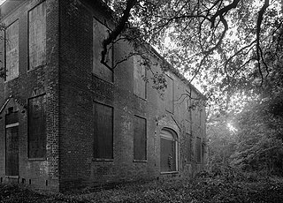
The Van Dorn House is a historic hilltop residence in Port Gibson, Mississippi built circa 1830 for Peter Aaron Van Dorn and his wife. He was a lawyer from New Jersey who made his fortune in this area, having a practice, gaining political appointments, and becoming a cotton planter. This was the home for years for his large family in Port Gibson, including son Earl Van Dorn. The latter was a career U.S. Army officer who joined the Confederate Army after the start of the Civil War, ultimately reaching the rank of Major General.
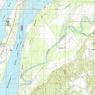
Bruinsburg is an extinct settlement in Claiborne County, Mississippi, United States. Founded when the Natchez District was part of West Florida, the settlement was one of the end points of the Natchez Trace land route from Nashville to the lower Mississippi River valley.
John Dabney Terrell Sr., surveyor, planter, and politician in Alabama, was born to a planter family in Bedford County, Virginia, and died in Marion County, Alabama. He moved to the region about 1814, well before Indian Removal which began in the 1830s, and served as the United States Indian Agent to the Chickasaw under two presidents. He developed a plantation and was a slaveholder. He became active in territorial and state politics, serving as a state senator and also as a state representative.
Bigbee Valley is an unincorporated community in Noxubee County, Mississippi, United States. Variant names are "Bigbeevale", "Nances Mill", and "Whitehall".
Nashville is a ghost town in Lowndes County, Mississippi, United States.
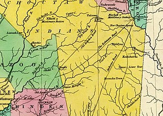
The Robinson Road is a historical road in the US state of Mississippi. It ran from Columbus to the Natchez Trace via Agency, Louisville, and Carthage. From the Natchez Trace intersection, the road continued to Canton; and the road's southwestern terminus was near Ridgeland, ten miles north of Jackson.


