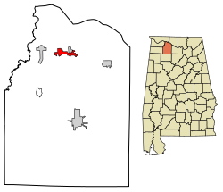
Courtland, Alabama

Last updated
Courtland, Alabama
Courtland-Town-Square-east2-al.jpg
Buildings along the Town Square (College Street)
Lawrence County Alabama Incorporated and Unincorporated areas Courtland Highlighted 0118040.svg
Location of Courtland in Lawrence County, Alabama.
Coordinates: 34°40′6″N87°18′38″W / 34.66833°N 87.31056°W / 34.66833; -87.31056
Country United States
State Alabama
County Lawrence
IncorporatedDecember 13, 1819 [1]
Area
[2]
  Total2.98 sq mi (7.71 km2)
  Land2.95 sq mi (7.65 km2)
  Water0.03 sq mi (0.06 km2)
Elevation
[3]
568 ft (173 m)
Population
 (2020)
  Total583
  Density197.49/sq mi (76.24/km2)
Time zone UTC-6 (Central (CST))
  Summer (DST) UTC-5 (CDT)
ZIP code
35618
Area code 256
FIPS code 01-18040
GNIS feature ID2406323 [3]

Courtland is a town in Lawrence County, Alabama, United States, and is included in the Decatur Metropolitan Area, as well as the Huntsville-Decatur Combined Statistical Area. The population was 609 at the 2010 census, down from 769 in 2000.

Contents

History

A small creek named Big Nance Creek runs through the town. The creek was named for a Cherokee chief who lived in the area when the first European settlers arrived. The current town is reportedly located on the site of the Native American village.

Courtland began as a small settlement known as Ebenezer in the early 1800s. Its early settlers were wealthy planters mostly from Virginia, Tennessee, the Carolinas and Georgia. It was presently named for the federal courthouse and land office there. In 1818, a group known as the Courtland Land Company bought the land on which the town is now situated and subdivided it into lots. [4] The town was incorporated on December 13, 1819, by the Alabama territorial legislature [1]

The early roads Gaines Trace and Byler Road went through town. [5]

One of the South's earliest railroads, the Tuscumbia, Courtland and Decatur Railroad, was organized at Courtland in 1831, and chartered the following year. The railroad's organizers routed the 50-mile (80 km) railroad to bypass the dangerous shoals along the Tennessee River to the north. The railroad was absorbed by the Memphis and Charleston Railroad in the 1850s, and later became part of the Southern Railway. [4]

In 1835, Courtland physician Jack Shackelford organized a volunteer military unit to fight in the Texas Revolution. Known as the "Red Rovers" for the color of their uniforms, the company was captured by Mexican forces at Coleto in March 1836, and most of its men were killed in the Goliad massacre. Shackelford was among the few survivors. [6]

In 1944 and 1945, during World War II, Courtland was home to the Courtland Army Airfield (Courtland AAF). It was dismantled after the war and given to the city of Courtland, which now operates it as Courtland Airport.

Courtland Historic District

In the early 1990s, more than 100 buildings in Courtland were listed on the National Register of Historic Places as the Courtland Historic District. Most of the buildings in the district date from the 1830s through the 1930s, and architectural styles include Federal, Italianate, Victorian, Colonial Revival, and Neoclassical. The Town Square was part of the town's original 1818-1819 plan. Many of the commercial buildings facing the square, especially along College Street and Tennessee Street, were built in the 1890s and early 1900s. The train depot on the south side of the square, now a community center, was built in the late 1880s. The Old Sherrod Hotel, located at the northwest corner of Tennessee Street and Alabama Street, was built around 1930, and provided housing for early Tennessee Valley Authority employees. [7]

The John McMahon House, a Federal-style home built around 1830, is listed individually on the National Register of Historic Places. [8] [9] Rocky Hill Castle was a forced-labor plantation whose architecturally renowned plantation house was demolished in 1961. [10] [11]

Geography

Courtland is located at 34°40′6″N87°18′39″W / 34.66833°N 87.31083°W / 34.66833; -87.31083 (34.668457, -87.310821). [12] The town is concentrated in area along Big Nance Creek, a tributary of the Tennessee River, west of Decatur and southeast of Muscle Shoals. The town's municipal boundaries extend northeastward to U.S. Route 72. The town of North Courtland borders Courtland to the north.

According to the U.S. Census Bureau, the town has a total area of 2.3 square miles (6.0 km2), of which 2.3 square miles (6.0 km2) is land and 0.43% is water.

Demographics

Historical population
CensusPop.Note
1880 580
1890 579−0.2%
1900 488−15.7%
1910 478−2.0%
1920 367−23.2%
1930 359−2.2%
1940 45426.5%
1950 50711.7%
1960 495−2.4%
1970 54710.5%
1980 456−16.6%
1990 80376.1%
2000 769−4.2%
2010 609−20.8%
2020 583−4.3%
U.S. Decennial Census [13]
2013 Estimate [14]

From 1880 until 1910, Courtland was the largest town in Lawrence County, losing the distinction in 1920 to the county seat of Moulton, which has held it to date. [15]

As of the census [16] of 2000, there were 769 people, 316 households, and 210 families residing in the town. The population density was 331.2 inhabitants per square mile (127.9/km2). There were 363 housing units at an average density of 156.4 per square mile (60.4/km2). The racial makeup of the town was 54.23% White, 40.44% Black or African American, 2.08% Native American, 0.26% Asian, 0.13% Pacific Islander, and 2.86% from two or more races. 0.91% of the population were Hispanic or Latino of any race.

There were 316 households, out of which 32.9% had children under the age of 18 living with them, 44.0% were married couples living together, 20.3% had a female householder with no husband present, and 33.5% were non-families. 30.7% of all households were made up of individuals, and 14.2% had someone living alone who was 65 years of age or older. The average household size was 2.43 and the average family size was 3.06.

In the town, the population was spread out, with 27.8% under the age of 18, 8.7% from 18 to 24, 26.9% from 25 to 44, 23.0% from 45 to 64, and 13.5% who were 65 years of age or older. The median age was 36 years. For every 100 females there were 85.7 males. For every 100 females age 18 and over, there were 77.3 males.

The median income for a household in the town was $27,500, and the median income for a family was $36,000. Males had a median income of $31,250 versus $17,188 for females. The per capita income for the town was $14,456. About 18.1% of families and 20.2% of the population were below the poverty line, including 22.7% of those under age 18 and 32.9% of those age 65 or over.

2020 census

Courtland racial composition [17]
RaceNum.Perc.
White (non-Hispanic)28148.19%
Black or African American (non-Hispanic)24141.34%
Native American 91.54%
Pacific Islander 10.17%
Other/Mixed 518.75%
Hispanic or Latino 81.37%

As of the 2020 United States census, there were 583 people, 293 households, and 211 families residing in the city.

Notable people

Related Research Articles

<span class="mw-page-title-main">Morgan County, Alabama</span> County in Alabama, United States

Morgan County is a county in the north central part of the U.S. state of Alabama. As of the 2020 census, its population was 123,421. The county seat is Decatur. The county was created by the Alabama Territorial legislature on February 6, 1818, from land acquired from the Cherokee people in the Treaty of Turkeytown, and was originally called Cotaco County. On June 14, 1821, it was renamed in honor of American Revolutionary War General Daniel Morgan of Virginia. It is a prohibition or dry county, although alcohol sales are allowed in the cities of Decatur, Hartselle, and Priceville. Morgan County is included in the Decatur, AL Metropolitan Statistical Area, which is also included in the Huntsville-Decatur-Albertville, AL Combined Statistical Area. It is a part of the North, Northwest, and North-Central regions of Alabama.

<span class="mw-page-title-main">Lawrence County, Alabama</span> County in Alabama, United States

Lawrence County is a county in the northern part of the U.S. state of Alabama. As of the 2020 census, the population was 33,073. The county seat is Moulton. The county was named after James Lawrence, a captain in the United States Navy from New Jersey.

<span class="mw-page-title-main">Limestone County, Alabama</span> County in Alabama

Limestone County is a county of the U.S. state of Alabama. As of the 2020 census, the county's population was 103,570. Its county seat is Athens. The county is named after Limestone Creek. Limestone County is included in the Huntsville, AL Metropolitan Statistical Area.

<span class="mw-page-title-main">Cherokee, Alabama</span> Town in Alabama, United States

Cherokee is a town in west Colbert County, Alabama, United States. Located near the Tennessee River, it is part of the Florence–Muscle Shoals metropolitan area, known as "The Shoals". As of the 2010 census, the population of the town was 1,048.

<span class="mw-page-title-main">Leighton, Alabama</span> Town in Alabama, United States

Leighton is a town in Colbert County, Alabama, United States. It is part of the Florence - Muscle Shoals Metropolitan Statistical Area known as "The Shoals". At the 2020 census, the population was 665. Leighton has been hit by several tornadoes in the 2000s, including a damaging EF2 on May 8, 2008, that was caught on tape flipping over many cars and damaging buildings.

<span class="mw-page-title-main">Tuscumbia, Alabama</span> City in Alabama, United States

Tuscumbia is a city in and the county seat of Colbert County, Alabama, United States. As of the 2010 census, the population was 8,423. The city is part of The Shoals metropolitan area.

<span class="mw-page-title-main">Vina, Alabama</span> Town in Alabama, United States

Vina is a town in Franklin County, Alabama, United States. At the 2010 census the population was 358, down from 400 in 2000.

<span class="mw-page-title-main">Hillsboro, Alabama</span> Town in Alabama, United States

Hillsboro is a town in Lawrence County, Alabama, and is included in the Decatur Metropolitan Area, as well as the Huntsville-Decatur Combined Statistical Area. It was incorporated in 1899. As of the 2010 census, the population of the town is 552, down from its record high of 608 in 2000. Along with North Courtland, it is one of two majority black communities in Lawrence County out of its six populated communities as of 2010.

<span class="mw-page-title-main">Moulton, Alabama</span> City in Alabama, United States

Moulton is a city in Lawrence County, Alabama, and is included in the Decatur Metropolitan Area, as well as the Huntsville-Decatur Combined Statistical Area. Although it incorporated in 1819, along with its rival of Courtland, to compete for the honor of county seat, it did not first appear on the U.S. Census rolls until 1900. As of the 2010 census, the population of the city is 3,471, its record high. The city has been the county seat of Lawrence County since 1820. It has been the largest community in the county since the 1920 U.S. Census.

<span class="mw-page-title-main">North Courtland, Alabama</span> Town in Alabama, United States

North Courtland is a town in Lawrence County, Alabama, United States, and is included in the Decatur Metropolitan Area, as well as the Huntsville-Decatur Combined Statistical Area. It incorporated in 1981. At the 2010 census, the population of the town was 632, down from 799 in 2000. Along with Hillsboro, it is one of two majority black communities in Lawrence County out of its six populated communities as of 2010.

<span class="mw-page-title-main">Town Creek, Alabama</span> Town in Alabama, United States

Town Creek is a town in Lawrence County, Alabama, United States, and is included in the Decatur Metropolitan Area, as well as the Huntsville-Decatur Combined Statistical Area. It incorporated in March 1875. As of the 2010 census, the population of the town is 1100, down from 1216 in 2000. Since 1920, it has been the second largest town in Lawrence County after Moulton.

<span class="mw-page-title-main">Ardmore, Alabama</span> Town in Alabama, United States

Ardmore is a town in Limestone County, Alabama, United States, and is included in the Huntsville-Decatur Metro Area. It is home to the Saturn IB rocket at the Alabama Welcome Center, just south of the Tennessee border, on Interstate 65. As of the 2010 census, the population of the town is 1,194. It borders its sister city Ardmore, Tennessee.

<span class="mw-page-title-main">Decatur, Alabama</span> City in and county seat of Morgan County, Alabama

Decatur is the largest city and county seat of Morgan County in the U.S. state of Alabama. Nicknamed "The River City", it is located in northern Alabama on the banks of Wheeler Lake, along the Tennessee River. The population in 2020 was 57,938.

<span class="mw-page-title-main">Elkmont, Alabama</span> Town in Alabama, United States

Elkmont is a town in Limestone County, Alabama, United States, and is included in the Huntsville-Decatur Combined Statistical Area. As of the 2010 census, the population of the town was 434, down from its record high of 470 in 2000.

<span class="mw-page-title-main">Triana, Alabama</span> Town in Alabama, United States

Triana is a town in Madison County, Alabama, United States, and is included in the Huntsville-Decatur Combined Statistical Area. As of the 2020 census, the population of the town was 2,890, up from 496 at the 2010 census.

<span class="mw-page-title-main">Albertville, Alabama</span> City in Alabama, United States

Albertville is a city in Marshall County, Alabama, United States, and is included in the Huntsville-Decatur Combined Statistical Area. As of the 2020 census, the population of the city was 22,386. It is the largest city in Marshall County.

<span class="mw-page-title-main">Eva, Alabama</span> Town in Alabama, United States

Eva is a town in Morgan County, Alabama, and is included in the Decatur Metropolitan Area and the Huntsville-Decatur Combined Statistical Area. As of the 2020 census, the population of the town was 589, up from 519 in 2010. The mayor currently is Gary Livingston.

<span class="mw-page-title-main">Falkville, Alabama</span> Town in Alabama, United States

Falkville is a town in Morgan County, Alabama, United States, and is included in the Decatur Metropolitan Area and Huntsville-Decatur Combined Statistical Area. As of the 2020 census, the population of the town was 1,197.

<span class="mw-page-title-main">Priceville, Alabama</span> City in Alabama, United States

Priceville is the third largest municipality in Morgan County, Alabama, United States and is included in the Decatur Metropolitan Area, as well as the Huntsville-Decatur Combined Statistical Area. The 2020 census counted a population of 3,513, up from 2,658 in 2010.

<span class="mw-page-title-main">Somerville, Alabama</span> Town in Alabama, United States

Somerville is a town in Morgan County, Alabama, United States. It is included in the Decatur Metropolitan Area and the Huntsville-Decatur Combined Statistical Area. As of the 2020 census, the population of the town was 796.

References

  1. 1 2 A Digest of the Laws of the State of Alabama: Containing The Statutes and Resolutions in Force at the end of the General Assembly in January, 1823. Published by Ginn & Curtis, J. & J. Harper, Printers, New-York, 1828. Title 62. Chapter LII. Page 827-828. "An Act to Establish the Town of Courtland, in Lawrence County.—Passed December 13, 1819." (Google Books)
  2. "2020 U.S. Gazetteer Files". United States Census Bureau. Retrieved October 29, 2021.
  3. 1 2 U.S. Geological Survey Geographic Names Information System: Courtland, Alabama
  4. 1 2 James P. Kaetz, "Courtland," Encyclopedia of Alabama, 20 June 2013.
  5. "Early Roads / One of the South's First Railroads 1832". The Historical Marker Database. Retrieved 2012-04-26.
  6. Alabama Historical Association, "The Red Rovers" historical marker on the Town Square in Courtland, 1964.
  7. Robert Gamble, "Courtland Historic District," National Register of Historic Places inventory form, 1991.
  8. "National Register Information System". National Register of Historic Places . National Park Service. July 9, 2010.
  9. AHC Historical Markers Archived 2009-03-21 at the Wayback Machine (PDF). Retrieved on 2008-04-03.
  10. Gamble, Robert (1987). The Alabama Catalog: A Guide to the Early Architecture of the State. University, AL: University of Alabama Press. p. 253. ISBN   0-8173-0148-8.
  11. Matrana, Marc R. (2009). Lost Plantations of the South . Jackson, MS: University Press of Mississippi. pp.  112–117. ISBN   978-1-57806-942-2.
  12. "US Gazetteer files: 2010, 2000, and 1990". United States Census Bureau. 2011-02-12. Retrieved 2011-04-23.
  13. "U.S. Decennial Census". Census.gov. Retrieved June 6, 2013.
  14. "Annual Estimates of the Resident Population: April 1, 2010 to July 1, 2013". Archived from the original on May 22, 2014. Retrieved June 3, 2014.
  15. 1880-2010 U.S. Censuses research on Lawrence County, Alabama Communities
  16. "U.S. Census website". United States Census Bureau . Retrieved 2008-01-31.
  17. https://data.census.gov/cedsci/table?q=Courtland%20town,%20Alabama&tid=DECENNIALPL2020.P1