
The Creek War was a regional conflict between opposing Native American factions, European powers, and the United States during the early 19th century. The Creek War began as a conflict within the tribes of the Muscogee, but the United States quickly became involved. British traders and Spanish colonial officials in Florida supplied the Red Sticks with weapons and equipment due to their shared interest in preventing the expansion of the United States into regions under their control.

The Mobile River is located in southern Alabama in the United States. Formed out of the confluence of the Tombigbee and Alabama rivers, the approximately 45-mile-long (72 km) river drains an area of 44,000 square miles (110,000 km2) of Alabama, with a watershed extending into Mississippi, Georgia, and Tennessee. Its drainage basin is the fourth-largest of primary stream drainage basins entirely in the United States. The river has historically provided the principal navigational access for Alabama. Since construction of the Tennessee-Tombigbee Waterway, it also provides an alternative route into the Ohio River watershed.
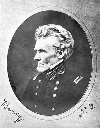
Edmund Pendleton Gaines was a career United States Army officer who served for nearly fifty years, and attained the rank of major general by brevet. He was one of the Army's senior commanders during its formative years in the early to mid-1800s, and was a veteran of the War of 1812, Seminole Wars, Black Hawk War, and Mexican–American War.

The Fort Mims massacre took place on August 30, 1813, at a fortified homestead site 35-40 miles north of Mobile, Alabama, during the Creek War. A large force of Creek Indians belonging to the Red Sticks faction, under the command of Peter McQueen and William Weatherford, stormed the fort and defeated the militia garrison.
The Federal Road through the territory of the Creek people was a project that started in 1805 when the Creek gave permission for the development of a "horse path" through their nation for more efficient mail delivery between Washington City and New Orleans, Louisiana. This section started at Fort Wilkinson near Milledgeville, Georgia, and ended at Fort Stoddert near Mobile, Alabama. By the time of the War of 1812, the Federal Road began in Augusta, Georgia, ran through Fort Hawkins, on to Fort Mitchell, Alabama, and was connected via the Three Notch Road to Pensacola in Spanish West Florida.

Fort Strother was a stockade fort at Ten Islands in the Mississippi Territory, in what is today St. Clair County, Alabama. It was located on a bluff of the Coosa River, near the modern Neely Henry Dam in Ragland, Alabama. The fort was built by General Andrew Jackson and several thousand militiamen in November 1813, during the Creek War and was named for Captain John Strother, Jackson's chief cartographer.

The Canoe Fight was a skirmish between Mississippi Territory militiamen led by Captain Samuel Dale and Red Stick warriors that took place on November 12, 1813 as part of the Creek War. The skirmish was fought largely from canoes and was a victory for the militiamen, who only had one member wounded. The victory held little military value in the overall Creek War but its participants gained widespread notoriety for their actions during the fight. The fight has been depicted in multiple illustrations, but only a historical marker currently exists near the site of the fight.

Fort Claiborne was a stockade fort built in 1813 in present-day Monroe County, Alabama during the Creek War.
The Choctaw Corner is a former Native American boundary location near the modern border between Clarke and Marengo counties in Alabama, United States. It was established as the northernmost terminus for a mutually agreed upon boundary line between the Choctaw and Creek peoples during the Mississippi Territory period. This boundary line, now known as the “Old Indian Treaty Boundary,” starts at the Alabama River cut-off in southernmost Clarke County and follows a northward path through the county along the drainage divide between the Tombigbee and Alabama rivers to the Choctaw Corner, then turns ninety degrees to the west and follows the modern county-line between Clarke and Marengo to the Tombigbee River.
The Tombigbee District, also known as the Tombigbee, was one of two areas, the other being the Natchez District, that were the first in what was West Florida to be colonized by British subjects from the Thirteen Colonies and elsewhere. This later became the Mississippi Territory as part of the United States. The district was also the first area to be opened to white settlement in what would become the state of Alabama, outside of the French colonial outpost of Mobile on the Gulf Coast. The Tombigbee and Natchez districts were the only areas populated by whites in the Mississippi Territory when it was formed by the United States in 1798.
Fort Armstrong was a stockade fort built in present-day Cherokee County, Alabama during the Creek War. The fort was built to protect the surrounding area from attacks by Red Stick warriors but was also used as a staging area and supply depot in preparation for further military action against the Red Sticks.

Fort Carney was a stockade fort built in 1813 in present-day Clarke County, Alabama, during the Creek War.

Fort Dale was a stockade fort built in present-day Butler County, Alabama, United States, by Alabama Territory settlers. The fort was constructed in response to Creek Indian attacks on settlers in the surrounding area.
Fort Easley was a stockade fort built in 1813 in present-day Clarke County, Alabama during the Creek War.

Fort Glass was a stockade fort built in July 1813 in present-day Clarke County, Alabama during the Creek War.

Fort Hull was an earthen fort built in present-day Macon County, Alabama in 1814 during the Creek War. After the start of hostilities, the United States decided to mount an attack on Creek territory from three directions. The column advancing west from Georgia built Fort Mitchell and then clashed with the Creeks. After a pause in operations, the column from Georgia continued its march and built Fort Hull. The fort was used as a supply point and was soon abandoned after the end of the Creek War.
Fort Madison was a stockade fort built in August 1813 in present-day Clarke County, Alabama, during the Creek War, which was part of the larger War of 1812. The fort was built by the United States military in response to attacks by Creek warriors on encroaching American settlers. The fort shared many similarities to surrounding stockade forts in its construction but possessed a number of differences in its defenses. The fort housed members of the United States Army and settlers from the surrounding area, and it was used as a staging area for raids on Creek forces and supply point on further military expeditions. Fort Madison was subsequently abandoned at the conclusion of the Creek War and only a historical marker exists at the site today.
Fort Montgomery was a stockade fort built in August 1814 in present-day Baldwin County, Alabama, during the Creek War, which was part of the larger War of 1812. The fort was built by the United States military in response to attacks by Creek warriors on encroaching American settlers and in preparation for further military action in the War of 1812. Fort Montgomery continued to be used for military purposes but in less than a decade was abandoned. Nothing exists at the site today.
Fort Pierce, was two separate stockade forts built in 1813 in present-day Baldwin County, Alabama, during the Creek War, which was part of the larger War of 1812. The fort was originally built by settlers in the Mississippi Territory to protect themselves from attacks by Creek warriors. A new fort of the same name was then built by the United States military in preparation for further action in the War of 1812, but the fort was essentially abandoned within a few years. Nothing exists at the site today.

Jeremiah Austill was an American politician, planter and soldier who served in the Alabama Militia during the Creek War, in which he participated in a skirmish that became known as the Canoe Fight. After the Creek War, Austill held various jobs and briefly served as a member of the Alabama House of Representatives.


