Tishomingo County, Mississippi

Last updated

Tishomingo County
County of Tishomingo
Tishomingo County Courthouse.JPG
Tishomingo County Courthouse
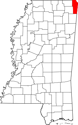
Map of Mississippi highlighting Tishomingo County.svg
Location within the U.S. state of Mississippi
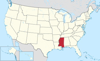
Mississippi in United States.svg
Mississippi's location within the U.S.
Coordinates: 34°44′25.6″N88°14′21.6″W / 34.740444°N 88.239333°W / 34.740444; -88.239333
CountryFlag of the United States.svg United States
StateFlag of Mississippi.svg  Mississippi
FoundedFebruary 9, 1836
(188 years ago)
 (1836-02-09)
Named for Tishomingo
Seat Iuka
Largest cityIuka
Area
  Total
445 sq mi (1,150 km2)
  Land424 sq mi (1,100 km2)
  Water20 sq mi (50 km2)  4.6%
Population
 (2020)
  Total
18,850
  Estimate 
(2023)
18,507 Decrease2.svg
  Density42/sq mi (16/km2)
Time zone UTC−6 (Central)
  Summer (DST) UTC−5 (CDT)
Congressional district 1st
Website co.tishomingo.ms.us

Tishomingo County is a county located in the northeastern corner of the U.S. state of Mississippi. As of the 2020 census, the population was 18,850. [1] Its county seat is Iuka. [2]

Contents

History

Old Tishomingo County Courthouse 1888 Tishomingo County Mississippi Courthouse.jpg
Old Tishomingo County Courthouse

Tishomingo County was organized February 9, 1836, from Chickasaw lands that were ceded to the United States. The Chickasaw were forced by Indian Removal to relocate to lands in the Indian Territory (now Oklahoma).

Jacinto was the original county seat of Tishomingo County and its historic courthouse building is listed on the National Register of Historic Places.

Parts of the northeastern side of Tishomingo county are part of the Battle of Shiloh Civil War battlefield.

In 1870 the area was divided into Alcorn, Prentiss and Tishomingo counties. Tishomingo's county seat was relocated to Iuka.

Geography

Woodall Mountain, elevation 807 feet, is the highest point in the state of Mississippi. Woodall Mountain Mississippi.JPG
Woodall Mountain, elevation 807 feet, is the highest point in the state of Mississippi.

According to the U.S. Census Bureau, the county has a total area of 445 square miles (1,150 km2), of which 424 square miles (1,100 km2) is land and 20 square miles (52 km2) (4.6%) is water. [3] The highest natural point in Mississippi, the 806 feet (246 meters) Woodall Mountain, is located in the county. Tishomingo County is the only county in Mississippi with outcroppings of natural limestone formations. [4]

Adjacent counties

Major highways

National protected area

Natchez Trace Parkway Logo.svg Natchez Trace Parkway

Demographics

Historical population
CensusPop.Note
1840 6,681
1850 15,490131.9%
1860 24,14955.9%
1870 7,350−69.6%
1880 8,77419.4%
1890 9,3026.0%
1900 10,1248.8%
1910 13,06729.1%
1920 15,09115.5%
1930 16,4118.7%
1940 16,9743.4%
1950 15,544−8.4%
1960 13,889−10.6%
1970 14,9407.6%
1980 18,43423.4%
1990 17,683−4.1%
2000 19,1638.4%
2010 19,5932.2%
2020 18,850−3.8%
2023 (est.)18,507 [5] −1.8%
U.S. Decennial Census [6]
1790-1960 [7] 1900-1990 [8]
1990-2000 [9] 2010-2013 [10]

2020 census

Tishomingo County racial composition [11]
RaceNum.Perc.
White (non-Hispanic)17,16991.08%
Black or African American (non-Hispanic)4332.3%
Native American 480.25%
Asian 410.22%
Other/Mixed 6223.3%
Hispanic or Latino 5372.85%

As of the 2020 United States census, there were 18,850 people, 7,635 households, and 5,035 families residing in the county.

2010 census

As of the 2010 United States Census, there were 19,593 people living in the county. 94.5% were White, 2.6% Black or African American, 0.2% Native American, 0.1% Asian, 1.7% of some other race and 0.8% of two or more races. 2.8% were Hispanic or Latino (of any race).

2000 census

As of the census [12] of 2000 there were 19,163 people, 7,917 households, and 5,573 families living in the county. The population density was 45 people per square mile (17 people/km2). There were 9,553 housing units at an average density of 22 units per square mile (8.5 units/km2). The racial makeup of the county was 94.93% White, 3.11% Black or African American, 0.21% Native American, 0.08% Asian, 0.01% Pacific Islander, 1.06% from other races, and 0.59% from two or more races. 1.79% of the population were Hispanic or Latino of any race.

By 2005 the population was 93.4% non-Hispanic white. 3.6% of the population was African-American. 2.6% of the population was Latino.

At 93.4% of the county's population, Tishomingo County has the highest percentage of Non-Hispanic whites in the state of Mississippi.

In 2000 there were 7,917 households, out of which 30.2% had children under the age of 18 living with them, 57.1% were married couples living together, 10.1% had a female householder with no husband present, and 29.6% were non-families. 27.5% of all households were made up of individuals, and 12.8% had someone living alone who was 65 years of age or older. The average household size was 2.39 and the average family size was 2.89.

In the county, the population was spread out, with 23.2% under the age of 18, 7.8% from 18 to 24, 27.5% from 25 to 44, 24.7% from 45 to 64, and 16.8% who were 65 years of age or older. The median age was 39 years. For every 100 females there were 92.7 males. For every 100 females age 18 and over, there were 89.8 males.

The median income for a household in the county was $28,315, and the median income for a family was $34,378. Males had a median income of $28,109 versus $19,943 for females. The per capita income for the county was $15,395. About 11% of families and 14.1% of the population were below the poverty line, including 15.6% of those under age 18 and 15.6% of those age 65 or over.

Recreation

Communities

City

Towns

Villages

Census-designated place

Unincorporated communities

Ghost town

Government and politics

Board of supervisors

Sheriff

Constable

Chancery Clerk

Circuit Clerk

State representatives

Presidential election results

Tishomingo County is solidly Republican at the Presidential level, having last voted for a Democrat in 1992 when it voted for Bill Clinton. Since then the closest a Democrat has come to winning the county was in 1996 when Clinton narrowly lost to Bob Dole. In 2024 Donald Trump received 89.1 percent of the vote, the best result for a Republican since 1972 when Richard Nixon received 89.2 percent of the vote.

United States presidential election results for Tishomingo County, Mississippi [13]
Year Republican Democratic Third party(ies)
No.%No.%No.%
2024 8,06489.10%92110.18%650.72%
2020 7,93386.81%1,05911.59%1461.60%
2016 7,16685.61%99911.93%2062.46%
2012 6,13377.28%1,64320.70%1602.02%
2008 6,24974.22%1,96223.30%2082.47%
2004 5,37964.51%2,84634.13%1131.36%
2000 4,12258.95%2,74739.29%1231.76%
1996 2,76645.28%2,70944.34%63410.38%
1992 3,39342.03%3,91048.44%7699.53%
1988 3,64651.70%3,37847.90%280.40%
1984 3,52754.87%2,87944.79%220.34%
1980 2,48934.47%4,59563.63%1371.90%
1976 1,96933.72%3,73463.95%1362.33%
1972 4,17789.23%4439.46%611.30%
1968 61711.13%3586.46%4,56982.41%
1964 1,93466.44%97733.56%00.00%
1960 53622.08%1,22250.35%66927.56%
1956 51623.78%1,57772.67%773.55%
1952 67929.86%1,59570.14%00.00%
1948 985.20%71137.74%1,07557.06%
1944 29617.33%1,41282.67%00.00%
1940 1599.75%1,46389.75%80.49%
1936 1156.59%1,61992.83%100.57%
1932 1126.39%1,63693.27%60.34%
1928 58537.74%96562.26%00.00%
1924 27919.11%1,18180.89%00.00%
1920 38730.98%84167.33%211.68%
1916 17514.29%1,03184.16%191.55%
1912 657.19%70177.54%13815.27%

Education

All of the county is in Tishomingo County Schools. [14]

Northeast Mississippi Community College is the community college for Tishomingo County. [15]

See also

Related Research Articles

<span class="mw-page-title-main">Colbert County, Alabama</span> County in Alabama, United States

Colbert County is a county located in the northwestern part of the U.S. state of Alabama. As of the 2020 census the county's population was 57,227. The county seat is Tuscumbia. The largest city is Muscle Shoals.

<span class="mw-page-title-main">Lauderdale County, Alabama</span> County in Alabama, United States

Lauderdale County is a county located in the northwestern corner of the U.S. state of Alabama. At the 2020 census the population was 93,564. Its county seat is Florence. Its name is in honor of Colonel James Lauderdale, of Tennessee. Lauderdale is part of the Florence-Muscle Shoals, AL Metropolitan Statistical Area, also known as "The Shoals".

<span class="mw-page-title-main">Tipton County, Tennessee</span> County in Tennessee, United States

Tipton County is a county located on the western end of the U.S. state of Tennessee, in the Mississippi Delta region. As of the 2020 census, the population was 60,970. Its county seat is Covington. Tipton County, founded in 1823, is part of the Memphis, TN-MS-AR Metropolitan Statistical Area.

<span class="mw-page-title-main">Hickman County, Tennessee</span> County in Tennessee, United States

Hickman County is a county located in the U.S. state of Tennessee. As of the 2020 Census, the population was 24,925. Its county seat is Centerville. As of 2023, Hickman County is part of the Nashville–Davidson–Murfreesboro–Franklin, TN Metropolitan Statistical Area, although it was once removed in 2018.

<span class="mw-page-title-main">Prentiss County, Mississippi</span> County in Mississippi, United States

Prentiss County is a county located in the U.S. state of Mississippi. As of the 2020 census, the population was 25,008. Its county seat is Booneville. The county is named for Seargent Smith Prentiss, a noted speaker and US Congressman from Natchez.

<span class="mw-page-title-main">Pontotoc County, Mississippi</span> County in Mississippi, United States

Pontotoc County is a county located in the U.S. state of Mississippi. As of the 2020 census, the population was 31,184. Its county seat is Pontotoc. It was created on February 9, 1836, from lands ceded to the United States under the Chickasaw Cession. Pontotoc is a Chickasaw word meaning "land of hanging grapes". The original Natchez Trace and the current-day Natchez Trace Parkway both pass through the southeast corner of Pontotoc County.

<span class="mw-page-title-main">Itawamba County, Mississippi</span> County in Mississippi, United States

Itawamba County is a county located in the U.S. state of Mississippi. As of the 2020 United States Census, the population was 23,863. Its county seat is Fulton. The county is part of the Tupelo, MS Micropolitan Statistical Area.

<span class="mw-page-title-main">Chickasaw County, Mississippi</span> County in Mississippi, United States

Chickasaw County is a county located in the U.S. state of Mississippi. As of the 2020 census, the population was 17,106. Its county seats are Houston and Okolona. The county is named for the Chickasaw people, who lived in this area for hundreds of years. Most were forcibly removed to Indian Territory in the 1830s, but some remained and became citizens of the state and the United States.

<span class="mw-page-title-main">Alcorn County, Mississippi</span> County in Mississippi, United States

Alcorn County is a county located in the northeastern portion of the U.S. state of Mississippi. As of the 2020 census, the population was 34,740. Its county seat is Corinth. The county is named in honor of Governor James L. Alcorn. The Corinth Micropolitan Statistical Area includes all of Alcorn County.

<span class="mw-page-title-main">Cherokee, Alabama</span> Town in Alabama, United States

Cherokee is a town in west Colbert County, Alabama, United States. Located near the Tennessee River, it is part of the Florence–Muscle Shoals metropolitan area, known as "The Shoals". As of the 2010 census, the population of the town was 1,048.

<span class="mw-page-title-main">Houston, Mississippi</span> City in Mississippi, United States

Houston is a city and one of two county seats of Chickasaw County, in northeastern Mississippi, United States. The population was 3,623 at the 2010 census.

<span class="mw-page-title-main">Fulton, Mississippi</span> City in Mississippi, United States

Fulton is a city in and the county seat of Itawamba County, Mississippi, United States. The population was 4,542 at the 2020 census.

<span class="mw-page-title-main">Aberdeen, Mississippi</span> City in Mississippi, United States

Aberdeen is the county seat of Monroe County, Mississippi, United States. As of the 2020 census, the population was 4,961, down from 5,612 in 2010.

<span class="mw-page-title-main">Amory, Mississippi</span> City in Mississippi, United States

Amory is a city in Monroe County, Mississippi, United States. The population was 6,666 at the 2020 census, down from 7,316 in 2010. Located in the northeastern part of the state near the Alabama border, it was founded in 1887 as a railroad town by the Kansas City, Memphis and Birmingham Railroad. As a result, Cotton Gin Port, along the Tombigbee River to the east, was abandoned as businesses and people moved for railroad access.

<span class="mw-page-title-main">Belmont, Mississippi</span> Town in Mississippi, United States

Belmont is a town in Tishomingo County, Mississippi, United States. The population was 2,021 at the 2010 census.

<span class="mw-page-title-main">Burnsville, Mississippi</span> Town in Mississippi, United States

Burnsville is a town in Tishomingo County in northeastern Mississippi, United States. The population was 936 at the 2010 census.

<span class="mw-page-title-main">Iuka, Mississippi</span> City in Mississippi, United States

Iuka is a city in and the county seat of Tishomingo County, Mississippi, United States. Its population was 3,028 at the 2010 census. Woodall Mountain, the highest point in Mississippi, is located just south of Iuka.

<span class="mw-page-title-main">Paden, Mississippi</span> Village in Mississippi, United States

Paden is a village in Tishomingo County, Mississippi, United States. The population was 116 at the 2010 census.

<span class="mw-page-title-main">Tishomingo, Mississippi</span> Town in Mississippi

Tishomingo is a town in Tishomingo County, Mississippi, United States. The population of the city of Tishomingo was 339 at the 2010 census.

<span class="mw-page-title-main">Tishomingo, Oklahoma</span> City in Oklahoma

Tishomingo is the largest city in, and the county seat of, Johnston County, Oklahoma, United States. The population was 3,101 as of the 2020 Census, an increase of 2.2% over the population of 3,034 reported at the 2010 census. It was the first capital of the Chickasaw Nation, from 1856 until Oklahoma statehood in 1907. The city is home to Murray State College, a community college with an annual enrollment of 3,015 students. Tishomingo is part of the Texoma region.

References

  1. "Census - Geography Profile: Tishomingo County, Mississippi". United States Census Bureau . Retrieved January 15, 2023.
  2. "Find a County". National Association of Counties. Retrieved June 7, 2011.
  3. "2010 Census Gazetteer Files". United States Census Bureau. August 22, 2012. Archived from the original on September 28, 2013. Retrieved November 8, 2014.
  4. Lowe, Ephraim Noble; Survey, Mississippi Geological, Economic, and Topographical (1915). Bulletin - Mississippi State Geological Survey. Mississippi Geological, Economic and Topographical Survey.{{cite book}}: CS1 maint: multiple names: authors list (link)
  5. "Annual Estimates of the Resident Population for Counties: April 1, 2020 to July 1, 2023". United States Census Bureau. Retrieved April 5, 2024.
  6. "U.S. Decennial Census". United States Census Bureau. Retrieved November 8, 2014.
  7. "Historical Census Browser". University of Virginia Library. Retrieved November 8, 2014.
  8. "Population of Counties by Decennial Census: 1900 to 1990". United States Census Bureau. Retrieved November 8, 2014.
  9. "Census 2000 PHC-T-4. Ranking Tables for Counties: 1990 and 2000" (PDF). United States Census Bureau. Archived (PDF) from the original on March 27, 2010. Retrieved November 8, 2014.
  10. "State & County QuickFacts". United States Census Bureau. Retrieved September 7, 2013.
  11. "Explore Census Data". data.census.gov. Retrieved December 16, 2021.
  12. "U.S. Census website". United States Census Bureau . Retrieved January 31, 2008.
  13. Leip, David. "Dave Leip's Atlas of U.S. Presidential Elections". uselectionatlas.org. Retrieved March 5, 2018.
  14. "2020 CENSUS - SCHOOL DISTRICT REFERENCE MAP: Tishomingo County, MS" (PDF). U.S. Census Bureau . Retrieved September 25, 2024. - Text list
  15. "About the College". Northeast Mississippi Community College . Retrieved September 25, 2024.

Further reading