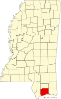
Long Beach, Mississippi | |
---|---|
Nickname: The Friendly City [1] | |
Coordinates: 30°21′9″N89°9′35″W / 30.35250°N 89.15972°W | |
Country | United States |
State | Mississippi |
County | Harrison |
Founded Incorporated | August 10, 1905 |
Government | |
• Mayor | George Bass |
Area | |
• Total | 13.99 sq mi (36.23 km2) |
• Land | 10.24 sq mi (26.53 km2) |
• Water | 3.75 sq mi (9.70 km2) |
Elevation | 26 ft (8 m) |
Population (2020) | |
• Total | 16,780 |
• Density | 1,638.19/sq mi (632.53/km2) |
Time zone | UTC−6 (CST) |
• Summer (DST) | UTC−5 (CDT) |
ZIP code | 39560 |
Area code | 228 |
FIPS code | 28-41680 |
GNIS feature ID | 0672794 |
Website | City of Long Beach official website |
Long Beach is a city located in Harrison County, Mississippi, United States. It is part of the Gulfport-Biloxi metropolitan area. As of the 2020 census, the city had a population of 15,829. [3]
According to the United States Census Bureau, the city has a total area of 10.4 square miles (26.9 km2), of which 0.39 square miles (1.0 km2), or 3.74% is covered by water. [4]
Census | Pop. | Note | %± |
---|---|---|---|
1910 | 1,026 | — | |
1920 | 980 | −4.5% | |
1930 | 1,346 | 37.3% | |
1940 | 1,495 | 11.1% | |
1950 | 2,703 | 80.8% | |
1960 | 4,770 | 76.5% | |
1970 | 6,170 | 29.4% | |
1980 | 14,199 | 130.1% | |
1990 | 15,804 | 11.3% | |
2000 | 17,320 | 9.6% | |
2010 | 14,792 | −14.6% | |
2020 | 16,780 | 13.4% | |
U.S. Decennial Census [5] |
Race | Num. | Perc. |
---|---|---|
White (non-Hispanic) | 12,860 | 76.64% |
Black or African American (non-Hispanic) | 1,528 | 9.11% |
Native American | 52 | 0.31% |
Asian | 476 | 2.84% |
Pacific Islander | 10 | 0.06% |
Other/mixed | 1,005 | 5.99% |
Hispanic or Latino | 849 | 5.06% |
As of the 2020 United States census, 16,780 people, 6,545 households, and 4,243 families were residing in the city.
The city of Long Beach is served by the Long Beach School District, which operates five campuses and has an enrollment around 2,700 students. These campuses are Long Beach High School, Long Beach Middle School, Reeves Elementary School, Quarles Elementary School, and Harper McCaughan Elementary School, rebuilt in a new location after the previous school was destroyed by Hurricane Katrina.
The University of Southern Mississippi's Gulf Coast campus is located in Long Beach on East Beach Boulevard. Through the 52-acre beachfront campus in Long Beach, Mississippi, USM serves as the only four-year public institution located on the Mississippi Gulf Coast, offering bachelor’s, master’s and doctoral degrees in more than 50 distinct academic fields. The Gulf Park campus is also home to the state’s only bachelor’s degree in ocean engineering and the only film studies pathway offered at a public institution in the state.
Long Beach began as an agricultural town, based around its radish industry, but on August 10, 1905, Long Beach incorporated and became another city on the Mississippi Gulf Coast. As the years went on, the city moved from its agricultural heritage and moved toward tourism with the beach becoming increasingly popular.
Long Beach's early economy was based largely upon radishes. Logging initially drove the local economy, but when the area's virgin yellow pine forests became depleted, row crops were planted on the newly cleared land. [7]
A productive truck farming town in the early 20th century, citizens of Long Beach proclaimed the city to be the "Radish Capital of the World". The city was especially known for its cultivation of the Long Red radish variety, a favorite beer hall staple in the northern US at the time. In 1921, a bumper crop resulted in the shipment of over 300 trainloads of Long Beach's Long Red radishes to northern states. [8] [9]
Eventually, the Long Red radishes for which Long Beach was known fell into disfavor, and the rise of the common button radish caused a dramatic decline in the cultivation of this crop in the area. [7]
Hurricane Katrina struck the city on August 29, 2005, destroying almost all buildings within 500 m (1,600 ft) of the Gulf of Mexico shoreline. [ failed verification ] Many Long Beach residents were left homeless or living in water- and or wind-damaged houses. At least one person was confirmed dead. [10]
The city of Long Beach, California, held a fund raiser to help its eponymous relative. [11] The city of Peoria, Arizona, adopted Long Beach and provided both public and private resources. This resulted in a close relationship between the two communities.[ citation needed ]
This section has multiple issues. Please help improve it or discuss these issues on the talk page . (Learn how and when to remove these messages)
|
Today, the city is still recovering from Hurricane Katrina. Residents are returning as beaches and condominiums in the area are being repaired, but the city has not seen a return of business to pre-Katrina levels due in part to building codes on the beach established by the Federal Emergency Management Agency and Mississippi Emergency Management Agency and to the economic downturn.
Baldwin County is a county located in the southwestern part of the U.S. state of Alabama, on the Gulf coast. It is one of only two counties in Alabama that border the Gulf of Mexico, along with Mobile County. As of the 2020 census, the population was 231,767, making it the fourth-most populous county in Alabama. The county seat is Bay Minette. The county is named after the founder of the University of Georgia, Senator Abraham Baldwin.
Jackson County is a county located in the U.S. state of Mississippi. As of the 2020 census, the population was 143,252, making it the fifth-most populous county in Mississippi. Its county seat is Pascagoula. The county was named for Andrew Jackson, general in the United States Army and afterward President of the United States. Jackson County is included in the Pascagoula, MS Metropolitan Statistical Area. It is located at the southeastern tip of the state. The county has sandy soil and is in the Piney Woods area. It borders the state of Alabama on its east side. The county was severely damaged by both Hurricane Camille in August 1969 and Hurricane Katrina on August 29, 2005, which caused catastrophic effects.
Harrison County is a county located in the U.S. state of Mississippi. As of the 2020 census, the population was 208,621. Its county seats are Biloxi and Gulfport. The county is named after U.S. President William Henry Harrison. Harrison County is part of the Gulfport-Biloxi metropolitan area. The county was severely damaged from both Hurricane Camille on August 17, 1969, and Hurricane Katrina on August 29, 2005, causing catastrophic effects.
Hancock County is the southernmost county of the U.S. state of Mississippi and is named for Founding Father John Hancock. As of the 2020 census, the population was 46,053. Its county seat is Bay St. Louis. Hancock County is part of the Gulfport–Biloxi, MS Metropolitan Statistical Area. It is situated along the Gulf of Mexico and the state line with Louisiana. The area is home to the John C. Stennis Space Center, NASA's largest rocket engine test facility. The county was severely damaged from Hurricane Katrina on August 29, 2005, which caused a huge storm surge and catastrophic damage.
St. Bernard Parish is a parish in the U.S. state of Louisiana. The parish seat and largest community is Chalmette. The parish was formed in 1807. St. Bernard Parish is part of the New Orleans–Metairie metropolitan statistical area; the parish is located southeast of the city of New Orleans and comprises the Chandeleur Islands and Chandeleur Sound in the east.
Gulf Shores is a resort city in Baldwin County, Alabama, United States. As of the 2020 Census, the population was 15,014.
Bayou La Batre is a city in Mobile County, Alabama, United States. It is part of the Mobile metropolitan area. As of the 2020 census, the population was 2,204, down from 2,558 at the 2010 census.
Dauphin Island is an island town in Mobile County, Alabama, United States, on a barrier island of the same name, in the Gulf of Mexico. It incorporated in 1988. The population was 1,778 at the 2020 census, up from 1,238 at the 2010 census. The town is part of the Mobile metropolitan area. The island was renamed for Louis XIV of France's great-grandson and heir, the dauphin, the future Louis XV of France. The name of the island is often mistaken as Dolphin Island; the word dauphin is French for dolphin, but historically, the term was used as the title of the heir apparent to the French monarch.
Violet is a census-designated place (CDP) in St. Bernard Parish, Louisiana, United States. The population was 5,758 at the 2020 census. Violet is located on the east bank of the Mississippi River, approximately 7.5 miles (12.1 km) southeast of New Orleans and is part of the New Orleans–Metairie–Kenner metropolitan statistical area.
Bay St. Louis is a city in and the county seat of Hancock County, Mississippi, in the United States. Located on the Gulf Coast on the west side of the Bay of St. Louis, it is part of the Gulfport–Biloxi Metropolitan Statistical Area. The population was 9,284 at the 2020 census, up from 9,260 at the 2010 census.
Waveland is a city located in Hancock County, Mississippi, United States, on the Gulf of Mexico. It is part of the Gulfport–Biloxi, Mississippi Metropolitan Statistical Area. The city of Waveland was incorporated in 1972. As of the 2010 census, the city had a population of 6,435. Waveland was nearly destroyed by Hurricane Camille on August 17, 1969, and by Hurricane Katrina on August 29, 2005.
Biloxi is a city in Harrison County, Mississippi, United States. It lies on the Gulf Coast in southern Mississippi, bordering the city of Gulfport to its west. The adjacent cities are both designated as seats of Harrison County. The population of Biloxi was 49,449 at the 2020 census, making it the state's 4th most populous city. It is a principal city of the Gulfport–Biloxi metropolitan area, home to 416,259 residents in 2020. The area's first European settlers were French colonists.
D'Iberville is a city in Harrison County, Mississippi, United States, immediately north of Biloxi, across the Back Bay. The population was 12,721 at the 2020 census. It is part of the Gulfport—Biloxi Metropolitan Statistical Area.
Gulfport is the second-most populous city in the U.S. state of Mississippi after the state capital, Jackson. Along with Biloxi, Gulfport is the co-county seat of Harrison County and part of the Gulfport–Biloxi metropolitan area. As of the 2020 census, Gulfport has a population of 72,926; the metro area has a population of 416,259. Gulfport lies along the gulf coast of the United States in southern Mississippi, taking its name from its port on the Gulf Coast on the Mississippi Sound. It is home to the U.S. Navy Atlantic Fleet Seabees.
Pass Christian, nicknamed The Pass, is a city in Harrison County, Mississippi, United States. It is part of the Gulfport–Biloxi Metropolitan Statistical Area. The population was 6,307 at the 2019 census.
Gautier is a city in Jackson County, Mississippi, United States, along the Gulf of Mexico west of Pascagoula. It is part of the Pascagoula Metropolitan Statistical Area. The population was 18,572 at the 2010 census, up from 11,681 at the 2000 census. In 2002, Gautier had annexed land more than doubling its area.
Ocean Springs is a city in Jackson County, Mississippi, United States, approximately 2 miles (3.2 km) east of Biloxi and west of Gautier. It is part of the Pascagoula, Mississippi Metropolitan Statistical Area. The population was 18,429 at the 2020 U.S Census, down from 18,434 in 2010.
Venice is an unincorporated community and census-designated place in Plaquemines Parish, Louisiana, United States. As of the 2020 census, its population was 162. It is 77 miles (124 km) south of New Orleans on the west bank of the Mississippi River at 29°16′37″N89°21′17″W. It is the last community down the Mississippi accessible by automobile, and it is the southern terminus of the Great River Road. This has earned the town the nickname "The end of the world." The ZIP code for Venice is 70091.
The Mississippi Gulf Coast, also known as Mississippi Coast, Mississippi Gulf Coast region, Coastal Mississippi, and The Coast, is the area of Mississippi along the Mississippi Sound at the northern extreme of the Gulf of Mexico.
The Gulfport–Biloxi Metropolitan Statistical Area is a metropolitan statistical area (MSA) in the Mississippi Gulf Coast region that includes four counties – Hancock, Harrison, Jackson and Stone. The principal cities are Gulfport and Biloxi. The 2010 census placed the Gulfport-Biloxi MSA population at 388,488, though as of 2019, it was estimated to have increased to 417,665. The area was significantly impacted by Hurricane Katrina on August 29, 2005, and prior to the hurricane, had experienced steady to moderate population growth. However, growth has since rebounded, with the population steadily increasing every year throughout the 2010s.