Louisville, Mississippi

Last updated

Louisville, Mississippi
Louisville mississippi.jpg
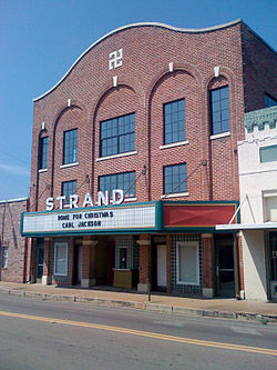
Main Street in Louisville, 2008
Flag of Louisville, Mississippi.png
Logo of Louisville, Mississippi.png
Winston County Mississippi Incorporated and Unincorporated areas Louisville Highlighted.svg
Location of Louisville, Mississippi
Usa edcp location map.svg
Red pog.svg
Louisville, Mississippi
Location in the United States
Coordinates: 33°7′23″N89°3′22″W / 33.12306°N 89.05611°W / 33.12306; -89.05611
Country United States
State Mississippi
County Winston
Government
  MayorWill Hill
Area
[1]
  Total15.27 sq mi (39.56 km2)
  Land15.10 sq mi (39.10 km2)
  Water0.18 sq mi (0.46 km2)
Elevation
571 ft (174 m)
Population
 (2020)
  Total6,072
  Density402.17/sq mi (155.28/km2)
Time zone UTC-6 (Central (CST))
  Summer (DST) UTC-5 (CDT)
ZIP code
39339
Area code 662
FIPS code 28-42280
GNIS feature ID0693835
Website City Website

Louisville (pronounced LEW-iss-vill) [2] is a city in Winston County, Mississippi. The population was 6,631 at the 2010 census. It is the county seat of Winston County. [3]

Contents

History

Like Winston County, Louisville is named for Louis Winston (1784–1824), a colonel in the militia, a prominent lawyer, and a judge of the Mississippi Supreme Court. [4] In 1863 Union Colonel Benjamin Grierson marched 900 troops through Louisville during his raid through Mississippi. There was no fighting in Winston County. [5]

In 1927, a mob of 1,000 white men from Louisville, lynched two African-Americans, Jim and Mark Fox by wrapping them in barbed wire and setting them on fire. The Foxes were accused of killing Clarence Nichols, a white man who started a fight with them because they would not let him pass their Ford touring car in his Chevrolet. [6] [7] [8] [9]

On April 28, 2014, Louisville was hit by an EF4 tornado, resulting in ten fatalities. [10] [11]

Geography

Louisville is located at 33°7′23″N89°3′22″W / 33.12306°N 89.05611°W / 33.12306; -89.05611 (33.122931, -89.056182). [12] According to the United States Census Bureau, the city has a total area of 15.3 square miles (40 km2), of which 15.1 square miles (39 km2) is land and 0.2 square miles (0.52 km2) (1.44%) is water. It is known by many as the "Front porch of the South". [13]

Climate

Climate data for Louisville, Mississippi (1991–2020 normals, extremes 1891–2020)
MonthJanFebMarAprMayJunJulAugSepOctNovDecYear
Record high °F (°C)84
(29)
87
(31)
92
(33)
92
(33)
101
(38)
105
(41)
107
(42)
107
(42)
106
(41)
97
(36)
88
(31)
83
(28)
107
(42)
Mean daily maximum °F (°C)55.0
(12.8)
58.9
(14.9)
67.8
(19.9)
75.0
(23.9)
82.5
(28.1)
89.0
(31.7)
91.5
(33.1)
91.0
(32.8)
86.2
(30.1)
76.5
(24.7)
64.8
(18.2)
56.8
(13.8)
74.6
(23.7)
Daily mean °F (°C)44.4
(6.9)
48.0
(8.9)
55.7
(13.2)
63.0
(17.2)
71.4
(21.9)
78.2
(25.7)
81.0
(27.2)
80.5
(26.9)
75.2
(24.0)
64.5
(18.1)
53.5
(11.9)
46.5
(8.1)
63.5
(17.5)
Mean daily minimum °F (°C)33.9
(1.1)
37.1
(2.8)
43.6
(6.4)
50.9
(10.5)
60.4
(15.8)
67.4
(19.7)
70.6
(21.4)
70.0
(21.1)
64.1
(17.8)
52.6
(11.4)
42.2
(5.7)
36.2
(2.3)
52.4
(11.3)
Record low °F (°C)−3
(−19)
−13
(−25)
12
(−11)
26
(−3)
37
(3)
43
(6)
52
(11)
46
(8)
37
(3)
24
(−4)
10
(−12)
−3
(−19)
−13
(−25)
Average precipitation inches (mm)5.05
(128)
5.68
(144)
5.47
(139)
5.31
(135)
4.96
(126)
3.95
(100)
4.62
(117)
4.76
(121)
4.05
(103)
4.21
(107)
4.21
(107)
5.24
(133)
57.51
(1,460)
Average precipitation days (≥ 0.01 in)8.88.68.87.48.78.110.08.95.55.97.38.996.9
Source: NOAA [14] [15]

Demographics

Historical population
CensusPop.Note
1870 385
1880 4188.6%
1890 48415.8%
1900 5054.3%
1910 1,181133.9%
1920 1,77750.5%
1930 3,01369.6%
1940 3,45114.5%
1950 5,28253.1%
1960 5,066−4.1%
1970 6,62630.8%
1980 7,32310.5%
1990 7,169−2.1%
2000 7,006−2.3%
2010 6,631−5.4%
2020 6,072−8.4%
U.S. Decennial Census [16]

2020 census

Louisville Racial Composition [17]
RaceNum.Perc.
Black or African American 3,89564.15%
White 1,92531.7%
Other/Mixed 1201.98%
Hispanic or Latino 961.58%
Asian 280.46%
Native American 70.12%
Pacific Islander 10.02%

As of the 2020 United States Census, there were 6,072 people, 2,309 households, and 1,589 families residing in the city.

2000 census

As of the census [18] of 2000, there were 7,006 people, 2,641 households, and 1,817 families living in the city. The population density was 464.5 inhabitants per square mile (179.3/km2). There were 2,884 housing units at an average density of 191.2 per square mile (73.8/km2). The racial makeup of the city was 46.29% White, 52.46% African American, 0.13% Native American, 0.17% Asian, 0.44% from other races, and 0.51% from two or more races. Hispanic or Latino of any race were 1.66% of the population.

There were 2,641 households, out of which 34.3% had children under the age of 18 living with them, 40.4% were married couples living together, 25.0% had a female householder with no husband present, and 31.2% were non-families. 28.2% of all households were made up of individuals, and 14.4% had someone living alone who was 65 years of age or older. The average household size was 2.55 and the average family size was 3.12.

In the city, the population was spread out, with 28.9% under the age of 18, 9.3% from 18 to 24, 24.7% from 25 to 44, 19.8% from 45 to 64, and 17.3% who were 65 years of age or older. The median age was 35 years. For every 100 females, there were 80.6 males. For every 100 females age 18 and over, there were 73.8 males.

The median income for a household in the city was $27,485, and the median income for a family was $31,750. Males had a median income of $29,951 versus $17,491 for females. The per capita income for the city was $15,857. About 24.8% of families and 28.5% of the population were below the poverty line, including 39.3% of those under age 18 and 20.9% of those age 65 or over.

Education

Prior to 1970, Louisville maintained a dual system of schools for White and Black students. Black students were educated at the Louisville Colored School, also known as Camile Street School, whereas White students had their own schools, including Louisville High School. Several federal laws and U.S. Supreme Court decisions forced this to change. In 1967, due to the Civil Rights Act of 1964, the school adopted a desegregation plan that in theory allowed students to choose which schools to attend. [19] When the courts mandated that the schools be integrated, students from Louisville Colored School were allowed to attend Louisville High School. In order to preserve a segregated education for White students only, a segregation academy, Winston Academy was created. [20] [21] The City of Louisville is now served by the Louisville Municipal School District and Louisville High School. Private schools in Louisville include Winston Academy, which as of 2020 was still over 99% white, [22] and Grace Christian School.

Culture

The historic Strand Theatre in downtown Louisville; note that the Swastika incorporated into the building's facade is decorative rather than political, as the theatre antedates the Nazi era. Strand Theatre Louisville.jpg
The historic Strand Theatre in downtown Louisville; note that the Swastika incorporated into the building's facade is decorative rather than political, as the theatre antedates the Nazi era.

The American Heritage "Big Red" Fire Museum is located in Louisville. This museum features a collection of restored antique fire equipment and fire engines. [23] The Strand Theatre, in downtown Louisville, is an historic movie theater which now serves as an art and music venue. Louisville native Carl Jackson plays an annual Christmas concert at the theater to raise money for the building's restoration. [24]

Transportation

Mississippi Highway 14 enters east from the Alabama state line through Macon and when it enters in Louisville it is also known as Main Street. It leaves westbound eventually traveling to the Mississippi River where it ends.

Mississippi Highway 15 enters from the north from Ackerman, MS, then meets up with Mississippi Highway 25 just north of Louisville. M.S. 25 enters from the north from Starkville. M.S. 15 and 25 travel together along the western side of town. At the southern edge of town they separate: M.S. 15 traveling to Philadelphia & Interstate 20; and M.S. 25 to Jackson.

Notable people

Related Research Articles

<span class="mw-page-title-main">Winston County, Mississippi</span> County in Mississippi, United States

Winston County is a county located in the U.S. state of Mississippi. In the 2020 census, the population was 17,714. Its county seat is Louisville. The county is named for Louis Winston (1784–1824), a colonel in the militia, a prominent lawyer, and a judge of the Mississippi Supreme Court.

<span class="mw-page-title-main">Sharkey County, Mississippi</span> County in Mississippi, United States

Sharkey County is a county located in the U.S. state of Mississippi. Part of the eastern border is formed by the Yazoo River. According to the 2020 census, the population was 3,800, making it the second-least populous county in Mississippi, after Issaquena County. Its county seat is Rolling Fork. The county is named after William L. Sharkey, the provisional Governor of Mississippi in 1865.

<span class="mw-page-title-main">Issaquena County, Mississippi</span> County in Mississippi, United States

Issaquena County is a county located in the U.S. state of Mississippi. As of the 2020 Census, its population was 1,338, making it the least populous county in the United States east of the Mississippi River. Its county seat is Mayersville. With a per-capita income of $24,489, Issaquena County is, by that measure, the third-poorest county in the United States and the lowest without a prison depleting the numbers.

<span class="mw-page-title-main">Red Bay, Alabama</span> City in Alabama, United States

Red Bay is a city in Franklin County, Alabama, United States. It was founded in 1907; its western boundary line is integral with the state line between Mississippi and Alabama. The population was 3,232 at the 2020 census. The town's name comes from the area's red clay soil and the many redbay trees in this area of north Alabama.

<span class="mw-page-title-main">Brandenburg, Kentucky</span> City in Kentucky, United States

Brandenburg is a home rule-class city on the Ohio River in Meade County, Kentucky, in the United States. The city is 40 miles (64 km) southwest of Louisville. It is the seat of its county. The population was 2,894 at the 2020 census.

<span class="mw-page-title-main">Louin, Mississippi</span> Town in Mississippi, United States

Louin is a town in Jasper County, Mississippi, United States, located along Mississippi Highway 15. The population was 277 at the 2010 census, down from 339 at the 2000 census. On June 18, 2023, the town was hit by a destructive EF3 tornado causing 1 death.

<span class="mw-page-title-main">Carthage, Mississippi</span> City in Mississippi, United States

The city of Carthage is the county seat of Leake County, Mississippi, United States. The population was 5,075 at the 2010 census.

<span class="mw-page-title-main">Redwater, Mississippi</span> Census-designated place in Mississippi, United States

Redwater is a census-designated place (CDP) in Leake County, Mississippi, United States. It is one of the eight communities of the Mississippi Band of Choctaw Indians Reservation, and the population is 61% Choctaw. The population was 633 at the 2010 census, up from 409 at the 2000 census.

<span class="mw-page-title-main">Madison, Mississippi</span> City in Mississippi, United States

Madison is the 11th most populous city in Mississippi, United States, located in Madison County, 13 miles (21 km) north of the state capital, Jackson. The population was 27,747 at the 2020 census, up from 24,149 in 2010. It is part of the Jackson Metropolitan Statistical Area.

<span class="mw-page-title-main">Amory, Mississippi</span> City in Mississippi, United States

Amory is a city in Monroe County, Mississippi, United States. The population was 6,666 at the 2020 census, down from 7,316 in 2010. Located in the northeastern part of the state near the Alabama border, it was founded in 1887 as a railroad town by the Kansas City, Memphis and Birmingham Railroad. As a result, Cotton Gin Port, along the Tombigbee River to the east, was abandoned as businesses and people moved for railroad access.

<span class="mw-page-title-main">Philadelphia, Mississippi</span> City in Mississippi, United States

Philadelphia is a city in and the county seat of Neshoba County, Mississippi, United States. The population was 7,118 at the 2020 census.

<span class="mw-page-title-main">Tucker, Mississippi</span> CDP in Mississippi, United States

Tucker is a census-designated place (CDP) in Neshoba County, Mississippi. It is one of the eight communities of the Mississippi Band of Choctaw Indians Reservation and the population is 93% Choctaw. The population was 642 at the 2020 census.

<span class="mw-page-title-main">Starkville, Mississippi</span> City in Mississippi, United States

Starkville is a city in, and the county seat of, Oktibbeha County, Mississippi, United States. As of the 2020 United States census, Starkville's population is 24,360, making it the 16th-most populated city in Mississippi. Starkville is the largest city in the Golden Triangle, which had a population of 175,474 in 2020, and the principal city of the Starkville-Columbus, MS CSA. Founded in 1831, the city was originally known as Boardtown for the local sawmilling operation there, but was renamed in 1837 to honor American Revolutionary War general John Stark.

<span class="mw-page-title-main">Picayune, Mississippi</span> City in Mississippi, United States

Picayune is the largest city in Pearl River County, Mississippi, United States. The population was 11,885 at the 2020 census. The city is located approximately 45 miles (72 km) from New Orleans, Hattiesburg, and Gulfport–Biloxi. The Stennis Space Center is 10 miles (16 km) away. Picayune is part of the New Orleans–Metairie–Hammond combined statistical area.

<span class="mw-page-title-main">Rolling Fork, Mississippi</span> City and county seat in Mississippi, United States

Rolling Fork is a city and county seat of Sharkey County, Mississippi, United States. As of the 2020 census, the population of the town was 1,883.

<span class="mw-page-title-main">Inverness, Mississippi</span> Town in Mississippi, United States

Inverness is a town in Sunflower County, Mississippi, United States. The population was 1,019 at the 2010 census. As the town had the largest cotton gin in the Mississippi Delta, it served as a gathering place for farmers from the region when they brought their cotton for processing. The town was heavily damaged by a tornado in 1971.

<span class="mw-page-title-main">New Albany, Mississippi</span> City in Mississippi, United States

New Albany is a city in and the county seat of Union County, Mississippi, United States. According to the 2020 United States Census, the population was 7,626.

<span class="mw-page-title-main">Yazoo City, Mississippi</span> City in Mississippi, United States

Yazoo City is the county seat of Yazoo County, Mississippi, United States. It was named after the Yazoo River, which, in turn was named by the French explorer Robert La Salle in 1682 as "Rivière des Yazous" in reference to the Yazoo tribe living near the river's mouth. Yazoo City is the principal city of the Yazoo City Micropolitan Statistical Area, which is part of the larger Jackson–Yazoo City Combined Statistical Area. According to the 2010 census, the population was 11,403. The most important industry in 2021 is a group of federal prisons.

<span class="mw-page-title-main">Noxapater, Mississippi</span> Town in Mississippi, United States

Noxapater is a town in Winston County, Mississippi. The population was 472 at the 2010 census.

Winston Academy is a private college preparatory school in Louisville, Mississippi. It was founded in 1969 as a segregation academy.

References

  1. "2020 U.S. Gazetteer Files". United States Census Bureau. Retrieved July 24, 2022.
  2. "The Hard To Pronounce Town In Every Single State". January 27, 2018. Retrieved March 13, 2018.
  3. "Find a County". National Association of Counties. Retrieved June 7, 2011.
  4. Gannett, Henry (1905). The Origin of Certain Place Names in the United States. Govt. Print. Off. pp.  191.
  5. "Winston County" . Retrieved January 15, 2019.
  6. "Man Killed: Mob Negroes". Winston County Journal. June 17, 1927.
  7. "Shal Law or Criminal Rule". Winston County Journal. June 17, 1927.
  8. "Shall the law rule?". Newton Record. June 16, 1927. Retrieved September 19, 2022.
  9. "Winston mob burns negroes at the stake". Clarion-Ledger. June 14, 1927. Retrieved September 19, 2022.
  10. "Winston Tornado". Archived from the original on May 2, 2014. Retrieved February 4, 2023.
  11. "Tornado Kills Nearly 220,000 Chickens in Direct Hit on Mississippi Farm".
  12. "US Gazetteer files: 2010, 2000, and 1990". United States Census Bureau. February 12, 2011. Retrieved April 23, 2011.
  13. "Louisville among top 5 safest cities in MS". September 3, 2014. Retrieved March 24, 2017.
  14. "NOWData - NOAA Online Weather Data". National Oceanic and Atmospheric Administration. Retrieved October 31, 2023.
  15. "Summary of Monthly Normals 1991-2020". National Oceanic and Atmospheric Administration. Retrieved October 31, 2023.
  16. "Census of Population and Housing". Census.gov. Retrieved June 4, 2015.
  17. "Explore Census Data". data.census.gov. Retrieved December 8, 2021.
  18. "U.S. Census website". United States Census Bureau . Retrieved January 31, 2008.
  19. "Notice of School Desegregation Plan". Winston County Journal. April 27, 1967.
  20. Thompson, Jeremy S. (January 2014). "From Segregation To Integration: A Historical Study Of Music Education In The Colored School In Louisville, Mississippi Through 1970". Electronic Theses and Dissertations. Retrieved March 12, 2022.
  21. "300 Attend Foundation Meet Friday". The Winston County Journal. June 12, 1969. p. 1.
  22. "Search for Private Schools - School Detail for WINSTON ACADEMY".
  23. The American Heritage "Big Red" Fire Museum in Louisville
  24. McCain, Joseph (December 13, 2006). "Strong cast of musicians serves up Christmas joy". Winston County Journal. Archived from the original on February 10, 2013.
  25. https://www.ttusports.com/sports/wbkb/coaches/rosamond_kim?view=bio Kim Rosamond